- Chipinge District
-
Chipinge 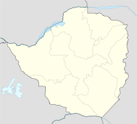

Coordinates: 20°12′S 32°37′E / 20.2°S 32.617°ECoordinates: 20°12′S 32°37′E / 20.2°S 32.617°E Country Zimbabwe Province Manicaland Time zone CET (UTC+1) – Summer (DST) CEST (UTC+1) Chipinge (formerly known as Chipinga) is a town in southeastern Zimbabwe in the province of Manicaland near the Mozambique border. The town lies in a valley in the southern Eastern Highlands. One of Zimbabwe's most famous landmarks, the Birchenough Bridge is located on the Sabi River 62 km from Chipinge. The hot climate and high rainfalls (1 105 mm ave annual rainfall) is well suited to agriculture and the local farmers grow tea, coffee and macadamia nuts. In fact this was the first place to grow tea in Zimbabwe, when Grafton and Florence Phillips smuggled seeds from Assam in India in 1924. The surrounding mountain slopes are covered with pine and wattle plantations. According to the 1992 Population Census, the town has a population of 11,582.
A white settlement began here with the arrival of Thomas Moodie's trek in 1893 and was called South Melsetter (Melsetter being his family home in Scotland). In 1903 a police outpost was built here and by 1909 a school was built. The settlement was renamed Chipinga after a local chief in 1907 and in 1946 Chipinga got town status. Dairy farming was established early in the 1900s and by 1931 there was 2 cheese factories in operation. In 1945 a third cheese factory was open in the town but the same year saw the 3 factories been amalgamated into one and production continued until 1976. Tea was introduced in 1924 while coffee was introduced on a small scale but was not successful until 1950 when a coffee experiment farm was established.
The ZANU - Ndonga political leader Ndabaningi Sithole was from Chipinge, and was elected to represent it in parliament in 1995 and 2000.
Subdivisions of Zimbabwe Provinces Districts Beitbridge · Bikita · Bindura · Binga · Bubi · Buhera · Bulawayo · Bulilimamangwe · Chegutu · Chikomba · Chimanimani · Chipinge · Chiredzi · Chirumhanzu · Chivi · Gokwe North · Gokwe South · Goromonzi · Guruve · Gutu · Gwanda · Gweru · Harare · Hurungwe · Hwange · Hwedza · Insiza · Kadoma · Kariba · Kwekwe · Lupane · Makonde · Makoni · Marondera · Masvingo · Matobo · Mazowe · Mberengwa · Mount Darwin · Mudzi · Mukumbura · Murehwa · Mutare · Mutasa · Mutoko · Muzarabani · Mwenezi · Nkayi · Nyanga · Rushinga · Seke · Shamva · Shurugwi · Tsholotsho · Umguza · Umzingwane · Uzumba-Maramba-Pfungwe · Wedza · Zaka · Zvimba · ZvishavaneWards Largest cities References
Categories:- Chipinge District
- Districts of Manicaland Province
- Zimbabwe geography stubs

Wikimedia Foundation. 2010.