Oudegracht

Oudegracht
The Oudegracht in Utrecht center, seen from the Dom Tower.

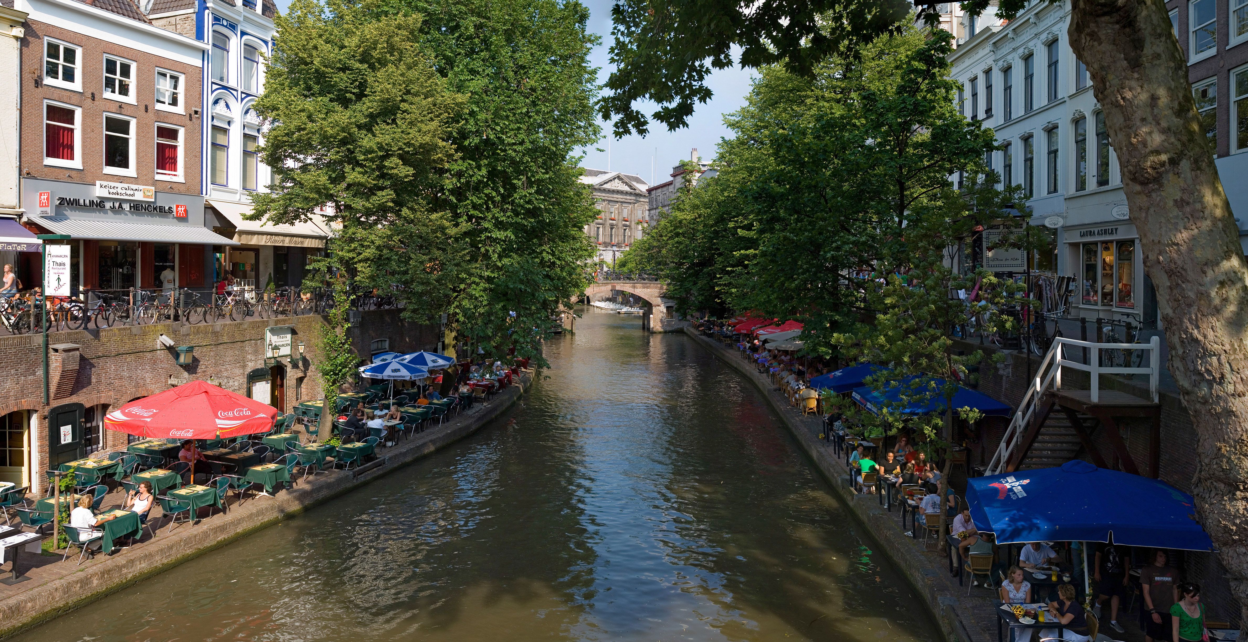
The Oudegracht, or "old canal", runs through the center of Utrecht, the Netherlands. It starts in the southeast of the city. Here the Kromme Rijn (the original main bed of the Rhine river) and the Vaartse Rijn (a medieval canal reconnecting Utrecht to the newer main stream of the Rhine, the Lek) arrive to meet the original moat of the fortified town, and the Oudegracht goes from there into the center of town. Parts of the Oudegracht follow the original flow of the river Rhine, but there is some disagreement on what parts. The northern part is most likely an early canal (app. 1000) connecting the Rhine section to the river Vecht. The southern part was started in 1122, after the water level of the Rhine in Utrecht dropped because of the new dam at Wijk bij Duurstede. The ground excavated was used to raise the sides of the canal, to reduce the chance of flooding. When the city's system of locks was finished in 1275 the water level was constant, enabling the creation of permanently dry cellars and new quays at water level, hence the typical wharfs (Dutch: werven) below street level. Warehouses used to line the canal. Today many of these warehouses have been converted into restaurants and cafés.

Wharfs along the Oudegracht.
The Oudegracht by night.

Coordinates: 52°05′30″N 5°07′04″E / 52.09167°N 5.11778°E / 52.09167; 5.11778


Wikimedia Foundation. 2010.

Игры ⚽ Нужна курсовая?

Look at other dictionaries:

  • Utrecht — For other uses, see Utrecht (disambiguation). Utrecht   Municipality   Oudegracht …   Wikipedia

  • Zoudenbalch — The Zoudenbalch family (also known as Soudenbalch) was one of the most prominent families of Utrecht throughout the Middle Ages to the age of the Dutch Revolt. They occupied all posts of importance in the city government, possessed various… …   Wikipedia

  • Utrecht (city) — Infobox Settlement official name = Utrecht skylinesize = 280px mapsize = 280px image shield = UtrechtCity COA.gif subdivision type = Country subdivision name = flagicon|Netherlands Netherlands subdivision type1 = Province subdivision name1 =… …   Wikipedia

  • Haarlem — Infobox Settlement official name = Haarlem nickname = Bloemenstad (Dutch for flower city) motto = Vicit vim virtus (Latin for Virtue conquered force) imagesize = 230px image caption = flag size = 120x100px image shield = Haarlem wapen.svg shield… …   Wikipedia

  • Christelijk Gymnasium Utrecht — The Christelijk Gymnasium Utrecht is a Dutch grammar school in Utrecht, in the Netherlands. It was founded in 1897. The school was divided into two parts in September 2007, with a new location in Lombok. Both parts now operate almost… …   Wikipedia

  • Utrecht — Bandera …   Wikipedia Español

  • GreenLeft — Infobox Dutch Political Party party name = GroenLinks party party wikicolourid = GL leader = Femke Halsema partychair = Henk Nijhof EKleader = Tof Thissen TKleader = Femke Halsema EPleader = Kathalijne Buitenweg (of the GreenLeft Green!… …   Wikipedia

  • Kromme Rijn — Geobox River name = Kromme Rijn native name = other name = Crooked Rhine other name1 = image size = 220 image caption = country = The Netherlands country1 = state = Utrecht state1 = region = region1 = district = district1 = city = city1 = length …   Wikipedia

  • Trijn van Leemput — (c. 1530 Utrecht, 1607) was a Dutch heroine of the Eighty Years War against Spain. According to local legend in Utrecht, she led a large group of women on May 2, 1577 to the castle of Vredenburg and gave the signal to begin demolishing the castle …   Wikipedia

  • The Good Cause — was the English name for Dutch pop group Het Goede Doel with the singer duo Henk Westbroek and Henk Temming. They recorded an English version of their 1982 hit België [Although België means Belgium in Dutch language, the song refers to the… …   Wikipedia

Share the article and excerpts

Direct link
Do a right-click on the link above
and select “Copy Link”