- Fair Haven (New Haven)
-
 The northern portion of Front Street in Fair Haven, as seen from the Grand Avenue bridge in May, 2005.
 The southern portion of Front Street in Fair Haven, as seen from the Grand Avenue bridge in May, 2005.
Fair Haven is a neighborhood in the eastern part of the city of New Haven, Connecticut located between the Mill and Quinnipiac rivers. The northeast section of the neighborhood is also known as Chatham Square.
In 2010, New Haven mayor John DeStefano, Jr. summarized the neighborhood by remarking that people in Fair Haven stay in the neighborhood to shop, eat, go to school and worship. "More than any other neighborhood in the city," Fair Haven is rooted in, and contained within itself.[1]
Fair Haven is located about two miles east of the New Haven Green comprising New Haven wards 14, 15, 16, and a portion of 8.[2] It is bounded on the east and south by the Quinnipiac River, on the west by the Mill River, on the northwest by Amtrak railroad tracks, and on the north by I-91 (in the vicinity of Exit 7). The main through routes of the area are Grand Avenue, Blatchley Avenue, and Ferry Street.
In its early days, the area was called by a succession of names including Farmes, East Farmes, The Neck, Dragon, and Clamtown. Herman Hotchkiss is credited as founder due to his investments and development.
Fair Haven is not to be confused with the adjacent Fair Haven Heights neighborhood.
Contents
History
17th century
Prior to its founding by European settlers, Fair Haven was used by the Momauguin group of Quinnipiack Native Americans for farming.
It is said that in 1639, when Captain Richard Russell first viewed the harbor, "The sight of the harbor did so please the Captain of the ship, that they called it a Fayre Haven." In 1640, the area currently called Fair Haven was named 'The Neck'. Fair Haven was originally a village formed in 1679 to house industrial workers, as the area was a source of oysters and other products of the rivers and nearby harbor. It is said to have produced almost 5,000 gallons of oysters per day in season when at its peak. Besides oyster houses, manufacturing plants and a brewery were established. In the beginning, Fair Haven could only be reached by boat, on foot, or on horseback. In time, dirt roads were laid, for use by horse-drawn vehicles.
18th century
In 1784 Fair Haven became a part of the city of New Haven. The Pardee Family of East Haven began a ferry service across the Quinnipiac in 1785. The service was discontinued in 1791 with the construction of the Dragon Bridge.
19th century
In 1806, land was donated for Fair Haven Union Cemetery.
By 1808, Fair Haven had 50 houses.
In 1820, the first apartment building for multiple residences was built.
In 1824, residents changed the name of their home from 'Dragon' to 'Fair Haven'.
By 1830, the oyster beds were dried up.
In 1835, importation of oysters began, with the supply being replenished by 1900.
In 1837 Fair Haven withdrew from the jurisdiction of New Haven.
A number of homes in Fair Haven were used to hide slaves in the Underground Railroad.
By the time of the Civil War, some streets had been paved. There was an influx of immigrants after the war, notably Irish, German, Polish, Italian and Russian. One area with a large number of Irish was nicknamed 'little Dublin'.
In 1860, a group of local businessmen drew up a charter to build and operate a horsecar line of one or two tracks between Fair Haven and Westville.
In 1866, Samuel L. Blatchley developed Blatchley Ave., building moderately-priced homes for local workers.
St. Francis Church held its first service in 1867.
In 1870 Fair Haven rejoined New Haven.
In 1885, Nathaniel Graniss donated land for the construction of the First Quinnipiac School.
In 1888, Lancraft Fife and Drum Corps organized, practiced in Ed Lancraft's Oyster house.
20th century
By the 1930s, Fair Haven was home to more immigrants than 'natives'. Many black and Puerto Rican families migrated into Fair Haven by the 1960s. Redevelopment occurred along the Quinnipiac River.
As part of Mayor Richard C. Lee's urban renewal program, 107 Fair Haven households were displaced in the 1960s.[3]
In 1978, a local historic district was created.
In the early 1980s, many buildings on Grand Avenue were renovated.
21st century
The waterfront area (Front Street and adjancent streets) have been redeveloped in the last decade, including construction of luxury condominiums, renovation of the Fair Haven marina, demolition of the Quinnipiac Terrace public housing project and replacement with a Cape Cod style village with both subsidized and market rate units, and the renovation of many of the old oyster houses. This part of Fair Haven has attracted a culturally diverse mix of young professionals, students, artists, and families with children. Other parts of Fair Haven continue to struggle with poverty related problems such as crime and homelessness.
Historical populations
- 1808 - 150 (15 families)
- 1837 - 1,000
- 1850 - 1,317
- 1870 - 5,600
- 1930 - 23,960
- 1989 - 13,895
- 1990 - 14,545
- 2000 - 13,753 (4,724 households)
Flora and fauna
Aside from stray cats and dogs, other small animals that can be found in Fair Haven include mice, opossums, raccoons, and squirrels. Common birds include blue jays, feral pigeons, robins, and starlings. Along Dover Beach, there are scuds and caddisflies. [4] Plants include the Autumn Olive, the Beach Rose, Spartina alterniflora, Rosa virginiana, and the Weeping Willow. [5]
Notables sites
- Barnesville Bridge (carrying Grand Ave over the Mill River)
- Clinton Avenue School (built in 1911)
- Christopher Columbus Academy
- Erector Square
- Fair Haven Middle School (built in 1927)
- Fair Haven Union Cemetery
- Grand Avenue Bridge (built in 1896; the 3rd bridge on the site)
- Lewis Bridge (carries Middletown Ave. across the Quinnipiac River)
- Methodist Episcopal Church (originally a Congregational Church)
- New Haven Brewing Company
- Quinnipiac River Historic District
- Quinnipiac River Park
- River Street Historic District
- St. Donato Roman Catholic Church (built in 1915)
- St. Francis Roman Catholic Church
- St. Rose Roman Catholic Church (built in 1908)
- Strong School (built in 1916)
- Tomlinson Bridge (built 1796-98)
Notable sites of the past
- A. C. Gilbert Company
- Bigelow Company
- Ezekiel Cheever School
- Dover Beach
- Dragon Bridge
- Ferry Street School
- First Church
- First Quinnipiac School (built in 1885, burned down in 1914)
- Grace Church
- Grapevine Point
- John Rowe's tavern
- King's Hotel
- Lloyd Street School
- National Folding Box Company (In Cedar Hill (New Haven) once a community of Fair Haven)[6]
- National Pipe Bending Company
- Quinnipiac Brewery
- Warner's Hardware Store (built in 1875)
- Woolsey Grade School
List of streets
Street Origin of name Other 2nd St. Alton St. possibly Alton, Hampshire, England previously called Arch St. Atwater St. probably William Atwater, Fair Haven native and realtor Bailey St. William R. Bailey, farmer shortened with construction of I-91 Beach View Ln. new street added with 2006 Quinnipiac Terrace redevelopment Blatchley Ave. Samuel L. Blatchley, realtor and developer segment previously named Jackson Brewery Sq. Bright St. Bright family, wholesale rag dealers Castle St. Chambers St. possibly William R. Chambers, file manufacturer previously called 3rd St. Chapel St. Yale College Chapel previously called Winthrop St. Chatham St. Chatham, England Clay St. Henry Clay, U.S. statesman Clinton Ave. DeWitt Clinton, governor of New York Clinton Pl. Del Rio Dr. new street added with 2006 Quinnipiac Terrace redevelopment Dover Dr. Dover St. Dover, England, a seaside resort partially obliterated in 1923 with creation of Clinton Park Downing St. probably Downing St. in London East Pearl St. originally named Pearl Street, perhaps because of the custom of using crushed oyster shells as a road surface English St. Nathaniel S. English, farmer Exchange St. location of an exchange office where oyster were traded for merchandise or for money Fawn St. possibly named for a fawn sighted in the area Ferry St. route to a ferry crossing the river originally Ferry Path, although the diagonal street was relaid straight; also previously called Guilford Tpke Fillmore St. Millard Fillmore, 13th U.S. President Fox St. Isadore Fox, landowner Front St. in front of the river thought to be the oldest road in Fair Haven, with the exception of Ferry Path; it used to be low enough that oyster boats could reach houses at high tide Grafton St. probably Grafton St., Dublin, Ireland Grand Ave. called Grand St. until 1871; East Grand St. until 1887 Haven St. probably a haven for boats Houston St. Senator Sam Houston James St. possibly James Hillhouse, landowner, but probably James E. English, land developer John W. Murphy Dr. Mayor of New Haven from 1940-1941, a Fair Haven native John Williamson Dr. John Williamson, a basketball player from New Haven new street added with 2006 Quinnipiac Terrace redevelopment Lewis St. Charles Lewis, ship master and oyster dealer Limerick St. Limerick, Ireland Lloyd St. Sarah Lloyd, wife of James Hillhouse Lombard St. Lombardy poplar trees planted by James Hillhouse on his land Main St. Amasa Porter, developer, probably mistakenly thought the area would maintain its importance as a main street Maltby Pl. Oliver E. Maltby, wealthy retired New York businessman Maltby St. Maltby family, early Fair Haven settlers Market St. possible site of an old farmers' market Middletown Ave. Middletown, Connecticut Mill St. Mill River Monroe St. James Monroe, 5th U.S. President Murray Pl. Peter Murray, carpenter Park Pl. Clinton Park Peck Aly. Peck St. probably William A. Peck, landowner Perkins St. Charles Perkins, landowner Pierpont St. Rev. James Pierpont Pine Aly. Pine Pl. Pine St. Pine grove near the Quinnipiac River Poplar St. Lombardy poplar trees Qualmish Ave. Fair Haven Union Cemetery road Richard St. River St. Quinnipiac River Rowe St. Rowe family, prominent Civil-War era Fair Haveners interrupted by I-95 Saltonstall Ave. Rev. Gurdon Saltonstall Saltonstall Ct. Sandford St. Captain Titus Sanford, steamboat pilot and landowner previously called 4th St. Shelter St. possibly Shelter Island Wilcox Pl. Edward T. Wilcox, joiner Wolcott St. Governor Oliver Wolcott Woolsey St. Rebecca Woolsey or Theodore D. Woolsey, President of Yale References
- ^ This Farmacia Delivers - September 22, 2010 at New Haven Independent
- ^ City of New Haven Street Map
- ^ Life in the Model City: The Process of Urban Renewal - The Process of Redevelopment
- ^ Quinnipiac River Water Testing
- ^ Grand Avenue plants
- ^ http://books.google.com/books?id=9_UUAAAAYAAJ&pg=RA6-PA9&dq=National+Folding+Box+%26+Paper+Co,+cedar+hill&hl=en&ei=AHofTJoJ0r6sB_Cb1bUL&sa=X&oi=book_result&ct=result&resnum=9&ved=0CFYQ6AEwCA#v=onepage&q&f=false Public documents of the State of Connecticut, Volume 3, Part 1 By Connecticut
Bibliography
Digital
- A River Runs Through It - A Brief History of Fair Haven
- CTSchools.net - Clinton Avenue School
- The Community and You: Learning Your Way Around Fair Haven
- DataHaven
- Fair Haven: An Historical and Ecological Field Study
- Fair Haven Community and the Grand Avenue Bridge
- Fair Haven Walking Tour
- The Fair Haven & Westville Railroad
- New Haven Vital Statistics
- Population of Connecticut Towns 1756-1820
Print
- Harrison's Illustrated Guide: Greater New Haven ISBN 0-927054-39-6
- Images of America: New Haven - Reshaping the City 1900-1980 ISBN 0-7385-1032-7
- New Haven - A Guide to Architecture and Urban Design ISBN 0-300-01993-9
- The Streets of New Haven - The Origin of Their Names, 2nd edition 1998 ISBN 0-943143-02-0
- Three Centuries of New Haven - The Tercentenary History ISBN 0-300-00812-0
Neighborhoods of New Haven Amity-West Hills · The Annex · Beaver Hills · Cedar Hill · City Point · Dixwell · Downtown · Dwight · East Rock · East Shore · Edgewood · Fair Haven · Fair Haven Heights · The Hill · Long Wharf · Mill River · Newhallville · Prospect Hill · Quinnipiac Meadows · West River · West Rock · Westville · Wooster SquareMunicipalities and communities of New Haven County, Connecticut Cities 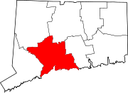
Towns Beacon Falls | Bethany | Branford | Cheshire | East Haven | Guilford | Hamden | Madison | Middlebury | Naugatuck* | North Branford | North Haven | Orange | Oxford | Prospect | Seymour | Southbury | Wallingford | Wolcott | Woodbridge
*Consolidated borough and town
Borough Unincorporated
communitiesDevon | Fair Haven | Heritage Village | Northford | Quaker Farms | Short Beach | South Britain | Stony Creek | Waterville | Westville | Yalesville
Coordinates: 41°18′40″N 72°53′44″W / 41.31111°N 72.89556°W
Categories:- Neighborhoods in New Haven, Connecticut
- Underground Railroad locations
- Fair Haven (New Haven)


Wikimedia Foundation. 2010.