- Martuni, Armenia
-
- For the village of the same name located on the northern side of Lake Sevan, see Martuni (village).
Martuni
ՄարտունիMartuni at dusk Location of Martuni in Armenia
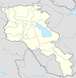
 Martuni
ՄարտունիCoordinates: 40°08′24″N 45°18′23″E / 40.14°N 45.30639°E Country
Marz Armenia
GegharkunikGovernment - Mayor Bagrat Harutyunyan Elevation 1,509.3696 m (4,952 ft) Population (2008) - Metro 11,987 Time zone GMT+4 (UTC+4) - Summer (DST) GMT+5 (UTC+5) Coordinates: 40°08′24″N 45°18′23″E / 40.14°N 45.30639°E
Martuni (Armenian: Մարտունի, also Romanized as Martuny; originally, Mets Kznut, from 1830-1922, Karanlug, Nerkin Karanlukh, Nerkin Gharanlugh, and Russified as Nizhniy-Karanlug) is a city located in the Gegharkunik Province (marz) of Armenia. It is near Lake Sevan which is a largest lake in the Caucasus. Its population is estimated to be 11,987 as of 2008. In ancient times it was known as Mets Kznut, but from 1830-1922 it was called Nerkin Gharanlugh and in 1926 it was changed to Martuni in honor of the first Soviet premier of Armenia, Aleksandr Myasnikyan, whose nom de guerre was "Martuni". Martuni was the former capital of Gegharkunik Province. Martuni has a church called Astvatsatsin church which was rebuilt in 1886. There is also an Iron Age fort excavated in 1997 by an Armenian-Italian team.
Sports
- Alashkert Martuni (football club)
References
- Martuni, Armenia at GEOnet Names Server
- World Gazeteer: Armenia – World-Gazetteer.com
- Report of the results of the 2001 Armenian Census, National Statistical Service of the Republic of Armenia
- Brady Kiesling, Rediscovering Armenia, p. 45; original archived at Archive.org, and current version online on Armeniapedia.org.
Capital: Gavar Gavar Berdkunk · Gandzak · Gavar · Gegharkunik · Hayravank · Karmirgyugh · Lanjaghbyur · Lchap · Noratus · Sarukhan · Tsaghkashen · Tsovazard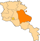
Sevan Chkalovka · Ddmashen · Geghamavan · Lchashen · Norashen · Semyonovka · Sevan · Tsaghkunk · Tsovagyugh · Varser · ZovaberChambarak Martuni Artsvanist · Astghadzor · Dzoragyugh · Geghhovit · Lichk · Madina · Martuni · Nerkin Getashen · Tsakkar · Tsovasar · Tsovinar · Vaghashen · Vardadzor · Vardenik · Verin Getashen · Yeranos · ZolakarVardenis Akhpradzor · Akunk · Areguni · Arpunk · Avazan · Ayrk · Azat · Daranak · Geghakar · Geghamabak · Geghamasar · Jaghatsadzor · Kakhakn · Karchaghbyur · Khachaghbyur · Kut · Kutakan · Lchavan · Lusakunk · Makenis · Mets Masrik · Nerkin Shorzha · Norabak · Norakert · Pambak · Pokr Masrik · Shatjrek · Shatvan · Sotk · Torfavan · Tretuk · Tsapatagh · Tsovak · Vanevan · Vardenis · Verin ShorzhaCategories:- Populated places in Gegharkunik
- Gegharkunik geography stubs


Wikimedia Foundation. 2010.