- Munderoo, New South Wales
-
Munderoo
New South Wales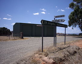
Munderoo - showing Bush Fire Brigade Shed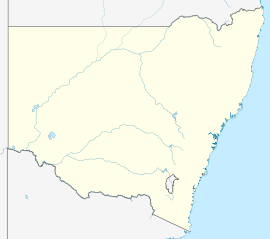
 Munderoo
Population: 358 (2006 Census)[1] Postcode: 2653 Elevation: 561 m (1,841 ft) Location: County: Selwyn State District: Albury Munderoo is a rural community in the south east part of the Riverina. It is situated about 11 kilometres west from Mannus and 16 kilometres north from Ournie. At the 2006 census, Munderoo had a population of 358 people.[1]
The area probably took its name from a farming property Mundaroo which is situated near the Ournie Road and Linden Roth Drive T-intersection.
The only public building in the area is the Bush Fire Brigade Shed situated on that same intersection.
Notes and references
- ^ a b Australian Bureau of Statistics (25 October 2007). "Munderoo (State Suburb)". 2006 Census QuickStats. http://www.censusdata.abs.gov.au/ABSNavigation/prenav/LocationSearch?collection=Census&period=2006&areacode=SSC18247&producttype=QuickStats&breadcrumb=PL&action=401. Retrieved 4 November 2009.
Coordinates: 35°51′0″S 147°52′0″E / 35.85°S 147.866667°E
Categories:- Towns in New South Wales
- Towns in the Riverina


Wikimedia Foundation. 2010.