- Omaruru, Namibia
-
Omaruru 
SealMotto: Believe and Courage Location in Namibia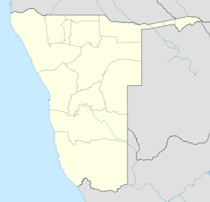
 Omaruru
Coordinates: 21°26′S 15°56′E / 21.433°S 15.933°E Country  Namibia
Region Erongo Region Constituency Omaruru constituency Population (2010)[1] - Total 4,800 Time zone South African Standard Time (UTC+1) Omaruru is a city[2] and constituency in the Erongo Region of Namibia. The town has 4,800 inhabitants and owns 352 square kilometres (136 sq mi) of land.[1] The town is situated near the Erongo Mountains, on the usually dry Omaruru River. It is located on the main paved road from Swakopmund to Otjiwarongo. The name in the local Otjiherero language means 'bitter milk', as the cattle used to browse on a local bush that turned their milk bitter.
The town is known for its annual festival where the Hereros commemorate their past local chiefs, its winery and for the dinosaur footprints at nearby Otjihenamaparero.
Contents
History
In 1871, Anders Ohlsson and Axel Eriksson established a brewery at Omaruru. Eriksson had also established a trading post, which flourished and by 1878 he employed about forty whites.[3] Eriksson's business was based upon long-distance trading between southern Angola and Cape Colony, which necessitated the establishment of regional trade routes[4]
The town grew around a mission built in 1872 by Gottlieb Viehe, now a museum, and was attacked in 1904 during the Herero and Namaqua Genocide. Captain Franke's Tower was later erected to commemorate the relief by Hauptmann Franke's troops of the local garrison that was beleaguered by Hereo tribesmen who had risen against the German colonial presence.
Legacy of von Trotha
The descendants of Lothar von Trotha and the von Trotha family travelled to Omaruru in October 2007 by invitation of the royal Herero chiefs and publicly apologised for his role in the Herero Genocide. Member of the family Wolf-Thilo von Trotha: "We, the von Trotha family, are deeply ashamed of the terrible events that took place 100 years ago. Human rights were grossly abused that time," BBC News.
Politics
In the 2010 regional elections, SWAPO's Uparura U. U Michael Tjirare won the constituency with 1,102 votes. The defeated challengers were Josef Landuleni Nangolo of the Rally for Democracy and Progress (570 votes), Lisken Noabes of the United Democratic Front (398 votes) and John Tjiuongua of the Congress of Democrats (96 votes).[5]
Transport
The town lies on the Trans-Namib Railway.
See also
References
- ^ a b "ELECTIONS 2010: Erongo regional profile". New Era. 16 November 2010. http://www.newera.com.na/article.php?articleid=14109.
- ^ Alliance of Mayors and Municipal Leaders on HIV/AIDS in Africa
- ^ Christison, G. "BEYOND THE PALE: DAMARALAND & OVAMBOLAND". http://dspace.ukzn.ac.za:8080/jspui/bitstream/10413/233/4/chapter%202%20Beyond%20the%20Pale.pdf. Retrieved 19 Nov 2009.
- ^ Sellström, Tor (1999). "Sweden and National Liberation in Southern Africa: Volume 1". Nordiska Afrikainstitutet, Uppsala. http://www.liberationafrica.se/publications/91-7106-430-3.pdf. Retrieved 19 Nov 2009.
- ^ Election results from Electoral Commission of Namibia
Coordinates: 21°26′S 15°56′E / 21.433°S 15.933°E
Constituencies in the Erongo Region of Namibia  Categories:
- Cities in Namibia
- Constituencies of Erongo Region
- Namibia geography stubs


Wikimedia Foundation. 2010.