- Cerro Machín
-
Cerro Machín Tolima Department, Colombia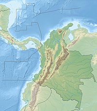
 Cerro Machín
Elevation 2,650+ metres (8,694 feet) [1] Listing List of volcanoes in Colombia Location Range Cordillera Central Coordinates 04°29′00″N 75°23′30″W / 4.4833333°N 75.39167°WCoordinates: 04°29′00″N 75°23′30″W / 4.4833333°N 75.39167°W[1] Geology Type Stratovolcano Age of rock 1,000,000+ Last eruption 1180 ± 150 years[1] Cerro Machín is a stratovolcano located in Tolima Department, Colombia. Cerro Machin is a volcanic plug that is approximately the same age (1,000,000+ years) as the Ruiz-Tolima Massif and has the appearance of being part of that volcanic system. Its sisters are Nevado del Tolima, 17000+ feet; Santa Isabel, 15,000 feet, Nevado del Ruiz, 17,000+ feet, plus nine other lesser volcanoes and a 10,000 foot volcanic South Wall containing in excess of thirty volcanic domes.
All the Ibague volcanoes are rift volcanoes from the San Jeronimo Fault (this fault has three names, the Palestina, the Romero Faults and the San Jeronimo) (the RJP Fault), which comes ashore from the Caribbean at the Santa Marta Volcano and runs south from there to Peru. The entire volcanic complex, except for east Ruiz and the east portion of the south wall lie west of the San Jeronimo (RJP) Fault, in the “broken” western tectonic field (see below).
The San Jeronimo Fault Rift Valley south of Ibague is “The Boqueron Canyon.” Visually, the Boqueron Canyon looks like the San Andreas Valley just south of San Franicsco, where Dr. Richter decided there was a San Andreas fault (view is from Calle 7 at Avenida 13, Ibague), in the Beima Canyon. The Boqueron Canyon is just deeper and the mountains higher than the San Andreas Valley. Nevada Huila rises majestically in the distance, the eastern foot of Huila is part of the wall of the fault canyon. Directly opposite this vista point is another thousand plus foot ridge with at least four volcanoes on it. Beyond that, the most distant sister from the fault, Machn lies, maybe 15 km away.
In the main valley, the fault’s track is obvious as it goes up the South Wall behind the University of Ibague and Vergel, on its way to the crest of Nevada del Ruiz.
The San Jeronimo Fault (RJP) runs on a northeast-southwest axis and can be seen on world maps as the line of the Magdalena River running from Ibague to Manizales. The RJP is paralleled by other parallel faults weaving in and out from the Caribbean to Peru, much like a cow track. At Ibague the Matulla is 10–15 km west and east about 25 km is another the Nazz??.
At Poyayan, in 1906, on the RJP, there was an 8.8 Magnitude Earthquate, the fifth largest on the planet the last two hundred years. On 27 October 2009, there was a 5.5 at Mesa de los Santos, Northern Santander. At Ibague, 500 km away this small quake felt like a 3.5 at 10 miles (The Daily City Earthquake, 1979).
West of the fault line, the land is moving north. Follow the fault line out in both directions and much of the volcanic activity of Colombia is explained, including Machin, Huila, Ruiz-Tolima, Galleras, Santa Marta and the Bogota Caldera (not listed as a volcano, but the area covers about 40 km (east-west) and 60 km (north-south), a mouth at Suba and one north near Avenida Jeminez), active (2 day sound event in 1917 called the “epoca del ruido,” and the Legend of The Tequendama Falls which sets a date last eruption window).”
The Bogota Caldera fits the P.B.S. (2006) description of Tuba, including the ring of support volcanoes. So the question is, can a rift volcano be a mega? If a rift volcano can’t be a mega, then Bogota has excellent volcanic heat camouflage, millions of people living in the caldera, so the heat doesn’t show up on the satellite surveys. Just imagine a flat oval piece of land 40x60 km in the middle of the Andes (that is an oxymoron) that matches the U.S. Public Broadcasting Service’s description of Tuba, not being a volcano. Bogota’s lake silted in from the heavy rainfall erosion (It was there when the Spanish arrived), and the land is obviously saturated because the streets are all at up and down angles. Many buildings have such serious foundation problems from the ground water and in other jurisdictions, they would be demolished (hotel at &th and 70)). But in other jurisdictions, they would be trying to move the city too.
Around Machin, the surface land is all a cream color to brown hard sand, almost, but not quite rock, with lots of crystal rocks and granite balls mixed in (the granite balls run up to maybe eight foot in diameter in the lava flows. This lava bed is thousands of feet thick. On the surface, there is no sign of tectonic fragmentation, except on the south wall of the Massif, and that only if you know what you are looking at.
The South Wall looks like Mauna Loa with the lava tubes coming down. But one of the domes at Vergel, just east of Ibague, has been opened in a mining operation and the core exposed (The core looks like a really nice ring that has gold or platinum plates built up into a cone shaped). The wall is not lava tubes, rather its all mini volcanic domes, more than thirty of them.
Most years (this is a “La Nina Year (2009), hence dry), the area has extremely heavy rainfall for about eight months a year and the result is a lattice of small rivers which cut the lava mass into long, narrow mountains interspaced by deep river canyons (fifteen hundred to two thousand feet deep). And everything is covered with vegetation, in some places thick, but its not a jungle, the mean ground level is too high (4500 feet), the climate is subtropical.
At Ibague, U.S.G.S. maps of the region show a lattice network of earthquake faults beneath the surface. To be accurate, in the area west of the RJP, around Ibague, the fault network is more accurately depicted as a fine mesh network, representing very brittle one kilometer square tectonic plates (Vargas). Its ice cube tectonics, which logically should have muffed earthquakes, but the condition apparently amplifies earthquakes.
Machin is about seventeen kilometers west into this broken tectonic field (as measured from the RJP at Ibague, so the logical question is, “how does being in a broken tectonic field affect volcanic activity?”
A broken tectonic debris field like this field implies a thin Earth mantle, resulting in lots of heat at the surface. That is Machin. A volcanic plug in the ground, with lava too hot to build an edific, and huge lava flows towards north because the caldera ring is broken on that side. The flows are up to 40 km long and threaten Melgar and Hierdot according to Inerominas, but not Ibague.
A 360 degree pyroclastic flow pattern out 15 km from the throat has been referenced, but in the context of Plinian Columns, there is no reference to Ibague, the mountain behind Ibague and pyroclastic flows in any public record, obviously warnings do not exist (reference Armero). At 17 kilometers from the throat, Ibague should experience, at minimum, all the problems of Antigua (Guatemala), and possibly on the west side, if the wind goes east during an eruption, serious Plinian Column collapse problems (West winds between February and August happen about 20% of the time and the back side of Ibague is a several kilometer steep slope which will funnel the pyroclastic flow).
Controversial Notes:
- With reference to Machin, neither Plinian Columns nor Pyroclastic Flows have ever been discussed flowing down the backside of Ibague's mountain, in the public record of Colombia, and Inerominias has not issued a warning for Machin with particular reference to the portion of Ibague west of Plaza Bolivar. With particular reference to Armero, pyroclastic flows on the backside of Ibague appear to present a hazard to substantial numbers of Humans. Please consider this the first health warning notice dated November 2009.
- Reference was made in the body of the article to the Caldera at Bogota. There is no written reference materials to the Bogota Caldera. My observations were made on the road\trail above the Club Metropolitan at the top of the step. One mouth of the volcano appears to be the Suva Hills. If so, there has to be another mouth far to the north, if the caldera is not totally open at the bottom.
It is hoped that this reference will inspire some energetic academic to go out, look and prove the obvious. That Bogota is a caldera that has burnt down at least twice ((there is a second step on the east wall above Club Metropolitan, that there are three obvious blast rings north of the caldera on the highway along the escarpe north from Bogota, and a ring of dragons teeth on the western escarp.
As stated in the article, millions live in the caldera, and there is the appearance that it is a mega volcano, not a rift, which if true, has evaded detection by having millions live in the calders. If it’s a rift volcano, it’s still excessively dangerous. Once again, within the context of the Armero Disaster, please also consider this, like the first note, to be the first public heath warning notice, dated November 2009.
References
- ^ a b c "Machín". Global Volcanism Program, Smithsonian Institution. http://www.volcano.si.edu/world/volcano.cfm?vnum=1501-04=. Retrieved 2007-01-19.
- U.S.G.S. MAPS-www.usgs.gov
- Lorcan Kennan and James Pindel (forthcoming, 2009). Dextral shear, terrain accretion and basin formation in the North Andes: best explained by interaction with a Pacific-derived Caribbean Plate (preprint). To appear in The geology and evolution of the region between North and South America, Geological Society of London, Special Publication.
- "New Geological and Geophysical Contributions in the Section Ibague-Armenia, Central Cordillera-Colmiba", Carlos A. Vargas et al., Earth Sciences Research Journal Vol. 9, No 2, Dec 2005 pp99–109
External links
Categories:- Mountains of Colombia
- Volcanoes of Colombia
- Stratovolcanoes

Wikimedia Foundation. 2010.