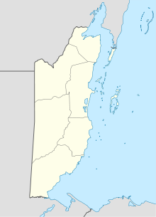
Dangriga — Drums of our Fathers Monument in Dangriga, Belize Nickname(s): The Culture Capital, Griga … Wikipedia
Philip S. W. Goldson International Airport — Infobox Airport name = Philip S. W. Goldson International Airport nativename = nativename a = nativename r = image width = caption = IATA = BZE ICAO = MZBZ type = Public owner = operator = N/A city served = location = Belize City elevation f = 15 … Wikipedia
Belize City Municipal Airport — Infobox Airport name = Belize City Municipal Airport nativename = nativename a = nativename r = image width = caption = IATA = TZA ICAO = type = Public owner = operator = city served = location = Belize City elevation f = elevation m =… … Wikipedia
Placencia Airport — Infobox Airport name = Placencia Airport nativename = nativename a = nativename r = image width = caption = IATA = PLJ ICAO = type = Public owner = operator = N/A city served = Placencia location = elevation f = 42 elevation m = 14 coordinates =… … Wikipedia
Punta Gorda Airport — Infobox Airport name = Punta Gorda Airport nativename = nativename a = nativename r = image width = caption = IATA = PND ICAO = type = Public owner = operator = city served = location = Punta Gorda, Belize elevation f = elevation m = coordinates … Wikipedia
Big Creek Airport (Belize) — Infobox Airport name = Big Creek Airport nativename = nativename a = nativename r = image width = caption = IATA = BGK ICAO = ? type = Public owner = operator = N/A city served = location = Big Creek, Savanah elevation f = 16 elevation m = 5… … Wikipedia
DGA — may refer to: Damned Good Airplane (DGA) a series of planes, i.e. DGA 15 built by Howard Aircraft Corporation Dangriga Airport in Dangriga, Belize (IATA Code: DGA) Direction Générale de l Armement, a French governmental organization for defence… … Wikipedia
Glovers Reef — Belize … Deutsch Wikipedia
Transport in Belize — This article is about transport in Belize. Roads * total: 2,872 km * paved: 565 km * unpaved: 2,307 km Belize has four major asphalt paved two lane roads: the Hummingbird Highway, Southern Highway, Western Highway, Northern Highway. The remaining … Wikipedia
Fantasy Island Eco Resort — (Dangriga,Белиз) Категория отеля: Адрес: South End, Coco Plum Range, 0000 … Каталог отелей
 Dangriga Airport