Cobequid Bay

Cobequid Bay
Cobequid Bay
Cobequid Bay - Aerial photograph of the Cobequid Bay at low tide, looking towards the East.
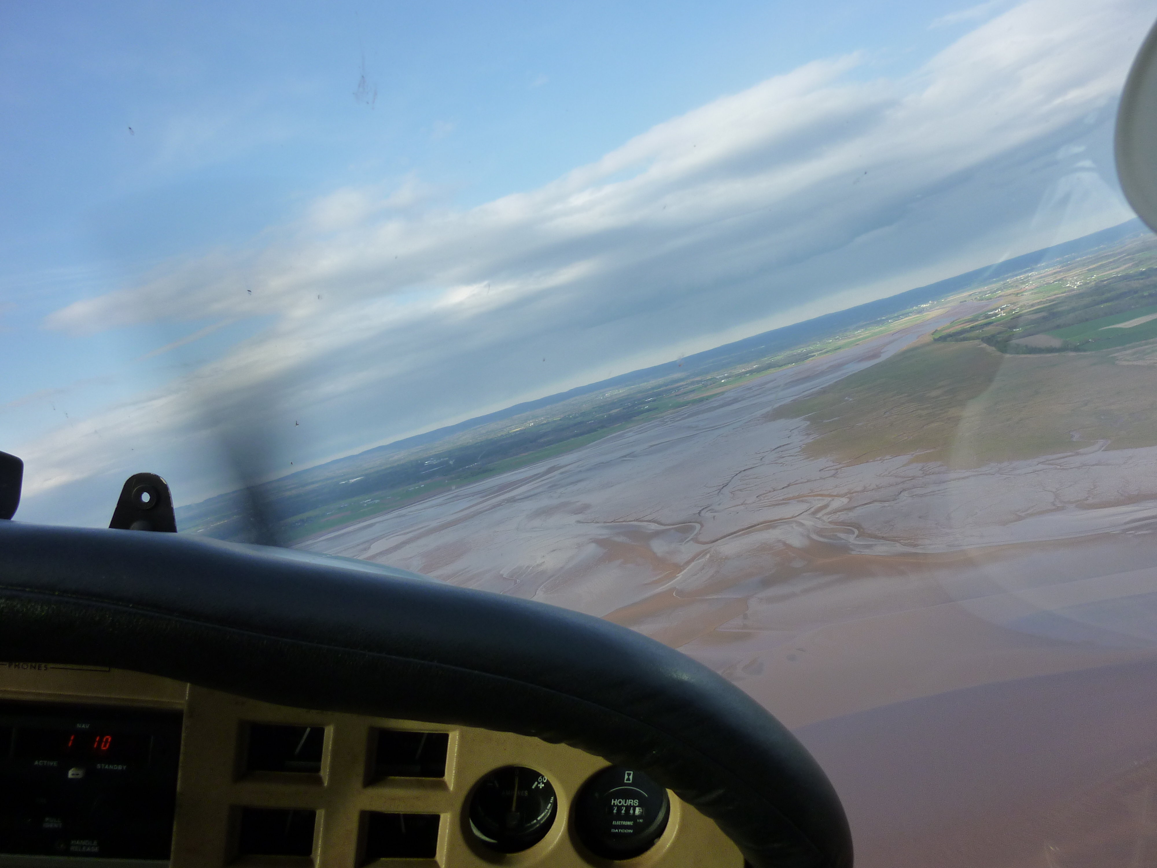
Aerial photograph of the Cobequid Bay at low tide, looking towards the East.
Location Eastern end of Bay of Fundy
Coordinates 45°21′N 63°45′W / 45.35°N 63.75°W / 45.35; -63.75Coordinates: 45°21′N 63°45′W / 45.35°N 63.75°W / 45.35; -63.75
River sources Shubenacadie River Salmon River
Ocean/sea sources Atlantic Ocean
Countries Canada


Cobequid Bay is an inlet of the Bay of Fundy and the easternmost part of the Minas Basin, located in the Canadian province of Nova Scotia. The bay was carved by rivers flowing into the eastern end of the Bay of Fundy.[1]

The eastern end of the bay hosts the estuary of the Salmon River, whereas the west end of the bay is less well-defined, typically delineated by Burntcoat Head on the southern shore and Five Islands or Economy Mountain on the northern shore.

The highest tidal range in the world was measured at Burntcoat Head where average tidal ranges measure a 12.4 m (41 ft) vertical difference in water level between low tide and high tide.

References

  1. ^ Nova Scotia Museum of Natural History. "Geology and Landscape Development". http://museum.gov.ns.ca/mnh/nature/nhns2/600/620.htm. Retrieved 2011-09-18. 


Wikimedia Foundation. 2010.

Игры ⚽ Нужен реферат?

Look at other dictionaries:

  • Cobequid Bay — Sp Kòbekvido įlanka Ap Cobequid Bay L Mainaso įl. dalis, Kanada (N. Škotija) …   Pasaulio vietovardžiai. Internetinė duomenų bazė

  • Cobequid — The old name Cobequid was derived from the Mi kmaq word Wagobagitk meaning the bay runs far up , in reference to the area surrounding the easternmost inlet of the Minas Basin, a body of water called Cobequid Bay. [1] Cobequid was granted in 1689… …   Wikipedia

  • Cobequid Mountains — Waterfall on the Great Village River, one of many deeply cut rivers flowing out of the Cobequid Mountains of Nova Scotia. The Cobequid Mountains[1], also sometimes referred to as the Cobequid Hills, is a Canadian mountain range located in Nova …   Wikipedia

  • Cobequid Hills — The Cobequid Hills, also sometimes referred to as the Cobequid Mountains, is a Canadian mountain range located on the mainland portion of Nova Scotia.Geologic historyGeologically they are considered part of the Appalachians. The range stretches… …   Wikipedia

  • Bay of Fundy — The Bay of Fundy ( fr. Baie de Fundy) is a bay on the Atlantic coast of North America, on the northeast end of the Gulf of Maine between the Canadian provinces of New Brunswick and Nova Scotia, with a small portion touching the U.S. state of… …   Wikipedia

  • Masstown, Nova Scotia — Masstown (2006 population: 153) is a farming community located approximately 17 kilometers from Truro, Nova Scotia …   Wikipedia

  • Minas Basin — The Minas Basin is an inlet of the Bay of Fundy and a sub basin of the Fundy Basin located in Nova Scotia, Canada. It is known for its extremely high tides. A view of the Southern Bight of the Minas Basin from The Lookoff …   Wikipedia

  • Theodore Tugboat — Format Children s television series Presented by Denny Doherty as the Harbourmaster (Canada US) …   Wikipedia

  • Nova Scotia peninsula — Map of Nova Scotia highlighting the Nova Scotia peninsula The Nova Scotia peninsula is a peninsula on the Atlantic coast of North America. Contents …   Wikipedia

  • Bass River, Nova Scotia — Bass River is an unincorporated rural community in western Colchester County, north central Nova Scotia, in the Maritimes of Canada.LocationBass River is located along an approximate 4 km stretch of Cobequid Bay north shoreline, from the… …   Wikipedia

Share the article and excerpts

Direct link
Do a right-click on the link above
and select “Copy Link”