Heves (former county)

Heves (former county)

Infobox Former Subdivision
native_name =
conventional_long_name = Heves County
common_name = Heves
subdivision = County
nation = the Kingdom of Hungary
p1 =
s1 = Heves (county)
year_start = 13th century
event_end =
year_end = 1946
date_end =


capital = Eger
stat_area1 = 3761
stat_pop1 = 279700
stat_year1 = 1910
today = Hungary
"This article is about the county of the Kingdom of Hungary. For the modern county see Heves (county). For the town see Heves."

Heves was the name an administrative county in the former
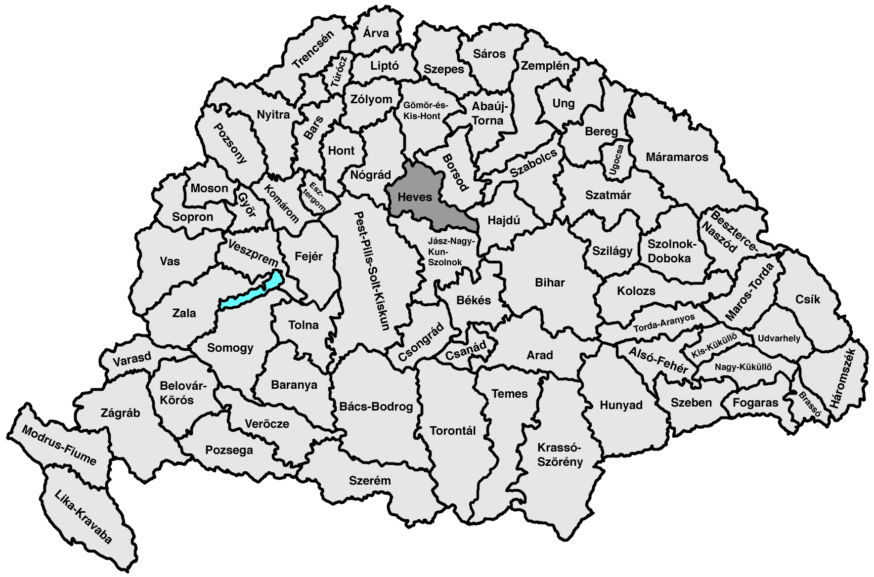
 Kingdom of Hungary. Its territory, which is presently in northern Hungary, was slightly larger than that of present Heves county. The capital of the county was Eger.

Geography

Heves county shared borders with the Hungarian counties Pest-Pilis-Solt-Kiskun, Nógrád, Gömör-Kishont, Borsod, Hajdú and Jász-Nagykun-Szolnok. It stretched from the Mátra and Bükk mountains to and across the river Tisza. Its area was 3761 km² around 1910.

History

Heves county was formed in the 13th century. It was ruled by the Turks between 1596-1687. After World War II, the territory of the county was modified: the region around Pásztó is now in Nógrád county, the area on the left bank of the Tisza (Tiszafüred) is now in Jász-Nagykun-Szolnok county, and an area north of Eger was taken from Borsod-Abaúj-Zemplén county.

ubdivisions

In the early 20th century, the subdivisions of Heves county were:


Wikimedia Foundation. 2010.

Игры ⚽ Поможем написать реферат

Look at other dictionaries:

  • Nógrád (former county) — Infobox Former Subdivision native name = Comitatus Neogradiensis conventional long name = Nógrád County common name = Nógrád subdivision = County nation = the Kingdom of Hungary p1 = s1 = year start = 12th century event end = Treaty of Trianon… …   Wikipedia

  • Heves County — Infobox Hungarian county name =Heves region =Northern Hungary seat = Eger area = 3637 population = 328,000 density = 90.1 cities = 119 This article is about the current administrative entity called Heves county. For the historical county see… …   Wikipedia

  • Jász-Nagykun-Szolnok (former county) — This article is about the historical county, for the modern Jász Nagykun Szolnok county click on the link. Infobox Former Subdivision native name = conventional long name = Jász Nagykun Szolnok County common name = Jász Nagykun Szolnok… …   Wikipedia

  • Nógrád County — Salgótarján, seat of Nógrád …   Wikipedia

  • Tolna County — For other uses, see Tolna (disambiguation). Tolna County Coat of arms …   Wikipedia

  • Csongrád County — This article is about the county. For the town see Csongrád. For the historical comitatus see Csongrád (former county). Csongrád County Coat of arms …   Wikipedia

  • Zala County — For other uses, see Zala (disambiguation). Zala County Coat of arms …   Wikipedia

  • Pest County — Infobox Hungarian county name =Pest region =Central Hungary seat = Budapest area = 6394 population = 1,077,300 density = 168 cities = 186Pest County (IPA2|pɛʃt) is a county ( megye ) in central Hungary. It covers an area of 6394 km², and has a… …   Wikipedia

  • Jász-Nagykun-Szolnok County — Infobox Hungarian county name =Jász Nagykun Szolnok region =Northern Great Plain seat = Szolnok area = 5582 population = 399,000 density = 72 cities = 75 This article is about the modern county, for the historical one see Jász Nagykun Szolnok… …   Wikipedia

  • Borsod-Abaúj-Zemplén County — Coat of arms …   Wikipedia

Share the article and excerpts

Direct link
Do a right-click on the link above
and select “Copy Link”