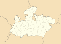
- Datia
-
This article is about the municipality in Madhya Pradesh, India. For its namesake district, see Datia District.
Datia — city — Coordinates 25°40′N 78°28′E / 25.67°N 78.47°ECoordinates: 25°40′N 78°28′E / 25.67°N 78.47°E Country India State Madhya Pradesh District(s) Datia Population 82,742 (2001[update]) Time zone IST (UTC+05:30) Area
• 302 metres (991 ft)
Datia is a small rural town and a municipality in Datia district in the state of Madhya Pradesh, India. It is the administrative center of Datia District. It was formerly the seat of the eponymous princely state in the British Raj. Datia is situated near Gwalior and on the border with Uttar Pradesh (U.P); the town of Jhansi in U.P. is only about 25 km away.
The old town is surrounded by a stone wall, enclosing handsome palaces and gardens; the 17th century palace of Bir Singh Deo is one of the finest examples of Hindu domestic architecture available in north India.
Contents
History
Main article: Datia StateDatia had formerly been a state in the bundelkhand region.The ruling family were Rajputs of the Bundela clan; they descended from a younger son of a former raja of Orchha. The state was administered as part of the Bundelkhand Agency of Central India. It lay in the extreme north-west of Bundelkhand, near Gwalior, and was surrounded on all sides by other princely states of Central India, except on the east where it bordered upon the United Provinces.
Geography
Datia is located at 25°40′N 78°28′E / 25.67°N 78.47°E.[1] It has an average elevation of 302 metres (990 feet).
Demographics
As of 2001[update] India census,[2] Datia had a population of 82,742. Males constitute 53% of the population and females 47%. Datia has an average literacy rate of 68%, higher than the national average of 59.5%: male literacy is 75% and, female literacy is 60%. In Datia, 15% of the population is under 6 years of age.
Educational Institutes
1. Saraswati Vidya Mandir Bharatgarh 2. Holy Cross Ashram School 3. Rani Laxmibai Public School 4. Government Higher Secondary School No.1 5. Government Higher Secondary School No 2 6. Government Girl School 7. Rajeev Vidyalaya 8. Mahila Samiti School 9. Rass JB professional studies 10. Omprakash Gupta School in Bundela colony 11. College of Advance Studies, Datia, Madhya Pradesh, India 12. St. Kolbe School, Indergarh, Datia
Colleges
Under the single umbrella of SRI there are five colleges providing world class education in various disciplines i.e. Engineering, Pharmacy, B.Ed. and D.Ed., Nursing and Allied Sciences. All the Institutes & colleges are set up and run by Shri Ramraja Sarkar Lok Kalyan Trust, an autonomous foundation which is a registered charitable trust functioning through Board of Governors and Board of Trustees.
Shri Rawatpura Group of Colleges(SRGOC) consists the following institutions:-
- Shri Rawatpura Institute of Technology & Science(SRITS)
- Shri Rawatpura Institute of Management Sciences(SRIMS)
- Shri Rawatpura Institute of Pharmacy(SRIP)
- Shri Rawatpura College of Nursing(SRCN)
- Shri Rawatpura College of Physical Education(SRSCPE)
- Shri Rawatpura Sarkar Collage of Science & Education(SRCSE)
- Shri Rawatpura Sarkar Polytechnic Colleage(SRPC)
- Shri Rawatpura Sarkar Institute of Journalism and Mass Communication
- Shri Rawatpura Sarkar Snatak Mahavidhyalaya(SRSMV)
Culture
Datia is best known for the Pitambara Peeth. Peetambra peeth is a famous shaktipitha located at the entrance of Datia in Madhya Pradesh. This pilgrimage spot features Bagalamukhi Devi Temple and Dhumavati Mai Temple established by shri Golokwasi Swamiji Maharaj. Vankhandeshwar temple is a Mahabharat period temple of Lord Shiva which is situated at this place. Pitambra peeth is about 0.6 mile from Datia Bus Station and 1.8 Miles from Datia Railway Station .
Temple of the goddess Peetaambara Bagalamukhi, and Jain Temples (Sonagir).Sonagir is located at 9 miles from Datia and is well connected by Road and Train.it has white marvel jain temples and shines looks very beautiful
Tourist Place
Pathra village Gujarra Botonical Garden Sonagiri-Temples Badoni Temples Unao-Balaji Sun Temple Seondha Pancham Kavi Ki Toriya Govind Palace Bhander Udnu Ki Toriya Khairi ki mata Temple Rajgarh Palace & Museum
External links
it also famous for jain temple which located at stone hill in sonagir 12 km from datia
References
- ^ Falling Rain Genomics, Inc - Datia
- ^ "Census of India 2001: Data from the 2001 Census, including cities, villages and towns (Provisional)". Census Commission of India. Archived from the original on 2004-06-16. http://web.archive.org/web/20040616075334/http://www.censusindia.net/results/town.php?stad=A&state5=999. Retrieved 2008-11-01.
- ^ Shri Rawatpura Group of Colleges
Cities and towns in Gwalior Division Ashoknagar district Datia district Guna district Gwalior district Shivpuri district Related topics Cities and towns
in other DivisionsCategories:- Railway stations in Madhya Pradesh
- Cities and towns in Datia district
- Datia
Wikimedia Foundation. 2010.


