- Deora, Colorado
-
Deora, Colorado — Town — Location within the state of Colorado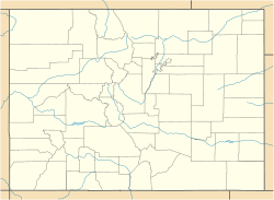
 Deora, Colorado
Coordinates: 37°34′46″N 102°57′58″W / 37.57944°N 102.96611°WCoordinates: 37°34′46″N 102°57′58″W / 37.57944°N 102.96611°W Country  United States
State  State of Colorado
County Baca County[1] Government – Type unincorporated town Elevation[1] 4,659 ft (1,420 m) Time zone MST (UTC-7) – Summer (DST) MDT (UTC-6) ZIP code[2] Las Animas CO 81054 Area code(s) 719 Deora is an unincorporated town in Baca County, Colorado, United States. The U.S. Post Office at Las Animas (ZIP Code 81054) now serves Deora postal addresses.[2]
Geography
Deora is located at 37°34′46″N 102°57′58″W / 37.57944°N 102.96611°W (37.579413,-102.966099).
See also
References
- ^ a b "US Board on Geographic Names". United States Geological Survey. 2007-10-25. http://geonames.usgs.gov. Retrieved 2008-01-31.
- ^ a b "ZIP Code Lookup" (JavaScript/HTML). United States Postal Service. January 3, 2007. http://zip4.usps.com/zip4/citytown.jsp. Retrieved January 3, 2007.
Municipalities and communities of Baca County, Colorado Towns Campo | Pritchett | Springfield | Two Buttes | Vilas | Walsh

Unincorporated
communitiesBuckeye Crossroads | Deora | Lycan | Utleyville
Categories:- Populated places in Baca County, Colorado
- Unincorporated communities in Colorado


Wikimedia Foundation. 2010.