- Collinstown
-
This article is about the village in Westmeath in Ireland. For other uses, see Collinstown (disambiguation).
Collinstown
Baile na gCailleach— Town — Location in Ireland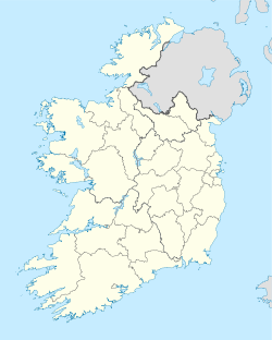
 Collinstown
Coordinates: 53°38′50″N 7°12′39″W / 53.6472°N 7.2109°WCoordinates: 53°38′50″N 7°12′39″W / 53.6472°N 7.2109°W Country Ireland Province Leinster County County Westmeath Elevation 128 m (420 ft) Population (2006) - Urban 326 - Rural 355 Time zone WET (UTC+0) - Summer (DST) IST (WEST) (UTC-1) Irish Grid Reference N500673 Website westmeathcoco.ie Collinstown (Irish: Baile na gCailleach) is an expanding village in County Westmeath, situated on the R395 regional road 18 km northeast of the county town of Mullingar. Collinstown is in St Mary's (Roman Catholic) parish and has a population of approaching 700.
 Lough-Lene Inn Collinstown
Contents
Name
The old Irish name of this village, translated means town of the veiled women. In the past the town was referred to irreverently as "the town of the hags" because there was once a convent established on the Nun's island of nearby Lough Lene. Collinstown was known in the past as Maypole.
History
 Sign
SignCollinstown has been an inhabited area from pre-Christian times, as the presence of a number of Ringforts[1] and other historic relics testifies. Though some are now overgrown they may be seen on the high ground surrounding Lough Lene. The area contains ancient burial-grounds associated with Saint Colman who was responsible for 7 early Christian cells, of which Lene and Carric are in the vicinity of Collinstown. Christian mass paths, and styles by which pilgrims travelled on foot through fields to Sunday mass date date from the penal times. Turgesius the Viking had a fortress built nearby, upon the main Lough Lene Island. These and other historical relics are clearly marked on the Ordnance Survey of Ireland (OSi) maps numbers 41 & 42.
West of Collinstown (in Ranaghan area, south-west of Lough Lene) are the remains of different ringforts. At least one of these is attributed to the Viking, Turgesius. They were likely placed on the high ground overlooking the lake, for defensive purposes. Legend has it that Turgesius dwelled here before being killed by Máel Sechnaill mac Maíl Ruanaid[2] on Melaghlins instruction. In addition to this fort, Turgesius also had another upon the biggest island of Lough Lene which still today bears his name, Turgesius Island.
Collinstown also has historic links with several religious orders: the Irish name Baile na gCailleach is based on an association with the convent on the second island on Lough Lene. Nearby, to the north is the village of Fore and the religious and monastic complex of Fore Abbey.
The Lough Lene Bell
In 1882, the Royal Irish Academy was presented with the Bell of Lough Lene by the Barbavila estate proprietor, Mr. William Barlow Smythe. The bell had been discovered in Lough Lene the previous year by a boy fishing for eels on Castle Island, which was owned by Smythe at the time.
 Lough Lene Bell
Given the close proximity to the Fore Abbey, the estate owner Smythe concluded that the bell possibly belonged to the St Feichin Abbey; During the Viking and Anglo-Norman oppressions, it may have been transferred to Nun's Island, before being eventually being hidden upon Castle Island.
The Bell has a faint outline of the Christian Celtic cross upon opposing sides and has an ornamental peripheral border. Smythe pronounced that ornamentation was generally reserved for the cases or shrines for that era and was therefore most unusual. The bell appears similar to two other bells from that early Christian period. These had been found in Bangor, County Down in the year 1832, and another in Cashel, County Tipperary in 1849.
Smythe, the Barbavila owner, believed that the Lough Lene Bell was contemporary to these other 7th century bells, supporting his theory that it was possible that it could have been a relic of St. Feichins. The Folklore Commission[citation needed] also hold an account of Kit "the Blade" Fagan's discovery of the bell, which consequentially triggered a local treasure hunt for further artifacts around Collinstown and Fore.
While the original Lough Lene Bell remains within the National Museum, a half sized replica holds a place of pride as the Ceann Comhairle's Bell in Dáil Éireann. This replica was presented to the Dáil in 1931 by the widow of Major Bryan Cooper, a former member of the House.
Barbavila Manor
During the last century, the Barbavila House & Estate provided employment in the area. Houses, farm buildings, and animal dwellings were built from stone for employees throughout the immediate surroundings of Barbavilla in and around Collinstown. These stone houses, the old school, and farm buildings are protected through local heritage conservation laws. The notable feature of these buildings of stone is the roofing tile baked from local red coloured clay, which was manufactured within the Barbavilla estate.[3] Some of these remaining buildings are identified by the small moss-green circles.[1]
Barbavilla is now an industrial complex for automotive parts.
Co-ordinates: Latitude = 53.6357, Longitude = -7.2293
Sport activities
Bathing, Sailing, wind-surfing, authorised fishing,[4] and jetty facilities are available at the Collinstown lake access point named locally as "The Cut" [5] about 2 km north of the village. The Pitch and putt club of Collinstown is also popular.
Lough Lene Gaels, the local hurling club, was founded in 1969 as a result of an amalgamation between the Collinstown, Fore, Glenidan and Rickardstown hurling clubs. The club has enjoyed plenty of success since its formation and has won the Westmeath Senior Hurling Championship on seven occasions since 1975.
Also catering for GAA Sport in the area is Ballycomoyle GAA Club.
This Football Club caters for those who live in the Fore, Castlepollard or Collinstown area, and has teams to suit everyone.
Commerce & industry
Since 1964, the IRALCO Irish Aluminum Company situated in the Barbavilla Estate have made automotive parts for major European car companies, employing personnel locally.
Other local industries include Goats cheese production, electrical and plumbing.[citation needed]
See also
References
- ^ a b http://www.westmeathcoco.ie/docs/planning/Collinstown_Zoning.pdf
- ^ A Popular History of Ireland: from the Earliest Period to the Emancipation of the Catholics By Thomas D'Arcy McGee- book-2 Chapter 2 from Nalanda Digital Library at NIT Calicut
- ^ National archives Finding aid: Women's History Resources (Browse records)
- ^ Angling in County Westmeath
- ^ http://www.iol.ie/wmeathtc/carr/images/VIEW.JPG
External links
- Lough Lene Communities
- Westmeath County Council
- Gleann Álainn Residents Association Collinstown
- Viking Ireland Network school project
- Lough Lene "Monk's boat"
- Lough Lene Gaels
- Ballycomoyle GAA Club
- St. Colman (Colman Mac Luachain 6th/7th century)
- Betha Colmáin Maic Lúacháin, or, The Life of Colmán son of Lúachan
- Collinstown
- The family and estate papers of the Smythe family of Barbavilla, Collinstown, 1621 - 1930. Collection List No. 120 at the National Library of Ireland
Places in County Westmeath County town: Mullingar Towns and
villagesAthlone · Ballinahown · Ballykeeran · Ballymore · Ballynacargy · Castlepollard · Castletown-Geoghegan · Clonmellon · Collinstown · Coole · Crookedwood · Delvin · Drumcree · Drumraney · Finnea · Fore · Glassan · Horseleap · Kilbeggan · Killucan and Rathwire · Kinnegad · Milltownpass · Moate · Mount Temple · Moyvoughly · Mullingar · Multyfarnham · Raharney · Rathconrath · Rathowen · Rochfortbridge · Rosemount · Streamstown · Street · Tang · Tubberclare · Tyrrellspass
Baronies Brawny · Clonlonan · Corkaree · Delvin · Farbill · Fartullagh · Fore · Kilkenny West · Moyashel and Magheradernon · Moycashel · Moygoish · RathconrathList of townlands in County Westmeath · Category:Geography of County Westmeath Categories:- Untranslated Irish place names
- Towns and villages in County Westmeath
- Tourism in County Westmeath
- Buildings and structures in County Westmeath
- Archaeological sites in County Westmeath


Wikimedia Foundation. 2010.