- Metro Manila
-
This article is about the capital region of the Philippines. For the capital city, see Manila. For the former province, see Manila (province). For other uses, see Manila (disambiguation).
Metropolitan Manila
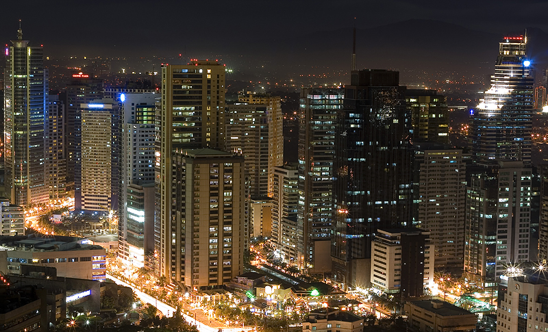
Kalakhang Maynila— Metropolis — Skyline of Metro Manila Political map of Metro Manila
Country  Philippines
Divisions 16 Cities & 1 MunicipalityGovernment – Chairman of MMDA Francis Tolentino (since 2010) Area[1] – Total 638.55 km2 (246.5 sq mi) Population (2007)[2] – Total 11,553,427 – Density 18,093.2/km2 (46,861.2/sq mi) Demonym Manileños Time zone PST (UTC+8) Website mmda.gov.ph Metropolitan Manila[3] (Filipino: Kalakhang Maynila, Kamaynilaan), the National Capital Region (NCR) (Filipino: Pambansang Punong Rehiyon), or simply Metro Manila, is the metropolitan region encompassing the City of Manila and its surrounding areas in the Philippines. It is composed of 16 cities namely City of Manila, Caloocan, Las Piñas, Makati, Malabon, Mandaluyong, Marikina, Muntinlupa, Navotas, Pasay, Pasig, Parañaque, Quezon City, San Juan, Taguig, Valenzuela and the Municipality of Pateros.
The region is the political, economic, social, cultural, and educational center of the Philippines. As proclaimed by Presidential Decree No. 940, Metro Manila as a whole is the Philippines' seat of government but the City of Manila is the capital.[4] The largest city in the metropolis is Quezon City. While the largest business district is the Makati Central Business District.
Metro Manila is the most populous of the twelve defined metropolitan areas in the Philippines and the 11th most populous in the world. As of the 2007 census, it had a population of 11,553,427, comprising 13% of the national population.[2] The sum total population of provinces with a provincial density above 700 people per square kilometer (more than double the national average) in a contiguous zone with Metro Manila is 25.5 million people as of the 2007 census, one way to refer to the conurbation around Metro Manila is Greater Manila.
Metro Manila's gross regional product is estimated as of July 2009 to be ₱468.4 billion (at constant 1985 prices) and accounts for 33% of the nation's GDP.[5] In 2008, it ranked as the 40th wealthiest urban agglomeration in the world and the 2nd in Southeast Asia, according to PricewaterhouseCoopers.[6]
Contents
Etymology
For information on the etymology of "Manila" see History of Manila.
The term Metro Manila increasingly came into use after the creation of the metropolitan area in 1975 and is the de facto name for Metropolitan Manila. Metro Manila is often referred to as simply as Manila. It is abbreviated M.M..
History
 Development of Metro Manila showing the years that each area became a city. Pateros is currently the only remaining municipality.
Spanish Manila was founded on June 24, 1571 by three conquistadors: Martín de Goiti, Juan de Salcedo and Miguel López de Legazpi. In 1867, the Spanish Government of the Philippines established the municipalities and territories south of the District of Morong in Nueva Ecija, north of the Province of Tondo and Imperial Manila, and isolated these from their mother province of Nueva Ecija. The government created the Province of Manila composed of the Province of Tondo to the south and the isolated territories of Nueva Ecija to the north. The parts of Tondo were Navotas, Malabon, and Caloocan; the parts of Nueva Ecija were Mariquina, Balintawak, Caloocan, Pasig, San Felipe Neri (presently called Mandaluyong), Las Piñas, what had been known as Parañaque, and Muntinlupa. The capital of the Province was Intramuros, then itself called and considered to be Manila, a walled city located along the banks of the Pasig River and on the shore of Manila Bay.
During the Philippine Revolution the Province of Manila was the 8th and last Province to revolt against Spain paving the establishment of the Federated Philippine Republics (composed of Nueva Ecija, Pampanga, Bulacan, Tarlac, Laguna, Batangas, Cavite and Manila). The Province of Manila remained in existence until 1901, when its territory was subdivided by the Americans.
In 1901, the Philippine Assembly created the City of Manila composed of the municipalities of Ermita, Intramuros or the Imperial City of Manila, Tondo, Santa Cruz, Sta. Ana, San Nicolas, San Miguel, Paco, Port Area, Pandacan, Sampaloc, Quiapo, Binondo, Malate, San Andres, and Sta. Mesa. The municipalities of Caloocan, Marikina, Pasig, Parañaque, Malabon, Navotas, San Juan, Makati, Mandaluyong (San Felipe Neri), Las Piñas, Muntinlupa and Taguig-Pateros were incorporated into a new province named Rizal, the capital of which was Pasig.
In 1941 with the onset of World War II, President Manuel L. Quezon created the City of Greater Manila as an emergency measure, merging the city and municipal governments of Manila, Quezon City, San Juan del Monte, Caloocan, etc. and appointed Jorge Vargas as mayor. Existing mayors of the included cities and municipalities served as vice-mayors for their areas. This was in order to ensure Vargas, who was Quezon's principal lieutenant for administrative matters, would have a position of authority that would be recognized under international military law. There were doubts if the Japanese Imperial Army poised to occupy Manila would recognize the authorities of members of the Quezon cabinet. The City of Greater Manila was abolished by the Japanese with the formation of the Philippine Executive Commission to govern the occupied regions of the country. As an administrative concept, however, the City of Greater Manila served as a model for Metro Manila and the position of Metro Manila governor established during the Marcos administration.
In 1975, the Metropolitan Manila Commission was created to administer the emerging metropolis when President Ferdinand Marcos issued Presidential Decree No. 824.[3] Marcos appointed his wife Imelda Marcos as governor of Metro Manila.
In 1986, after a major government reorganization, President Corazon Aquino issued Executive Order No. 392 and changed the structure of the Metropolitan Manila Commission and renamed it to the Metropolitan Manila Authority. Metro Manila mayors chose from among themselves the chair of the agency.
In 1995, through Republic Act 7924, Metro Manila Authority was reorganized and became the Metropolitan Manila Development Authority. The chair of the agency is appointed by the President and should not have a concurrent elected position such as mayor.
Geography
 View of the Manila Bay Sunset from the Bay City in Pasay
Metro Manila is situated on an isthmus bounded by Manila Bay to the west and Laguna de Bay to the south-east and divided by the Pasig River which links the two bodies of water. The city lies on a wide flood plain that is one of the biggest in the country. The area is bounded by Bulacan to the north, Rizal to the east, Laguna to the south and Cavite to the southwest.
Metro Manila is located at 14°40' N 121°3 E. The swampy isthmus on which the western metropolitan area partly lies has an average elevation of 10 meters. The eastern area lies on a ridge gradually rising towards the foothills of the Sierra Madre and overlooks the Marikina River valley, which is part swamp.
Metro Manila's primary waterway is the Pasig River, which bisects the isthmus. It originates in Laguna de Bay, marking the borders between Makati and Mandaluyong, as well as between Pasig and Taguig, then passing through Manila before draining into Manila Bay. The river is severely polluted from municipal waste.
Climate
Under the Köppen climate classification system, Metro Manila is split between a tropical wet and dry climate and a tropical monsoon climate. Manila, which features less rainfall than Quezon City, has a tropical wet and dry climate while Quezon City features a tropical monsoon climate. Together with the rest of the Philippines, Metro Manila lies entirely within the tropics. Its proximity to the equator means that the temperature range is very small, rarely going lower than 20C or higher than 38C. However, humidity levels are usually very high which makes it feel much warmer. It has a distinct, albeit relatively short dry season from January through April, and a relatively lengthy wet season from May through December.
Climate data for Metro Manila Month Jan Feb Mar Apr May Jun Jul Aug Sep Oct Nov Dec Year Record high °C (°F) 35
(95)35
(95)36
(97)37
(99)38
(100)38
(100)38
(100)36
(97)35
(95)35
(95)35
(95)34
(93)38
(100)Average high °C (°F) 30
(86)30
(86)31
(88)33
(91)34
(93)34
(93)33
(91)31
(88)31
(88)31
(88)31
(88)31
(88)31 Average low °C (°F) 21
(70)21
(70)21
(70)22
(72)23
(73)24
(75)24
(75)24
(75)24
(75)24
(75)23
(73)22
(72)23 Record low °C (°F) 14
(57)14
(57)16
(61)16
(61)17
(63)20
(68)22
(72)21
(70)21
(70)21
(70)19
(66)17
(63)14
(57)Precipitation mm (inches) 23
(0.91)23
(0.91)13
(0.51)18
(0.71)33
(1.3)130
(5.12)254
(10)432
(17.01)422
(16.61)356
(14.02)193
(7.6)145
(5.71)2,042
(80.39)Source: BBC Government
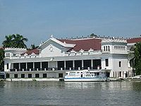 Malacañan Palace as viewed from Pasig River
 Coconut Palace, the residence of the vice president
The City of Manila proper is the national capital of the Philippines. The wider Metro Manila area is the seat of government. The executive and judicial branches of government are based in Manila as represented by Malacañan Palace, the official office and residence of the President of the Philippines, and the buildings of the Supreme Court of the Philippines respectively. However, the upper house of the legislature, the Senate of the Philippines, is based in Pasay, and the lower house, the House of Representatives of the Philippines, in Quezon City.
Metro Manila is the smallest of the country's administrative regions, but the most populous and the most densely populated, having a population of 11,553,427 (2007 census) in an area of approximately 638.55 square kilometers (246.55 sq mi). It is also the only region without any provinces, instead being subdivided into 17 local government units: 16 cities and one municipality.
 Administrative districts of Metro Manila:1st district2nd district3rd district4th district
Local government unit Population
(2007 census)[2]Area
(km²)[1]Pop. density
(per km²)[1]Annual pop.
growth rate[2]Per capita
GDPCityhood[1] Caloocan 1,381,610 53.33 25,907 3.06 $9,426 1962 Las Piñas 532,330 41.54 12,815 1.65 $8,678 1997 Makati 567,349 27.36 20,736 3.41 $29,259 1995 Malabon 363,681 15.76 23,076 0.98 $4,334 2001 Mandaluyong 305,576 11.26 27,138 1.29 $20,258 1994 Manila 1,660,714 38.55 43,079 0.68 $13,731 1571 Marikina 424,610 33.97 12,500 1.14 $10,346 1996 Muntinlupa 452,943 46.70 9,699 2.48 $13,789 1995 Navotas 245,344 10.77 22,780 0.87 $5,296 2007 Parañaque 552,660 47.69 11,589 2.88 $10,146 1998 Pasay 403,064 19.00 21,214 1.77 $6,876 1947 Pasig 627,445 31.00 20,240 3.04 $12,032 1995 Pateros 61,940 2.10 29,495 1.05 $3,324 Not a city Quezon City 2,679,450 161.12 16,630 2.92 $11,213 1939 San Juan 125,338 5.94 21,101 0.87 $16,893 2007 Taguig 613,343 47.88 12,810 3.82 $12,342 2004 Valenzuela 568,928 44.58 12,762 2.21 $7,531 1998 Total 11,566,3251 638.55 18,113 2.12 $10,223 1 Includes barangays disputed between Makati and Taguig cities.
In terms of local governance, Metro Manila cannot properly be considered a single political entity. The cities and municipality comprising it are considered the highest level of local government with each having their own set of separately elected officials. While the cities and municipality are independent from each other politically, several basic public services, such as traffic and flood control, are handled collectively by the Metropolitan Manila Development Authority (MMDA). The MMDA is headquartered in Makati and is headed by the MMDA Chairman, an appointee of the President of the Philippines, who holds cabinet rank. The mayors of the cities and municipality belong to the Metro Manila Mayor's League that serves as the board of the MMDA.
For mainly fiscal and statistical purposes Metro Manila or the National Capital Region (NCR) has also been divided into four districts grouped according to geographical basis in reference to the Pasig River. These districts were created in 1976 but have no local government and no congressional representation.
The cities and municipalities within the NCR are grouped into the four districts as follows:
# Alternate Name City/Cities 1 The Capital District Manila 2 Eastern Manila District Mandaluyong, Marikina, Pasig, Quezon City, and San Juan 3 CAMANAVA District Caloocan, Malabon, Navotas, and Valenzuela 4 Southern Manila District Las Piñas, Makati, Muntinlupa, Parañaque, Pasay, Pateros, and Taguig Representation to the two houses of the Congress of the Philippines is as follows:
- For the Senate, polling is done at-large, nationwide.
- For the House of Representatives, each city has at least one representative; Pateros' representation is included with the first Sangguniang Panlungsod district of Taguig.
Metro Manila is also a judicial region; as such, all regional trial court judges can be stationed anywhere within the region.
Economy
Business districts
Metro Manila is the financial, commercial and industrial center of the Philippines. It accounts for 33% of the Philippines' GDP. It has a third of the country's bank offices but over two thirds of its deposits. Makati is the financial and economic hub of the metropolitan area and the country. Its central business district (CBD) hosts many of the Philippines' largest corporations including the Ayala Group of Companies and the nation's major banks as well as the main Philippine offices of many multinational corporations.
 Skyline of Makati.
 Skyline of Ortigas Center.
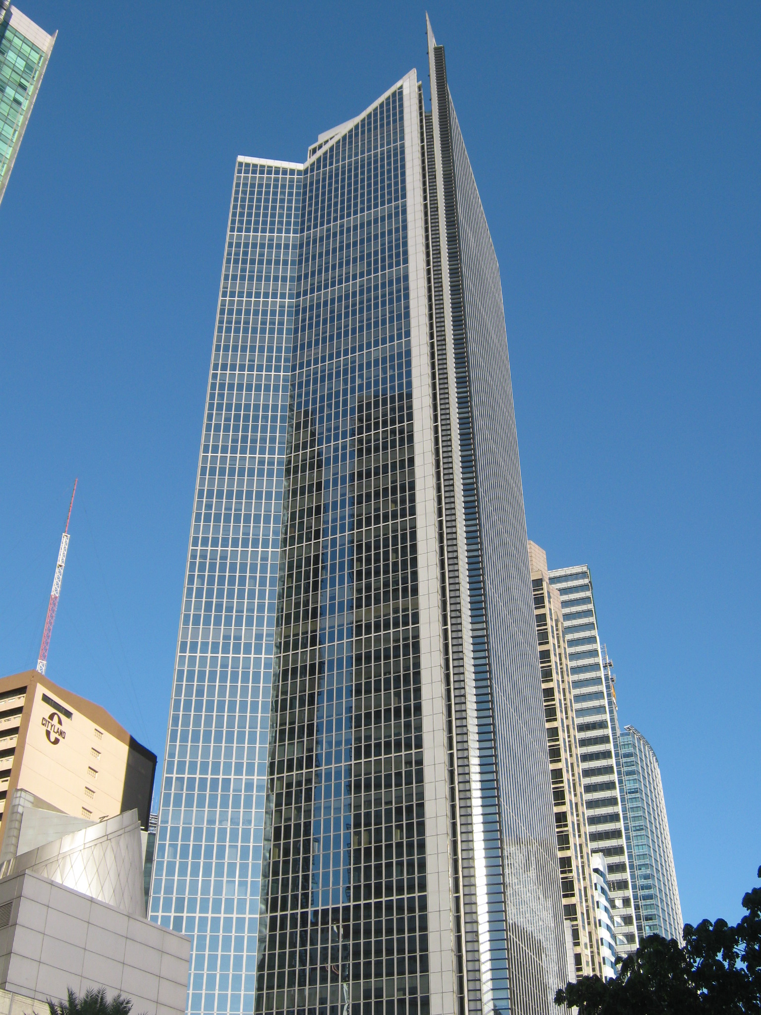
The fifty tallest skyscrapers in the Philippines (inc. two structures) are located in Metro Manila like the PBCom Tower and G.T. International Tower. The skyscrapers of Metro Manila are, for the most part, clustered in many locations although three areas are distinct for having the largest clusters in the metropolis. The first and biggest is the Makati Business District, followed by the Ortigas Center Business District in Pasig. The newest to rise is the Bonifacio Global City Business District in Taguig.
The Makati area is built around the former Nielsen Air Base, an American installation during World War II, and its runways now form the district's main roads, which cross each other at the Makati Triangle, home of one of the two trading venues of the nation's stock exchange. Ortigas Center is the second most important business district in Metro Manila. Situated in Mandaluyong and Pasig, it is home to the headquarters of several major Philippine companies such as San Miguel Corporation and Meralco, and hosts many shopping malls and hotels. It also hosts the Asian Development Bank's headquarters and the Philippine Stock Exchange's trading floor at Tektite Towers.
 PBCom Tower, the country's tallest building.
 G.T. International Tower, the country's second tallest building.
New developments seeking to become vibrant business centers of their own are Bonifacio Global City in Taguig; Eastwood City in Quezon City; the Manila Bay City Reclamation Area in the cities of Pasay, Parañaque and Las Piñas; and Alabang Estates, Madrigal Business Park, and Filinvest Corporate City in Muntinlupa. Triangle Park in Quezon City is the latest addition to the list. The traditional business center of Chinese-Filipino businessmen and the country's CBD prior to the development of the Makati CBD was the Binondo District in the City of Manila. Escolta was the central street of commerce during the time of the Spaniards up until the development of the Makati CBD when Ayala Avenue superseded it.
Shopping centers
In the early 1980s there were not that many shopping malls in Metro Manila, but ever since Henry Sy a Chinese-Filipino businessman started putting up his "megamalls" through his SM Group of Companies, Metro Manilans have taken eagerly to them. Three of these monuments to shopping are among the largest in the world. The largest mall in the country is currently the renovated SM City North EDSA in Quezon City. It is expected to become the nexus for three metropolitan rail lines once the terminal station next to it is fully completed. Previously the SM Mall of Asia in Pasay was the country's largest mall, and before it the SM Megamall in Ortigas Center in Mandaluyong held the distinction from 1991 to 2006. Various other SM malls dot the metropolis. Ortigas Center, located along intersection of the boundaries of Mandaluyong, Pasig, and Quezon City, is the site of many other shopping centers including Robinsons Galleria, Shangri-La Plaza, and The Podium.
 SM City North EDSA, the largest mall in the country and the 3rd largest in the world
Recently opened in Pasig is a new development called Frontera Verde, which currently hosts Tiendesitas, a tiangge-style shopping center; SM Supercenter Pasig; and SilverCity AutoMall, the first mall in the Philippines that is dedicated to the automotive market. In the Makati central business district, Ayala Center comprises other commercial developments, including Glorietta and the upscale Greenbelt shopping arcades. Also in Makati in Guadalupe is the Rockwell Center.
Bonifacio High Street and Serendra are in Bonifacio Global City. In the City of Manila proper, the largest malls include SM City Manila, Robinsons Place Manila, and the older Harrison Plaza. Cubao is Quezon City's central commercial area and has five malls including the Gateway Mall at the Araneta Center. There is also Eastwood City, located along Libis; SM City Fairview, in Novaliches; and TriNoma, Ayala Land's newest mall, in front of SM City North EDSA.
Muntinlupa hosts the Festival Supermall, Alabang Town Center, and Metropolis Star Mall, all in Alabang. Before the advent of the air-conditioned shopping centers, Metro Manila had the palengke, the Filipino-style open-air wet market and there are still many of them. One of these is the Central Market, in Sta. Cruz district of Manila. Another known for its bargains is the market in Divisoria, in Manila. Cloverleaf Market in Balintawak, Quezon City supplies much of Metro Manila's fruit and vegetable products.
Navotas Port Market supplies most of Metro Manila's fish products. Other smaller markets include the Cubao Farmers Market, EDSA Central, Nepa-Q Mart, Novaliches Talipapa, and those found in Muñoz, Balingasa, Galas, Santa Mesa, Baclaran, Pasay Libertad, and Pasay Cartimar, the latter also being one of the finest pet markets. Midway between a mall and a market are the tiangges, or airconditioned markets selling goods such as clothes, shoes, accessories, computer parts, mobile phones, CDs, VCDs, MP3s, iPods, and DVDs.
Examples are Greenhills Shopping Center in San Juan and St. Francis Square in Mandaluyong. Upscale malls in Metro Manila are Robinsons Place Manila in Manila, Gateway Mall, TriNoMa Mall, Eastwood Mall, and Robinsons Place Galleria in Quezon City, Glorietta, Powerplant Mall and SM Makati in Makati City, Bonifacio High Street in Taguig City, The Podium in Pasig City, Shangri-La Plaza and SM Megamall in Mandaluyong City, Greenbelt and SM Mall of Asia and Newport City Mall in Pasay.


Panoramic view of the SM Mall of Asia in Pasay from the east Wealth extremes
Metro Manila is a place of economic extremes. Many high-income citizens are concentrated in gated communities in places such as Forbes Park, Legazpi Village, and Dasmariñas Village in Makati, Ayala Alabang in Muntinlupa (all three initially developed in part by the influential Zobel de Ayala family), Valle Verde in Pasig, La Vista in Quezon City, Greenhills in San Juan or in high-rise developments in or around central business districts, such as Rockwell Center in Makati, Eastwood City in Libis, Quezon City and Fort Bonifacio Global City in Taguig, or along Roxas Boulevard overlooking Manila Bay.
In sharp contrast to these residences are the slums and illegal settlements scattered across the metropolitan area, often found on vacant government land or in districts such as Tondo. Illegal settlements have been concentrated on land adjacent to the tracks of PNR lines; but with efforts to rehabilitate the railway system, steps have been taken to clear these areas and relocate the squatters to other areas.
Landmarks and recreational areas
 Rizal Park
Located in the western portion of Metro Manila in the heart of Manila proper, Rizal Park, also known as the Luneta, is an iconic public promenade. Rizal Park features the Rizal Monument, a statue honoring José Rizal; a gigantic relief map of the Philippines; scenic Chinese and Japanese gardens; and several government offices, such as the Department of Tourism. On the seaside front of Rizal Park are numerous seafood restaurants specializing in Filipino and Asian cuisine. The National Museum of the Filipino People is also found here. It is a complex of two Greco-Roman buildings which house various relics and natural treasures in its galleries. The museum also boasts a large collection of artwork and masterpieces crafted by Filipinos. Part of the museum complex is the first planetarium in Southeast Asia. A newer attraction is the Manila Ocean Park, an oceanarium which opened in March 2008. Located nearby is the Quirino Grandstand, which apart from political campaign gatherings is also a popular staging ground for rallies such as those for various charismatic religious groups.
 The main entrance of Fort Santiago towering 40 feet (12 m) high
Near Rizal Park is the 400-year-old former imperial city known as Intramuros. Intramuros, is a walled domain which was once the seat of government during the Spanish Colonial Era and American Period. Among its attractions are Fort Santiago, a timeworn Spanish military fortress; Casa Manila, a Spanish colonial villa which is converted into a house gallery; Manila Cathedral, the official seat of the Archbishop of Manila; San Agustin Church, erected in 1587, the oldest existing church in the Philippines;[7] Intramuros Golf Club, a golf course outside the walls; and the Clam Shell Tent, an exhibition center of the Department of Tourism. Horse-carriages and tourist buses are also some of the attractions. The rest also includes a walk above the walls surrounding Intramuros, government offices, universities and colonial houses.
Fort Bonifacio is the location of military detachments, cemeteries, corporate headquarters, and world-class dining and shopping facilities. Other local recreation areas include the Nayong Pilipino (Philippine Village) in Parañaque, Quezon Memorial Circle and Ninoy Aquino Wildlife Center, both in Diliman district of Quezon City, the Cultural Center of the Philippines Complex and Bay City, both in Pasay. Meanwhile, the Paco Park, Arroceros Botanical Garden, Manila Zoo, Plaza Rajah Sulayman, Plaza Miranda, new Rizal Avenue Bargain Walkway, the all-steel Gothic San Sebastian Church, the bars and night clubs of Ermita and Malate districts and the Roxas Boulevard Bay Walk which offers a fine view of the Manila Bay sunset and hip dining are in Manila.
Transportation
See also: Transportation in the PhilippinesRoadways
 EDSAMain article: Major roads in Metro Manila
The metropolis has an extensive system of highways connecting the various cities and municipalities estimated to measure 5092 kilometers long. Of this total 1087 kilometers are national roads; 2366 kilometers are city, municipal, or barangay roads; 1639 kilometers are subdivision roads; and 37 kilometers are privately run toll expressways.[8][9]
The major roads include ten radial roads, which branch out from central Manila and five circumferential roads which form a series of concentric semi-circular arcs around downtown Manila. Most of these roads are very important transportation arteries. One is the C-4 (Circumferential Road 4), also called Epifanio de los Santos Avenue or more popularly as EDSA. It is the major thoroughfare in Metro Manila connecting five cities in Metro Manila, namely Pasay, Makati, Mandaluyong, Quezon City, and Caloocan. The MRT-3 line of Manila's metro network runs down the middle of EDSA between the road's opposite running lanes. A major alternative to EDSA is Circumferential Road 5 (C-5). Some other important roads are R-1 (Radial Road 1) better known as Roxas Boulevard and the Manila-Cavite Expressway (Coastal Road) connecting to Cavite province in the southwest; R-3 or the South Luzon Expressway (SLEX) connecting to Laguna province in the southeast; R-6 (Aurora Boulevard and Marcos Highway) connecting to Rizal province in the east; and R-8 or the North Luzon Expressway (NLEX) connecting to Bulacan province in the north. One of its newest roads, the Diosdado Macapagal Boulevard, running on the reclamation area parallel to R-1, is one of the destinations of Metro Manila's elite.
 Circumferential Road 5
Metro Manila is notorious for its traffic jams with trips averaging at speeds as low as 6–8 kilometers per hour.[10] A trip that should take 20 minutes will last an hour or more especially during rush hour. Consequently, the Metro Manila Development Authority (see section below) has constructed many projects to decongest traffic.
Such projects of the MMDA for motorists are the construction of flyovers (elevated roads), interchanges, loading bays for Public Utility Vehicles (PUVs), emergency bays, and U-turn slots over various intersections and thoroughfares, and the completion of the comprehensive railway system (see below). It has also been engaged in road widening with the support of the Department of Public Works and Highways. MMDA has also utilized projects for the pedestrians such as the installation of footbridges, waiting sheds, and men's urinals to various roads in the metropolis. The agency has also implemented various schemes for motorists such as the Uniform Vehicular Volume Reduction Scheme (UVVRS), more popularly known as "color coding", where vehicles whose plate numbers end in different digits are banned from traveling on different days, the Yellow Lane scheme, where yellow-plated PUBs (Public Utility Buses) will only use the two outermost lanes in EDSA, and the Organized Bus Route (OBR) for Metro Manila.
Railways
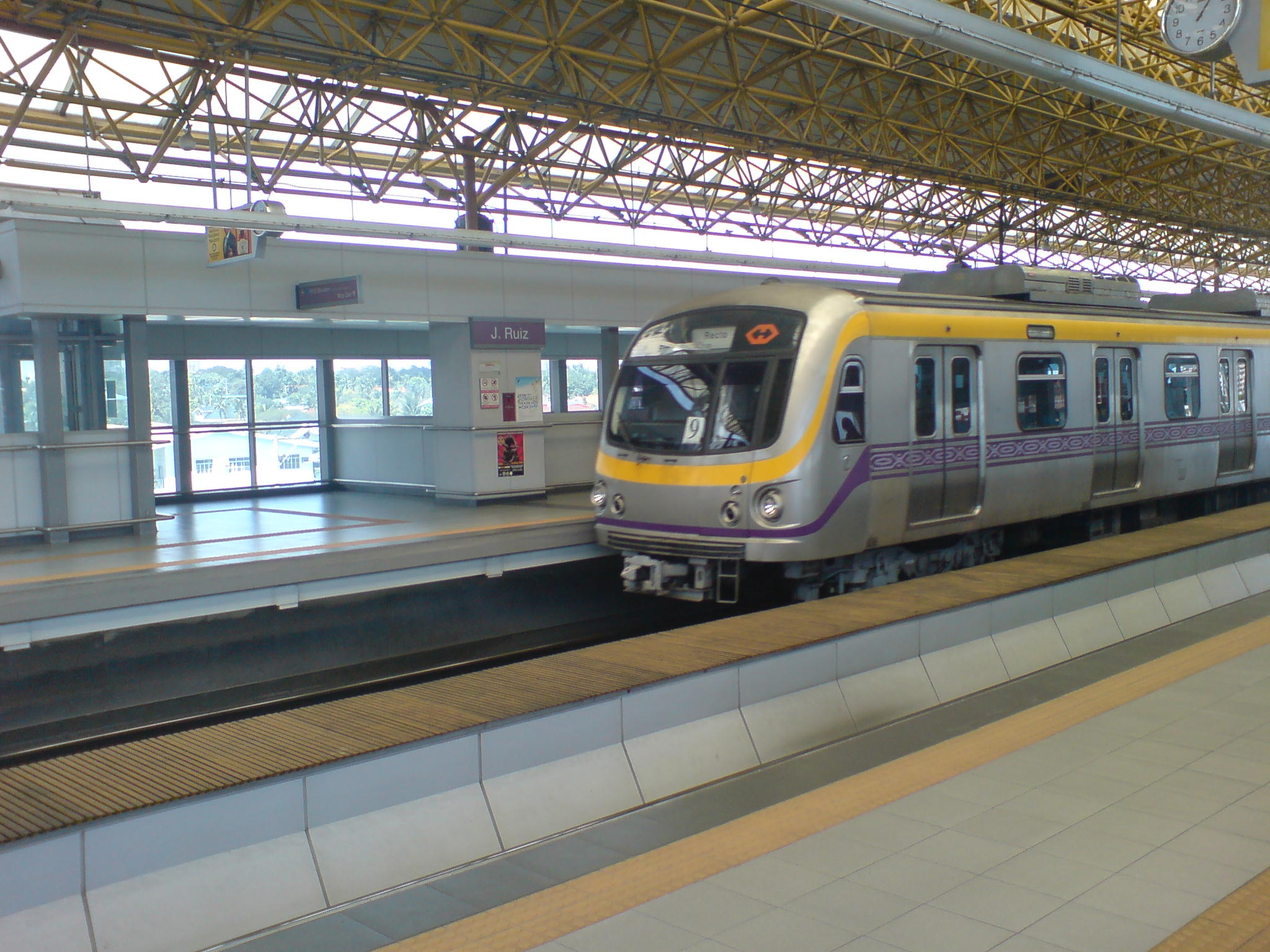
Main articles: Public transport in Manila, Strong Republic Transit System, Manila Light Rail Transit System, Manila Metro Rail Transit System, and Philippine National RailwaysAs of 2005[update], there are two different rapid transit systems in Metro Manila: the Manila Light Rail Transit System, or the LRT, and the Manila Metro Rail Transit System, or the MRT. The Yellow Line (LRT-1) and the Purple Line (LRT-2) form the LRT network, while the Blue Line (MRT-3) forms the MRT network, with 29 stations on the LRT and 13 stations on the MRT . Four more lines are proposed and would connect Metro Manila to the provinces of Bulacan, Cavite, Laguna and Rizal upon their completion.
Philippine National Railways also operates two main-line railway lines within Metro Manila, all part of the once-flourishing Luzon railway system. The northern line, known as Northrail and connecting Manila to Caloocan, is currently closed. Line extensions are proposed to Valenzuela and further on to Bulacan and Pampanga. The trans-Metro Manila portion of the still-open southern line, known as Southrail, commences at Tutuban station in Tondo, Manila, passes through the cities of Manila, Makati, Taguig, Parañaque and Las Piñas, and ends in Barangay Buli, Muntinlupa, before entering the province of Laguna.
Airports
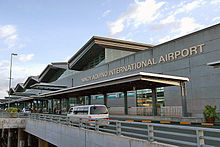 Terminal 3 of Ninoy Aquino International Airport, the main gateway to the country
Ninoy Aquino International Airport (NAIA), which straddles the boundary between Parañaque and Pasay, is the country's busiest airport. It consists of a domestic terminal and three international terminals; it has two main runways. It is the hub of Philippine Airlines which has its main hangar located near the Villamor Air Base. The future international gateway for the metropolitan area and the country is currently being built at Diosdado Macapagal International Airport in Angeles City, Pampanga. It is planned on becoming one of the world's biggest in terms of terminal size and land area. A fast train will be built to connect the new airport to Metro Manila.
Water transportation
The Manila Seaport Terminal in the Port Area, Manila is the shipping gateway to the Philippines. The Pasig River Ferry Service travels the Pasig River from Intramuros, Manila to Barangay Kalawaan Sur in Pasig.
Demographics
Metro Manila has a registered population of 11,553,427 people.[2] However, as of 2011, the greater urban area of Manila has a population at around 21,295,000.[11] According to the census of 2000, there were 9,932,560 people and 2,132,989 households residing in Metro Manila. With a population density of 15,617/km², it is by far the most densely populated region of the Philippines. For the period 1995 to 2000, the annual population growth rate was 1.06 percent, lower than that of the 1990 to 1995 period (3.30 percent).
Population of Metro Manila Census Pop. Rate 1980 5,925,884 — 1990 7,948,392 3.0% 1995 9,454,040 3.5% 2000 9,932,560 1.07% 2007 11,553,427 2.11% The indigenous people of the area now known as Metro Manila were the Tagalog. Other native ethnic groups of the Philippines also inhabit the metropolis as a result of migration. The include the Visayans, Bicolanos, Kapampangan, Ilocanos, Pangasinan, and Moro groups (mostly Maranao and Maguindanao). Tribal groups such as the Igorot and the Bajau have also settled. There are also numerous peoples of Chinese, Japanese, and Indian descent. Resident Spaniards, Americans, and Koreans are also present in large numbers. Metro Manila is classified as a social urban conglomerate, meaning, it is one of the most ethnically diverse cities in the world.
The most common language spoken in households is Tagalog (94.34%). English is widely used and understood, and is the main language of the middle and upper classes and in business. Chinese is taught in certain Chinese schools. Other languages of the Philippines are also spoken, mostly between family members, relatives, or neighbors belonging to the same ethnic group. Among these languages, the most spoken include Visayan languages, Bikol languages, and Kapampangan. The large majority of the population of Metro Manila is Roman Catholic (90%). Other religions represented are Protestant and Orthodox Christianity (3%), Islam (5%), and others (Hinduism, Buddhism and Judaism) (2%).
Education
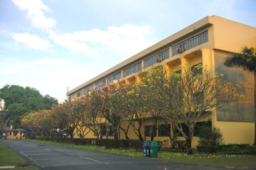
 PSHS Main Campus
As of 2008 there are 511 elementary schools and 220 secondary schools in the National Capital Region.[12] There are around 81 higher educational institutions. Literacy rate is around 92.4%.[13]
As the educational center of the country, many students from the provinces head to Metro Manila to study. Areas of high number of educational institutions include the so-called "University Belt" and Taft Avenue in Manila, Katipunan Avenue and Fairview in Quezon City, and Santa Mesa straddling the Manila, Quezon City and Mandaluyong borders. Metro Manila is also home to many private schools run by religious orders. These include the Ateneo de Manila University by the Jesuits, University of Santo Tomas and Colegio de San Juan de Letran by the Dominicans, De La Salle University by the Lasallian Brothers, Adamson University by the Vincentians, and San Beda College by the Benedictine order, among others.
Government-funded/run schools like the Diliman and Manila campuses of the University of the Philippines, the main campus of the Philippine Science High School and Manila Science High School are located here as well. In the University Belt area in Manila, is a nonsectarian, private university in the Philippines. Created by the merger of Far Eastern College and the Institute of Accounts, Business and Finance, FEU became a university in 1934 under the guidance of first president Nicanor Reyes, Sr.. It soon became the leading proprietary, for-profit university in the Philippines. FEU's campus is noted for a number of historical buildings preserved from the first half of the 20th century.
Health
Manila is home to the World Health Organization's Regional Office for the Western Pacific, the main office of the Department of Health, and several hospitals and medical centers. Major hospitals such as the Makati Medical Center in Makati City, Asian Hospital and Medical Center in Muntinlupa, St. Luke's Medical Center in Quezon City and The Medical City in Pasig City have world-class facilities. Some of these have geared themselves toward medical tourism.
Police and security
 Headquarters of the PNP
The Philippine National Police (PNP) is responsible for law enforcement in the country. Police structure in the Philippines is centralized and its command center is in Camp Rafael Crame in Santolan, Quezon City. Metro Manila is divided into 5 police districts under National Capital Region Police Office namely Central (Quezon City), Western (City of Manila), Eastern (Mandaluyong, Pasig, Marikina, San Juan), Northern (Caloocan, Malabon, Navotas, Valenzuela) and Southern (Makati, Muntinlupa, Las Piñas, Parañaque, Taguig and Pateros). The NCRPO Headquarters is located in Camp Bagong Diwa in Taguig.
The Armed Forces of the Philippines' command headquarters is in Camp Emilio Aguinaldo in Murphy, Quezon City. The National Capital Region Command is in Metro Manila and was created by President Gloria Macapagal-Arroyo to defend the metropolis from insurgents and terrorist groups. Philippine Army headquarters is in Fort Andres Bonifacio in Taguig. Philippine Air Force headquarters is in Jesus Villamor Air Base in Pasay. Philippine Navy headquarters is along Roxas Boulevard in Manila.
Public utilities
Electricity
Metro Manila's electricity is generated by the state-owned National Power Corporation (Napocor) and other independent power producers across the island of Luzon. It is transmitted by the privately-owned National Grid Corporation of The Philippines (NGCP) through high tension wires. It is distributed by the Manila Electric Company (Meralco), the only company allowed to distribute electricity to the metropolis.
Water
 Metro Manila and its surrounding areas are divided into two water concessionaires: Maynilad Water (red) and Manila Water (blue).
Metro Manila's tap water is sourced from the Angat Dam in Norzagaray, Bulacan. It is stored in the Novaliches Reservoir and filtered in the La Mesa Dam, both in northeast Quezon City. Metro Manila's water distribution and sewerage system used to be managed by the Metropolitan Water and Sewerage System (MWSS), a state-owned company. In 1997, MWSS awarded concessionaire licenses to two private corporations. Metro Manila was sliced into two distribution areas.
- Maynilad Water Services Inc (MWSI). It is currently majority-owned by DM Consunji Holdings, Inc (DMCI) and Metro Pacific Investments Corporation (MPIC). It operates in western Quezon City, southern Caloocan, Manila (excluding downtown), Valenzuela, Malabon, Navotas, Pasay, Parañaque, Las Piñas, and western Muntinlupa. MWSS is currently bidding out its shares in MWSI and expects to conclude the bidding before the end of the year.
- Manila Water Company, Inc. (MWC). It is majority-owned by the Ayala Corporation, which also controls Globe Telecom. MWC operates the East Concession Zone, which comprises Makati, Mandaluyong, Marikina, Pasig, Pateros, San Juan, Taguig, eastern Quezon City, and the southeast portions of Manila.
Communications
For a long time since its founding in 1925, the Philippine Long Distance Telephone Company (PLDT) was the Philippines' only phone carrier. With the passage of the National Telecommunications Act of 1995, the Philippine National Telecommunications Commission (NTC) granted licenses to new and independent companies to install new phones across the Philippines. The NTC granted 3 new licenses for Metro Manila.
- BayanTel/ Benpres - Northern Metro Manila (Quezon City, northern Caloocan, Malabon, Navotas, Valenzuela, Marikina, northeastern Manila, and the Ortigas Center in Pasig)
- Globelines/ Innove - Southern Metro Manila (Makati, Mandaluyong, Muntinlupa, Pasay, Las Piñas, Parañaque, Taguig, Pateros, San Juan, and Pasig excluding the Ortigas Center)
- Eastern Telecom - Western Metro Manila (Southern Caloocan and Manila, excluding the northeast part)
- Digitel
Gallery
Garbage
Metro Manila produces 4,000 tons of garbage each day. Paper wastes account for nearly 14% of the daily total.[citation needed] Efforts to reduce pollution is one of the metropolis' major public management concerns especially with the closure of some garbage dump sites in Greater Manila.
See also
- List of metropolitan areas in Asia by population
- Mega Manila
Largest cities of Philippines
Philippines 2007 CensusRank City Name Region Pop. Rank City Name Region Pop. 
Quezon City
1 Quezon City Metro Manila 2,679,450 11 Dasmariñas CALABARZON 556,330 
Caloocan
2 Manila Metro Manila 1,660,714 12 Cagayan de Oro Northern Mindanao 553,966 3 Caloocan Metro Manila 1,378,856 13 Parañaque Metro Manila 552,660 4 Davao City Davao Region 1,363,337 14 Las Piñas Metro Manila 532,223 5 Cebu City Central Visayas 798,809 15 General Santos SOCCSKSARGEN 529,542 6 Zamboanga City Zamboanga Peninsula 774,407 16 Makati Metro Manila 510,383 7 Antipolo CALABARZON 633,971 17 Bacolod Western Visayas 499,497 8 Pasig Metro Manila 617,301 18 Muntinlupa Metro Manila 452,943 9 Taguig Metro Manila 613,343 19 Tagum Davao Region 450,526 10 Valenzuela Metro Manila 568,928 20 San Jose del Monte Central Luzon 439,090 References
- ^ a b c d "Table 1.0: Metropolitan Manila Land Area and Year of Cityhood By Local Government Units". Metro Manila Development Authority. http://www.mmda.gov.ph/metromla.html. Retrieved 2009-10-17.
- ^ a b c d e Republic of the Philippines. National Statistics Office. (April 2008). "Total Population and Annual Population Growth Rates by Region: Population Censuses 1995, 2000, and 2007". http://www.census.gov.ph/data/census2007/index.html. Retrieved 2010-04-04.
- ^ a b Republic of the Philippines. (November 7, 1975). Presidential Decree No. 824 – Creating The Metropolitan Manila And The Metropolitan Manila Commission And For Other Purposes. Retrieved 2010-11-21 from the Chan Robles Virtual Law Library.
- ^ Republic of the Philippines. (May 29, 1976). Presidential Decree No. 940 – Establishing Manila as the Capital of the Philippines and as the Permanent Seat of the National Government. Retrieved 2010-04-04 from the Chan Robles Virtual Law Library.
- ^ Republic of the Philippines. National Statistical Coordination Board. (July 2009). 2008 Gross Regional Domestic Product - Levels of GRDP. Retrieved 2010-04-04.
- ^ Hawksworth, John, Thomas Hoehn and Anmol Tiwari. "Global City GDP Rankings 2008-2025". UK Economic Outlook November 2009. PricewaterhouseCoopers. p. 20. https://www.ukmediacentre.pwc.com/imagelibrary/downloadMedia.ashx?MediaDetailsID=1562. Retrieved 2009-11-20.
- ^ Torres, Jose Victor Z. (2005). Ciudad Murada: A Walk Through Historic Intramuros. Manila: Intramuros Administration & Vibal Publishing House, Inc.. pp. 62–63. ISBN 971-07-2276-x.
- ^ Asia Pacific Energy Research Centre (APERC). Institute of Energy Economics, Japan. (2008). Urban Transport Energy Use in the APEC Region - Benefits and Costs. Tokyo: Author. p. 62. ISBN 978-4-931482-39-5. http://www.ieej.or.jp/aperc/2008pdf/2008_Reports/Urban%20Transport%20Energy%20Use%20in%20the%20APEC%20Region%20l%20APERC%202008.pdf.
- ^ Metro Manila Development Authority. (2010). Metro Manila Road Classification and Surface Type, 2008. Retrieved April 3, 2010 from the Metro Manila Development Authority Website.
- ^ Cervero, Robert. (2000). Informal Transport in the Developing World. UN-HABITAT. ISBN 9211314534.
- ^ "Largest Urban Areas in the World: 2011". Demographia World Urban Areas: 7th Annual Edition (2011.04). Demogrpahia. http://www.demographia.com/db-worldua.pdf. Retrieved 3 July 2011.
- ^ Metro Manila Development Authority. (2010). Basic Education Indicators, 2004 to 2008. Retrieved April 3, 2010 from the Metro Manila Development Authority Website.
- ^ Philippine Information Agency. (2005). The National Capital Region. Retrieved 2010-04-04.
Categories:- Metro Manila
- Metropolitan areas of the Philippines
- Capital districts and territories
- Regions of the Philippines
- Luzon


Wikimedia Foundation. 2010.