Mugarra

Mugarra
Mugarra

Mugarra from the east. The quarry is clearly seen.
Elevation 936 m (3,071 ft)
Prominence 195 m (640 ft)
Location
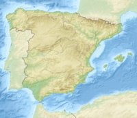
Mugarra is located in Spain
Mugarra
Location in Spain
Location Biscay, Spain
Range Basque mountains
Coordinates 43°09′9.13″N 02°40′46.19″W / 43.1525361°N 2.6794972°W / 43.1525361; -2.6794972Coordinates: 43°09′9.13″N 02°40′46.19″W / 43.1525361°N 2.6794972°W / 43.1525361; -2.6794972
Climbing
Easiest route From Mañaria and the col of Mugarrekolanda.

Mugarra is a peak of Biscay, Basque Country (Spain), 936 m high, belonging to the Aramotz massif.

The Aramotz massif is in the western limit of the Urkiola range. Mugarra continues the line of the Anboto, Alluitz, Aitz Txiki and Untxillaitz and is the eastern limit of the Aramotz massif.

Huge limestone rock where fossil rests of seashell can be found. The southern face forms a 300 m high cliff over the col of Mugarrekolanda. In this cliff have their nests the majority of the vulture couples of Urkiola (60 estimated). The northern face, facing Durango, is very steep but does not form a cliff, and it's covered by beeches and Cantabrian Holm Oaks.

The crest of Mugarra has many rock climbing ways, but climbing is not permitted to avoid disrupting of the vultures' habitat. This limestone crest is being consumed by a great quarry that causes irreparable damage to the mountain and is bordering the protected area.

Ascents

In Mañaria (181 m), a good path reaches the Mugarrekolanda (760 m) col. From the col an easy route leads to the summit from the west. It is possible from there to access the eastern part of the crest through the break of Atxurkulu (662 m). The ascent takes 2h.

General view of Mugarra, to the left Arrietabaso (1,010 m). The town at the bottom is Izurza

.

External links


Wikimedia Foundation. 2010.

Игры ⚽ Поможем написать курсовую

Look at other dictionaries:

  • Mugarra — Vue du Mugarra et de la carrière exploitant sa roche calcaire. Géographie Altitude 936 m Massif Montagnes basques …   Wikipédia en Français

  • Mugarra — Vista del Mugarra. Se aprecia como la cantera va minando su espolón. Tipo Cima Principal (Cat.: 1+) País …   Wikipedia Español

  • Parc naturel d'Urkiola — Parc naturel d’Urkiola Mugarra avec le massif d Euskaratz et son sommet Arrietabaso. Catégorie UICN V (paysage terrestre/marin protégé) Identifiant …   Wikipédia en Français

  • Montes del Duranguesado — Se conoce como Montes del Duranguesado, Peñas del Duranguesado o Sierra de Amboto al conjunto de picos y cimas que se extienden en el lado sur de la comarca vizcaína del Duranguesado, en el País Vasco (España) recorriéndola en sentido este oeste …   Wikipedia Español

  • Aramotz — Saltar a navegación, búsqueda la Sierra de Aramotz es un conjunto montañoso vizcaíno que separa las comarcas de Arratia y del Duranguesado en el País Vasco en el norte de España. Pertenece al sistema de los Montes Vascos. Paisaje de Aramotz, al… …   Wikipedia Español

  • Massif d'Aramotz — Aramotz Géographie Altitude 1 009 m, Leungane Massif Montagnes basques …   Wikipédia en Français

  • Parque Natural de Urquiola — Saltar a navegación, búsqueda Para otros usos de este término, véase santuario de Urkiola. Parque Natural de Urquiola (en euskera Urkiola, ferrería del abedul ) espacio protegido situado en el extremo suroriental de Vizcaya …   Wikipedia Español

  • Leungane — Géographie Altitude 1 009 m Massif Massif d Aramotz (Montagnes basques) Co …   Wikipédia en Français

  • Durango (Spanien) — Gemeinde Durango (Spanien) Wappen Karte von Spanien …   Deutsch Wikipedia

  • Durango (Biscaye) — Pour les articles homonymes, voir Durango. Durango Palais Zabala à Durango …   Wikipédia en Français

Share the article and excerpts

Direct link
Do a right-click on the link above
and select “Copy Link”