- New York State Route 196
-
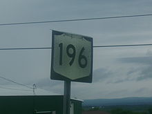
NYS Route 196
Route information Maintained by NYSDOT Length: 10.27 mi[2] (16.53 km) Existed: 1930[1] – present Major junctions West end:  US 4 in Hudson Falls
East end:  NY 40 in Hartford
Location Counties: Washington Highway system Numbered highways in New York
Interstate • U.S. • N.Y. (former) • Reference • County←  NY 195
NY 197  →
→New York State Route 196 (NY 196) is a state route in New York, running from the village of Hudson Falls east to the hamlet of South Hartford in Hartford, Washington County.
Along NY 196 is the northern terminus of NY 32 (Burgoyne Avenue), which oddly intersects NY 196 on its north side. NY 32 crosses US 4 north of the western terminus of NY 196, and then curves southward for its final segment. The route then continues south of NY 196 as County Route 37.
Contents
Route description
 Old NY 196 shield
Route 196 begins at an intersection with U.S. Route 4 in the suburbs of Hudson Falls.[3] The highway progresses eastward, intersecting with local roads before leaving the city limits. Just after the city limits, NY 32 and Washington County Route 37 both terminate at the same intersection along 196. Route 196 then intersects with local roads before crossing a river. On the other side of the river is an intersection with Washington County Route 42.[3]
Route 196 progresses through farmlands in rural Washington County and intersects with short local roads before intersecting with Washington County Route 43.[3] There, Route 196 turns to the northeast and passes to the south of the Pole Valley Players Club. Route 196 terminates at an intersection with NY 40.[3]
History
NY 196 was assigned as part of the 1930 renumbering of state highways in New York to its current alignment.[1]
Major intersections
The entire route is in Washington County.
Location Mile[2] Destinations Notes Hudson Falls 0.00 US 41.23 
 NY 32 / CR 37
Northern terminus of NY 32 Hartford 10.27 NY 40Hamlet of South Hartford 1.000 mi = 1.609 km; 1.000 km = 0.621 mi References
- ^ a b Standard Oil Company of New York (1930). Road Map of New York (Map). Cartography by General Drafting.
- ^ a b "2008 Traffic Volume Report for New York State" (PDF). New York State Department of Transportation. June 16, 2009. p. 182. https://www.nysdot.gov/divisions/engineering/technical-services/hds-respository/NYSDOT%20TVR%202008%20by%20Route.pdf. Retrieved February 1, 2010.
- ^ a b c d Google, Inc. Google Maps – overview map of NY 196 (Map). Cartography by Google, Inc. http://maps.google.com/maps?hl=en&q=from:+Maple+St/RT-196+%4043.300652,+-73.585965+to:+RT-196+%4043.345509,+-73.408374&um=1&ie=UTF-8&sa=N&tab=wl. Retrieved February 25, 2008.
External links
Categories:- State highways in New York
- Transportation in Washington County, New York


Wikimedia Foundation. 2010.