- Natchez Trace State Park
-
For the Mississippi state park, see Trace State Park.
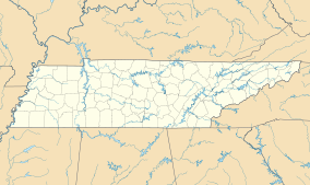
Natchez Trace State Park Location within Tennessee Location Western Tennessee Nearest city Wildersville Coordinates 35°47′11″N 88°15′49″W / 35.7863°N 88.2636°WCoordinates: 35°47′11″N 88°15′49″W / 35.7863°N 88.2636°W Area 10,154 acres (4,109 ha) Official website Natchez Trace State Park is a 10,154-acre (4,109 ha) state park located in western Tennessee.
Natchez Trace State Park was named for the famous Natchez Trace, a Natchez, Mississippi-to-Nashville highway that was an important wilderness road during the late 18th and early 19th centuries. A western spur of the trace ran through part of the modern-day park.[1] With the many acres of scenic woodlands, the park includes four lakes, a swimming beach, a 47 room resort inn and restaurant complex, cabins, group lodge, camping areas, picnicking sites, playgrounds, a ballfield, a regulation pistol firing range, picturesque hiking trails, a wrangler camp, 250 miles (400 km) of horse riding trails, a park store, and archery range. Natchez Trace is located in Carroll, Henderson, and Benton counties, near the unincorporated community of Wildersville. Interstate 40 bisects the park, which is roughly equidistant from Memphis and Nashville. The park is the home to the third largest pecan tree in the world.[2]
The park was built during the New Deal on land bought from residents who could no longer farm due to erosion.[1]
Contents
Water activities
Cub Lake is 58 acres (230,000 m2) and offers swimming, jonboats and pedal boats. You can rent boats between Memorial Day and Labor Day.
Pin Oak Lake being 690 acres (2.8 km2), is one of the more recreational lakes. It has two boat ramps and lake use permits can be purchased at the Pin Oak Lodge. Water skiing is allowed at this lake only. Other activities are fishing, picnicking, swimming, R.V. camping and more. Over night guests are not required to have a permit.
Browns Lake, 167 acres (0.68 km2), and Maples Lake, 90 acres (360,000 m2), have one boat ramp each. Jonboats, life jackets and paddles are available at both lakes, but it is on a first-come first-serve basis. Permits are available for purchase at both sites.
Pin Oak Lodge offers a swimming pool for inn and cabin guests only. Cub Lake offers a free public swim beach.
Horseback riding
Natchez Trace offers 250 miles (400 km) of riding trails on the South end of the park.
Playgrounds and Sports Fields
Archery Archery is free, but you must bring your own equipment.
Basketball There are basketball courts at 3 different locations in the park. All are unlighted courts.
Horseshoes Horseshoes can be played at Campground #1.
Softball Baseball fields are available to play, but you must bring your own equipment. The field is not lighted.
Tennis Pin Oak Lodge has a lighted tennis court.
Volleyball Cub Lake Beach has two sand courts.
References
- ^ a b http://www.state.tn.us/environment/parks/NatchezTrace/
- ^ http://treenotes.blogspot.com/2009/12/big-pecan-tree-at-natchez-trace-state.html
External links
- Natchez Trace State Park from the official web site of the state of Tennessee
- TNYesterday web site
Categories:- Tennessee geography stubs
- Southern United States protected area stubs
- Natchez Trace
- Tennessee state parks
- Protected areas of Benton County, Tennessee
- Protected areas of Carroll County, Tennessee
- Protected areas of Henderson County, Tennessee
Wikimedia Foundation. 2010.

