- Toiyabe Range
-
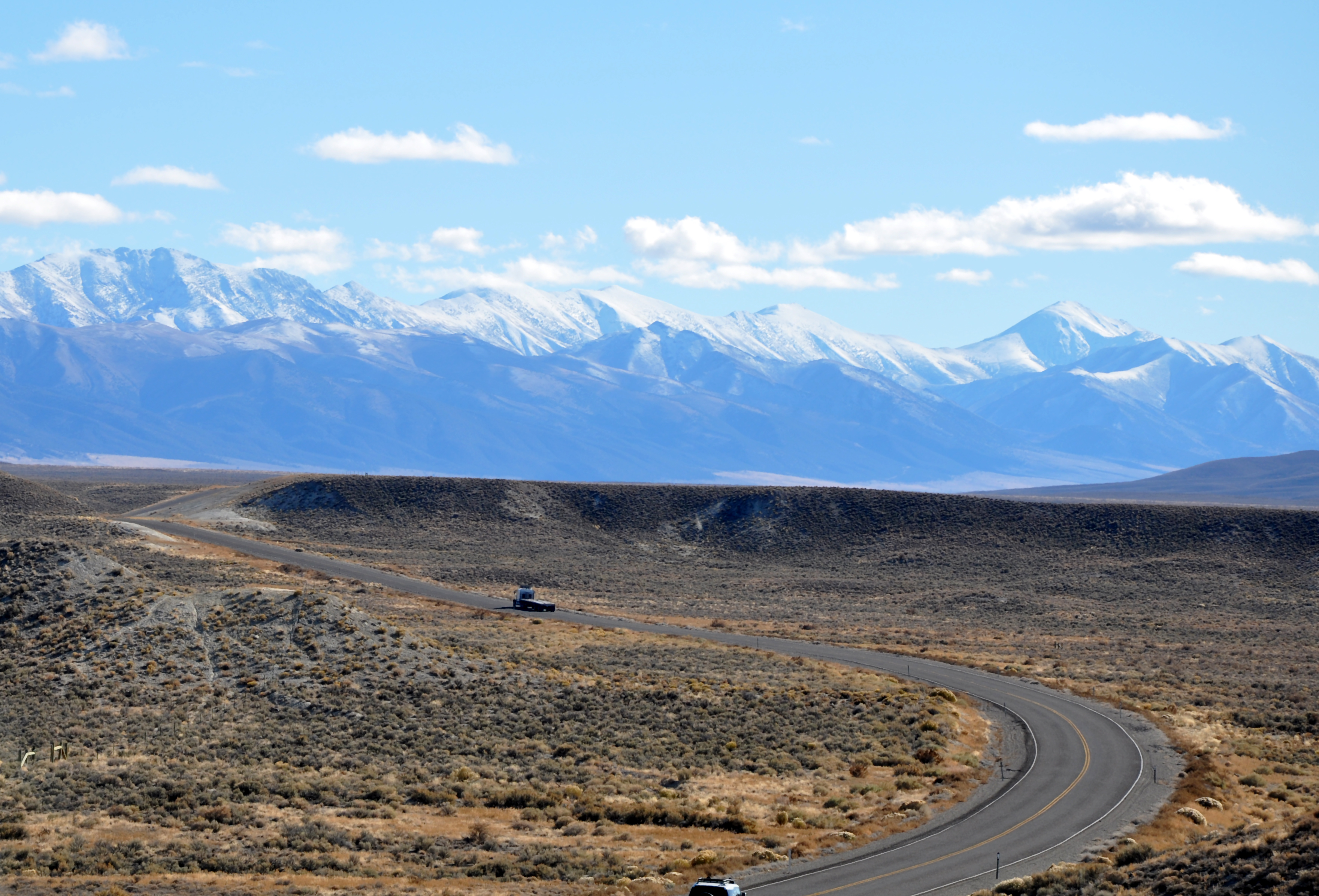
Toiyabe Range Mountain Range  Looking southeast from above Nevada State Route 305 north of Austin
Country United States State Nevada Region Central Basin and Range ecoregion District Lander and Nye counties Parts Toiyabe Dome Coordinates 39°59′59″N 116°43′03″W / 39.99972°N 116.7175°W Highest point Arc Dome[1] - elevation 11,778 ft (3,590 m) - coordinates 38°49′57″N 117°21′10″W / 38.8325°N 117.35278°W Timezone Pacific (UTC-8) - summer (DST) PDT (UTC-7) The Toiyabe Range is a range of mountains in central Nevada in the western United States. It starts in northwestern Nye County north of Tonopah, Nevada and runs approximately 120 miles (190 km) north-northeast through eastern Lander County, making it the second longest range in the state. The highest point in the range, near its southern end, is Arc Dome (11,788 feet, 3592 m), an area protected as the Arc Dome Wilderness.
Contents
Geography
Although the Toiyabe Range is in the rain shadow of the higher Sierra Nevada (U.S.) range to the west and is too arid to support forests except for scattered pines, the climate was cold and snowy enough during the Pleistocene to develop alpine glaciers in several places, with cirques, moraines, and other glacial features still apparent. There are numerous hiking routes in the Toiyabes, including one along the crest.
The Toiyabe Range is separated from the Shoshone Mountains to the west by the Reese River Valley, although they intermingle at their southern extremes. On the east the Toiyabe Range is separated from the Toquima Range by the Big Smoky Valley. The historic mining community of Austin is located on the western slope of the Toiyabe Range, about midway along its length. U.S. Route 50, the "Loneliest Highway in America", runs through Austin and then crosses the range at Scotts Summit at an elevation of 7,484 feet (2,281 m).[citation needed] U.S. Route 6 passes to the south of the range between Tonopah and Ely.
Humboldt-Toiyabe National Forest
The Toiyabe Range is in the Austin Ranger District of the Humboldt-Toiyabe National Forest
Toiyabe Crest Trail
The National Recreation Toiyabe Crest Trail runs through the Humboldt-Toiyabe National Forest in the Toiyabe Range, consisting of over 70 miles of trail atop the ridge, 30 miles of which travel through the Arc Dome Wilderness.[3] The Army Corps of Engineers constructed the trail and its many "feeder" trails in the 1930s.[4] It travels through one of the longest roadless areas in the state,[5] and sits atop the longest mountain range in Nevada at over 120 miles long. It is the longest continuous maintained trail in Nevada.[citation needed]
Trailheads
Its northern terminus, with an altitude of approximately 7,500 ft, is the trailhead on Kingston Creek Road and its southern terminus, with an altitude of approximately 6,100 ft, is the trailhead on Twin River Road(Forest route 080); both of which are roads off SR376.
References
- ^ "Arc Dome". Geographic Names Information System, U.S. Geological Survey. December 12, 1980. http://geonames.usgs.gov/pls/gnispublic/f?p=gnispq:3:::NO::P3_FID:858740. Retrieved November 5, 2009.
- ^ "Toiyabe Range". Geographic Names Information System, U.S. Geological Survey. December 12, 1980. http://geonames.usgs.gov/pls/gnispublic/f?p=gnispq:3:::NO::P3_FID:861745. Retrieved November 4, 2009.
- ^ Humboldt-Toiyabe National Forest
Arc Dome Wilderness Trails - ^ Austin Nevada Wilderness
- ^ Nevada Backcountry
Categories:- Mountain ranges of the Great Basin
- Humboldt-Toiyabe National Forest
- Landforms of Nye County, Nevada
- Landforms of Lander County, Nevada
- Mountain ranges of Nevada
- Protected areas of the Great Basin

Wikimedia Foundation. 2010.