- Akkar District
-
Akkar District — District — عكار Coastline Location in Lebanon
Coordinates (Halba): 34°33′02″N 036°04′41″E / 34.55056°N 36.07806°ECoordinates: 34°33′02″N 036°04′41″E / 34.55056°N 36.07806°E Country  Lebanon
Governorate North Governorate Capital Halba Area – Total 788 km2 (304.2 sq mi) Population – Total 198,174 Time zone EST (UTC+2) – Summer (DST) +3 (UTC) Akkar (Arabic: عكار) is a district (Qadaa) in the North Governorate, Lebanon. It covers an area of 788 km2 (304 sq mi) and has a population of 198,174. The capital lies at Halba.
The district is characterized by the presence of a relatively large coastal plain, with high mountains to the east. Akkar had been governed during the last 400 years by the Emirs and the beiks of the Merheb family. After the civil war this was no longer the case as peasants took over the land with the aid of syrian troops during the civil war. The largest cities in Akkar are Halba, al-Bireh (previously called "Biret el Hokem" where we find the Castle of Merheb Family), Kobayat (Quobayet).
Akkar has many important Roman and Arabic archaeological sites. One of the most famous archaeological sites and the birth place of the Emperor Alexander Severus, is the Tell of Arqa near the town of Miniara.
Demographics
The inhabitants of the Akkar region are largely Sunni Muslims then Greek Orthodox Christians. Maronites inhabit the area in fairly large numbers, moreover, this region has the largest population of Alawites in Lebanon. Melkites or Greek Catholics are also present in small numbers in the region.
References
Capital: HalbaTowns and villages 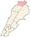
Districts of Lebanon Beirut Governorate Beirut
Mount Lebanon Governorate North Governorate Beqaa Governorate South Governorate Nabatieh Governorate Categories:


Wikimedia Foundation. 2010.