- Mount Warning
-
Mount Warning
(aka Wollumbin)
Mount Warning at sunset.Elevation 1,156 m (3,793 ft) Location Location Northern Rivers, New South Wales, Australia Range Great Dividing Range Coordinates 28°23′50″S 153°16′15″E / 28.39722°S 153.27083°ECoordinates: 28°23′50″S 153°16′15″E / 28.39722°S 153.27083°E Geology Type Shield volcano Climbing Easiest route Walking track 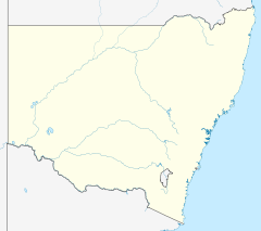
 Mount WarningLocation in New South Wales
Mount Warning (also known as Wollumbin)[1] is a mountain 14 kilometres (9 mi) west-south-west of Murwillumbah, near the border with Queensland in the Northern Rivers region of New South Wales, Australia.[1] Due to Mount Warning's proximity to Cape Byron, the Australian continent's easternmost point, it is the first place on mainland Australia to receive the sun's rays each day.[2]
It was on 16 May 1770 that Lieutenant James Cook, seeing the mountain from the sea, named it Mount Warning.[1][3]
Contents
Shield volcano
Main article: Tweed VolcanoMount Warning is the central volcanic remnant of an ancient shield volcano, the Tweed Volcano, which would have been about 1,900 m (6,200 ft) above sea level or just under twice the height of the current mountain.[4] This volcano erupted around 23 million years ago.[5] As the mountain's central vent cooled it shrank, forming a depression at the top that has greatly eroded.[4]
Today the vast areas that were part of the volcano include many mountains and ranges at some distance from Mount Warning, and include the Border Ranges, Tamborine Mountain, the McPherson Range and both the Lamington Plateau and Springbrook Plateaus. The erosion caldera formed since this eruption is easily visible around the summit and forms the rim of the Tweed Valley.
During the last stages of eruption, different and more resistant forms of lava that were cooler than those flows that created the shield volcano remained to form the current peak. The whole central Mount Warning massif was also pushed up by forces that remained active after lava eruptions had stopped.[4]
Aboriginal significance
The mountain remains a place of cultural and traditional significance to the Bundjalung people and is the site of particular ceremonies and initiation rites.[1] The Bundjalung observe cultural and traditional restrictions forbidding the uninitiated from climbing the mountain, and, as such, generally ask that others also do not attempt to climb the mountain.[citation needed] The government National Parks and Wildlife Service advertise this request and do not encourage climbers, but it is not expressly forbidden by park regulations.
Origin of Mount Warning name
On 16 May 1770, Lieutenant James Cook was the first European to record seeing “… a remarkable sharp peaked Mountain lying inland…”[3] from a point of land he named Cape Byron. Just five hours later while sailing North, Cook was forced to change course to the East after encountering the dangerous reefs that run 3 miles to the East from Fingal Head, now named Danger Reefs (Inner, South, and Outer reefs).[6]
Next morning Cook recorded:
“…We now saw the breakers [reefs] again within us which we past at the distance of 1 League, they lay in the Lat de of 38°..8' [later changed to 28°..8'] & stretch off East two Leagues from a point under which is a small Island. There situation may always be found by the peaked mountain before mentioned which bears SWBW from them this and on this account I have named Mount Warning it lies 7 or 8 Leagues inland in the latitude of 28°..22" S° the land is high and hilly about it but it is conspicuous enough to be distinguished from everything else.[3] The point off which these shoals lay I have named Point Danger to the northward of it the land which is low trends NWBN but we soon found that it did not keep that direction long before it turnd again to the northward.”[3]
Protected area
The mountain is now protected by the surrounding Mount Warning National Park, and access is regulated by the New South Wales National Parks and Wildlife Service. Mount Warning is part of the United Nations World Heritage listed Gondwana Rainforests of Australia.
An ascent of the mountain is discouraged out of respect for local Aboriginal lore,[1] but if undertaken, takes approximately 1½ to 3½ hours (one way) and requires a good level of fitness. There are also viewing platforms at the summit. The total journey is 8.8 km.[2]
Gallery
-

Mount Warning
-

Mount Warning seen from Point Danger, Coolangatta.
-

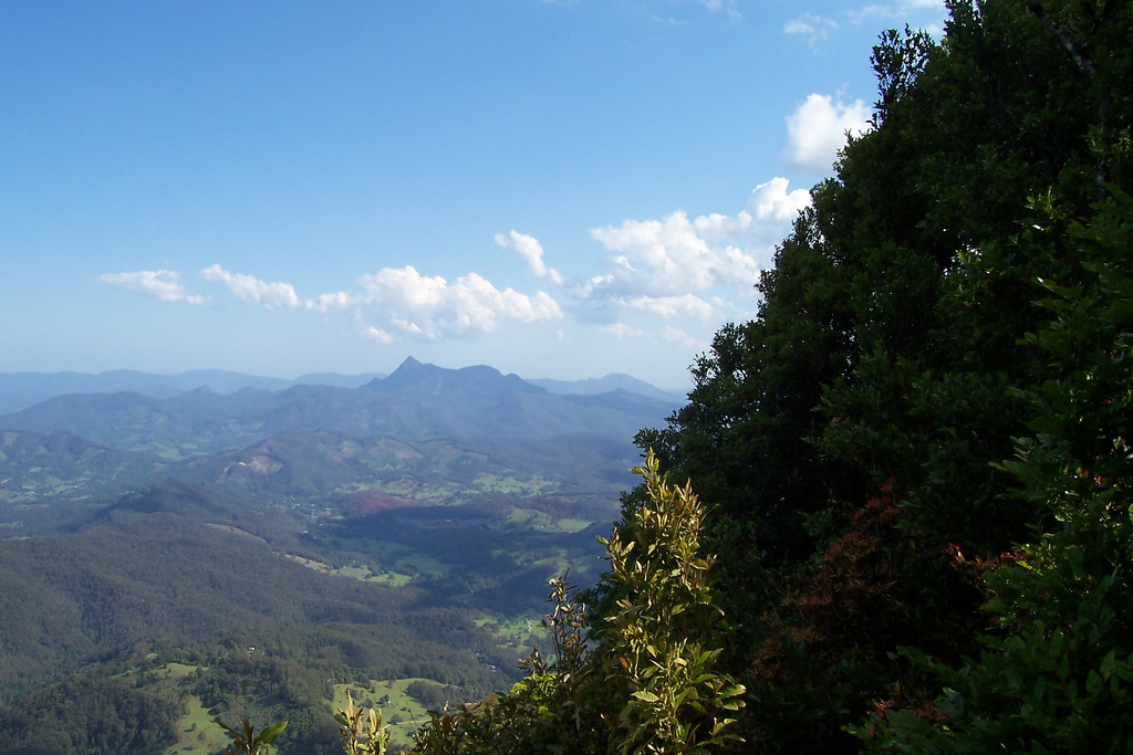
View of Byron Bay and surrounding areas from the summit
-

On the path to the summit.
-

View from Beechmont
-

View from Clarrie hall dam
-

View from Clarrie hall dam
See also
References
- ^ a b c d e "Geographical Names Register Extract: Mount Warning". Geographical Names Register (GNR) of NSW. Geographical Names Board of New South Wales. http://www.gnb.nsw.gov.au/name_search/extract?id=SXqwZxsEKW. Retrieved 2009-04-07.; "Geographical Names Register Extract: Wollumbin". Geographical Names Register (GNR) of NSW. Geographical Names Board of New South Wales. http://www.gnb.nsw.gov.au/name_search/extract?id=MnqwBKUluj. Retrieved 2009-04-07.
- ^ a b Hema Maps (1997). Discover Australia's National Parks. Milsons Point, New South Wales: Random House Australia. pp. 142. ISBN 1975992472.
- ^ a b c d "James Cook’s Manuscript Daily Journal for 16 May 1770". http://southseas.nla.gov.au/journals/cook/17700516.html.
- ^ a b c The Caldera of the Mount Warning Shield Volcano. [brochure] New South Wales National Parks and Wildlife Service. 1990.
- ^ Knesel K. M., Cohen B.E., Vasconcelos P. M., and Thiede D.S. (2008) Rapid change in drift of the Australian plate records collision with Ontong Java Plateau, Nature vol 454, pages 754-757.
- ^ Australian Hydrographic Chart "AUS 813"
External links
- UNESCO World Heritage Listing
- Mount Warning National Park
- Mount Warning National Park information and accommodation guide
- Climbing Mount Warning - a personal account by a local
- Mount Warning Map / Driving Directions
- Peakbagger.com: Mount Warning
Categories:- Tweed Volcano
- Mountains of New South Wales
- Volcanic plugs of New South Wales
-


Wikimedia Foundation. 2010.