- Warkworth, New Zealand
-
Warkworth — Town — Location of Warkworth, New Zealand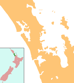
 Warkworth
Coordinates: 36°24′S 174°40′E / 36.4°S 174.667°E Country  New Zealand
Region Auckland Population (2006 Census) – Urban 3 270 Time zone NZST (UTC+12) – Summer (DST) NZDT (UTC+13)  Mahurangi Harbour
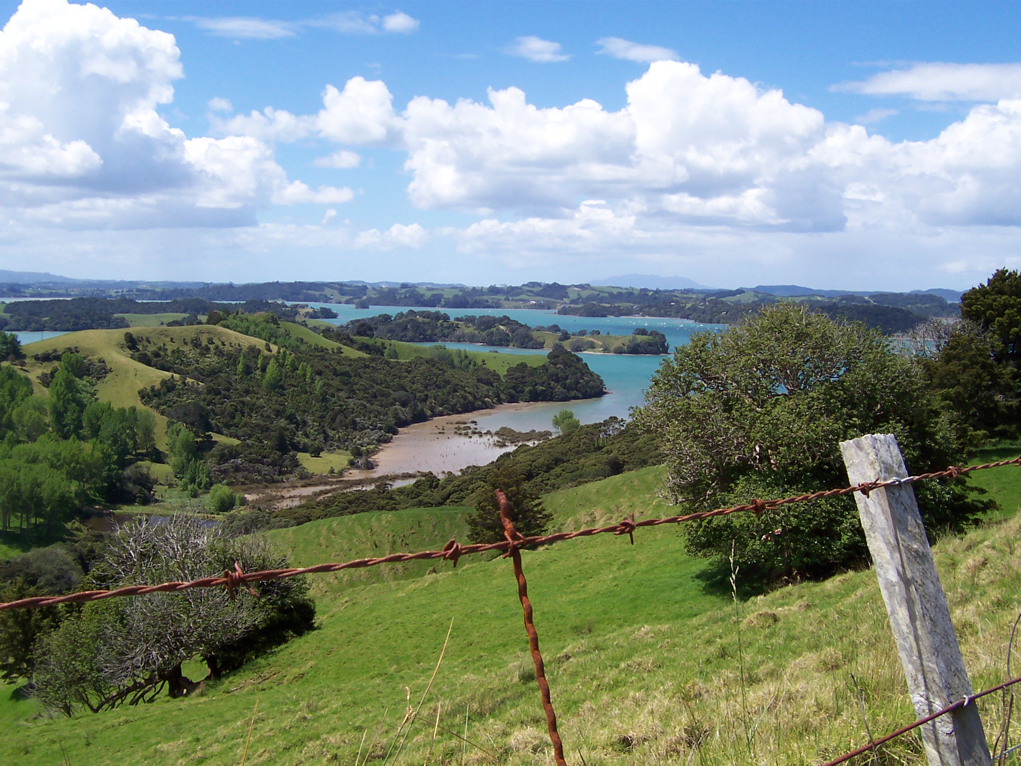
 Tawharanui Regional Park
Warkworth is a town in the upper North Island of New Zealand, within the Rodney District and lying at the far north of the Auckland Region but just south of the Northland Region. It is located on State Highway 1, 64 km north of Auckland and 98 km south of Whangarei, and is at the head of Mahurangi Harbour.[1][2]
The population was 3,270 according to the 2006 census, an increase of 15.7 percent over the preceding five years.[3]
The Warkworth district is known as the Kowhai Coast, named after the native kowhai tree, and the town's annual Kowhai Festival is one of the largest community festivals in the country, running for around a week in spring. Warkworth is known for the ducks which live around the river running through the town.
New Zealand's main satellite communications ground station is located 5 km south of Warkworth
Contents
Geography
One of the most prominent features of Warkworth is the Mahurangi River, an estuary which runs right through the township, where it then joins the Mahurangi Harbour and flows into the Hauraki Gulf. On the eastern side of the river is the Mahurangi East peninsula, with the seaside towns of Snells Beach and Algies Bay. It is here that the scenic Kawau Island is found, notable for its historic Mansion House, once the private retreat of Governor Grey. East of Warkworth and north of Mahurangi East lies the Tawharanui Peninsula, home of the Tawharanui Regional Park and Tawharanui Marine Park. To the north is the town of Wellsford, with the thickly forested Dome Valley lying in between. On the west coast lies the Kaipara Harbour, while to the south is the small historic township of Puhoi and further south the larger town of Orewa.
History
Warkworth, previously known as Browns Mill,[4][5] was founded in 1853 by John Anderson Brown (born Newcastle upon Tyne), who named it after the village of Warkworth, Northumberland, where one of his relatives had taught for many years. In 1853 the government finished surveying the district and began to offer the land for sale. John Anderson Brown purchased 153 acres (0.62 km2) of land and his daughter Amelia purchased a further 81 acres (330,000 m2). He then surveyed the land into allotments where the well known streets such as Lilburn, Alnwick, Neville, and Bertram were named. Six months later in May 1854 the allotments were offered for sale in The New Zealander, an Auckland Newspaper.[5] Bridge House Lodge, established on the site of John Anderson Brown's home next door to the Warkworth Bridge, is the oldest survivng building in Warkworth.[6] Early industry included logging of kauri and other timbers, flour milling and boat-building.
The first portland cement manufacturing works in the southern hemisphere, Wilson's Cement Company, was established near the town in 1884.[5] It closed its doors in 1928 during the depression years. The ruins still remain and the mine is now a popular local fresh water swimming hole.
In 1883 the Masonic Hall was built and up until 1911 served as a public hall until a dedicated building was constructed on the corner of Alnwick and Neville streets. Across the road on the opposite corner the new post office was built the same year and was furnished with a telephone exchange within 12 months of being open.[5][7]
In 1922 Stubbs Butchery first opened and took over the site on Wharf Street that once housed Bowen's Store, the first commercial premises to be built in the 1860s.[5]
At the end of the 1930s came WWII, and although Warkworth escaped the physical devastation it became host to thousands of military men from America. There were 25 military camps which sprung up around the towns farmlands. They carried out exercises prior to being sent to the Pacific Campaigns. They were well received by the community.[8][9]
Education
Mahurangi College
Mahurangi College is a co-educational secondary (years 7-13, form 1-7) school with a roll of 1,217 students and a decile rating of 8.[10] It was first built on the current site in 1957 and was known as Warkworth District High School. It then became Mahurangi College in 1962 with an existing roll of 210 students. Mahurangi College first reached the 1,000 pupil milestone in 1998 and as a result the school decided to have an entire staff and pupil photograph taken.[11] Well known All Blacks Zinzan Brooke and Robin Brooke attended the college during the late 1970s early 1980s. Zinzan attended from form 1 in 1976 to the end of form 5 in 1980 and Robin attended from form 1 in 1978 until form 7 in 1984. Cricket twins Hamish Marshall and James Marshall, who represented New Zealand with the Black Caps Cricket Team, also attended Mahurangi College. Both attended from form 1 in 1991 until form 6 in 1996 when they were offered a cricket scholarship to Kings College.[11]
A new auditorium was completed at the end of January 2011.[12]
Warkworth Primary School
Warkworth Primary School is a co-educational primary (years 1-6) school with a roll of 515 students and a decile rating of 8.[13]
Sports
Mahurangi RFC
Mahurangi RFC is the local rugby club, formed in 1989 as an amalgamation of three strong local rugby clubs: Warkworth, Kaipara Flats and Omaha. There was no formal College Rugby competition and the three Clubs competed against each other for players from the Mahurangi College to play in the Under 15, 16 and 17 age group competitions. The three clubs felt that this arrangement was unsatisfactory for youth development and this provided the impetus for a steering committee from all three clubs to investigate the possibility of amalgamation and to compete in the North Harbour Provincial Union.[14]
Sister towns
Warkworth has several sister towns including:
- Warkworth, Northumberland (Town founder John Anderson Brown named Warkworth after his former home in England)
- Furudono, Fukushima (Furudono is a sister school of Mahurangi College and Warkworth Primary School located in Honshū, Japan)
- Warkworth, Ontario (This town in Canada was sistered in 2003)
Notes
- ^ Peter Dowling (editor) (2004). Reed New Zealand Atlas. Reed Books. map 11. ISBN 0-7900-0952-8.
- ^ Roger Smith, GeographX (2005). The Geographic Atlas of New Zealand. Robbie Burton. map 31. ISBN 1-877333-20-4.
- ^ Quickstats about Warkworth
- ^ http://www.warkworthnz.com/warkworth.php?page=ww_heritage
- ^ a b c d e (2007). DVD. Warkworth: Majorlook.
- ^ Keys. H. J, (1954). Mahurangi - The Story of Warkworth
- ^ Bioletti, H. (1996). Warkworth New Zealand. Book 2. Warkworth, New Zealand: Times Colour Print.
- ^ Clague, C. (2006). Recollections of Warkworth and Warkworth People. Warkworth and District Museum Society Inc
- ^ Bioletti, H. (1993). Tales of the Mahurangi. Warkworth, New Zealand: Times Colour Print.
- ^ "Te Kete Ipurangi - Mahurangi College". Ministry of Education. http://www.tki.org.nz/e/schools/display_school_info.php?school_id=24.
- ^ a b P. Barlett, personal communication: Mahurangi College Staff, March 19, 2009
- ^ "Mahurangi College News - Auditorium Completion". Mahurangi College. http://www.mahurangi.school.nz/mahu2/themewide?num=640&area=news.
- ^ "Te Kete Ipurangi - Warkworth School". Ministry of Education. http://www.tki.org.nz/e/schools/display_school_info.php?school_id=1561.
- ^ "History of the Mahurangi Rugby Club". All Teams Ltd.. http://mahurangirugbyclub.co.nz/mahurangi-rugby-club/history/.
External links
Categories:- Rodney District
- Populated places in New Zealand


Wikimedia Foundation. 2010.