- Nanmoku, Gunma
-
Nanmoku
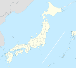
南牧村— Village — Location of Nanmoku in Gunma Prefecture
 Nanmoku
Coordinates: 36°1′N 138°30′E / 36.017°N 138.5°ECoordinates: 36°1′N 138°30′E / 36.017°N 138.5°E Country Japan Region Kantō Prefecture Gunma Prefecture District Kanra Area – Total 118.78 km2 (45.9 sq mi) Population (2003) – Total 3,086 – Density 26/km2 (67.3/sq mi) Time zone Japan Standard Time (UTC+9) Website Village of Nanmoku Nanmoku (南牧村 Nanmoku-mura) is a village located in Kanra District, Gunma, Japan.
As of 2003, the village has an estimated population of 3,086 and a density of 25.98 persons per km², with a total area of 118.78 km². Nanmoku, like many rural areas in Japan, is seeing a significant amount of population decline; in 1955 there were more than 10,000 inhabitants. The majority of the remaining villagers are over 60 years in age (56% in 2000)[1].
Contents
Geography
- Major mountains:
- Mount Arafune (1423 m)
- Mount Hikage (1407 m)
- Mount Ōya (1081 m)
- Eboshidake (1182 m)
- Mount Kurotaki (870 m)
- Mount Yotsumata (900 m)
- Tateiwa (1265 m)
- Major rivers:
- Nanmoku River
- Ōshiozawa River
- Kumakura River
- Ōnita River
Local attractions
Nanmoku is popular locally for its beautiful scenery. The village is located in the valley of a small mountain range, where there are excellent hiking opportunities. One of the mountains, Mt. Arahune, is home to a large natural park. The park serves as a campsite, with a large multipurpose recreational area that has tennis, water sports, and fishing facilities. There is also an astronomy center located on the grounds. Nanmoku also has a museum that documents local culture and history.
Hitoboshi
 Nanmoku's fire-spinning festival, hitoboshi.
The village is particularly famous for hitoboshi (火とぼし), the two-day local fire festival, the largest in the prefecture[2]. Many people who have moved away but still have family in the village return for this festival, and it is popular with tourists as well. Though such fire festivals were once popular, few remain. Nanmoku's version falls on August 14th and 15th, and coincides with Obon, a festival honoring dead ancestors. However, Hitoboshi itself commemorates the village's victorious alliance with the Takeda during the Sengoku period [3]. During the festival, villagers take turns standing on a bridge and twirling burning bales of hay over the edge.
External links
 Media related to Nanmoku, Gunma at Wikimedia Commons
- Nanmoku official website (Japanese) (some English content)
Categories:- Villages in Gunma Prefecture
- Major mountains:


Wikimedia Foundation. 2010.