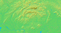
- Moštenica
-
Moštenica Village Country Slovakia Region Banská Bystrica District Banská Bystrica Elevation 479 m (1,572 ft) Coordinates 48°48′N 19°18′E / 48.8°N 19.3°E Area 33.75 km2 (13.03 sq mi) Population 189 (2004-12-31) Density 6 / km2 (16 / sq mi) First mentioned 1340 Postal code 976 61 Area code +421-0 48 Car plate BB Statistics: MOŠ/MIS Moštenica is a village and municipality in Banská Bystrica District in the Banská Bystrica Region of central Slovakia.
History
In historical records the village was first mentioned in 1340.
Geography
The municipality lies at an altitude of 479 metres and covers an area of 13.422km². It has a population of about 189 people.
External links
Banská Bystrica
Badín · Baláže · Brusno · Čerín · Dolná Mičiná · Dolný Harmanec · Donovaly · Dúbravica · Harmanec · Hiadeľ · Horná Mičiná · Horné Pršany · Hrochoť · Hronsek · Kordíky · Králiky · Kynceľová · Lučatín · Ľubietová · Malachov · Medzibrod · Moštenica · Motyčky · Môlča · Nemce · Oravce · Podkonice · Pohronský Bukovec · Poniky · Povrazník · Priechod · Riečka · Sebedín-Bečov · Selce · Slovenská Ľupča · Staré Hory · Strelníky · Špania Dolina · Tajov · Turecká · Vlkanová Categories:
- Villages and municipalities in Banská Bystrica District
- Banská Bystrica Region geography stubs
Wikimedia Foundation. 2010.


