Sarkadkeresztúr

Sarkadkeresztúr

Infobox Settlement

settlement_type =
subdivision_type = Country
subdivision_name = HUN

latd= |latm= |lats= |latNS=N
longd= |longm= |longs= |longEW=E

pushpin_

pushpin_label_position =
pushpin_map_caption =
pushpin_mapsize =

timezone=CET
utc_offset=+1
timezone_DST=CEST
utc_offset_DST=+2|official_name=Sarkadkeresztúr
picture=Sarkadkeresztúr
subdivision_type1=County
subdivision_name1=Békés
area_total_km2=35.33
population_as_of=2002
population_total=1877
population_density_km2=53
postal_code_type=Postal code
postal_code=5731
area_code=66

[
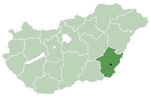
thumb|right|300px|Location_of_Békés County in Hungary] Sarkadkeresztúr is a village in Békés County, in the Southern Great Plain region of south-east Hungary.

Geography

It covers an area of 35.33km² and has a population of 1877 people (2001).


Wikimedia Foundation. 2010.

Игры ⚽ Нужна курсовая?

Look at other dictionaries:

  • Sarkadkeresztúr — Administration …   Wikipédia en Français

  • Orosháza — Aerial view …   Wikipedia

  • Békés County — For the historical county see Békés (former county)Infobox Hungarian county name =Békés region =Southern Great Plain seat = Békéscsaba area = 5631 population = 376,657 density = 69.6 cities = 75Békés County ( hu. Békés megye), is an… …   Wikipedia

  • Dévaványa — Coat of arms …   Wikipedia

  • Mezőberény — Coat of arms …   Wikipedia

  • List of cities, towns, and villages in Békés county — A list of cities and towns, and villages in Békés county in south east Hungary:Largest cities and towns(ordered by population, according to the 2001 census)*Gyula (32 967) *Orosháza (32 052) *Békés (21 657) *Szarvas (18 563) *Gyomaendrőd (15 523) …   Wikipedia

  • Csorvás — Coat of arms …   Wikipedia

  • Mezőhegyes — Coat of arms …   Wikipedia

  • Mezőkovácsháza — Aerial view …   Wikipedia

  • Magyardombegyház — Country  Hungary County Békés Area  – Total 7.64 km2 (2.9 sq&# …   Wikipedia

Share the article and excerpts

Direct link
Do a right-click on the link above
and select “Copy Link”