- Necpaly
-
Necpaly Village 
Country Slovakia Region Žilina District Martin Elevation 510 m (1,673 ft) Coordinates 48°59′N 18°59′E / 48.983°N 18.983°E Area 42.17 km2 (16.28 sq mi) Population 850 (2007-01-01) Density 20 / km2 (52 / sq mi) First mentioned 1266 Postal code 038 12 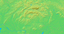

 Location of Necpaly in Slovakia
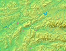
 Location of Necpaly in the Žilina Region
Wikimedia Commons: Necpaly Statistics: MOŠ/MIS Website: www.necpaly.sk Necpaly is a village and municipality in Martin District in the Žilina Region of northern Slovakia.
Contents
History
In historical records the village was first mentioned in 1266.
Manor house
In the 19th century the chateau got under control of Franklins. The first member of the Franklins’ clan was Benjamin Franklin, an illegitimate son of Dionyz Justh and grand-granddauther of Benjamin Franklin.
- Franklins descentors in Slovakia, "see Castle for sale". http://castles.glo-con.com/property.php?property_no=AD3_20310 Franklins descentors in Slovakia,.
Geography
The municipality lies at an altitude of 515 metres and covers an area of 42.172km². It has a population of about 826 people.
Municipal water power station
 The first munucipal water power station in Slovakia
In summer 2007 the first municipal water power station in Slovakia started generating electricity which is in part used for the municipal office building needs and public lighting and in part supplied to the public grid. It is expected to have a yearly output of 160,000 kW. The construction, which cost 5 million Slovak crowns, should be profitable after five years of operation. Three more similar power stations are planned to be finished by the end of 2007 in Necpaly.
Resources
- "Prvá obecná malá vodná elektráreň na Slovensku je v Turci". Hospodárske noviny. 2007-07-22. http://ekonomika.hnonline.sk/c1-21663460-prva-obecna-mala-vodna-elektraren-na-slovensku-je-v-turci. Retrieved 2007-10-08.
Martin · Vrútky
Belá-Dulice · Benice · Blatnica · Bystrička · Diaková · Dolný Kalník · Dražkovce · Ďanová · Folkušová · Horný Kalník · Karlová · Kláštor pod Znievom · Košťany nad Turcom · Krpeľany · Laskár · Ležiachov · Lipovec · Necpaly · Nolčovo · Podhradie · Príbovce · Rakovo · Ratkovo · Sklabiňa · Sklabinský Podzámok · Slovany · Socovce · Sučany · Šútovo · Trebostovo · Trnovo · Turany · Turčianska Štiavnička · Turčianske Jaseno · Turčianske Kľačany · Turčiansky Ďur · Turčiansky Peter · Valča · Vrícko · Záborie · Žabokreky Categories:
- Villages and municipalities in Martin District
- Žilina Region geography stubs


Wikimedia Foundation. 2010.