Ochodnica

Ochodnica
Ochodnica
Village
Country Slovakia
Region Žilina
District Kysucké Nové Mesto
Elevation 403 m (1,322 ft)
Coordinates 49°21′N 18°47′E / 49.35°N 18.783°E / 49.35; 18.783
Area 18.05 km2 (6.97 sq mi)
Population 2,017 (2004-12-31)
Density 112 / km2 (290 / sq mi)
First mentioned 1244
Postal code 023 35
Area code +421-41
Car plate KM
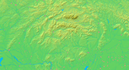
Location of Ochodnica in Slovakia
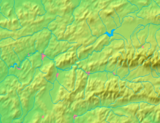
Location of Ochodnica in the Žilina Region
Wikimedia Commons: Ochodnica
Statistics: MOŠ/MIS
Website: www.ochodnica.sk

Ochodnica (Hungarian: Ösvényes, to 1899 Ochodnicza) is a village and municipality in Kysucké Nové Mesto District in the Zilina Region of northern Slovakia.

History

In historical records the village was first mentioned in 1598.

Geography

The municipality lies at an altitude of 403 metres and covers an area of 18.052km². It has a population of about 2,017 people.

External links


Wikimedia Foundation. 2010.

Игры ⚽ Поможем написать курсовую

Look at other dictionaries:

  • Ochodnica — Wappen Karte …   Deutsch Wikipedia

  • Ochodnica — (Village) Administration Pays …   Wikipédia en Français

  • Nesluša — Coordinates: 49°19′N 18°45′E / 49.317°N 18.75°E / 49.317; 18.75 …   Wikipedia

  • Žilina Region — Geobox | Region name = Žilina other name = category = Region image caption = symbol = CoA Žilina Region Slovakia.png symbol type = Coat of arms etymology = official name = motto = nickname = country = Slovakia country state = region = district =… …   Wikipedia

  • Kysucké Nové Mesto District —   District   Country Slovakia …   Wikipedia

  • List of municipalities and towns in Slovakia — Slovakia This is a comprehensive list of municipalities and towns in Slovakia. For lists of towns and municipalities sorted by Regions see the individual articles on Regions. For an outdated list of towns only in Slovakia see also List of towns… …   Wikipedia

  • Dolný Vadičov — Location of Kysucké Nové Mesto District in the Žilina Region Dolný Vadičov is a village and municipality in Kysucké Nové Mesto District in the Zilina Region of northern Slovakia. History In historical records the …   Wikipedia

  • Bahnstrecke Zilina–Bohumin — Žilina–Bohumín Kursbuchstrecke (ČD): 320 Kursbuchstrecke (ZSSK): 127 Streckenlänge: 100 km …   Deutsch Wikipedia

  • Bahnstrecke Žilina–Bohumín — Žilina–Bohumín Kursbuchstrecke (SŽDC): 320 Kursbuchstrecke (ZSSK): 127 Streckenlänge: 100 km Spurweite …   Deutsch Wikipedia

  • Kischützneustadt — Kysucké Nové Mesto Wappen Karte …   Deutsch Wikipedia

Share the article and excerpts

Direct link
Do a right-click on the link above
and select “Copy Link”