- Nebo, Gwynedd
-
Nebo, Gwynedd is a small village in Gwynedd, Wales near Llanllyfni.Amenities
The local television broadcasting tower is on a mountain and supplies most of the valley below, as well as a large part of Gwynedd. Erected in 1963, it is currently the highest structure in Wales since the addition of a new antenna in 2008 slightly extended it to 317 metres [1].
Nebo has a primary school with currently nearly 40 children ( Jan 2011 ), up from less than 20 children in 2006, therefore reversing the trend in many small Welsh villages for declining numbers, and is linked with its neighbouring smaller village Nazareth.[citation needed]
Nebo is mainly a small residential area now, as the chapel and post office have been sold in the last couple of decades.[citation needed]
There is still a play-area and a football pitch where school and community events are held. The village no longer has a youth club, which used to meet in the room above the school.[citation needed]
The population are largely Welsh speakers.[citation needed]
References
External links
Coordinates: 53°01′48″N 4°16′06″W / 53.03°N 4.26833°W
Gwynedd Principal settlements Bala • Bangor • Barmouth • Bethesda • Blaenau Ffestiniog • Caernarfon • Criccieth • Dolgellau • Ffestiniog • Harlech • Nefyn • Porthmadog • Pwllheli • Tywyn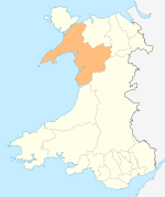
Towns and villages Aberangell • Aberdaron • Aberdesach • Aberdyfi • Abererch • Abergeirw • Abergwyngregyn • Abergynolwyn • Aberllefenni • Abersoch • Abertrinant • Afon Wen • Anelog • Arthog • Beddgelert • Bethania • Bethel • Bethesda • Betws Garmon • Bodferin • Boduan • Bontddu • Bontnewydd • Botwnnog • Bryncroes • Bryn-crug • Brynrefail • Buan • Bwlch-derwin • Caeathro • Capel Celyn • Carmel • Carnguwch • Ceidio • Chwilog • Clwt-y-bont • Clynnog Fawr • Corris Uchaf • Corris • Croesor • Cwm y Glo • Deiniolen • Dinas • Dinas Dinlle • Dinas Mawddwy • Dinorwig • Dolbenmaen • Dolmelinllyn • Dwygyfylchi • Edern • Efailnewydd • Eisingrug • Fairbourne • Friog • Frongoch • Ganllwyd • Garndolbenmaen • Garneddwen • Gellilydan • Glasinfryn • Groeslon • Llan Ffestiniog • Llanaber • Llanaelhaearn • Llanarmon • Llanbedr • Llanbedrog • Llanberis • Llandanwg • Llandegwning • Llandeiniolen • Llandudwen • Llandwrog • Llandygai • Llanegryn • Llanelltyd • Llanengan • Llanfaelrhys • Llanfaglan • Llanfair • Llanfihangel Bachellaeth • Llanfihangel-y-Pennant • Llanfihangel-y-Pennant, Dolbenmaen • Llanfrothen • Llangelynnin • Llangian • Llangwnnadl • Llangybi • Llaniestyn • Llanigian • Llanllechid • Llanllyfni • Llannor • Llanrug • Llanuwchllyn • Llanwnda • Llanymawddwy • Llanystumdwy • Llithfaen • Llwyndyrys • Llwyngwril • Maentwrog • Mallwyd • Mellteyrn • Minffordd • Morfa Bychan • Morfa Nefyn • Mynydd Llandygai • Mynydd Nefyn • Mynytho • Nantlle Valley • Rhostryfan • Nantmor • Nasareth • Nebo • Pant Glas • Penffridd • Penisa'r Waun • Penllech • Penllyn • Penmaenpool • Pennal • Penrhos • Penrhyndeudraeth • Pentre Gwynfryn • Penygroes • Pen-y-meinl • Pistyll • Pontrug • Porthdinllaen • Portmeirion • Prenteg • Rachub • Rhiwddolion • Rhosgadfan • Rhoshirwaun • Rhoslefair • Rhos-y-gwaliau • Rhyd Ddu • Rhyd • Rhydyclafdy • Sarn Meyllteyrn • Soar • Talsarnau • Tal-y-bont (near Bangor) • Tal-y-bont (near Barmouth) • Talysarn • Tanygrisiau • Trawsfynydd • Trefor • Tregarth • Tremadog • Tudweiliog • Tywyn • Waunfawr • Y Felinheli • Y Ffor • Y Fron • Y RhiwUniversities and colleges Castles and forts Rivers Afon Artro • Afon Cwmnantcol • Afon Dwyryd • Afon Dysynni • Afon Fathew • Afon Glaslyn • Afon Llyfni • Afon Mawddach • Afon Rhythallt • Afon Seiont • Afon TrywerynIslands Categories:- Gwynedd geography stubs
- Villages in Gwynedd

Wikimedia Foundation. 2010.