- 1986 Atlantic hurricane season
Infobox hurricane season
Basin=Atl
Year=1986
Track=1986 Atlantic hurricane season map.pngJune 5 ,1986
Last storm dissipated=November 21 ,1986
Strongest storm name=Earl
Strongest storm pressure=979
Strongest storm winds=90
Average wind speed=1
Total depressions=10
Total storms=6
Total hurricanes=4
Total intense=
Fatalities=9
Da
Inflated=1
five seasons=1984, 1985, 1986, 1987, 1988June 1 ,1986 , and lasted untilNovember 30 ,1986 . These dates conventionally delimit the period of each year when mosttropical cyclone s form in theAtlantic basin .The 1986 season had lower than average activity because of an
El Niño event, and was the first season since 1972 to have no major hurricanes. Few storms caused significant damage; Hurricane Bonnie caused heavy rains and flooding across southeastTexas when it made landfall nearSea Rim State Park . Hurricane Charley caused limited damage inNorth Carolina andMassachusetts , but crossed the Atlantic as an extratropical low pressure system and caused considerable damage inIreland andGreat Britain .__TOC__
torms
Tropical Storm Andrew
Infobox Hurricane Small
Basin=Atl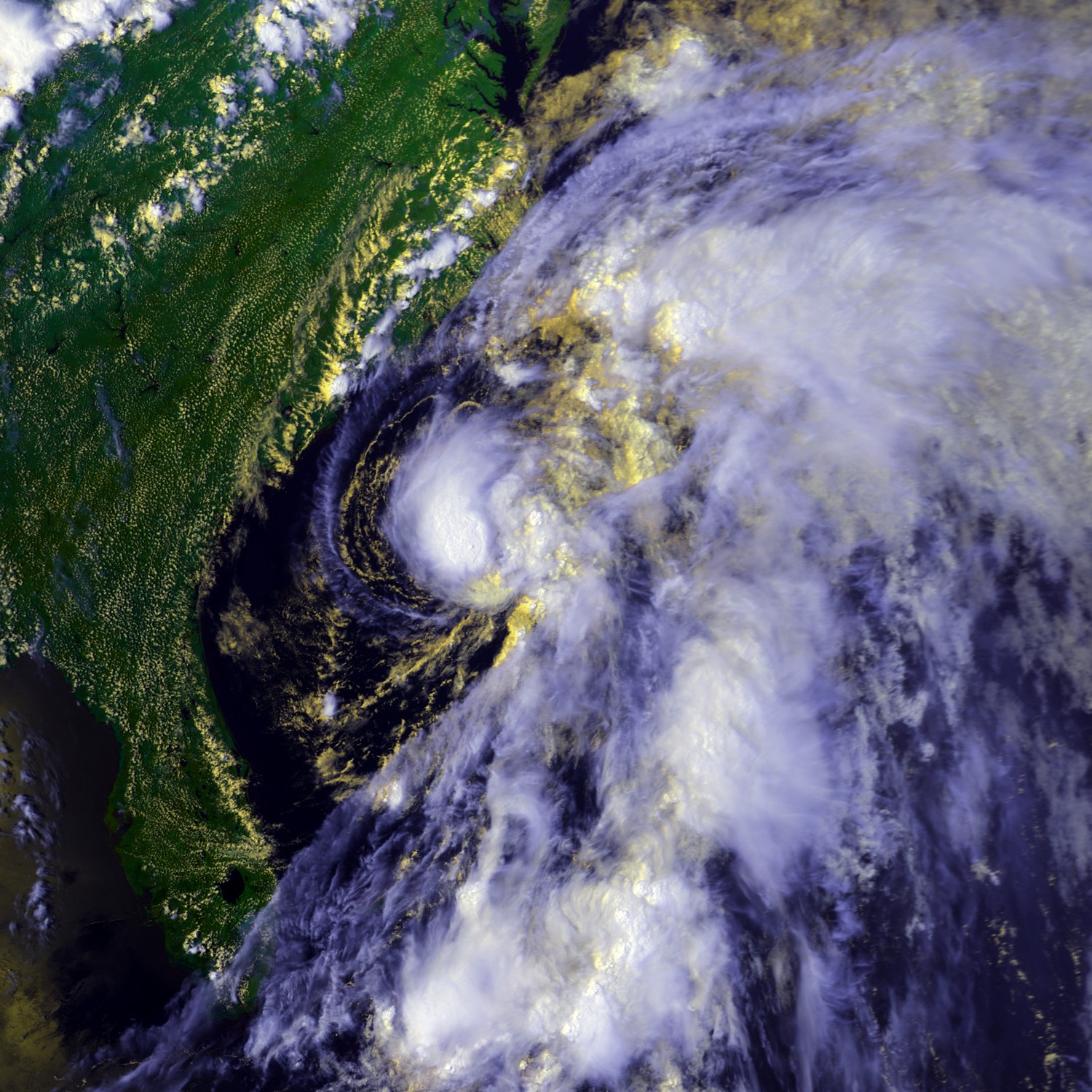
Track=Andrew 1986 track.pngJune 5
Dissipated=June 8
1-min winds=45
Pressure=999June 5 north of theBahamas . It strengthened into Tropical Storm Andrew the next day. Andrew headed along theEast Coast of the United States , causing riptides and high surf along the shore but little else. Andrew dissipated south ofCape Cod . One person drowned off theNorth Carolina coast in high surf, but no significant damage was reported.Hurricane Bonnie
Infobox Hurricane Small
Basin=Atl
Track=Bonnie 1986 track.pngJune 23
Dissipated=June 28
1-min winds=75
Pressure=990Gulf of Mexico , and byJune 22 a surface circulation formed. Tracking west-northwestward, it developed into Tropical Depression Two onJune 23 while located about 330 miles (535 km) south ofPensacola, Florida . The next day, it attained tropical storm status, and with continued favorable conditions attained hurricane status onJune 25 to the south ofLouisiana . Bonnie turned to the northwest and made landfall nearSea Rim State Park inTexas . The storm quickly weakened over land as it turned to the north and northeast, and onJune 28 it was absorbed by an approaching frontal zone in southeasternMissouri .Prior to moving ashore, 22,000 people were evacuated. Upon making landfall, Hurricane Bonnie produced a
storm surge peaking at 5.2 feet (1.5 m) atSabine Pass . Rainfall from the storm peaked at 13 inches (330 mm) inAce, Texas , which caused some street flooding and destroyed a small dam inLiberty County, Texas . The hurricane also spawned eleven tornadoes, which, in combination with moderate winds, destroyed about 25 residencies in southwesternLouisiana . Three storm deaths occurred in thePort Arthur, Texas area; two deaths occurred from separate car accidents, and another occurred after a partially paralyzed woman died in a house fire. Hurricane Bonnie caused minor damage totaling $2 million (1986 USD, $3.5 million 2006 USD).Tropical Depression Three
The third tropical depression of the season was detected early on
July 27 in the open waters of the Atlantic, north ofBermuda . While about 180 miles north of the island, the storm was moving northward at 15mph while its maximum sustained winds were about 30 mph.cite news|title=Sunday, BC cycle|work=Domestic News|publisher=United Press International|date=1986-07-27|accessdate=2008-09-21] Later that afternoon, aircraft reconnaissance found no well-defined circulation and the storm's status was reduced from a depression. The depression never threatened any land areas.cite news|title=Sunday, AM cycle|work=Domestic News|publisher=The Associated Press|date=1986-07-27|accessdate=2008-09-21]Tropical Depression
A tropical disturbance was detected on
August 4 in the northwestern Gulf of Mexico along the lower Texas coast. The low-pressure system moved slowly toward land, limiting the system's development.cite news|title=Tropical Disturbance Along Lower Texas Coast|work=Domestic News|publisher=The Associated Press|date=1986-08-05|accessdate=2008-09-21] On August 5, the system was organized enough to become a tropical depression.cite web|url=http://www.hpc.ncep.noaa.gov/tropical/rain/td4of1986.html|title=Tropical Depression of August, 1986|accessdate=2008-09-25|author=David Roth|publisher=Hydrometeorological Prediction Center|location=Camp Springs, Maryland] The storm moved inland overnight, dumping several inches of rain over South Texas and causing street flooding inBrownsville and nearbySouth Padre Island . The system rained up to 4.45 inches in some areas but caused no major problems.cite news|title=Heavy Rains Cause Street Flooding|work=Domestic News|publisher=The Associated Press|date=1986-08-05|accessdate=2008-09-21] This storm was not carried as a depression operationally, and thus has no assigned number.Hurricane Charley
Infobox Hurricane Small
Basin=Atl
Track=Charley 1986 track.pngAugust 13
Dissipated=August 20
1-min winds=70
Pressure=987Florida Panhandle and moved inland. The depression moved off the coast nearSavannah, Georgia and strengthened into Tropical Storm Charley. Continuing up the coastline, the storm strengthened into a hurricane before moving across theOuter Banks andDelmarva Peninsula . Charley turned out to sea, becameextratropical in theNorth Atlantic , and later brought severe weather acrossGreat Britain andIreland onAugust 25 .As the hurricane moved up the
East Coast of the United States , it caused moderate yet beneficial rainfall. Charley's wind and slow movement caused 2 to 3 foot higher tides, causing $1.015 million in damage (1986 USD, $1.7 million 2005 USD). Five deaths were reported from the hurricane, of which three were from a plane crash. [ftp://ftp.nhc.noaa.gov/pub/storm_archives/atlantic/prelimat/atl1986/charley/] When it hit Europe as an extratropical storm, Charley's strong winds and rain caused structural damage to houses and bridges, along with large-scale uprooting of trees. Abnormally large amounts of rainfall occurred, particularly inIreland , resulting in extensive flooding amounting to over 5 inches in an already wet and cold month. Damage amounted to IR£25 million (1986 Irish Pounds, €47 million 2002 Euro, $57.5 million 2005 USD). [http://www.iif.ie/press03/press260203.htm] [http://www.personal.dundee.ac.uk/~taharley/1986_weather.htm]Tropical Storm Danielle
Infobox Hurricane Small
Basin=Atl
Track=Danielle 1986 track.pngSeptember 7
Dissipated=September 10
1-min winds=50
Pressure=1000September 1 , atropical wave moved off the coast ofAfrica and headed westward. The disturbance was below the 10 degree latitude as it organized into atropical depression onSeptember 7 and then atropical storm later that day. Danielle peaked as a 60 mph storm on the 8th, whileReconnaissance Aircraft reported gusts of up to hurricane force. After passing through theLesser Antilles , Danielle encountered verticalwind shear , and on the 10th it dissipated in the centralCaribbean Sea . http://www.aoml.noaa.gov/general/lib/lib1/nhclib/mwreviews/1986.pdf] The remnants continued westward and ultimately regenerated into Tropical Storm Lester. [ [http://ams.allenpress.com/archive/1520-0493/115/9/pdf/i1520-0493-115-9-2155.pdf 1986 Pacific Hurricane season] ]The islands of
Saint Vincent and the Grenadines experienced wind gusts up to hurricane force, causing severe power outages and causing roof damage. In the Grenadines, the storm drove a coast guard ship aground, [ftp://ftp.nhc.noaa.gov/pub/storm_archives/atlantic/prelimat/atl1986/danielle/prelim01.gif] ] while five people were injured and hundreds of homes were destroyed. Torrential rainfall produced several mudslides, which, in turn, damaged roads, bridges, electricity, and water services. [ [http://www.reliefweb.int/rw/RWB.NSF/db900SID/OCHA-64C6PP?OpenDocument Relief Web] ] Danielle also destroyed twelve homes on the island ofBarbados . [ [http://www.sidsnet.org/docshare/other/20041103160354_BARBADOS_NAR_2004.doc Barbados damage] ] InTrinidad and Tobago , strong flooding of up to four feet caused 27 landslides, destroying four bridges. The storm caused $8 million dollars in damage inTobago . http://web.archive.org/web/20051223215859/http://nema.gov.tt/resources/downloads/tropicalcyclones.pdf] Total damage from the storm amounted to $9.2 million (1986 USD), mostly to crops, though no deaths were reported. [ [http://www.reliefweb.int/rw/RWB.NSF/db900SID/OCHA-64C6PP?OpenDocument Danielle damage] ]Hurricane Earl
Infobox Hurricane Small
Basin=Atl
Track=Earl 1986 track.pngSeptember 10
Dissipated=September 18
1-min winds=90
Pressure=979Africa onSeptember 4 . After moving across the tropicalAtlantic Ocean it strengthened as Tropical Depression Five onSeptember 10 while about 1240mile s (2000 km) east ofPuerto Rico . The depression quickly strengthened and reached hurricane strength the next day, peaked as aCategory 2 onSeptember 12 as it made a half circle, weakened to a Category 1 onSeptember 16 and bounced back the way it came. Earl then turned north and becameextratropical southeast of Newfoundland onSeptember 19 . At its peak, Earl had sustained winds of 105 mph (170 km/h) and a minimum central pressure of 979 mbar. [ftp://ftp.nhc.noaa.gov/pub/storm_archives/atlantic/prelimat/atl1986/earl/prelim03.gif]Hurricane Frances
Infobox Hurricane Small
Basin=Atl
Track=Frances 1986 track.pngNovember 18
Dissipated=November 21
1-min winds=75
Pressure=1000November 18 and quickly strengthened into atropical storm . The storm curved northeast and strengthened further, reaching hurricane strength onNovember 20 . However, a high pressure system to the north caused the storm to fall apart. Frances was absorbed by an extratropical low on the 21st.Accumulated Cyclone Energy (ACE) Rating
The table on the right shows the ACE for each storm in the season. The ACE is, broadly speaking, a measure of the power of the hurricane multiplied by the length of time it existed for, so hurricanes that lasted a long time have higher ACEs.
torm names
The following names were used for named storms that formed in the north Atlantic in 1986. No names were retired, so it was used again in the 1992 season. This is the same list used for the 1980 season except for Andrew, which replaced Allen. A storm was named Andrew for the first time in 1986. Names that were not assigned are marked in tcname unused.
Retirement
The
World Meteorological Organization retired no names used in the 1986 season.ee also
*
List of Atlantic hurricanes
*List of Atlantic hurricane seasons
*1986 Pacific hurricane season
*1986 Pacific typhoon season
*1986 North Indian Ocean cyclone season
*Southern Hemisphere tropical cyclone seasons: 1985–86, 1986–87References
External links
* [http://www.aoml.noaa.gov/general/lib/lib1/nhclib/mwreviews/1986.pdf Monthly Weather Review]
* [http://www.hpc.ncep.noaa.gov/tropical/rain/1986.html U.S. Rainfall information on tropical cyclones from 1986]

Wikimedia Foundation. 2010.