Mindarie, South Australia
- Mindarie, South Australia
-
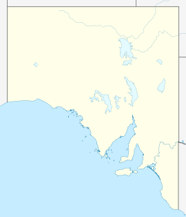
Mindarie is a small town in the Murray Mallee of South Australia between Karoonda and Loxton. The town was gazetted in 1912. The name Mindarie is believed to originate from the Dieri Aboriginal language, and possibly means "festival to invoke peace".
Mindarie is home to the Australian Zircon heavy mineral sands mine.[1]
It is also home to an old unused local school.
Together with nearby Halidon, it hosts the Mindarie-Halidon Races in September each year, which is known as the Melbourne Cup of the Mallee.[2]
References
External links
Categories:
- Towns in South Australia
- South Australia geography stubs
Wikimedia Foundation.
2010.
Look at other dictionaries:
Mindarie, Western Australia — Coordinates: 31°41′17″S 115°42′25″E / 31.688°S 115.707°E / 31.688; 115.707 … Wikipedia
Lands administrative divisions of South Australia — The 37 counties of South Australia in 1886; later 12 more were proclaimed … Wikipedia
Mindarie — can refer to: Mindarie, South Australia Mindarie, Western Australia This disambiguation page lists articles about distinct geographical locations with the same name. If an internal link led you here, you may wis … Wikipedia
List of cities and towns in South Australia — This is a list of town and locality names in South Australia outside of the metropolitan postal area of Adelaide.:For a list of suburbs in metropolitan areas of Adelaide, see lists inside following individual city council articles: City of… … Wikipedia
Electoral district of Mindarie — Infobox Australian Electorate name = Mindarie state = wa caption = lifespan = 2005–present mp = John Quigley mp party = Labor namesake = Mindarie area = 547 class = North MetropolitanThe Electoral district of Mindarie is a Legislative Assembly… … Wikipedia
Clarkson, Western Australia — Coordinates: 31°41′02″S 115°43′41″E / 31.684°S 115.728°E / 31.684; 115.728 … Wikipedia
Merriwa, Western Australia — Coordinates: 31°39′58″S 115°43′05″E / 31.666°S 115.718°E / 31.666; 115.718 … Wikipedia
Neerabup, Western Australia — Neerabup Perth, Western Australia Agricultural land on Wattle Avenue … Wikipedia
Nowergup, Western Australia — Nowergup Perth, Western Australia … Wikipedia
Quinns Rocks, Western Australia — Infobox Australian Place | type = suburb name = Quinns Rocks city = Perth state = wa caption = Quinns Beach looking south lga = City of Wanneroo postcode = 6030 est = pop = 7,991 (2006) area = propval = stategov = Mindarie fedgov = Pearce near nw … Wikipedia
 Mindarie