- Dosewallips River
-
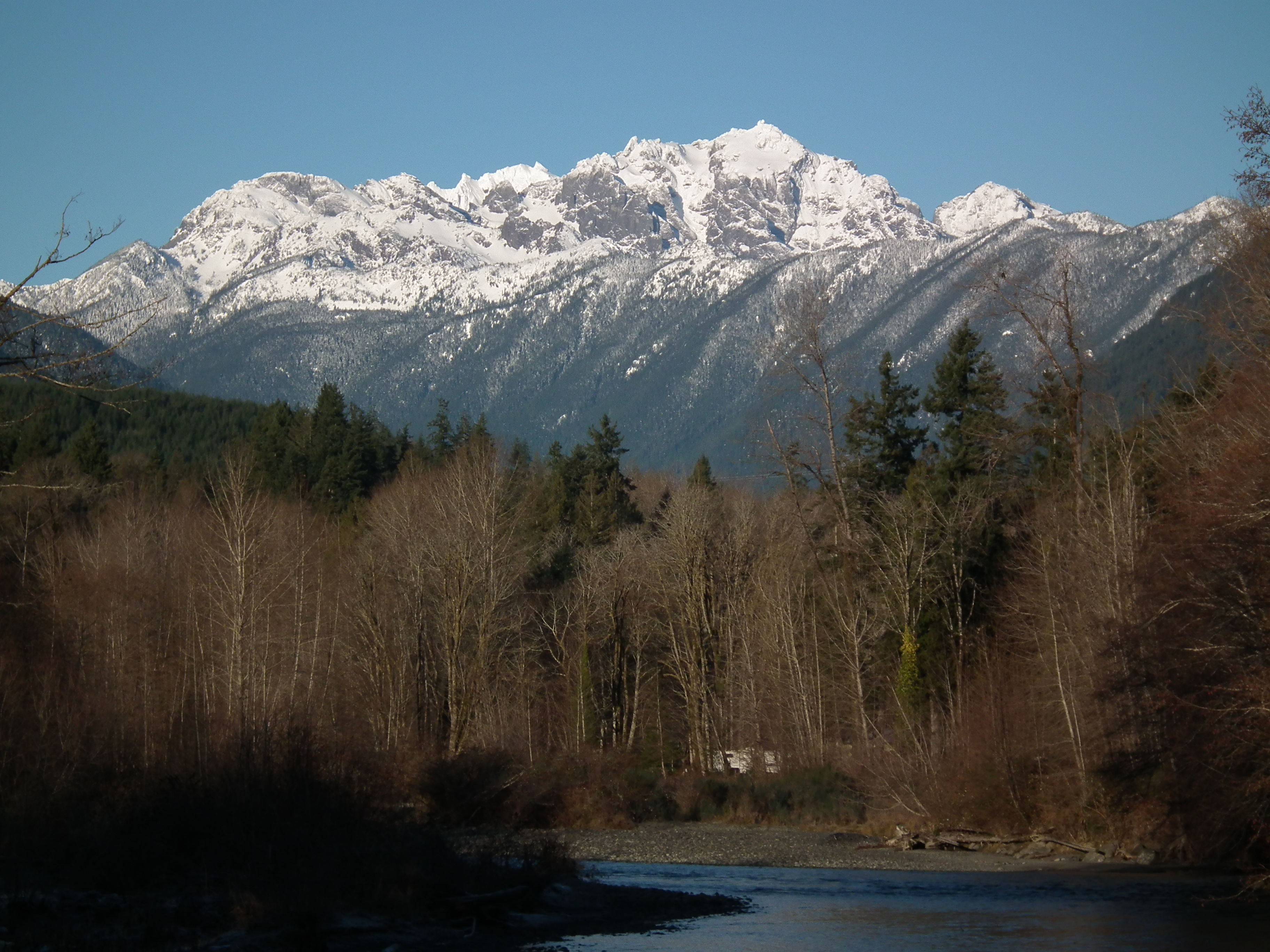
Dosewallips River  Mount Constance (7,756 ft) above the Dosewallips River in Dosewallips State Park
Country United States State Washington County Jefferson Source Olympic Mountains - coordinates 47°47′1″N 123°20′18″W / 47.78361°N 123.33833°W [1] Mouth Hood Canal - coordinates 47°41′6″N 122°53′47″W / 47.685°N 122.89639°W [1] 
 Location of the mouth of the Dosewallips River in Washington
The Dosewallips River (pronounced "doh'-si-wall-ips"[2]) is a river situated on the Olympic Peninsula in the U.S. state of Washington. It rises near Mount Anderson in the Olympic Mountains within Olympic National Park and drains to Hood Canal and thence to the Pacific Ocean.
The river originates in two forks, which join about five miles from the headwaters. The National Park Service maintains trails and campsites along both forks, including one at the fork itself. The road leading to the trailhead was washed out in January 2002,[3] and the ranger station near the trailhead has been abandoned.
The entire estuary of the Dosewallips is within Dosewallips State Park and ongoing restoration efforts led by Wild Fish Conservancy, the Port Gamble S'Kalallam Tribe, and the Hood Canal Coordinating Council are intended to improve salmon habitat through the reconnection of the river to its historical floodplain.
Contents
Name
The name Dosewallips comes from a Twana Indian myth about a man named Dos-wail-opsh who was turned into a mountain at the river's source.[4] There are also several Klallam legends about the "Great Changer", Doquebatl, who transformed a mythical Klallam chief into a mountain at the headwaters of the Dosewallips River. In another story Doquebatl changed a woman into Mount Rainier and her son into Little Tahoma.[5]
See also
- List of Washington rivers
References
- ^ a b U.S. Geological Survey Geographic Names Information System: Dosewallips River
- ^ Goode, J. Paul; Veregin Howard, Ph.D. (June 2006). Rand McNally Goode's World Atlas (21 edition ed.). Rand McNally & Company. pp. 288. ISBN 0528853392. http://www.amazon.com/gp/reader/0528853392/ref=sib_dp_srch_pop?v=search-inside&keywords=dosewallips&go.x=0&go.y=0&go=Go%21#. Retrieved 2008-03-10.
- ^ Washington Trails Association
- ^ Phillips, James W. (1971). Washington State Place Names. University of Washington Press. ISBN 0-295-95158-3.
- ^ Parratt, Smitty (1984). Gods & goblins: A Field Guide to Place Names of Olympic National Park. CP Publications. p. 38. ISBN 0-914195-00-X.
External links
Categories:- Rivers of Washington (state)
- Landforms of Jefferson County, Washington

Wikimedia Foundation. 2010.