Maungakotukutuku

Maungakotukutuku
Maungakotukutuku is located in New Zealand
{{{alt}}}
Maungakotukutuku

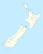
Maungakotukutuku is a rural locality on the Kapiti Coast of New Zealand's North Island. It is located inland, behind Paraparaumu and Raumati, and the 2001 New Zealand Census of Population and Dwellings gave its population as 621 people, an increase of 38.9% or 174 people since the 1996 census.[1]

The Maungakotukutuku Stream and Wharemauku Stream both have their headwaters in the Maungakotukutuku area. Maungakotukutuku Valley has been considered as a possible site for a dam to boost the Kapiti Coast's water supply.[2] The hilly areas, often called "the Maungatooks" by locals, have tracks popular with trampers, mountain and dirt bikers, and horse riders.

References

Coordinates: 40°57′S 175°1′E / 40.95°S 175.017°E / -40.95; 175.017


Wikimedia Foundation. 2010.

Игры ⚽ Нужен реферат?

Look at other dictionaries:

  • Maungakotukutuku Stream — The Maungakotukutuku Stream is a stream on the Kapiti Coast of New Zealand s North Island. Its headwaters are in the Maungakotukutuku area and it is a tributary of the Waikanae River. Consideration has been given to damming the stream in order to …   Wikipedia

  • Kapiti Coast District — The Kapiti Coast District is the name of a local government district in the north west corner of the Wellington Region, New Zealand. It is similar to, but not identical to, the area known as the Kapiti Coast, a more ambiguous and less defined… …   Wikipedia

  • List of rivers of New Zealand — This is a list of all waterways named as rivers in New Zealand. In a small number of cases, which have not been fully indexed here, there are multiple rivers bearing the same name; in these cases the notation (#) indicates the number of rivers… …   Wikipedia

  • Kapiti Coast — The Kapiti Coast (formerly known as The Golden Coast ) is the name of the section of the coast of the south western North Island of New Zealand that is north of Wellington and opposite Kapiti Island. It falls under the jurisdiction of the… …   Wikipedia

  • Raumati — is the name of two neighbouring places on the Kapiti Coast of New Zealand s North Island. They are located 50 60 km north east of Wellington, and immediately to the south west of the larger town of Paraparaumu. The Maungakotukutuku area is… …   Wikipedia

  • Paraparaumu — (typically pronounced Para para oo moo , although the correct pronunciation is Para pa raow moo [In Maori vowels are run together, even when they are brought together by the creation of compound words. See for example… …   Wikipedia

  • Waikanae River — is located on the Kapiti Coast in the North Island of New Zealand.The river drains the western flanks of the Tararua Ranges around Reikorangi and the Akatarawa Valley, then passes to the south of the town of Waikanae before entering the Tasman… …   Wikipedia

  • Wharemauku Stream — The Wharemauku Stream is a stream on the Kapiti Coast of New Zealand s North Island. Its headwaters are in the Maungakotukutuku valley, and it flows through Paraparaumu and Raumati Beach before reaching the Tasman Sea on the northern side of… …   Wikipedia

  • Reikorangi Stream — The Reikorangi Stream is a stream on the Kapiti Coast of New Zealand s North Island that acts as one of the Waikanae River s major tributaries. Its headwaters are in the Tararua Ranges near Maungakotukutuku, and it flows north to Reikorangi in… …   Wikipedia

  • Liste der Flüsse in Neuseeland — Die Liste der Flüsse in Neuseeland gibt eine Übersicht über alle permanent wasserführenden Flüsse im Staat Neuseeland: Inhaltsverzeichnis A B C D E F G H I J K L M N O P Q R S T U V W X Y Z …   Deutsch Wikipedia

Share the article and excerpts

Direct link
Do a right-click on the link above
and select “Copy Link”