- Offley
-
Coordinates: 51°55′40″N 0°20′10″W / 51.9279°N 0.3361°W
Offley 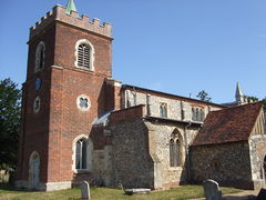
 Offley
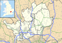
Offley shown within HertfordshirePopulation 1,307 [1] OS grid reference TL148262 District North Hertfordshire Shire county Hertfordshire Region East Country England Sovereign state United Kingdom Post town HITCHIN Postcode district SG5 Post town LUTON Postcode district LU2 Dialling code 01462 01582 Police Hertfordshire Fire Hertfordshire Ambulance East of England EU Parliament East of England UK Parliament Hitchin and Harpenden List of places: UK • England • Hertfordshire Offley is a civil parish in the English county of Hertfordshire, between Hitchin and Luton. The main village is Great Offley, and the parish also contains the nearby hamlets of Little Offley and The Flints. In the south-west of the parish, near Luton, there are the hamlets of Cockernhoe, Mangrove Green and Tea Green, and also the Putteridge Bury estate; these have LU2 postcodes and 01582 telephone numbers.
Contents
Great Offley
Great Offley lies on the top of a chalk escarpment ridge (521 ft/159 metres above sea level) in the centre of the parish (the most north eastern ridge of the Chiltern Hills), and its population is 673.[2] Offa, King of Mercia in the 8th century, is said to have built a palace here and thus gave his name to the village. There is a most interesting group of buildings, including Offley Place, which was rebuilt in 1810 but which retains a Tudor porch and a 17th century wing.
The church named after St. Mary Magdalene contains some attractive monuments. Its nave is Early English, and the chancel was recased and its interior built by Sir Thomas Salusbury in the 18th century. The tower dates from about 1800.
Modern Offley
The village was by-passed by the A505 dual carriageway in the 1970s. Two landmarks close to the centre of the village are the water tower which is painted white in response to a campaign started by a Liberal Democrat councilor candidate, within a several hundred feet is the radio mast, this often mistakenly identified as being part of the BT chain that includes Zouches Farm on Blows Down near Luton, but it is in fact owned by Arqiva and used by utility companies, the next one west being located in Isle of Wight Lane, on Dunstable Downs. Its use seems to have decreased in recent years with the number of microwave radio drums (dishes) declining.
The village has its own Telephone Exchange which is located on Offley Hill.
-

The village sign located in Pond Gardens
-

St Mary Magdalene, Great Offley
-

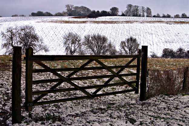
St Mary Magdalene, Great Offley, in the snow December 2009
-

Green Man Public house
-

The Green Man sign
-

Offley Place, now a private hotel/restaurant formerly owned by Hertfordshire County Council from the 1960's as a teacher training college
-

Offley place during the snow in December 2009
-

Offley place during the snow in December 2009
-

Offley's War Memorial
-

Red Lion Public house, Great Offley
-

Great Offley High Street, looking north, immediately on the right is the Old Post Office,
-

Chapel Cottges, Luton Road, Great Offley, (formerly the village Chapel)
-

View to the north from Luton Road, Great Offley
-

Looking north towards Offley Hill from Bakers Lane
-

Looking across the village pond toward the Pump and what is now the Green Man Public House (around 1900)
Development
Housing development in recent years has been restricted to the following areas:
- Kings Walden Road (1980's)
- Meadow Way, terrace of two bedroom houses
- Oflley Chapel, Luton Road, converted into housing units (1990's)
- Westbury Farm, refurbishment of existing flats in Farm House, conversion of barns and sheds into housing, new houses also built.
- John Hall Court
Bloor Homes[3] who have been building on regeneration sites in Luton have submitted proposals for a large scale development on the Putteridgebury Estate. This is likely to be opposed by local residents and groups such as the Keep East of Luton Green[4] and Campaign to Protect Rural England (CPRE).
Local services
The village still has a Post Office/General stores, the butchers shop was closed in recent times to be replaced by an Ladies hairdressers, there had been one previously in the late 1970s located in a property adjoining the butchers shop. The Village Petrol station closed in the late 1980s although a garage operated on the site until 2001 when the land was sold for development.
Offley Endowed JMI School is situated close to the village centre.
Public houses
At one time Great Offley had six pubs in the village, these have now decreased to two with a third being converted into a Chinese Restaurant.
- Green Man[5] (Chef and Brewer)
- Red Lion[6]
- The Bull (now closed and converted into a private dwelling)
- The Cock (now demolished)
- The Gloucester Arms
- refurbished and name changed to Prince Henry
- further refurbishment and name changed to Shaker Browns
- renamed as Astons (Restaurant and Bar)
- Reverted back to Gloucester Arms
- Converted into Chinese Restaurant The Offley Oriental[7]
- The Crusty Loaf (converted into the Lobster Tail restaurant which subsequently closed and has been turned into a private dwelling).
Recreation
- Offley and Stopsley Cricket Club, play at the Recreation Ground[8].
- Offley and District Riding Club have at least four shows at the Old Football Field, Luton White Hill.
- Luton and District Aeronautical Society fly remote control model aircraft at a field at the top of Chalk Hill to the south east of the village[9].
There is also a Fishing club which uses the Long Pond and the Pump Pond which are located along Salusbury Lane.
Little Offley
Little Offley is a small hamlet lying 1½ miles north-west of Great Offley, and it is reached via a bridge over the A505. It contains a late Tudor brick-built manor house.
The Hitchin Yeshiva is based in Wellbury House which is a mile north east of Little Offley.
The Flints
The Flints lies just ½ mile west of Great Offley, and its population is 40.[2]
Cockernhoe
Cockernhoe lies 2½ miles south-west of Great Offley, and its population is 191.[2]
Cockernhoe has a village school and a small church (St Hugh's).
-

St Hugh's Church, Cockernhoe
-

White Horse and Water Tower at Tea Green
-

Blacksmiths at Tea Green
-

The house and gardens of Offley Chase sourounded by fields and rolling hills
Mangrove Green
Mangrove Green lies just north of Cockernhoe and south of Putteridgebury, and its population is 108.[2] The village has one pub, the King William IV.
Tea Green
Tea Green lies 2½ miles south of Great Offley, and its population is 44.[2] Tea Green sits on top of a chalk ridge on the opposite side of Lilley Bottom/Mimram Valley. A major landmark is the tall water tower which is next to the White Horse Pub.
Two of the oldest barns in the area (dating from the 16th Century) are located at Tankards and Crutchmore Farms[10]
Offley Chase
Lies approximately 2 miles south west of Offley along Lilley Bottom.
Putteridge Bury
Main article: Putteridge BuryPutteridge Bury belongs to the University of Bedfordshire, previously being used as the Management Campus of the University of Luton , it was originally acquired in 1965 as a Teacher Training College. The mansion was built in the style of Chequers by architects Sir Ernest George and Alfred Yeats and completed in 1911. The grounds were redesigned by Edwin L Lutyens, soon to be recognised as the foremost architect of the era, and planted by Gertrude Jekyll, one of the first lady Victorian gardeners. Particular features are the reflective pool and massive yew hedges. As well as the mansion house the estate has a farm and a collection of spread out houses.
The Putteridge estate is a mixture of arable farmland and woodland; as well as the occasional visiting muntjac and fallow deer, the estate is home to Lady Amherst's Pheasant (Chrysolophus amherstiae) as well as the more common pheasant.
-

Putteridge Bury House
-

Lady Amherst's Pheasant
Agriculture and Wildlife
The land use in the parish is a mixture of arable, and woodland with some minor seasonal grazing for Beef Cattle and Sheep. To the east of the village all the round to the south east forms part of the King's Walden estate. During the winter months Pheasant and Partridge shooting takes with several shooting syndicates operating to the north of the village as well as a big shoot organised by King's Walden Estate.
Red Kites along with Common Buzzard and Sparrowhawks can be seen in the area.[11]
Decline in farming
Many of the farms in the area are no longer used for agriculture and some have been sold off for housing development. The fields being taken over by farms at a greater distance, this has happened due to technological advances which make small farms un-economical to run. Several farms up until the 1970s had herds of dairy cattle but low milk prices forced many farms to turn to arable farming.
Crops
Main crops include:
Woodland
Much of the woodland is not used for timber and is made up of Oak, Beech, Horse Chestnut trees with smaller plantations of pine and spruce. During the spring many of the woods are carpeted with Bluebells.
The area is home to a sizeable herd of Fallow Deer and muntjac can also be seen.
Chiltern Way
The 152 mile Chiltern Way long distance footpath passes through the parish,[12] as does the 170 mile Chiltern Cycleway[13].
-

Chiltern Cycleway
-

Spaniel with Pheasant
-

Common Pheasant
-

Fallow Deer
-

English Blue bell
-

Red Kite
-

A goat at one of Offleys farms
-

Birkitt Hill from Clouds Hill, Little Offley
Offley at War 1939 - 1945
Offley was Headquarters for an Auxiliary Territorial Service (ATS) Searchlight unit based in Hoo Lane, that had detachments in Hitchin along Bedford Road, Chapel Foot along London Road, as well as at Whitwell and Diamond End[14].
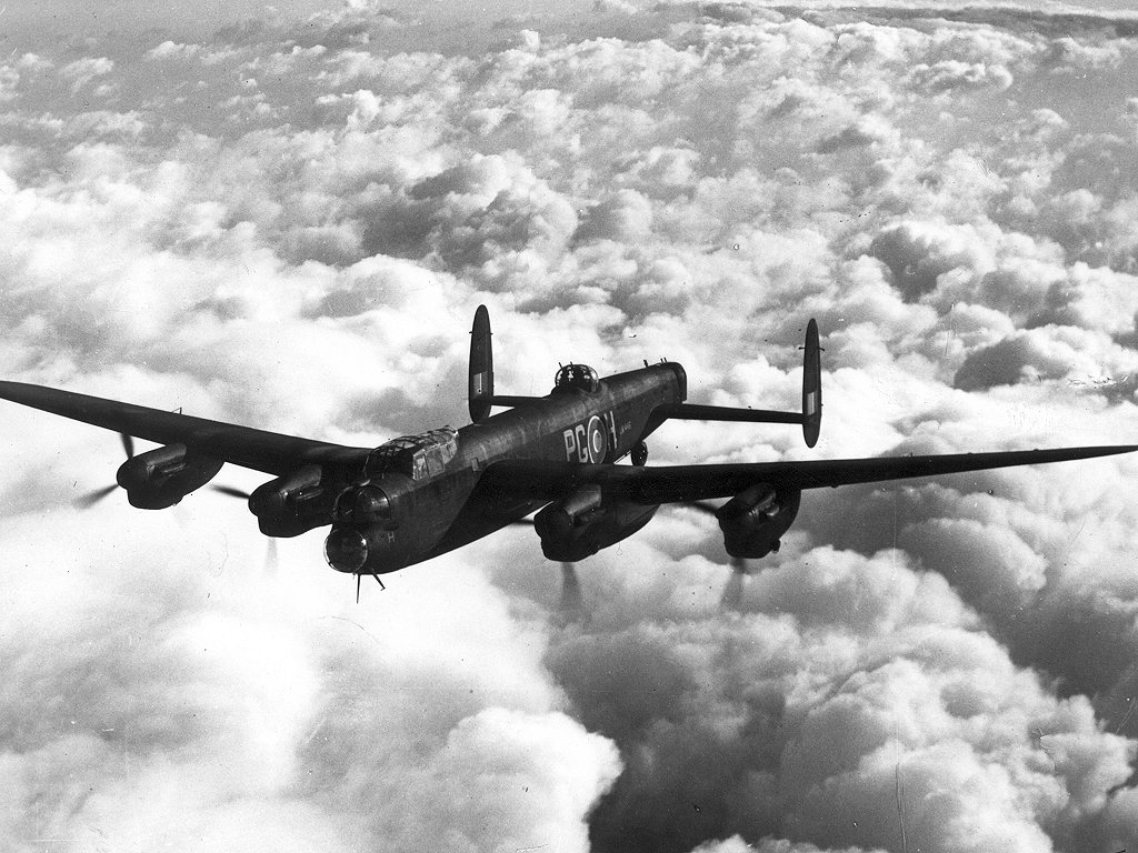
Lancaster bomber crash
At 7.15am on 18 July 1944 an Lancaster Mk.111 bomber belonging to 115 Squadron RAF[15][16] crashed into the farm house at West End Farm (51°56′03″N 0°20′35″W / 51.934070°N 0.343035°W) killing the crew as well as the Farmers wife and two daughters (one who was home on leave from the ATS).
The aircraft LM616 (KO J) had left its base at RAF Witchford near Ely several hours earlier to support Allied Ground Forces taking part in Operation Goodwood during the Normandy campaign. The RAF and USAAF objective was to bomb units of the 16th Luftwaffe Field Division and the 21st Panzer Division which were located around the Manneville area[17].
LM616 received severe damage during the raid where its controls and navigation aids were shot up. The aircraft had descended through low cloud only to see the high escarpment of the Chiltern Hills at Offley loom into view too late for the crew to take immediate action. The aircraft hit trees in a wood on top of Birkitt Hill before the colliding with the Farm house at West End Farm.[18][19][20]
-

Auxiliary Territorial Service (ATS) Search Light Unit
-

Avro Lancaster
-

Avro Lancaster in flight
-

115 Sqn RAF
Glebe Farm Explosion
At 3pm on the 8 January 1945 a US Army lorry carrying munitions was involved in a road accident with a petrol tanker as it was passing Glebe Farm at the Flints.
The drivers managed to evacuate nearby residents however a bus from Luton came round the corner just as an explosion occurred, killing three US Servicemen on the bus and injuring 21 others. The explosion was so severe that it made a crater on the road 50 feet wide and 14 feet deep.
The Windmill and Farm were completely destroyed and Flint cottages were severely damaged, other houses in Offley suffered extensive blast damage[20][21][22].
References
- ^ Office for National Statistics, 2001 Census Parish Headcounts for Offley.
- ^ a b c d e Population figures are taken from Population and household counts for Hertfordshire settlements - 2001 census.
- ^ http://www.eastofluton.com/ website accessed 11/01/2009
- ^ http://www.keolg.org/ website accessed 11/01/2009
- ^ My Pub Heaven
- ^ The Red Lion, Great Offley
- ^ Offley Oriental
- ^ http://www.oscricket.com
- ^ Luton and District Aeronautical Society website accessed 2008-10-22
- ^ Parish History, Offley Parish Council (website accessed 21st June 2010)
- ^ Schurmer, Michael (November 2002). "Breeding Bird Survey of the Chilterns Area of Outstanding Natural Beauty 2002". RSPB. http://www.chilternsaonb.org/downloads/farm_birds_survey.pdf. Retrieved 26 October 2009.
- ^ http://www.ldwa.org.uk/ldp/members/show_path.php?path_id=1119
- ^ The Chilterns Cycleway , Chiltern Society website (accessed 04/07/10)
- ^ BBC Peoples War, Una Bracey Remembers
- ^ Lost Bombers, a database of bombers lost during World War Two, (Website accessed 03/07/10)
- ^ Aircrew Remembrance Society (website accessed 15.07.10)
- ^ Royal Air Force Bomber Command 60th Anniversary Campaign Diary, July 1944 (website accessed: 07/07/2010)
- ^ BBC Peoples War, Lancaster Bomber Crashes on Great Offley Farmhouse
- ^ Lost Bombers Database
- ^ a b BBC Peoples War, Brian Limbrick’s Wartime Childhood 1942 to 1945
- ^ BBC Peoples War Alex Tooley remembers
- ^ Hillyard. Angela M. Images of Old Offley. Published 1993
External links
- Great Offley - a resident's page about local history with many images.
- Offley & Stopsley Cricket Club - Contains pictures, match reports, results, statistics and features from the Cricket Club
- Offley Endowed Primary School
- Cockernhoe Endowed C of E Primary School
- Offley Parish Council
Jun 20 TWA Flight 277
Jul 18 LM616 (KO J) Bomber crash 1944 Offley
Dec 15 Glenn MillerIncidents resulting in at least 50 deaths shown in italics. Deadliest incident shown in bold smallcaps.Categories:- Villages in Hertfordshire
- Civil parishes in Hertfordshire
-


Wikimedia Foundation. 2010.