- Mam Sodhail
-
Mam Sodhail 
Mam Sodhail seen from Càrn Eige, 1 km to the NE.Elevation 1,181 m (3,875 ft) Prominence c. 137 m Listing Munro Translation Hill of the Barns (Gaelic) Pronunciation Scottish Gaelic: [mamˈs̪o.al] Location Location Glen Affric  Scotland
Range Northwest Highlands Topo map OS Landranger 25, OS Explorer 414 OS grid NH120253 Listed summits of Mam Sodhail Name Grid ref Height Status An Tudair NH127239 1074 m (3523 ft) Munro Top Creag Coire nan Each NH112232 1055 m (3461 ft) Munro Top Sgurr na Lapaich NH154243 1036 m (3399 ft) Munro Top Mullach Cadha Rainich NH139246 996 m (3267 ft) Munro Top  Looking down the long ESE ridge to the "top" Sgurr na Lapaich.
Mam Sodhail, sometimes known by its anglicised name of "Mam Soul", is a Scottish Munro situated in the secluded country on the northern side of Glen Affric, some 30 kilometres east of Kyle of Lochalsh.
Contents
Overview
At 1181 metres (3874 feet) it is the second highest mountain north of the Great Glen (after Càrn Eige) and the fourteenth highest in the United Kingdom. Càrn Eige stands just one kilometre to the north of Mam Sodhail and the two are regarded as twin mountains being roughly identical in height and appearance. They stand together above Gleann nam Fiadh (Glen of the Deer) and are linked by a high col of around 1045 metres, making the traverse of the two mountains a natural days walk. Mam Sodhail’s name translates from the Gaelic as “Hill of the Barns” although other sources give it as “Breast (-shaped hill) of the Barns”.
Geography and summit
Mam Sodhail is mostly grassy without too much rock, however its sheer size along with its long ridges and fine corries together with its four "tops" named in the Munro Tables make it a first-rate mountain. The hill casts three ridges down towards Glen Affric, the most impressive of these is the east southeast ridge which has two "tops" on it, Mullach Cadha Rainich (996 metres) stands at the midpoint of the ridge which runs for four kilometres to conclude at the other “top” of Sgurr na Lapaich (1036 metres) which is the most prominent part of the mountain when viewed from Glen Affric. It has the characteristics of a separate mountain and was regarded as a Munro in the original 1891 list, with Irvine Butterfield saying, "The peak certainly does not lack character and many were disappointed to find that its original status was not restored in the seventh edition of Munros Tables".[1] The other two ridges which form a horseshoe around the Allt Coulavie valley to the south of the summit carry the “tops” of An Tudair (1074 metres) and Creag Coire nan Each (1055 metres).[2] The mountains western flanks fall away towards Gleann a’ Choilich which drains northwards into Loch Mullardoch.
Mam Sodhail was an important part of the Ordnance Survey’s initial mapping of the northern Highlands in the 1840s and the summit carries a massive cairn which was used by the surveyors in their work. The cairn is hollow and its walls have to be climbed to get inside,[3] unusually there is a visitors book inside the cairn.[4] A few feet below the summit is the remains of a small bothy, complete with walls, fireplace and chimney which was formerly used by deerstalkers and watchers to keep sheep and walkers off the mountain. The bothy was mentioned by Sir Hugh Munro in volume one of the Scottish Mountaineering Club Journal along with tips to circumvent it and its inhabitants.[5] There is evidence of some quarrying south west of the main summit on the ridge to Creag Coire nan Each. There are a number of pits about three metres deep and several metres across and it is probable that this was the source of the stone for the summit cairn and the bothy.[6]
Ascents
The ascent of Mam Sodhail starts at the car park at the road end in Glen Affric at grid reference NH200233 the walker can either ascend by a stalkers path up Coire Leachavie or by climbing Sgurr na Lapaich first and then following the long ESE ridge to the top of the mountain. The view from the top takes in the impressive sights of Sgurr nan Ceathreamhnan and Càrn Eige close by and the distant view is crowded by the mountains of the north west Highlands. Most walkers will take in the nearby Carn Eige as part of the walk and strong walkers may take the opportunity to climb the remote Munro of Beinn Fhionnlaidh, which lies three kilometres to the north and is difficult to access from any other place.
See also
- Breast shaped hill
References and Footnotes
- The Munros (SMC Guide), Donald Bennett et al., ISBN 978 0 907521 13 6
- 100 Best Routes on Scottish Mountains, Ralph Storer, ISBN 978 0 7515 0300 5
- Hamish’s Mountain Walk, Hamish Brown, ISBN 978 1 898573 08 1
- The Munros and Tops, Chris Townsend, ISBN 1 84018 727 1
- The High Mountains of Britain and Ireland, Irvine Butterfield, ISBN 0 906371 30 9
Footnotes
- ^ "The High Mountains of Britain and Ireland" Pages 199 (Gives this quote).
- ^ www.biber.fsnet.co.uk. Online version of Munros Tables gives details of "Tops".[dead link]
- ^ "The Munros and Tops" Page 158 (Gives info on hollow summit cairn).
- ^ The Angry Corrie. Mentions the summit visitors book.
- ^ "Hamish's Mountain Walk" Pages 257 (Gives info on summit bothy).
- ^ "The Munros and Tops" Page 158 (Gives info on small quarry).
 A' Chràlaig · A' Ghlas-bheinn · An Socach (Glen Affric) · Aonach Meadhoin · Beinn Fhada · Beinn Fhionnlaidh · Càrn Eige · Càrn Ghluasaid · Ciste Dhubh · Mam Sodhail · Mullach Fraoch-choire · Mullach na Dheiragain · Sail Chaorainn · Sàileag · Sgurr a' Bhealaich Dheirg · Sgurr Fhuaran · Sgurr na Càrnach · Sgurr na Ciste Dhuibhe · Sgùrr nan Ceathramhnan · Sgurr nan Conbhairean · Toll Creagach · Tom a' Choinich
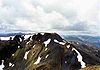
List of Munros Categories:- Munros
- Mountains and hills of the Northwest Highlands
- Anthropomorphic geographic features


Wikimedia Foundation. 2010.