- Coast Fork Willamette River
-
Coast Fork Willamette River  The Coast Fork Willamette River
Name origin: Willamette is from a similar Clackamas Indian village name[1] Country United States State Oregon County Lane County Tributaries - right Row River Source Confluence of Big River and Garoutte Creek - location Calapooya Mountains, Lane County, Oregon - elevation 990 ft (302 m) [2] - coordinates 43°35′44″N 123°4′4″W / 43.59556°N 123.06778°W [3] Mouth Willamette River - location near Eugene and Springfield, Lane County, Oregon - elevation 436 ft (133 m) [3] - coordinates 44°1′23″N 123°1′25″W / 44.02306°N 123.02361°W [3] Length 40 mi (64 km) [4] Basin 666 sq mi (1,725 km2) [5] Discharge for Goshen, 6.4 miles (10.3 km) from the mouth - average 1,558 cu ft/s (44 m3/s) [6] - max 58,500 cu ft/s (1,657 m3/s) - min 36 cu ft/s (1 m3/s) 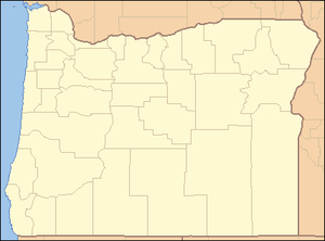
 Location of the mouth of the Coast Fork Willamette River in Oregon
The Coast Fork Willamette River is one of several forks that unite to form the Willamette River in western Oregon in the United States. It is about 40 miles (64 km) long, draining an area of the mountains at the south end of the Willamette Valley south of Eugene.
Course
The Coast Fork Willamette River is formed in southwestern Lane County, in the Calapooya Mountains, by the confluence of Garoutte Creek and the Big River. The river flows north through the mountains, through the Cottage Grove Lake reservoir, to Cottage Grove, where it receives the Row River from the southeast. It continues north past Creswell and joins the Middle Fork from the south, about 2 miles (3.2 km) southwest of Eugene, to form the Willamette.
See also
- Tributaries of the Columbia River
References
- ^ Bright, William (2004). Native American Placenames of the United States. Norman, Oklahoma: University of Oklahoma Press. p. 567. ISBN 9780806135984.
- ^ Source elevation derived from Google Earth search using GNIS source coordinates.
- ^ a b c "Coast Fork Willamette River". Geographic Names Information System (GNIS). United States Geological Survey. November 28, 1980. http://geonames.usgs.gov/pls/gnispublic/f?p=gnispq:3:::NO::P3_FID:1119059. Retrieved August 4, 2010.
- ^ United States Geological Survey (USGS). "United States Geological Survey Topographic Map: Harness Mountain, Oregon, Quadrant". TopoQuest. http://www.topoquest.com/map.php?lat=43.595556&lon=-123.067778&datum=nad83&zoom=4. Retrieved August 3, 2010. The map includes river-mile markers from mouth to source.
- ^ "Coast Fork Willamette". Willamette Riverkeeper. http://willamette-riverkeeper.org/nww1.htm#Coast. Retrieved August 4, 2010.
- ^ "Water-data report 2009: 14157500 Coast Fork Willamette River near Goshen, OR" (pdf). United States Geological Survey. http://wdr.water.usgs.gov/wy2010/pdfs/14157500.2010.pdf. Retrieved 2011-04-22.
 The Coast Fork at Mount Pisgah
 Categories:
- Tributaries of the Willamette River
- Landforms of Lane County, Oregon
- Rivers of Oregon


Wikimedia Foundation. 2010.