- Chetco River
-
Chetco River 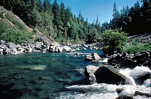 Chetco River near Boulder Creek
Name origin: Named after the Chetco Native Americans Country United States State Oregon County Curry County Source Northwest of Chetco Peak - location Oregon Coast Range, Curry County, Oregon - elevation 3,201 ft (976 m) [Note 1] - coordinates 42°07′47″N 123°52′39″W / 42.12972°N 123.8775°W [1] Mouth Pacific Ocean - location Brookings, Curry County, Oregon - elevation 0 ft (0 m) [1] - coordinates 42°02′43″N 124°16′14″W / 42.04528°N 124.27056°W [1] Length 56 mi (90 km) [2] Basin 352 sq mi (912 km2) [2] Discharge for river mile 10.7 (river kilometer 17.2) - average 2,241.4 cu ft/s (63.5 m3/s) [Note 2][3] - max 85,400 cu ft/s (2,418.3 m3/s) (December 22, 1964)[4] - min 42 cu ft/s (1.2 m3/s) (October 14, 1987)[4] 
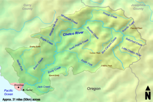 The Chetco River watershed
The Chetco River is a 56-mile-long (90 km) stream located in the southwestern portion of the U.S. state of Oregon. It drains approximately 352 square miles (912 km2) of Curry County. Flowing through a rugged and isolated coastal region, it descends rapidly from about 3,200 feet (980 m) to sea level at the Pacific Ocean. Except for the lowermost 5 miles (8 km), the river is located entirely within the Rogue River – Siskiyou National Forest. The river rises in the Kalmiopsis Wilderness, northwest of Chetco Peak at the junction of the Oregon Coast Range and the Klamath Mountains. It flows generally north, west, and then southwest, before emptying into the ocean between Brookings and Harbor, approximately 6 miles (10 km) north of the California state line.
Native Americans have lived in the Chetco River's watershed for the last one to three thousand years. Several explorers, including Sir Francis Drake, George Vancouver, and Jedediah Smith, visited the region between the 16th and 19th centuries, and found the Chetco people inhabiting the area. European American settlers arrived soon after gold and other precious metals were discovered in the 1840s and 1850s. The town of Brookings was founded in the early 20th century, and incorporated in 1951. The watershed remains largely undeveloped, protected by the Rogue River – Siskiyou National Forest and the Kalmiopsis Wilderness. The upper 45 miles (72 km) of the river have been designated Wild and Scenic since 1988.
Fourteen thousand residents of the cities of Brookings and Harbor rely on the Chetco for drinking water. In 2008, a proposal was made to dredge 24 miles (39 km) of the Wild and Scenic portion of the river for gold and minerals, permitted by the General Mining Act of 1872. Oregon's governor and several members of Congress have opposed the idea, asking the United States Department of Agriculture to withdraw the Chetco River from the 1872 act.
Supporting a large population of salmon and trout, the Chetco's water is of very high quality. The watershed is home to many other species, including several that are endemic to the Siskiyou Mountains area. The northernmost grove of Redwoods—the tallest trees on Earth—grow in the southern region of the Chetco's drainage basin. In total, the river is home to over 200 species of animals, and 97 percent of the watershed is forested.
Contents
Course
The Chetco River begins about 4 miles (6 km) east of Chetco Peak, approximately 3,201 feet (976 m) above sea level.[Note 1][5] It flows north, gathering small tributaries such as the Little Chetco River and Babyfoot Creek. The river turns west near the 5,098-foot (1,554 m) tall Pearsoll Peak, the highest point in the watershed. It receives Box Canyon Creek on the left bank, Tincup Creek on the right bank, and Boulder Creek on the left. It then flows south, gathering the South Fork Chetco River. A few miles farther south, the river passes through a Redwood grove.[5] It flows between Bosley Butte to the north and Mount Emily to the south; the latter is the impact site of one of only four bombs known to have been dropped in the continental United States by an enemy aircraft. This occurred during the Lookout Air Raids of 1942.[6]
Turning southwest, the river flows through Alfred A. Loeb State Park and collects the North Fork Chetco River on the right at river mile (RM) 5 (or river kilometer (RK) 8).[5][7] The Chetco becomes an estuary about 1.7 miles (2.7 km) from its mouth.[2] It passes through the communities of Brookings to the north and Harbor to the south, and discharges into the Pacific Ocean.[5]
Discharge
The United States Geological Survey monitors the flow of the Chetco River at a stream gauge at RM 10.7 (RK 17.2), which is 6.8 miles (10.9 km) northeast of Brookings. It opened in 1969, and continues to operate. The average flow was 2,241.4 cubic feet per second (63.5 m3/s) from a drainage area of 271 square miles (702 km2), about 77 percent of the Chetco's total drainage basin.[Note 2][3] The maximum flow recorded on the north fork was 85,400 cubic feet per second (2,420 m3/s) on December 22, 1964, during the Pacific Northwest flood of 1964. The minimum flow was 42 cubic feet per second (1 m3/s) on October 14, 1987.[4]
Watershed
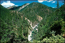 The Chetco River flowing through the Kalmiopsis Wilderness
The Chetco River drains 352 square miles (912 km2) of the southern Oregon Coast. About 78 percent is owned by the United States Forest Service, and another 5 percent is owned by the Bureau of Land Management. Sixteen percent is privately owned, while the remaining one percent is managed by the cities of Brookings and Harbor, Curry County, and the state of Oregon. Approximately 97 percent of the land is used for forestry, 2 percent for agriculture and rural areas, and 1 percent is urban. Gravel and minerals are mined from the lower and upper regions of the watershed, respectively.[2]
The region is mostly mountainous, characterized by steep river valleys. Elevations in the Chetco River watershed range from sea level to 5,098 feet (1,554 m) at the summit of Pearsoll Peak. Precipitation averages between 45 and 140 inches (1,143 and 3,556 mm) per year, with October through June being the wettest months. Seventy percent of surface runoff is collected from rain, and 30 percent from rain on snow. Twenty-five separate wetlands totaling 93 acres (38 ha) have been identified in the watershed.[2] Temperatures average between 32 and 82 °F (0 and 28 °C), although the Brookings effect (or Chetco effect; similar to a foehn wind) often brings localized hot weather to the Brookings area.[2][8] The increase in temperature is caused by the geography of the region; cool air funnels down the Chetco River valley from the Siskiyou and Coast ranges, gradually heating up before eventually reaching Brookings as a warm wind. The mountains also shield the area from cool marine layers.[8] Partially as a result of this phenomenon, Brookings recorded its highest temperature ever, 108 °F (42 °C), on July 8, 2008.[9]
Earthquakes are common, and large-scale ones occur around every 300 years.[2] The Cascadia earthquake of 1700—measuring over nine on the Richter scale—caused a tsunami to sweep across California, Oregon, Washington, and British Columbia, reaching Japan the next day. It was produced when the entire Cascadia subduction zone, about 680 miles (1,100 km) long, slipped approximately 66 feet (20 m) in a megathrust event.[10] Another major earthquake occurred in 1873 near present-day Brookings. With a magnitude of 7.3, the quake was felt from Seattle to San Francisco.[11] Wind is also a factor in the region; storms can sometimes reach over 100 miles per hour (160 km/h).[2] The Columbus Day Storm of 1962 brought devastating winds to nearly all of Oregon; nearby Port Orford recorded gusts exceeding 190 miles per hour (306 km/h).[12] The storm killed 38 people across the state and caused over $200 million worth of damage.[13] The watershed often experiences wildfires, some of them major. The Biscuit Fire of 2002 burned over 500,000 acres (200,000 ha) of the Kalmiopsis Wilderness and surrounding regions.[2][14]
As of the 2000 census, the city of Brookings had a population of 5,447,[15] while nearby Harbor had 2,622.[16] In total, over 14,000 residents of the Brookings–Harbor area depend on the Chetco River for drinking water.[17][18] Nearby watersheds include the Winchuck and Smith rivers to the south, the Pistol River to the north, and the Illinois River, a tributary of the Rogue River, to the north and east.[5]
Flora and fauna
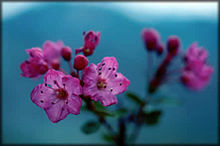 The rare Kalmiopsis plant only grows in the Siskiyou Mountains.
The Chetco River watershed is covered primarily by coniferous forest, which includes species such as Douglas-fir, Western Hemlock, White Fir, Port Orford Cedar, Incense Cedar, and Sitka Spruce. Jeffrey Pine, Knobcone Pine, and Golden Chinquapin have also been identified. Hardwoods including Tanoak, Bigleaf Maple, Red Alder, and Madrone are common. Manzanita, Hazelnut, Vine Maple, Skunk Cabbage, and multiple species of berries and grasses make up the understory. Kalmiopsis, a flowering evergreen shrub and the namesake of the Kalmiopsis Wilderness, only grows in the Siskiyou Mountains.[19] Several noxious weeds have also been identified, including gorse, Scotch Broom, Blackberries, and thistles.[2]
The most prevalent species of the extreme southern portion of the watershed is the Coastal Redwood, one of the tallest types of trees on Earth.[2] The world's northernmost Redwood grove is located near the south bank of the Chetco at RM 15 (RK 24), about 8 miles (13 km) north of the California border.[20][21] Trees here are around 300 to 800 years old, 5 to 13 feet (2 to 4 m) in diameter, and some exceed 300 feet (90 m) tall.[22][23] The Redwoods were heavily logged in the early 20th century. Prior to logging, the massive trees created their own microclimate by capturing moisture from fog, and also by the immense amount of shade they produced. The Redwoods region is less mountainous than the rest of the watershed, and meandering streams are much more common.[2]
Over 200 species of animals inhabit the river and its tributaries.[17] Birds such as loons, grebes, ducks, kingfishers, and Bald Eagles are known to live around streams and other regions of the watershed.[23][24] Auks, gulls, and terns have been spotted around the river's mouth, and Black-legged Kittiwakes nest in the area during the winter.[24] The wildlife in the Kalmiopsis region of the Chetco watershed is more diverse than that of any other region in Oregon.[19] Mammals such as Black Bears, Black-tailed Deer, Bobcats, Ring-tailed Cats, and Gray Foxes are common inhabitants of this region. The rare Siskiyou Chipmunk is endemic to the Klamath Mountains.[19] Steelhead, Chinook and Coho salmon are the most common anadromous fish that inhabit the Chetco River. Steelhead are abundant and have been spotted in most major and minor streams. Chinook salmon usually travel as far as Boulder Creek, about halfway between the Chetco's headwaters and its mouth. Coho also generally stay in this area, but some have been found in the Granite and Carter Creek area, about 12 miles (19 km) above Boulder Creek. Cutthroat Trout can be found all around the watershed; some migrate to the ocean, while others live in the river and its tributaries year round.[2] Pacific Lamprey, Three-spined Stickleback, and various sculpins have also been observed.[25]
Geology
The Chetco River flows through the ancient Klamath Mountain terrane, which is between 400 and 100 million years old, the oldest rocks in Oregon.[26] The Klamath microcontinent was originally located beneath the ocean near southern California before separating hundreds of millions of years ago.[27] Plate tectonics pushed the microcontinent north, and bits of granite, sea floor sediment, subduction zones, and coral reefs gradually accreted into small islands.[26][27] Between 212 and 170 million years ago, a massive volcanic arc erupted on the Klamath microcontinent, binding the islands together in a single block. The Klamath microcontinent went through a period of intense tectonic activity known as the Siskiyou orogeny roughly 170 to 165 million years ago. The process was strong enough to force sedimentary rocks deep into the Earth's crust, melting them into large plutons of granite, which rose slowly to the surface.[28] Shortly after, a large portion of sea floor was thrust over the older Klamath terranes; much of it is still visible atop Vulcan and Chetco peaks.[29][30] This region is known as the Josephine Ophiolite, and contains a rare type of rock called peridotite, originating from the Earth's mantle.[29][31][32]
The mountainous terrain of the Chetco River watershed was created approximately 130 million years ago when the microcontinent collided with the much larger North American continent. The process uplifted the complex and exotic terranes of the microcontinent to form the Klamath Mountains.[30][32] Many glaciers carved U-shaped valleys and cirques during the last ice age, and several alpine lakes still exist today.[27]
Today, sandstone, shale, granite, and serpentine are the primary rock types in the Chetco region. Various forms of loam comprise its soil. Erosion levels are high due to a combination of high precipitation, steep slopes, and landslides, which can result in earthflows.[2]
History
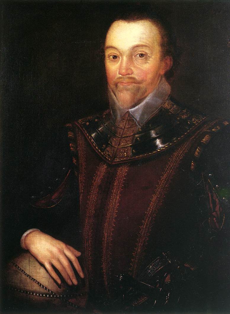
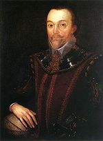 Sir Francis Drake visited the region in 1579.
Humans have lived in the Chetco River watershed since approximately 1,000 to 3,000 years ago. The first inhabitants were perhaps ancestors of the Chetco Indians and other Native American tribes, themselves descendants of the first humans who traveled across the Bering land bridge from Siberia over 10,000 years ago.[33] At least nine separate Native American villages were constructed along the Chetco River, including two on either side of its mouth.[34] The first European American to visit the area may have been Sir Francis Drake on June 5, 1579, during his circumnavigation of the world.[35] The Vancouver Expedition also explored the area in 1792.[36] In June 1828 Jedediah Smith and his company of fur traders camped on the south bank of the river near a Native American village.[36][37] Between 1853 and 1855, many Native Americans were killed and their villages destroyed in skirmishes occurring around the same time as the nearby Rogue River Wars.[38][39][40] On July 9, 1856, the remaining Chetco were marched north to the Siletz Reservation.[41]
Oregon—and therefore the Chetco watershed—was jointly occupied by the United Kingdom and the United States after the Treaty of 1818 was signed. The Oregon Treaty was ratified in 1846, giving the United States ownership of Oregon. Soon after, the Oregon Territory was established, and Oregon became a U.S. state on February 14, 1859.[42]
Gold and other precious metals were discovered in the watershed during the 1840s and 1850s by explorers, and settlers soon arrived. Nickel, cobalt, and chromium were also mined. Very few roads were built in the late 19th century because of the region's mountainous terrain, so the area was left relatively isolated.[33] The town of Harbor was founded in 1891, and a ferry service across the Chetco River opened in 1904. It was shut down in 1915 when the Chetco Bridge opened.[43] In 1912, the Brookings Lumber & Box Company moved north from the San Bernardino Mountains in southern California to the southern Oregon coast region. The company constructed a sawmill in 1914, and founded the town of Brookings.[33][44] Brookings was not incorporated until 1951.[33] In 1917, a 1,200-foot (366 m) long wharf was built at the mouth of the river. Jetties were constructed on either side of its mouth by the United States Army Corps of Engineers in 1957.[45]
The Siskiyou National Forest was created on October 5, 1906, protecting the entire upper portion of the Chetco watershed.[46] The nearby Rogue River National Forest was combined with it in 2004, creating the nearly 1,800,000-acre (730,000 ha) Rogue River – Siskiyou National Forest.[47] In 1964, the United States Congress set aside over 80,000 acres (32,000 ha) of the eastern Chetco River watershed and surrounding regions to create the Kalmiopsis Wilderness. The wilderness was expanded several times in the 1970s, and now encompasses over 180,000 acres (73,000 ha).[48]
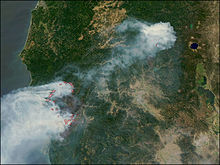 The smoke plume produced by the Biscuit Fire in 2002
On October 28, 1988, a 44.5-mile (71.6 km) stretch of the Chetco River was designated a National Wild and Scenic River, from its headwaters to the boundary of the Rogue River – Siskiyou National Forest.[25] In a court case in 1994, the Chetco was determined to be navigable.[49] In 2002, over 500,000 acres (200,000 ha) of the eastern portion of the watershed and surrounding regions were destroyed in the Biscuit Fire. Originally five separate fires, it was caused by several lightning strikes between July 12 and 15. By August 17, all five had burned together, creating one massive fire. It burned for over five months and was not fully extinguished until December 31.[14]
In 2002, 45 acres (18 ha) of land on the Little Chetco River were sold to real estate developer David Rutan, only several months after the Biscuit Fire tore through the region. He opened a gold mining camp on the site in 2007, flying in customers via helicopter. Curry County officials soon stated that the camp violated zoning and sanitation laws, but inspections were stymied because of the area's inaccessibility.[50] Rutan bought another claim on the Chetco River in the Kalmiopsis Wilderness in 2008. Despite environmentalists' concerns, he proposed mining the Chetco riverbed for gold and minerals by using commercial suction dredges, permitted by the General Mining Act of 1872. The claim begins 6 miles (10 km) within the Kalmiopsis Wilderness, and ends 24 miles (39 km) downstream.[17][18][50] All 24 miles are designated Wild and Scenic. Oregon's governor, Ted Kulongoski, two senators, Ron Wyden and Jeff Merkley, and congressman Peter DeFazio have all asked the United States Department of Agriculture to withdraw the Chetco River from the 1872 Mining Act, thus preventing mineral mining on the river. In 2010, the Chetco River was identified as the seventh most endangered river in America by advocacy organization American Rivers, facing a threat of "motorized instream mining".[17]
Pollution
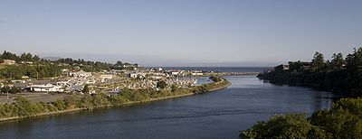 A panorama of the Chetco River near its mouth, with Harbor, Oregon, in the background
The Oregon Department of Environmental Quality (DEQ) has monitored the Chetco River for eight different parameters that affect water quality: temperature, oxygen saturation, pH, nutrients, bacteria, chemical contaminants such as pesticides and metals, turbidity, and alkalinity. Streams that exceed the standard level are then placed on the DEQ 303d list in accordance with the Clean Water Act. The Chetco from Box Canyon Creek to its mouth exceeded the standard level for temperature and turbidity. The North Fork, South Fork, and other tributaries were also listed for temperature and turbidity. All tributaries of the Chetco usually exceed the 64 °F (18 °C) temperature standard. Water temperatures range from 62.6 °F (17.0 °C) at Bosley Creek to 76 °F (24 °C) at Willow Bar. High turbidity levels in the Chetco River watershed are usually caused by landslides, various forms of erosion, and plugged road culverts.[2]
On the Oregon Water Quality Index (OWQI) used by DEQ, water quality scores can vary from 10 (worst) to 100 (ideal).[2][51] The average for the Chetco River at RM 10.8 (RK 17.4) between 1998 and 2007 was 95 (excellent) in the summer and 90 in the fall, winter, and spring.[51] These scores are comparable to the 1986 to 1995 results of 94 and 93. Despite the excellent ratings, the Chetco River actually ranks as the second most polluted stream in Curry County, after nearby Floras Creek, a tributary of the New River.[2]
Recreation
Fishing, four-wheel driving, swimming, boating, camping, sightseeing, and picnicking are the primary recreational activities in the watershed.[17][25] Whitewater kayaking is also popular in the winter months when water levels are high. Several trails are maintained throughout the Kalmiopsis Wilderness, as well as other regions in the watershed.[25] Eight boat launches are located on the river between its confluence with the south fork and its mouth.[52] Alfred A. Loeb State Park, located on the banks of the Chetco, has three cabins and 48 camping sites.[21]
Several large parks are located in Brookings. The 33-acre (13 ha) Azalea Park in Brookings features five species of wild azaleas.[53] The park was designated an Oregon State Park in 1939, but was given to Brookings in 1993.[53][54] It hosts the American Music Festival from June until September.[53][55] The Nature's Coastal Holiday light show is displayed in Azalea Park every December.[53][56] Chetco Point Park, located near the wharf, has several fire rings and picnic tables, as well as views of the river, Pacific Ocean, and the Port of Brookings Harbor. It is home to the rare Wolf's Evening Primrose.[57]
See also
- List of rivers of Oregon
- List of longest streams of Oregon
- List of National Wild and Scenic Rivers
Notes
- ^ a b Source elevation derived from Google Earth search using Geographic Names Information System (GNIS) source coordinates.[1]
- ^ a b The average discharge rate for this location was calculated by adding the average annual discharge rates for the total number of water years for which data was available and dividing by the total number of water years.
References
- ^ a b c d Chetco River, Geographic Names Information System
- ^ a b c d e f g h i j k l m n o p q Chetco River Watershed Assessment, South Coast Watershed Council
- ^ a b USGS 14400000 Chetco River Near Brookings, OR, United States Geological Survey
- ^ a b c USGS 14400000 Chetco River Near Brookings, OR, United States Geological Survey
- ^ a b c d e Benchmark Maps 2010, pp. 94–95
- ^ FS Today, September 19, 2008
- ^ Topographic Map: Mount Emily quadrant, United States Geological Survey
- ^ a b Mail Tribune, August 7, 2004
- ^ Mail Tribune, July 10, 2008
- ^ Atwater 2005, p. 98
- ^ The Register Guard, May 31, 2002
- ^ Port Orford Watershed Assessment, South Coast Watershed Council
- ^ Some of the Area's Windstorms, National Oceanic and Atmospheric Administration
- ^ a b Biscuit Fire Analysis of Fire Response, Resource Availability, and Personnel Certification Standards, General Accounting Office
- ^ Brookings city, Oregon, United States Census Bureau
- ^ Harbor CDP, Oregon, United States Census Bureau
- ^ a b c d e #7 Chetco River, American Rivers
- ^ a b Mail Tribune, June 2, 2010
- ^ a b c Wuerthner 2003, pp. 54–55
- ^ Jepson 1896, p. 125
- ^ a b Alfred A. Loeb State Park, Oregon Parks and Recreation Department
- ^ Morris 2007, p. 346
- ^ a b Ostertag 2001, p. 196
- ^ a b Rakestraw 2007, p. 152
- ^ a b c d Recreation – Wild and Scenic Chetco River, United States Forest Service
- ^ a b Bishop 2003, p. 19
- ^ a b c Wuerthner 2003, p. 48
- ^ Bishop 2003, p. 54
- ^ a b Bishop 2003, p. 56
- ^ a b Bishop 1996, p. 56
- ^ Bishop 1996, p. 53
- ^ a b Bishop 2004, pp. 220, 222
- ^ a b c d Brookings, Oregon, National Oceanic and Atmospheric Administration
- ^ Schwartz 1997, p. 9
- ^ Brereton 1907, p. 19
- ^ a b West Coast Athabaskans, University of Oregon Department of Linguistics
- ^ Jedediah Smith Route, 1828, The Oregon Historic Trails Fund
- ^ Coan 1922, p. 2
- ^ Gaston 1912, pp. 64, 407
- ^ Schwartz 1997, p. 66
- ^ Schwartz 1997, p. 147
- ^ Carey 1922, p. 915
- ^ Brookings, Oregon History, Virtual Cities
- ^ Carranco 2003, p. 123
- ^ Port History ~ From 1900 To The Present, Port of Brookings-Harbor
- ^ Davis 1983
- ^ Rogue River-Siskiyou National Forest, United States Forest Service
- ^ Kalmiopsis Wilderness, Oregon History Project
- ^ a b The Oregonian, March 13, 2010
- ^ a b Oregon Water Quality Index Summary Report Water Years 1998–2007, Oregon Department of Environmental Quality
- ^ Yuskavitch 2001, p. 102
- ^ a b c d Azalea Park, Brookings, Oregon
- ^ Chetco River, State of Oregon
- ^ American Music Festival, Brookings, Oregon
- ^ Nature's Coastal Holiday, Brookings, Oregon
- ^ Chetco Point Park, Brookings, Oregon
Bibliography
Books
- Atwater, Brian; Satoko, Musumi-Rokkaku; Kenji, Satake; Yoshinobu, Tsuji; Kazue, Ueda; Yamaguchi, David (2005). The Orphan Tsunami of 1700. Reston, Virginia: United States Geological Survey. ISBN 978-0-295-98535-0. OCLC 60453634. http://pubs.usgs.gov/pp/pp1707/pp1707.pdf. Retrieved June 21, 2010.
- Bishop, Ellen (2004). Best Hikes with Dogs Oregon. Seattle, Washington: The Mountaineers Books. ISBN 978-0-89886-944-6. OCLC 53356372. http://books.google.com/books?id=_fWof0vm3-UC&lpg=PP1&pg=PP1#v=onepage&q&f=false. Retrieved June 14, 2010.
- Bishop, Ellen (2003). In Search of Ancient Oregon. Portland, Oregon: Timber Press. ISBN 978-0-88192-590-6. OCLC 51614008. http://books.google.com/books?id=o5XxO3E8ap4C&lpg=PP1&pg=PP1#v=onepage&q&f=false. Retrieved June 14, 2010.
- Bishop, Ellen; Allen, John (1996). Hiking Oregon's Geology. Seattle, Washington: The Mountaineers Books. ISBN 978-0-585-34087-6. OCLC 47008924. http://books.google.com/books?id=fk2pBzzy9LsC&lpg=PP1&pg=PP1#v=onepage&q&f=false. Retrieved June 14, 2010.
- Brereton, Robert (1907). Question: Did Sir Francis Drake land on any part of the Oregon coast?. Portland, Oregon: The J. K. Gill Company. OCLC 16259718. http://www.archive.org/stream/questiondidsirfr00breriala#page/n9/mode/2up. Retrieved May 23, 2010.
- Carey, Charles (1922). History of Oregon. Chicago, Illinois: Pioneer Historical Publishing Company. OCLC 2077442. http://books.google.com/books?id=ZUMOAAAAIAAJ&pg=PR3#v=onepage&q&f=false. Retrieved June 14, 2010.
- Carranco, Lynwood; Labbe, John (2003). Logging the Redwoods. Caldwell, Idaho: Caxton Press. ISBN 978-0-87004-373-4. OCLC 174139535. http://books.google.com/books?id=G2FBSEfJxiMC&lpg=PP1&pg=PP1#v=onepage&q&f=false. Retrieved May 22, 2010.
- Coan, Charles (1922). The adoption of the reservation policy in Pacific Northwest, 1853–1855. Portland, Oregon: The Ivy Press. OCLC 18730769. http://books.google.com/books?id=Sv0XAAAAYAAJ&pg=PP7#v=onepage&q&f=false. Retrieved May 23, 2010.
- Davis, Richard, ed (1983). Encyclopedia of American Forest and Conservation History. 2. New York: Macmillan Publishing Company. pp. 743–788. ISBN 978-0-02-907350-6. OCLC 9350600. http://www.foresthistory.org/ASPNET/Places/National%20Forests%20of%20the%20U.S.pdf. Retrieved June 14, 2010.
- Gaston, Joseph (1912). The centennial history of Oregon, 1811–1912. Chicago, Illinois: S. J. Clark Publishing Company. OCLC 1656126. http://books.google.com/books?id=uWUUAAAAYAAJ&pg=PR1#v=onepage&q&f=false. Retrieved May 23, 2010.
- Jepson, Willis (1896). Erythea. 4–5. University of California. OCLC 446879907. http://books.google.com/books?id=UToCAAAAYAAJ&pg=PP7#v=onepage&q=&f=false. Retrieved May 22, 2010.
- Morris, Elizabeth; Morris, Mark; Jewell, Judy; McRae, W. C.; McCue, Elizabeth (2007). Moon Oregon (7th ed.). Emeryville, California: Avalon Travel. ISBN 978-1-56691-930-2. OCLC 74524856. http://books.google.com/books?id=-xEA_1nkxcAC&lpg=PP1&pg=PP1#v=onepage&q=&f=false. Retrieved May 22, 2010.
- Ostertag, Rhonda; Ostertag, George (2001). 75 Hikes in Oregon's Coast Range and Siskiyous (2 ed.). Seattle, Washington: The Mountaineers Books. ISBN 978-0-89886-620-9. OCLC 45387216. http://books.google.com/books?id=rEcQAG9YgqYC&lpg=PP1&pg=PP1#v=onepage&q&f=false. Retrieved May 22, 2010.
- Rakestraw, John (2007). Birding Oregon. Guilford, Connecticut: Globe Pequot. ISBN 978-0-7627-3913-4. OCLC 65165451. http://books.google.com/books?id=V741Dgud3RcC&lpg=PP1&pg=PP1#v=onepage&q&f=false. Retrieved May 22, 2010.
- Schwartz, E. A. (1997). The Rogue River Indian War and its aftermath, 1850–1980. Norman, Oklahoma: University of Oklahoma Press. ISBN 978-0-585-14637-9. OCLC 44964292. http://books.google.com/books?id=OZwAnfQj62cC&lpg=PP1&pg=PP1#v=onepage&q&f=false. Retrieved May 23, 2010.
- Wuerthner, George (2002). Oregon's Wilderness Areas. Englewood, Colorado: Westcliffe Publishers. ISBN 978-1-56579-434-4. OCLC 50243182. http://books.google.com/books?id=lb058FGWo2QC&lpg=PP1&pg=PP1#v=onepage&q&f=false. Retrieved May 22, 2010.
- Yuskavitch, Jim (2001). Fishing Oregon. Guilford, Connecticut: Globe Pequot. ISBN 978-1-56044-728-3. OCLC 47361440. http://books.google.com/books?id=lQbXDQdEWSIC&lpg=PP1&pg=PP1#v=onepage&q&f=false. Retrieved May 22, 2010.
News articles
- Burel, Patty (September 19, 2008). "Trail Dedication at Japanese Bombing Site Set". FS Today. http://www.fs.fed.us/fstoday/080919/03.0About%20Us/trail_dedication.html. Retrieved March 23, 2010.
- "Chetco River Boundary Dispute Settled". Oregon Department of State Lands. October 7, 2002. http://www.oregon.gov/DSL/news/pr0228_chetco.shtml. Retrieved May 22, 2010.
- Fattig, Paul (June 2, 2010). "Chetco River listed among threatened". Mail Tribune (Medford, Oregon). http://www.mailtribune.com/apps/pbcs.dll/article?AID=/20100602/NEWS/6020320. Retrieved June 4, 2010.
- Kettler, Bill (July 10, 2008). "108 ... in Brookings?". Mail Tribune (Medford, Oregon). http://www.mailtribune.com/apps/pbcs.dll/article?AID=/20080710/NEWS/807100327. Retrieved October 7, 2010.
- Since You Asked (August 7, 2004). "Brookings warms up with wind". Mail Tribune (Medford, Oregon). http://archive.mailtribune.com/archive/2004/0807/local/stories/18local.htm. Retrieved October 7, 2010.
- "Study takes second look at big quake". The Register-Guard (Eugene, Oregon). May 31, 2002. http://news.google.com/newspapers?nid=1310&dat=20020531&id=Q3UVAAAAIBAJ&sjid=qOsDAAAAIBAJ&pg=4885,8234398. Retrieved June 21, 2010.
- Zaitz, Les (March 13, 2010). "Developer lays claim to more than gold in Oregon wilderness". The Oregonian (Portland, Oregon). http://www.oregonlive.com/news/index.ssf/2010/03/developer_lays_claim_to_more_t.html. Retrieved June 4, 2010.
Websites
- Allen, Cain (2003). "Kalmiopsis Wilderness". Oregon History Project. http://www.ohs.org/education/oregonhistory/historical_records/dspDocument.cfm?doc_ID=436B7EAF-A987-1493-0B265C0219EFF652. Retrieved May 22, 2010.
- "Alfred A. Loeb State Park". Oregon Parks and Recreation Department. http://www.oregonstateparks.org/park_72.php. Retrieved May 12, 2010.
- "American Music Festival". Brookings, Oregon. http://www.brookings.or.us/American%20Music%20Festival/AMF%20Home.htm. Retrieved June 4, 2010.
- "Azalea Park". Brookings, Oregon. http://www.brookings.or.us/parks%20and%20recreation/azalea%20park/azalea%20park.htm. Retrieved June 4, 2010.
- "Brookings city, Oregon". United States Census Bureau. http://factfinder.census.gov/servlet/SAFFFacts?_event=Search&geo_id=&_geoContext=&_street=&_county=Brookings&_cityTown=Brookings&_state=04000US41&_zip=&_lang=en&_sse=on&pctxt=fph&pgsl=010&show_2003_tab=&redirect=Y. Retrieved June 14, 2010.
- "Brookings, Oregon History". Virtual Cities. http://www.virtualcities.com/ons/or/y/as/ory60a16.htm. Retrieved May 23, 2010.
- "Chetco Point Park". Brookings, Oregon. http://www.brookings.or.us/parks%20and%20recreation/Chetco%20Point%20Park/Chetco%20Point%20Park.htm. Retrieved June 4, 2010.
- "Harbor CDP, Oregon". United States Census Bureau. http://factfinder.census.gov/servlet/SAFFFacts?_event=Search&geo_id=16000US4108650&_geoContext=01000US. Retrieved June 14, 2010.
- "Jedediah Smith Route, 1828". The Oregon Historic Trails Fund. http://www.oregonhistorictrailsfund.org/trails/showtrail.php?id=11. Retrieved May 26, 2010.
- "Nature's Coastal Holiday". Brookings, Oregon. http://www.brookings.or.us/parks%20and%20recreation/azalea%20park/Nature%20Coastal%20Holiday.htm. Retrieved June 4, 2010.
- "Port History ~ From 1900 To The Present". Port of Brookings-Harbor. http://www.port-brookings-harbor.org/?nav=history. Retrieved May 23, 2010.
- "Recreation – Wild and Scenic Chetco River". United States Forest Service. http://www.fs.fed.us/r6/rogue-siskiyou/recreation/rivers/chetco.shtml. Retrieved May 12, 2010.
- "Rogue River-Siskiyou National Forest". United States Forest Service. http://www.fs.fed.us/r6/rogue-siskiyou/. Retrieved June 14, 2010.
- "Some of the Area's Windstorms". National Oceanic and Atmospheric Administration. http://www.wrh.noaa.gov/pqr/paststorms/wind.php. Retrieved June 21, 2010.
- "USGS 14400000 Chetco River Near Brookings, OR". United States Geological Survey. http://waterdata.usgs.gov/nwis/annual?referred_module=sw&site_no=14400000&por_14400000_1=547458,00060,1,1970,2010&year_type=W&format=html_table&date_format=YYYY-MM-DD&rdb_compression=file&submitted_form=parameter_selection_list. Retrieved March 29, 2010.
- "USGS 14400000 Chetco River Near Brookings, OR". United States Geological Survey. http://waterdata.usgs.gov/nwis/dv?referred_module=sw&site_no=14400000. Retrieved March 29, 2010.
- "West Coast Athabaskans". University of Oregon Department of Linguistics. February 8, 1997. http://logos.uoregon.edu/explore/Oregon/athabascan.html. Retrieved May 26, 2010.
Other
- "#7 Chetco River" (PDF). American Rivers. http://www.americanrivers.org/assets/pdfs/mer-2010/chetco_factsheet_2010.pdf. Retrieved June 3, 2010.
- Benchmark Maps (2010). Oregon Road and Recreation Atlas (Map). 1:225,000, (4th ed.). Medford, Oregon. ISBN 9780929591629. OCLC 466904230.
- "Biscuit Fire Analysis of Fire Response, Resource Availability, and Personnel Certification Standards" (PDF). General Accounting Office. April 2004. http://www.gao.gov/new.items/d04426.pdf. Retrieved March 23, 2010.
- "Brookings, Oregon" (PDF). National Oceanic and Atmospheric Administration. http://www.nwfsc.noaa.gov/research/divisions/sd/communityprofiles/Oregon/Brookings_OR.pdf. Retrieved May 11, 2010.
- "Chetco River". Geographic Names Information System, U.S. Geological Survey. November 28, 1980. http://geonames.usgs.gov/pls/gnispublic/f?p=gnispq:3:::NO::P3_FID:1139619. Retrieved March 23, 2010.
- "Chetco River" (PDF). State of Oregon. http://www.oregon.gov/OSMB/library/docs/CoastalBoating/ChetcoRiver.pdf. Retrieved June 11, 2010.
- Maguire, Mike (June 2001). "Chetco River Watershed Assessment" (PDF). South Coast Watershed Council. https://nrimp.dfw.state.or.us/web%20stores/data%20libraries/files/Watershed%20Councils/Watershed%20Councils_188_DOC_ChetcoRiverAssessment.pdf. Retrieved March 23, 2010.
- Maguire, Mike (June 2001). "Port Orford Watershed Assessment" (PDF). South Coast Watershed Council. https://nrimp.dfw.state.or.us/web%20stores/data%20libraries/files/Watershed%20Councils/Watershed%20Councils_194_DOC_PortOrfordAssessment.pdf. Retrieved June 21, 2010.
- "Oregon Water Quality Index Summary Report Water Years 1998–2007" (PDF). Oregon Department of Environmental Quality. May 2008. http://www.deq.state.or.us/lab/wqm/docs/09-LAB-008.pdf. Retrieved March 23, 2010.
- TopoQuest. United States Geological Survey Topographic Map: Mount Emily quadrangle (Map). Cartography by United States Geological Survey. http://www.topoquest.com/map.php?lat=42.07172&lon=-124.21522&datum=nad83&zoom=4&map=auto&coord=d&mode=zoomin&size=l. Retrieved June 14, 2010.
External links
- Chetco River Watershed at the Wayback Machine (archived August 15, 2007)
Categories:- Rivers of Oregon
- Wild and Scenic Rivers of the United States
- Landforms of Curry County, Oregon


Wikimedia Foundation. 2010.