- Dual carriageway
-
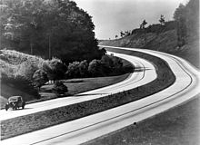 A German dual carriageway in the 1930s
A dual carriageway (North American English: divided highway) is a class of highway with two carriageways for traffic travelling in opposite directions separated by a central reservation (North American English: median). Roads with two or more carriageways which are designed to higher standards with limited access and grade separation are generally classed as motorways, freeways, etc., rather than dual carriageways. A road without a central reservation is a single carriageway (North American English undivided highway) regardless of the number of lanes. Dual carriageways have improved road traffic safety over single carriageways and typically have higher speed limits as a result. In some places, express lanes and local/collector lanes are used within a local-express-lane system to provide more capacity and to smoothe traffic flows for longer-distance travel.
Contents
History
A very early (perhaps the first) example of a dual carriageway was the Via Portuensis, built in the first century by the Roman emperor Claudius between Rome and its port Ostia at the mouth of the Tiber.
In 1907 the Long Island Motor Parkway opened and roughly 20% of it featured a semi-dual-carriageway design. The New York City Belt Parkway system, which was built between 1907 and 1934, also pioneered the same design. However the majority of it featured concrete or brick railings as lane dividers instead of grass medians.
In 1924 the first Italian autostrada was opened running 55 km (34 mi) from Milan to Varese. It featured a broad road bed and did not feature lane dividers except near cities and through the mountains.[1][2]
The London end of the Great West Road became Britain's first dual carriageway when it was opened in 1925 by King George V.[3]
In 1927 the Rome bypass was opened. It ran 92 km (57 mi) bypassing Rome to the east. Almost the entire length featured a dual-carriageway design. In the early 1930s it was extended southward all the way to Naples and northward to Florence. Most of the original routing was destroyed by the Allies in the World War II.
By 1930 several US and European cities had built dual-carriageway highways, mostly to control traffic jams and/or to provide bypass routes for traffic.
In 1932 the first German autobahn opened between Cologne and Bonn. It ran 21 km (13 mi) and became a precedent for future highways. Although it, like the first autostrada, did not feature a dual-carriageway design, it inspired the mass construction of future high-speed roadways.
During the 1930s, Germany, Italy, and the Soviet Union began construction of a network of dual carriageway expressways. By 1942, Germany had over 3,200 km (2,000 mi) of dual carriageway roads, Italy had nearly 1,300 km (800 mi), and the Soviet Union had 400 km (250 mi).
What may be the world's first long-distance intercity dual carriageway/freeway is the Queen Elizabeth Way in Southern Ontario in Canada, initially linking the large cities of Toronto and Hamilton together by 1939, with construction on this stretch of the present-day Queen Elizabeth Way beginning in 1936 as "Middle Road".
Opened to traffic in 1940, the 160-mile (260 km) long Pennsylvania Turnpike was the first rural dual carriageway built in the United States. By 1955 several states had built dual carriageway freeways and turnpikes and in 1957 the Interstate Highway System began. Completed in 1994, the major highway system links all the major cities of the United States.
European implementations
United Kingdom
In the UK, although the term dual carriageway applies to any road with physically separated lanes, it is frequently used as a descriptive term for major routes built in this style. Such major dual carriageways usually have two lanes of traffic in each direction, with the lane nearest the centre being reserved for overtaking.[citation needed] Occasionally dual carriageways have only one lane in each direction, or more than two lanes each way (usually to permit easier overtaking of slower uphill traffic). Different speed limits apply on dual carriageway sections from those that apply on single carriageway sections of the same class of road, except in cities and built-up areas where the dual carriageway is more of a safety measure, often intended to prevent pedestrians from crossing a busy road.
 Diagram of types of road in the UK
When first constructed, many dual carriageways - including the first motorways - had no crash or other barriers in the central reservation. Hence in the event of delays on the road, or if a driver missed his exit, there was a widespread problem of drivers making a U-turn onto the other carriageway; many accidents were caused as a result of their misjudging the speed of approaching traffic on the other carriageway when doing so. The majority of dual carriageway roads now have barriers. Some are heavy concrete obstructions which can have the effect of bouncing a vehicle back into the path of other traffic; others are made from steel ropes mounted on moderately weak posts, where the rope cuts into the vehicle body to slow the vehicle while keeping it against the barrier until it has stopped. Often on urban dual carriageways where the road has been converted from a four-lane single carriageway the central reservation will be nominal and often just a small steel divider to save space.
Turning right (that is, across the line of traffic heading in the opposite direction) is usually permitted only at specific locations. Often the driver will be required to turn left (away from the dual carriageway) in order to loop around to an access road that permits crossing the major road. Roundabouts on dual carriageways are relatively common, especially in cities or where the cost of a grade-separated junction would be prohibitive. Where space is even more limited, intersections may be controlled by traffic lights. Smaller residential roads adjoining urban dual carriageways may be blocked off at one end in an attempt to limit the number of junctions on a dual carriageway, often other roads may pass over or under the dual-carriageway without an intersection.
A dual carriageway with grade-separated junctions and which meets other requirements may be upgraded to motorway standard, denoted as an (M) added after the road number (e.g. "A1(M)" or "A38(M)"). Unlike in the Republic of Ireland, there is no official terminology for 'high-quality dual carriageways'. Many roads such as the A1, the A14, the A19 and the A42 are built to a high quality, with grade-separated junctions, full barriers at roadside and central reservations and, in some cases, three lanes of traffic. They may still fall short of motorway standard in terms of the height of overpasses or the quality of intersecting junctions.
Speed limits
The national speed limit applies on dual carriageways (unless it is in a 'built-up area', or a lower limit is posted), which is as follows:
National speed limits on dual carriageways in the UK Type of vehicle Speed limit Car, motorcycle or a car-based van up to 2 metric tonnes 70 mph (110 km/h) Car with caravan or trailer 60 mph (97 km/h) Bus or coach up to 12 m long 60 mph (97 km/h) Goods vehicle up to 7.5 t 60 mph (97 km/h) Goods vehicle over 7.5 t 50 mph (80 km/h) A dual carriageway in a built up area will have a statutory speed limit of 30 mph (48 km/h) unless otherwise sign-posted. It is common for such urban dual carriageways to have an increased speed limit of 40 mph (64 km/h). A built up road is indicated by the presence of street lights, on lit dual carriageways that are not considered to be in a built-up area, the speed limit will be clarified with intermittent signs.
Ireland
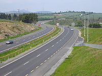 A typical modern Irish dual carriageway (opened 2004) along the N11, south of Newtownmountkennedy. On motorways, the yellow hard shoulder markings are unbroken.
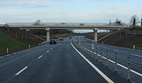 An example of a 2+2 dual-carriageway in Ireland. This type is similar to many found in the UK.
Although in the Republic of Ireland the term dual carriageway technically applies to any road with physically separated lanes, it is usually used only to refer to those route sections that do not have a motorway designation. Most often it is national roads (roads with a route number prefix of N; e.g. N8) that are built as or upgraded to dual carriageway. A number of non-national roads (for example, regional roads) are dual carriageway, for example in urban areas near or in cities, or where the road was formerly part of a national route.
Dual carriageways of this class differ from motorways in a number of ways. The hard shoulder is demarcated with a dashed yellow line (as opposed to an unbroken yellow line on motorways). The standard speed limit of 100 km/h (62 mph) for national routes usually applies (by default the limit is 80 km/h (50 mph) for non-national roads, even if dual carriageway). Local authorities have the power to apply a limit of up to 120 km/h (75 mph) as used on most motorways (The High Quality Dual Carriageway section of the N1 between the end of the M1 and the border with Northern Ireland and the N25/N22 Ballincollig Bypass in Cork are the only route sections with such special limits). Traffic lights and junctions are permitted at grade on dual carriageways. For older sections of dual carriageway, this has resulted in fewer flyover junctions. Newer dual carriageway sections are usually near motorway standard, with grade-separated junctions, but may not be designated as motorways due to the need to preserve access to adjoining property or to the absence of a non-motorway alternative route. Also, dual carriageways that are not motorway classified do not need to be equipped with emergency phones.
Motorway restrictions only apply to motorway sections, rather than all dual carriageway sections of national roads (these are signposted with the N prefix on the route number, rather than M). Some national secondary roads, and regional roads in particular often have houses, schools and other developments fronting on to them. Less important national primary roads, and older sections not yet upgraded may also feature such developments built before the introduction the Irish Planning system in 1964. Today Irish planning policy prohibits such development on National Primary or National Secondary roads where the speed limit exceeds 60 km/h (37 mph). This policy results from concerns expressed by the National Roads Authority. However, a local authority is not obliged to implement this policy and can disregard this policy at it own discretion. This would usually only occur in exceptional circumstances or where planners are over ruled by elected councillors using section 140 of the Local Government Act 2001. Accordingly, hard shoulders are included wherever feasible to provide for the resulting pedestrian and cyclist traffic, and are present on much of the national route network. These hard shoulders may also be used as running lanes by motorised traffic under certain conditions.
Until 2004/2005, many motorways and dual carriageways in Ireland did not have crash barriers in the central reservation, the policy being to use a wider median instead. Crash barriers are now mandatory for such routes, and wire cabling or full crash barriers (depending on whether or not the route is a motorway, and median width) have been fitted to existing routes.
As of 2008[update] three major types of dual carriageway are being built on national road schemes in the Republic of Ireland:
- High Quality Dual Carriageways (HQDC) - these are being built mainly on the major inter-urban routes, to full motorway standard but without motorway regulations. The Roads Act 2007 allows for these roads to be redesignated as motorways by ministerial order. Many of the sections of HQDC on the major inter-urban routes have been redesignated as motorways and full motorway regulations will apply when the redesignations come into effect.
- Standard dual carriageway of the traditional type is mainly planned for schemes on the N11 road, the N18 road and the N25 road. Plans for this type of dual carriageway on the N20 road have been superseded by newer plans to build a motorway, the M20, to replace most of this route. Traditionally this type of dual-carriageway had a mixture of at grade junctions (including roundabouts), grade separated junctions, and median crossings. Nowadays they are similar to HQDCs, but minor at grade exits - generally left turn only - are allowed and the design speed (by Irish standards) is only 100 km/h. Median crossings and roundabouts are no longer generally found on these schemes. An example of a standard dual carriageway scheme, opened in 2006, is the Ennis bypass although this road has grade separated junctions and no median crossings. This route has now been upgraded to motorway status.
- 2+2 roads - officially these roads are designated as Type 2 dual carriageways by the National Roads Authority (NRA). They will be created by widening existing roads or building new roads, and will have two lanes in each direction with a steel cable barrier in the middle but no hard shoulder. Most junctions will be at grade. With the exception of the restricted median width and the lack of lay-bys, this type of dual carriageway is similar to many dual carriageways found in the UK. The first 2+2 scheme (and the only example as of 2008), the N4 Dromod Roosky bypass, opened on 7 December 2007.[4]
- 2+1 roads - officially these roads are designated as Type 3 dual carriageways by the NRA. They have two lanes in one direction and one lane in the other, alternating every few kilometres, and usually separated with a steel cable barrier. Sections of 2+1 road have been built on the N20 and the N2. In July 2007, the NRA announced that it would no longer build 2+1 roads and 2+2 roads will be built instead.
Germany
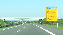 B6(M) near Abbenrode
In Germany the term "Schnellstraße" (expressway) refers to streets that allow for higher speed traffic than is common on other streets which in turn requires them to have a dual carriageway in most cases. A special exception is the 2+1 road system in some rural areas that are also referred to as expressways (three lanes on a single carriageway where bypassing on the lane of the opposite direction is prohibited so that speed restriction is not required to increase safety - they are generally built to a 100 or 120 km/h traffic standard). This is based on the definition of expressways as having an increased amount of grade-separated sections. Technically a dual carriageway with central reservation is the legal foundation that no blank speed limit exists - comparable to the German Autobahn - but expressways are factually always given speed limit signs.
Expressways however can be upgraded to motorway standard which is colloquially referred to as "Gelbe Autobahn" (yellow motorway) because they have the same technical standard of the German autobahn but they use black on yellow signs instead of the white on blue signs on the Autobahn motorway network. These are generally high speed arterial roads of larger cities and important streets inside a federal state that do not connect major cities so that they do not fall under the federal budgeting program for the Autobahn network. The federal road Bundesstraße 27 is an example where about half of its length is upgraded to a high speed motorway standard. Some of these non-Autobahn motorways do not have an actual speed limit (design speed 130 km/h).


Exit signs.The increasing importance of motorways outside of the Autobahn network is subject to upcoming legislation which does not exist so far in Germany where technically these are just rural roads that refer to the ministerial sign code for high speed dual carriageways. At the moment some (blue) motorways have been taken out of the Autobahn network program while still using the blue signs and on the other hand some former non-Autobahn (yellow) motorways have been added to Autobahn budgeting but the signs were not changed either. Motorways that are neither in the Autobahn network nor in the Bundesstraße network are given black on white signs following the same sign code for high speed dual carriageways - this is mostly seen with urban trunk roads.
Italy
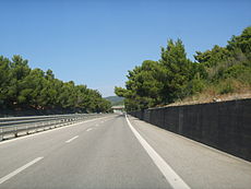 Italian national road SS 1 Via Aurelia near Livorno
In Italy, a dual carriageway is often called superstrada (meaning expressway), but this name is unofficial.
Italian Highway Code (Codice della strada) divides dual carriageways into three different classifications:[5]
- strada extraurbana principale (meaning main highway) or type-B road: a road with separate carriageways, at least two lanes for each direction, paved shoulder on the right and no cross-traffic. This type of road is quite similar to an autostrada or type-A road (Italian official name for motorways or freeways), but its building standards are lower. Access limitations and drive behaviour on type-B roads are exactly the same of the motorways (no pedestrians, bicycles and other low vehicles), as well as the signage (except for the background color, that is blue instead of green). Speed limit on type-B roads is up to 110 kilometers per hour. Type-B roads are always toll-free.
- strada extraurbana secondaria (meaning less importance road) or type-C road. This category contains all the roads in non-urban context that are neither autostrada (type A) nor strada extraurbana principale (type B). This means that a dual carriageway that may not be classified as type-B road, since it does not meet such quality standards, belongs to this category. For type-C roads, there aren't neither special signage nor access restrictions, unless a specific sign is placed. Speed limit is 90 kilometers per hour, on both single and dual carriageways.
- strada urbana di scorrimento (meaning urban expressway) or type-D road: a road in urban context, with separate carriageways, and at least two lanes for each direction. At-level junctions with smaller roads, regulated by traffic lights, are allowed as well as roundabouts. Unless a prohibition sign is placed, there are not access restrictions. Speed limit on this type of road is up to 70 kilometers per hour.
Italian type-B and type-C roads do not follow a specific numbering criterion. They may be numbered as state roads (SS), regional roads (SR), provincial roads (SP) or municipal roads (SC).
Croatia
Dual carriageways or expressways in Croatia (Croatian: brza cesta) are non-tolled roads with 2 or more lanes in each direction, but without emergency lanes. The main highways/motorways in Croatia are also dual carriageways, but they have emergency lanes and tolls.
Many bypasses and beltways of smaller cities in Croatia have been recently constructed or planned as dual carriageways. All dual carriageways in Croatia house a central median, usually fitted with guardrails.
The most heavily used dual carriageway in Croatia is the B28 expressway, connecting capital Zagreb to a satellite town, Vrbovec. The D28 is currently finished up to the Gradec interchange. It is undergoing extensions which will increase the traffic traversing it.
See also: Highways in Croatia#List of expresswaysOther regional implementations
United States
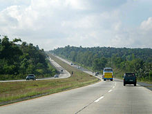
 A divided highway (U.S. Route 52) in the state of Indiana.
Savery Avenue in Massachusetts
First Divided Highway in the U.S.[6] In the U.S., this sign tells motorists they are crossing a divided highway
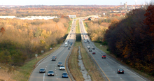
In the United States, this type of road may be called a divided highway, boulevard, parkway, expressway, freeway, or interstate, and has a grassy median or Jersey barrier separating the traffic directions. With few exceptions, all roads in the federally funded Interstate Highway System are fully controlled access divided highways known as freeways. A broader definition, expressways, includes both freeways and partial limited-access divided highways, and "expressway" is often used specifically to refer to the latter. United States Numbered Highways, state highways and other locally maintained highways may also be divided. Speed limits on rural divided highways range from 65–75 miles per hour (105–121 km/h), with some portions as high as 80 miles per hour (130 km/h). Urban divided highways which are at grade and typically have much lower speed limits are sometimes called boulevards.
In keeping with the U.S. Department of Transportation's Manual of Uniform Traffic Controls and Devices (MUTCD), since the early 1970s all divided highways are striped by color to show the direction of traffic flow. Two-way undivided roads have an amber center line, with a broken line indicating passing zones and a solid line indicating no passing zones and solid white baseline shoulder stripes. On undivided roads with more than one lane in each direction, the center is normally marked with a double solid line. The double solid stripe denotes that it is illegal to pass on the other side of the center line. Multilane one-way carriageways use broken white lines between lanes; the median-side baseline is solid amber, and the right sideline is solid white. Frequently in the U.S. the two carriageways are separated by some distance (wide medians with small forests or even hills in them), but drivers can always tell whether the roadway is two-way or one-way—and, if one-way, the direction in which the traffic flows—by looking at the striping coloration. For an example, see inset showing US Route 52 near Lafayette, Indiana.
Canada
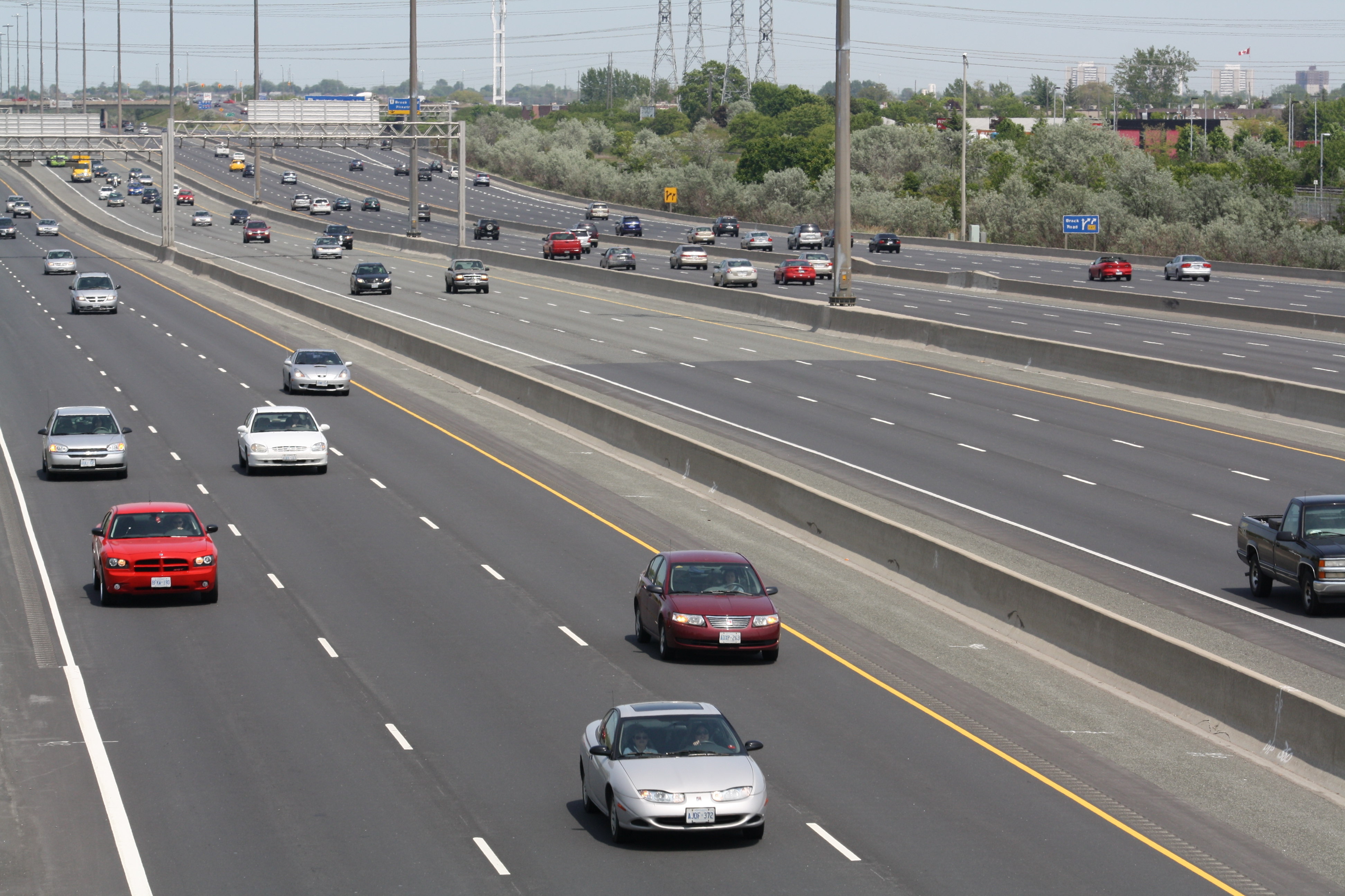
 Highway 401 in Ontario, Canada, uses a divided highway, collector / express system to separate local traffic from longer-distance travellers.
In Canada, "divided highway" is used for this type of road, and the segment between the roadways is referred to as a "median". More informally, a divided highway may be referred to as "twinned". This stems from the practice of "twinning" an existing two-lane highway (usually controlled-access) and converting it into a divided highway. On some portions of Ontario's 400-series highway network, the median may be either steel guardrail or an Ontario tall-wall barrier rather than an unpaved strip.
Like the US, there are two types of divided highways, fully controlled access divided routes known as freeways, while expressways may include both freeways and partial limited-access divided highways. Canadians often use "highway" to refer to freeways. Partial limited-access divided highways such as the Hanlon Parkway and Black Creek Drive have at-grade intersections and private entrances but have sufficient right-of-way to convert them to full freeways if traffic warrants. There are also RIRO expressways, such as Highway 11 and a portion of Highway 35, which are not full freeways since they allow access to existing properties, but traffic speeds are faster than regular roads due to a median barrier preventing left turns (motorists have to use a "turnabout" overpass to access exits on the opposing direction).[7]
Junctions may be at-grade or grade-separated, and there may be gaps in the median strip to allow turning and crossing. Divided highways are seldom equipped with traffic circles, roundabouts, or rotaries.
Australia
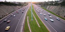 A typical dual carriageway in Melbourne, Australia.
Examples of dual carriageways on non-urban roads in Australia include the Hume Highway and the Pacific Highway (Australia); the Hume Highway by 2012, will be 100% dual carriageway and the Pacific Highway by 2016 will also be 100% dual carriageway. Today, 90% of the Hume Highway is dual carriageway and only 40% or 280 km (170 mi) of the Pacific Highway is dual carriageway, plus 10% of the Pacific Highway or 78 kilometres (48 mi) is under construction. The Federal Highway between the Hume Highway at Goulburn and Canberra is 100% dual carriageway, completed before the 2000 Summer Olympic Games. Some parts of the Princes Highway, Great Western Highway (A32) and the Barton Highway are also dual carriageway. Most non-urban dual carriageway highways/freeways are speed limited to 110 km/h (100 km/h for heavy vehicles), except for a short section in the Australian Capital Territory on the Federal Highway which is state limited to 100 km/h. The Warrego Highway between Brisbane and Toowoomba in Queensland is also dual carriageway with a maximum speed limit of 100km/h.
In Australia there is much confusion among the local population between a freeway and a dual carriageway, particularly those roads found in rural areas. While to be labelled a freeway, a road in Australia must have graded junctions, a physical barrier to separate the carriageways is not required. Speed limits do not change when road grades change from freeway to dual carriageway and vice versa. Stopping and U-turn prohibitions on Australian freeways are routinely ignored and rarely enforced. The Hume Freeway in Victoria, is actually a dual-carriageway grade road for much of its length with many ungraded junctions. Despite this, it has officially been called the "Hume Freeway" and given a route marking of M31. An M marking is traditionally used for Motorway or Freeway lengths of roads in international jurisdictions that adopt the same MABC route labelling system as Victoria.
Sources:
- AusLink
- Hume Highway
- Pacific Highway (Australia)
- DIVIDED HIGHWAY ACHIEVED BETWEEN BRISBANE AND BYRON BAY TURNOFF - MEDIA RELEASE, The Hon Jim Lloyd MP
- NSW South West construction projects, RTA
- Pacific Highway upgrade, RTA
China
The best examples of dual carriageways in mainland China can be seen on the China National Highways. On some routes, such as China National Highway 106, there is a central reservation.
Philippines
Principal Philippine Expressways, Metro Manila Roads and Avenues in Cebu are examples of dual carriageways in the Philippines.STAR Tollway, NLEX, SCTEX and SLEX have portions with central reservations. Some highways inside Metro Manila have underpasses, tunnels and flyovers.
Singapore
A high proportion of roads in Singapore are dual carriageways with central reservations; examples include Clementi Road, Commonwealth Avenue and Holland Road. Often there might be railings erected on the central reservation to prevent pedestrians from dashing across the road. These usually have traffic lights along the way but flyovers and road tunnels (or 'underpasses') can be built to minimise the use of traffic lights; for example, at the Holland Road-Farrer Road-Queensway junction there are three levels of roads. Before the 1980s roundabouts were popular but since then many have been changed to traffic-light controlled junctions.
These dual carriageways are to be distinguished from motorways, known in Singapore as expressways such as the Pan-Island Expressway (PIE) and Ayer Rajah Expressway (AYE) where no traffic lights are used.
Malaysia
There are dual expressways, such as East Coast Expressway.
See Also
Limited-access road
Freeway
Single carriageway
Carriageway
2+1 roadReferences
- ^ "German Myth 8: Hitler's Autobahn?". http://german.about.com/library/blgermyth08.htm. Retrieved 2006-04-03.
- ^ "1924 Mile Posts". http://local.aaca.org/bntc/mileposts/1924.htm. Retrieved 2006-04-03.
- ^ Mike Smith. "Roads and Roadworks". Igg.org.uk. http://www.igg.org.uk/gansg/00-app1/roads.htm. Retrieved 2009-07-31.
- ^ "Press Releases - National Roads Authority". Nra.ie. 2008-07-01. http://www.nra.ie/News/PressReleases/htmltext,11151,en.html. Retrieved 2009-07-31.
- ^ Automobile Club Italia. "Codice della strada della Repubblica Italiana (Italian Highway Code)" (in Italian). http://www.aci.it/index.php?id=460. Retrieved 2010-02-01.
- ^ http://www.wickedlocal.com/carver/town_info/history/x805329864
- ^ "RIRO". Onthighways.com. http://www.onthighways.com/riro.htm. Retrieved 2009-07-31.
External links
- Department for Transport. Speed: Know your limits (PDF)
Roads and junctions Types of road Freeway/Motorway · Dual carriageway/Expressway ·By countryGermany · Croatia · Spain · Italy · Portugal · Czech Republic · Ireland · United States (U.S. Routes · Interstates)Main roadsArterial road · Collector road · Express-collector setup · Farm-to-market road · Highway · Link road · Two-lane expressway · 2+1 road (Parkway · Super two · 2+2 road) · Trunk road · Highway systems by countryLocal roadsBoulevard · Frontage road · Road · Single carriageway · Street · Alley · Backroad · Cul-de-sac · Driveway · Lane · Primitive road · Side roadOther termsSurfaces Asphalt concrete · Brick · Chipseal · Cobblestone · Concrete · Corduroy · Dirt · Gravel · Ice · Macadam · Oiled (bitumen) · Plank · Sett · TarmacRoad junctions Cloverleaf · Diamond · Directional T · Diverging diamond · Parclo · Trumpet · SPUI · Stack · Three-level diamond · Raindrop · Roundabout interchangeCategories:- Types of roads


Wikimedia Foundation. 2010.