- Harford County, Maryland
-
Harford County, Maryland 
Seal
Location in the state of Maryland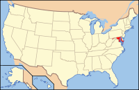
Maryland's location in the U.S.Founded 1773 Seat Bel Air Largest city Aberdeen Area
- Total
- Land
- Water
526.72 sq mi (1,364 km²)
440.35 sq mi (1,141 km²)
86.37 sq mi (224 km²), 16.4%Population
- (2010)
- Density
244,826
556/sq mi (214.5/km²)Website www.co.ha.md.us Harford County is a county in the U.S. state of Maryland. In 2010, its population was 244,826. Its county seat is Bel Air. Harford County forms part of the Baltimore-Washington Metropolitan Area.
Contents
History
Harford County was formed in 1773 from the eastern part of Baltimore County. It contains Tudor Hall, birthplace of Abraham Lincoln's assassin, John Wilkes Booth. Harford County also hosted the signers of the Bush Declaration, a precursor document to the American Revolution.
The county was named for Henry Harford (ca. 1759-1834), illegitimate son of Frederick Calvert, 6th Baron Baltimore. Henry Harford was born to Calvert's mistress, Hester Whelan, whose residence still stands as part of a private residence on Jarretsville Pike, in Phoenix MD. Harford was the last Proprietary Governor of Maryland, but did not inherit his father's title because of his illegitimacy.
Havre de Grace, an incorporated city in Harford County, was once under consideration to be the capital of the United States rather than Washington, D.C.. It was favored for its strategic location at the top of the Chesapeake Bay; this location would facilitate trade while being secure in time of war. Today, the waterways around Havre de Grace have been silted, one of the primary environmental issues of Harford County.
The county has a number of properties on the National Register of Historic Places.[1]
Environmental History
Harford County has been a hotbed of environmental issues in three major areas: land use, water pollution/urban runoff, and soil contamination/groundwater contamination.
The county's past, present, and future population booms and land development activities have created conflicts between farmers and developers/homeowners wishing to create subdivisions. The county was one of the first in the country to implement a development envelope plan, in which new development is channeled into specific areas of the county.
Because the county sits at the headwaters of the Chesapeake Bay along the Susquehanna River, it plays a key role in controlling sediment and fertilizer runoff into the bay as well as fostering submerged aquatic vegetation (SAV) regrowth. The county has had to balance the needs of land owners to practice agriculture and/or pave land (creating impervious surfaces) with effects of runoff into the bay.
Harford County has been burdened by soil contamination and groundwater contamination since the creation of Aberdeen Proving Ground. The military installation performs research for the U.S. Army and has released various chemical agents into soil and groundwater, including mustard gas and perchlorate. The bordering towns of Aberdeen, Edgewood and Joppatowne have been affected by this contamination.[2][3] Aberdeen Proving Ground contains three superfund priority sites as of 2006. Groundwater contamination by MTBE, a mandatory gasoline additive, has also affected Fallston.[4][5]
Harford County also faces conflict with residents living near its only municipal landfill in an area called Dublin. The landfill, approved for a triple size expansion in 2007, is the subject of complaints by neighbors of operating violations such as large areas of open trash and blown litter, leachate breaks which contaminate area residential wells and flow into Deer Creek, a tributary of the Susquehanna River, and increased health problems.
Law and government
Harford County was granted a charter form of government in 1972. The Harford County Government includes the Harford County Public Library service and the Harford County Sheriff's Office, which now has precincts in Bel Air, Edgewood and Jarrettsville.
 County Executive David R. Craig
The Harford County Executive is David R. Craig (Republican). The County Council comprises a President (elected at-large) and 6 council members (elected from single-member districts). The current President is William "Billy" Boniface.
Geography
According to the 2000 census, the county has a total area of 526.72 square miles (1,364.2 km2), of which 440.35 square miles (1,140.5 km2) (or 83.60%) is land and 86.37 square miles (223.7 km2) (or 16.40%) is water.[6]
The terrain rises in elevation and relief from south to north, with flat areas south of U.S. Route 40. The highest elevation, at 805 ft., is located near the Pennsylvania border in the county's northwestern corner. The lowest elevation is sea level along the Chesapeake Bay.
Adjacent counties
- York County, Pennsylvania (north)
- Lancaster County, Pennsylvania (northeast)
- Baltimore County (west)
- Cecil County (east)
- Kent County (south, over water only)
National protected area
- Susquehanna River National Wildlife Refuge [7]
Demographics
Historical populations
of Harford CountyYear Population 1790 14,976 1800 19,626 1810 21,258 1820 15,924 1830 16,319 1840 17,120 1850 19,356 1860 23,415 1870 22,605 1880 28,042 1890 28,993 Year Population 1900 28,269 1910 27,965 1920 29,291 1930 31,603 1940 35,060 1950 51,782 1960 76,722 1970 115,378 1980 145,930 1990 182,132 2000 218,590 2010 244,826 2010
Whereas according to the 2010 U.S. Census Bureau:
- 81.2% White
- 12.7% Black
- 0.3% Native American
- 2.4% Asian
- 0.1% Native Hawaiian or Pacific Islander
- 2.5% Two or more races
- 0.8% Other races
- 3.5% Hispanic or Latino (of any race)
2000
As of the census[8] of 2000, there were 218,590 people, 79,667 households, and 60,387 families residing in the county. The population density was 496 people per square mile (192/km²). There were 83,146 housing units at an average density of 189 per square mile (73/km²). The racial makeup of the county was 86.77% White, 9.27% African-American, 0.23% Native American, 1.52% Asian, 0.06% Pacific Islander, 0.69% from other races, and 1.47% from two or more races. 1.91% of the population were Hispanic or Latino of any race. 22.5% were of German, 13.1% Irish, 9.8% Italian, 9.2% English, 8.1% "American" and 6.0% Polish ancestry according to Census 2000.
By 2006 the population of Harford County had risen 10.4% to 241,402.[9]
The 2005 report on race and ethnicity indicated the county's population was 82.8% non-Hispanic whites. The proportion of African-Americans in the county had risen to 11.5%. Hispanics were now 2.4% of the total population.[9]
In 2000 there were 79,667 households out of which 38.70% had children under the age of 18 living with them, 61.90% were married couples living together, 10.20% had a female householder with no husband present, and 24.20% were non-families. 19.70% of all households were made up of individuals and 6.80% had someone living alone who was 65 years of age or older. The average household size was 2.72 and the average family size was 3.14.
In the county the population was spread out with 27.90% under the age of 18, 6.80% from 18 to 24, 31.60% from 25 to 44, 23.70% from 45 to 64, and 10.10% who were 65 years of age or older. The median age was 36 years. For every 100 females there were 96.00 males. For every 100 females age 18 and over, there were 92.50 males.
The median income for a household in the county was $57,234, and the median income for a family was $63,868. Males had a median income of $43,612 versus $30,741 for females. The per capita income for the county was $24,232. About 3.60% of families and 4.90% of the population were below the poverty line, including 5.80% of those under age 18 and 6.70% of those age 65 or over.
Cities and towns
Harford County contains the following incorporated municipalities:
- two cities:
- Aberdeen (incorporated 1892)
- Havre de Grace (incorporated 1785)
- one town:
- Bel Air (incorporated 1872)
Unincorporated areas are also considered as towns by many people and listed in many collections of towns, but they lack local government. Various organizations, such as the United States Census Bureau, the United States Postal Service, and local chambers of commerce, define the communities they wish to recognize differently, and since they are not incorporated, their boundaries have no official status outside the organizations in question. The Census Bureau recognizes the following census-designated places in the county:
- Aberdeen Proving Ground
- Bel Air North
- Bel Air South
- Edgewood
- Fallston
- Jarrettsville
- Joppatowne
- Perryman
- Pleasant Hills
- Riverside
Other unincorporated communities include:
- Abingdon
- Belcamp
- Cardiff
- Churchville
- Darlington
- Gunpowder
- Castleton
- Dublin
- Forest Hill
- Level
- Norrisville
- Pylesville
- Street
- Whiteford
- White Hall
Sports
Though there are not any major league teams in the county, Harford County is home to a minor league baseball team, the Aberdeen IronBirds. The team was founded by former Baltimore Orioles player and hall of famer Cal Ripken, who was raised in Aberdeen. Harford County is also home to Kimmie Meissner, who lives in Bel Air. Meissner competed in figure skating in the 2006 Winter Olympics and won a gold medal in the 2006 World Figure Skating Championships in Calgary, Alberta.
Major sports facilities include:
- Ripken Stadium minor league baseball facility in Aberdeen, capacity of 6,200
- Athletic fields at Harford Community College hosted the independent league Aberdeen Arsenal baseball team for one season
- Brand new Bobcat Stadium with astroturf at the newly built Bel Air High School was finished in 2010. It is the largest high school stadium in the county
- Harford Stadium at Harford Community College, capacity of 1,000
- Gymnasium at Harford Technical High School, capacity of 1,320
Education
Primary and Secondary Education
Harford County Public Schools
- For an entire list of schools, see Harford County Public Schools.
The Harford County Public Schools system is the public school system serving the residents of Harford County. It includes thirty-two elementary schools, eight middle schools, ten high schools, including one technical high school, a charter school, and an alternative education school.
Private Schools
- Harford Friends School, is a private Friends (Quaker) school for Kindergarten through 8th grades.
- The John Carroll School, is a private Catholic school in the county.
Harford Christian School is a private Christian school for pre-kindergarten through 12th grade.
Colleges
There are no 4-year universities in Harford County. Harford Community College, located in Churchville, offers 2-year Associates degrees and vocational programs.
Employment
The single largest employer in Harford County is Aberdeen Proving Ground, with over 11,000 civilian employees. Following the recommendations of the Base Realignment and Closure Commission of 2005, approximately 5,300 jobs will be moved to Aberdeen Proving Ground within the following decade.
The single largest private employer in the county is Klein's ShopRite of Maryland. ShopRite employs around 1,200 people in the county.
Family Support Services
General counseling and trauma-based therapy, in-home assistance for the elderly and adult disabled, and other support programs for families and individuals are offered by Family and Children's Services of Central Maryland (FCS),[10][11] a private nonprofit organization with offices in Bel Air, Maryland. FCS also operates an adult day care center on the grounds of Harford County Community College.[12] Some services are offered without charge; others are offered on a sliding-fee scale based on income.
Miscellaneous
The newspaper of record is The Aegis.
The Conowingo Dam is on the eastern border of Harford County; the dam operations and offices are on the Harford County side of the river.
Many scenes from the films Tuck Everlasting and From Within were filmed in various places around Harford County.
Public transit is operated by county-owned Harford Transit.
The Head of U.S. drug control policy recently deemed Harford County a designated High Intensity Drug Trafficking Area.[13]
See also
References
- ^ "National Register Information System". National Register of Historic Places. National Park Service. 2008-04-15. http://nrhp.focus.nps.gov/natreg/docs/All_Data.html.
- ^ U.S. Environmental Protection Agency (EPA). Philadelphia, PA. "Aberdeen Proving Ground (Edgewood Area Site) - Current Site Information." EPA Superfund Site ID No. MD2210020036. May 2008.
- ^ EPA. "Aberdeen Proving Ground (Michaelsville Landfill) - Current Site Information." EPA Superfund Site ID No. MD3210021355. May 2008.
- ^ Maryland Department of the Environment (MDE). Baltimore, MD. "Fact Sheet - Drinking Water Well Impact: Fallston Presbyterian Church/Fallston Pre-Kindergarten, 600 Fallston Road, Fallston, Maryland." 2004-08-27.
- ^ MDE. "Fact Sheet - Drinking Water Well Impact: Fallston Service Center, 602 Fallston Road, Fallston, Harford County, Maryland 21047." MDE Case No. 9-0816HA. 2004-12-01.
- ^ "Census 2000 U.S. Gazetteer Files: Counties". United States Census. http://www.census.gov/tiger/tms/gazetteer/county2k.txt. Retrieved 2011-02-13.
- ^ U.S. Fish & Wildlife Service, Cambridge, MD. "Susquehanna River National Wildlife Refuge: Overview". http://www.fws.gov/refuges/profiles/index.cfm?id=51532.
- ^ "American FactFinder". United States Census Bureau. http://factfinder.census.gov. Retrieved 2008-01-31.
- ^ a b Harford County QuickFacts from the US Census Bureau
- ^ http://www.fcsmd.org/
- ^ http://en.wikipedia.org/wiki/Family_and_Children%27s_Services_of_Central_Maryland
- ^ http://www.fcsmd.org/locations/harfordAdultDayCenters.htm
- ^ http://www.upi.com/Top_News/US/2011/06/20/8-counties-deemed-drug-trafficking-areas/UPI-42591308611325/
External links
- Harford County government
- Harford County Public Library
- Harford County Public Schools
- About Aberdeen Proving Ground
Coordinates: 39°32′N 76°18′W / 39.54°N 76.30°W

York County, Pennsylvania Lancaster County, Pennsylvania Baltimore County 
Cecil County  Harford County, Maryland

Kent County Chesapeake Bay Municipalities and communities of Harford County, Maryland Cities 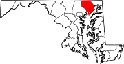
Town CDPs Aberdeen Proving Ground | Bel Air North | Bel Air South | Edgewood | Fallston | Jarrettsville | Joppatowne | Perryman | Pleasant Hills | Riverside
Other
communitiesAbingdon | Benson | Berkley | Cardiff | Castleton | Churchville | Clayton | Creswell | Darlington | Dublin | Emmorton | Fairview | Forest Hill | Glenwood | Joppatowne | Hopewell Village | Joppa | Kalmia | Norrisville | Pylesville | Street | Taylor | Whiteford
Categories:- Maryland counties
- Harford County, Maryland
- 1773 establishments in the Thirteen Colonies
- Populated places established in 1773


Wikimedia Foundation. 2010.