- Lake Baikal
-
"Baykal" and "Baikal" redirect here. For other uses, see Baykal (disambiguation).
Lake Baikal 
Coordinates 53°30′N 108°0′E / 53.5°N 108°ECoordinates: 53°30′N 108°0′E / 53.5°N 108°E Lake type Continental rift lake Primary inflows Selenge, Chikoy, Khilok, Uda, Barguzin, Upper Angara Primary outflows Angara Catchment area 560,000 km2 (216,000 sq mi) Basin countries Russia and Mongolia Max. length 636 km (395 mi) Max. width 79 km (49 mi) Surface area 31,722 km2 (12,248 sq mi)[1] Average depth 744.4 m (2,442 ft)[1] Max. depth 1,642 m (5,387 ft)[1] Water volume 23,615.39 km3 (5,700 cu mi)[1] Residence time 330 years[2] Shore length1 2,100 km (1,300 mi) Surface elevation 455.5 m (1,494 ft) Frozen January–May Islands 27 (Olkhon) Settlements Irkutsk 1 Shore length is not a well-defined measure. Lake Baikal (Russian: о́зеро Байка́л, tr. Ozero Baykal, IPA: [ˈozʲɪrə bəjˈkɑl]; Buryat: Байгал нуур, Mongolian: Байгал нуур, Baygal nuur, meaning "nature lake"[3]) is the world's oldest[4] at 30 million years old and deepest lake with an average depth of 744.4 metres.
Located in the south of the Russian region of Siberia, between Irkutsk Oblast to the northwest and the Buryat Republic to the southeast, it is the most voluminous freshwater lake in the world, containing roughly 20% of the world's unfrozen surface fresh water.[5][6]
At 1,642 metres (5,387 ft),[1] Lake Baikal is the deepest[7] and among the clearest[8] of all lakes in the world. Similarly to Lake Tanganyika, Lake Baikal was formed as an ancient rift valley, having the typical long crescent shape with a surface area of 31,722 km2/12,248 sq mi, less than that of Lake Superior or Lake Victoria. Baikal is home to more than 1,700 species of plants and animals, two thirds of which can be found nowhere else in the world[9] and was declared a UNESCO World Heritage Site in 1996.[10] It is also home to Buryat tribes who reside on the eastern side of Lake Baikal,[11][12] rearing goats, camels, cattle and sheep,[12] where the regional temperatures vary from a minimum of −19 °C (−2 °F) in winter to maximum of 14 °C (57 °F) in summer.[13] Lake Baikal is nicknamed "Older sister of Sister Lakes (Lake Khövsgöl and Lake Baikal)".
Contents
Geography and hydrography
 A digital elevation model of Lake Baikal region
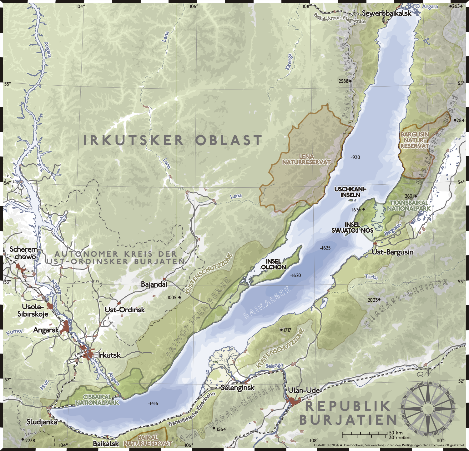
 The Yenisei River basin, Lake Baikal and the settlements of Dikson, Dudinka, Turukhansk, Krasnoyarsk and Irkutsk
Lake Baikal * UNESCO World Heritage Site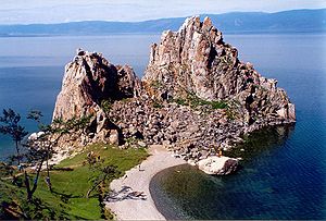
Country  Russian Federation
Type Natural Criteria http://whc.unesco.org/en/criteria/ Reference 754 Region ** Asia Inscription history Inscription 1996 (22nd Session) * Name as inscribed on World Heritage List
** Region as classified by UNESCOLake Baikal was known as the "North Sea" in historical Chinese texts. It was situated in the then Xiongnu territory. Little was known to Europeans about the lake until Russia expanded into the area in the 17th century. The first Russian explorer to reach Lake Baikal was Kurbat Ivanov in 1643.[14]
The Trans-Siberian railway was built between 1896 and 1902. The scenic railway around the southwestern end of Lake Baikal required 200 bridges and 33 tunnels; until its completion, a train ferry transported railcars across the lake (from Port Baikal to Mysovaya) for a number of years. At times during winter freezes, the lake could be crossed on foot—though at risk of frostbite and deadly hypothermia from the cold wind moving unobstructed across flat expanses of ice. A mass-crossing of military-historical significance (which did indeed leave many dead from cold-exposure) was the 1920 Great Siberian Ice March. Beginning in 1956, the impounding of the Irkutsk Dam on the Angara River raised the level of the lake by 1.4 m (4.6 ft).[15]
As the railway was built, a large hydro-geographical expedition headed by F.K. Drizhenko produced the first detailed contour map of the lake bed.[4]
Lake Baikal is in a rift valley, created by the Baikal Rift Zone, where the Earth's crust pulls apart.[6] At 636 kilometres (395 mi) long and 79 km (49 mi) wide, Lake Baikal has the largest surface area of any freshwater lake in Asia (31,722 km2/12,248 sq mi) and is the deepest lake in the world (1,642 m/5,387 ft). The bottom of the lake is 1,186.5 metres (3,893 ft) below sea level, but below this lies some 7 km (4.3 mi) of sediment, placing the rift floor some 8–11 kilometres (5.0–6.8 mi) below the surface: the deepest continental rift on Earth.[6] In geological terms, the rift is young and active—it widens about two cm per year. The fault zone is also seismically active; there are hot springs in the area and notable earthquakes every few years. The lake is divided into three basins: North, Central, and South, with depths of about 900, 1600, and 1400 m, respectively. Fault-controlled accommodation zones rising to depths of about 300 m separate the basins. The North and Central basins are separated by Academician Ridge while the area around the Selenga Delta and the Buguldeika Saddle separates the Central and South basins. The lake drains into the Angara tributary of the Yenisei.
Its age is estimated at 25–30 million years, making it one of the most ancient lakes in geological history. It is unique among large, high-latitude lakes, in that its sediments have not been scoured by overriding continental ice sheets. U.S. and Russian studies of core sediment in the 1990s provide a detailed record of climatic variation over the past 250,000 years. Longer and deeper sediment cores are expected in the near future. Lake Baikal is furthermore the only confined fresh water lake in which direct and indirect evidence of gas hydrates exists.[16][17][18]
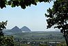
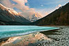
The lake is completely surrounded by mountains. The Baikal Mountains on the north shore and the taiga are technically protected as a national park. It contains 27 islands; the largest, Olkhon, is 72 km (45 mi) long and is the third-largest lake-bound island in the world. The lake is fed by as many as three hundred and thirty inflowing rivers.[5] The main ones draining directly into Baikal are the Selenga River, the Barguzin River, the Upper Angara River, the Turka River, the Sarma River and the Snezhnaya River. It is drained through a single outlet, the Angara River.
Despite its great depth, the lake's waters are well-mixed and well-oxygenated throughout the water column, compared to the stratification that occurs in such bodies of water as Lake Tanganyika and the Black Sea.
Wildlife and vegetation
 Omul Fish at the Listvyanka marketOrigin of the Angara River at Lake Baikal
Lake Baikal is rich in biodiversity. It hosts 1,085 species of plants and 1,550 species and varieties of animals. More than 80% of the animals are endemic. Epischura baikalensis is endemic to Lake Baikal and the dominating zooplankton species there, making up 80 to 90 percent of total biomass.[19] The Baikal Seal or nerpa (Pusa sibirica) is found throughout Lake Baikal.[20] It is one of only three entirely freshwater seal populations in the world, the other two being subspecies of Ringed Seal. Perhaps the most important local species is the omul (Coregonus autumnalis migratorius), a smallish endemic salmonid. It is caught, smoked and then sold widely in markets around the lake.
Of particular note are the two species of golomyanka or Baikal oil fish (Comephorus baicalensis and C. dybowskii). These long-finned, translucent fish normally live in depths of 200–500 m (650–1,600 ft) and are the primary prey of the Baikal seal, representing the largest fish biomass in the lake. The Baikal grayling (Thymallus arcticus baicalensis), a fast swimming salmonid, popular among anglers and the Baikal sturgeon (Acipenser baerri baicalensis), are both important endemic species with commercial value. The lake also hosts rich endemic fauna of invertebrates. Among them turbellarian worms, snails and amphipod crustaceans are particularly diverse.
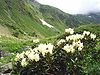
The watershed of Lake Baikal has numerous flora species represented. The marsh thistle, Cirsium palustre, is found here at the eastern limit of its geographic range.[21]
Research
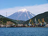
 Lake Baikal as seen from the OrbView-2 satellite
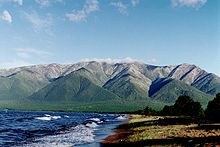 Mountains at the banks of the Baikal
Several organizations are carrying out natural research projects on Lake Baikal. Most of them are governmental or associated with governmental organizations. The Baikal Research Centre is an independent research organization carrying out environmental educational and research projects at Lake Baikal.[22]
In July 2008, Russia sent two small submersibles, Mir-1 and Mir-2, to descend 1,592 m (5,223 ft) to the bottom of Lake Baikal to conduct geological and biological tests on its unique ecosystem. Although originally reported as being successful, they did not set a world record for the deepest fresh water dive, reaching a depth of only 1,580 m (5,180 ft).[23] That record is currently held by Anatoly Sagalevich, at 1,637 m (5,371 ft) (also in Lake Baikal aboard a Pisces submersible in 1990).[23][24] Russian scientist and federal politician, Artur Chilingarov, the leader of the mission, also took part in the Mir dives.[25]
Russian exploration and conquest
 A circle of thin ice (dark in colour, with a diameter of about 4.4 kilometres or 2.7 mi thought to be caused by convection); this is the focal point for ice break up in the very southern end of the lake.
Russian expansion into the Buryat area around Lake Baikal[26] in 1628–1658 was part of the Russian conquest of Siberia. It was done first by following the Angara River upstream from Yeniseysk (founded 1619) and later by moving south from the Lena River. Russians first heard of the Buryats in 1609 at Tomsk. According to folktales related a century after the fact, in 1623, Demid Pyanda, who may have been the first Russian to reach the Lena, crossed from the upper Lena to the Angara and arrived at Yeniseysk.[27] Vikhor Savin (1624) and Maksim Perfilyev (1626 and 1627–1628) explored Tungus country on the lower Angara. To the west, Krasnoyarsk on the upper Yenisei was founded in 1627. There were a number of ill-documented expeditions eastward from Krasnoyarsk. In 1628 Pyotr Beketov first encountered a group of Buryats and collected yasak from them at the future site of Bratsk. In 1629 Yakov Khripunov set off from Tomsk to find a rumored silver mine. His men soon began plundering both Russians and natives. They were joined by another band of rioters from Krasnoyarsk but left the Buryat country when they ran short of food. This made it difficult for other Russians to enter the area. In 1631 Maksim Perfilyev built an ostrog at Bratsk. The pacification was moderately successful, but in 1634 Bratsk was destroyed and its garrison killed. (The story goes that the Buryats did not know how to use firearms, so they decided to burn the muskets along with the dead Cossacks. The fire caused the guns to go off, killing a few people which made the Buryats think that the Russians were still fighting after they were dead.[original research?]) In 1635 Bratsk was restored by a punitive expedition under Radukovskii. In 1638 it was besieged unsuccessfully.
In 1638 Perfilyev crossed from the Angara over the Ilim portage to the Lena River and went downstream as far as Olyokminsk. Returning, he sailed up the Vitim River into the area east of Lake Baikal (1640) where he heard reports of the Amur country. In 1641 Verkholensk was founded on the upper Lena. In 1643 Kurbat Ivanov went further up the Lena and became the first Russian to see Lake Baikal and Olkhon Island. Half his party under Skorokhodov remained on the lake, reached the Upper Angara at its northern tip and wintered on the Barguzin River on the northeast side. In 1644 Ivan Pokhabov went up the Angara to Baikal, becoming perhaps the first Russian to use this route which is difficult because of the rapids. He crossed the lake and explored the lower Selenge River. About 1647 he repeated the trip, obtained guides and visited a 'Tsetsen Khan' near Ulan Bator. In 1648 Ivan Galkin built an ostrog on the Barguzin River which became a center for eastward expansion. In 1652 Vasily Kolesnikov reported from Barguzin that one could reach the Amur country by following the Selenga, Uda and Khilok Rivers to the future sites of Chita and Nerchinsk. In 1653 Pyotr Beketov took Kolesnikov's route to Lake Irgen west of Chita and that winter his man Urasov founded Nerchinsk. Next spring he tried to occupy Nerchensk, but was forced by his men to join Stephanov on the Amur. Nerchinsk was destroyed by the local Tungus but restored in 1658.
Baikal Deep Underwater Neutrino Telescope
Main article: Baikal Deep Underwater Neutrino TelescopeSince 1993, neutrino research has been conducted at the Baikal Deep Underwater Neutrino Telescope (BDUNT). The Baikal Neutrino Telescope NT-200 is being deployed in Lake Baikal, 3.6 km (2.2 mi) from shore at a depth of 1.1 km (0.68 mi). It consists of 192 optical modules (OMs).[28]
Tourism
 Lake Baikal early April in Listvyanka, with sheets of ice
The lake, called "the Pearl of Siberia", drew investors from the tourist industry as energy revenues sparked an economic boom.[29] Viktor Grigorov's Grand Baikal in Irkutsk is one of the investors, who planned to build three hotels creating 570 jobs. In 2007, the Russian government declared the Baikal region a special economic zone. The popular resort of Listvyanka is home to the seven-story Hotel Mayak. At the northern part of the lake Baikalplan (a German NGO) built together with Russians in 2009 the Frolikha Adventure Coastline Track a 100 km long Long-distance trail as example for a sustainable development of the region. Baikal was also declared a UNESCO World Heritage site in 1996. Rosatom plans to build a laboratory in Baikal, in conjunction with an international uranium plant and to invest $2.5 bn in the region and create 2,000 jobs in the city of Angarsk.[29]
Access
To reach Lake Baikal, there are three main starting points:
Irkutsk
Irkutsk is on the Angara River which flows out from the southern tip of Lake Baikal. It has the international Irkutsk Airport and is a major stop on the Trans-Siberian Railway (Moscow-Novosibirsk-Taishet-Irkutsk-Vladivostok) and of the Trans-Siberian Highway.
Severobaikalsk
Severobaikalsk on the northern tip of Lake Baikal is a relatively new town, on Baikal-Amur Mainline railway (Taishet-Severobaikalsk-Komsomolsk-na-Amure-Sovetskaya Gavan). Its airport is Nizhneangarsk Airport in its adjacent town of Nizhneangarsk.
Ulan-Ude
Ulan-Ude is about 100 km (62 mi) east of Lake Baikal, but one can stop on the southern shore of the lake on the way to Irkutsk along Trans-Siberian Railway or Trans-Siberian Highway, or on the eastern shore on the way north to Novy Uoyan along a major road.
Environmental concerns
Baykalsk pulp and paper mill
 Baykalsk Pulp and Paper Mill
Baykalsk Pulp and Paper Mill (BPPM) was constructed in 1966, directly on the shore line, bleaching paper with chlorine and discharging waste into Baikal. After decades of protest, the plant was closed in November 2008 due to unprofitability.[30][31] In March 2009 the plant owner announced the paper mill would never reopen.[32] However, on 4 January 2010 the production was resumed. On 13 January 2010 Vladimir Putin introduced changes in the legislation legalising the operation of the mill, which brought about a wave of protests of ecologists and local residents. This was based on Putin's visual verification from a mini-submarine "I could see with my own eyes — and scientists can confirm — Baikal is in good condition and there is practically no pollution".[33]
Planned East Siberia-Pacific Ocean oil pipeline
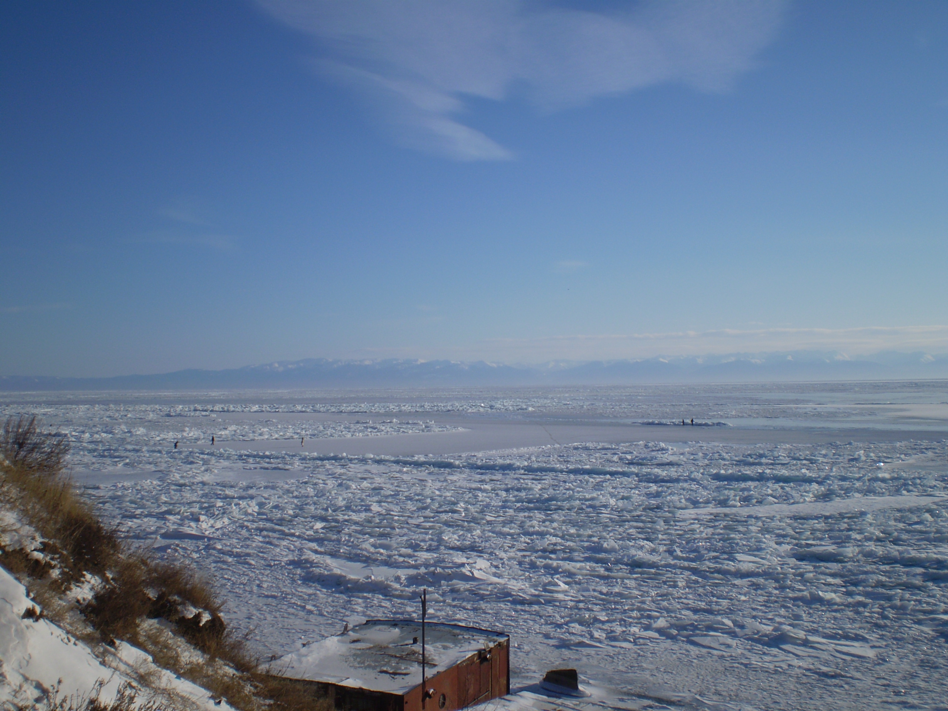
 The lake in the winter, as seen from the tourist resort of Listvyanka. The ice is thick enough to support pedestrians and snowmobiles.
 The lake in the summer, as seen from Bolshiye Koty on the southwest shore.Main article: Eastern Siberia – Pacific Ocean oil pipeline
Russian oil pipelines state company Transneft[34] was planning to build a trunk pipeline that would have come within 800 meters (2,600 ft) of the lake shore in a zone of substantial seismic activity. Environmental activists in Russia,[35] Greenpeace, Baikal pipeline opposition[36] and local citizens[37] were strongly opposed to these plans, due to the possibility of an accidental oil spill that might cause significant damage to the environment. According to the Transneft's president, numerous meetings with ordinary citizens were held in towns along the route, especially in Irkutsk.[38] However, it was not until Russian president Vladimir Putin ordered the company to consider an alternative route 40 kilometers (25 mi) to the north to avoid such ecological risks that Transneft agreed to alter its plans.[39] Transneft has since decided to move the pipeline away from Lake Baikal, so that it will not pass through any federal or republic natural reserves.[40][41] Work began on the pipeline, two days after President Putin agreed to changing the route away from Lake Baikal.[42]
Proposed nuclear plant
In 2006, the Russian government announced plans to build the world's first International Uranium Enrichment Centre at an existing nuclear facility in Angarsk, 95 km (59 mi) from the lake's shores. However, critics argue it would be a disaster for the region and are urging the government to reconsider.[43]
After enrichment, only 10 percent of the uranium-derived radioactive material would be exported to international customers,[43] leaving 90 percent in the Lake Baikal region for storage. Uranium tailings contain radioactive and toxic materials, which if improperly stored are potentially dangerous to humans and can contaminate rivers and lakes.[43]
Historical traditions
 An 1883 British map using the More Baikal (Baikal Sea) designation, rather than the conventional Ozero Baikal (Lake Baikal)
The first European to reach the lake is said to be Kurbat Ivanov in 1643.[44]
In the past, the Baikal was respectfully referred to by many Russians as the "Baikal Sea" (Russian: Море Байкал, More Baikal), rather than merely "Lake Baikal" (Russian: Озеро Байкал, Ozero Baikal).[45] This usage is attested already on the late-17th century maps by Semyon Remezov.[46] To these days, the strait between the western shore of the Lake and the Olkhon Island is called Maloye More (Малое Море), i.e. "the Little Sea".
According to 19th century traveler T. W. Atkinson, locals in the Lake Baikal Region had the tradition that Christ visited the area:
The people have a tradition in connection with this region which they implicitly believe. They say "that Christ visited this part of Asia and ascended this summit, whence he looked down on all the region around. After blessing the country to the northward, he turned towards the south, and looking across the Baikal, he waved his hand, exclaiming 'Beyond this there is nothing.'" Thus they account for the sterility of Daouria, where it is said "no corn will grow."[47]
Folk songs
Lake Baikal has been celebrated in several Russian folk songs. Two of these songs are well known in Russia and its neighboring countries, such as Japan.
- The Glorious Sea - Sacred Baikal (in Russian: Славное Mope, Священный Байкал) is about a katorga fugitive. The lyrics as documented and edited in the 19th century by Dmitriy P. Davydov (1811–1888).[48] See "Barguzin River" for sample lyrics.
- The Wanderer (in Russian: Бродяга) is about a convict who had escaped from jail and was attempting to return home from Transbaikalia.[49] The lyrics were collected and edited in the 20th century by Ivan Kondratyev.
The latter song was a secondary theme song for the Soviet Union's second color film, Ballad of Siberia (in Russian: Сказание о земле Сибирской).
References
- ^ a b c d e "A new bathymetric map of Lake Baikal. MORPHOMETRIC DATA. INTAS Project 99-1669.Ghent University, Ghent, Belgium; Consolidated Research Group on Marine Geosciences (CRG-MG), University of Barcelona, Spain; Limnological Institute of the Siberian Branch of the Russian Academy of Sciences, Irkutsk, Russian Federation; State Science Research Navigation-Hydrographic Institute of the Ministry of Defense, St.Petersburg, Russian Federation". Ghent University, Ghent, Belgium. http://users.ugent.be/~mdbatist/intas/morphometry.htm. Retrieved July 9, 2009.
- ^ "M.A. Grachev ON THE PRESENT STATE OF THE ECOLOGICAL SYSTEM OF LAKE BAIKAL". Lymnological Institute, Siberian Branch of Russian Academy of Sciences. http://lin.irk.ru/grachev/eng/introduction.htm. Retrieved July 9, 2009.
- ^ Altangerel Damdinsuren, English to Mongolian Dictionary (1998) Silverland: A Winter Journey Beyond the Urals, London, John Murray, page 173
- ^ a b Fact Sheet: Lake Baikal — A Touchstone for Global Change and Rift Studies, July 1993 (accessed December 04, 2007)
- ^ a b "Lake Baikal: the great blue eye of Siberia". CNN. Archived from the original on October 11, 2006. http://web.archive.org/web/20061011114225/http://www.cnn.com/SPECIALS/2000/russia/story/train/lake.baikal/. Retrieved October 21, 2006.
- ^ a b c "The Oddities of Lake Baikal". Alaska Science Forum. http://www.gi.alaska.edu/ScienceForum/ASF9/986.html. Retrieved January 7, 2007.
- ^ "Deepest Lake in the World". geology.com. http://geology.com/records/deepest-lake.shtml. Retrieved August 18, 2007.
- ^ Jung, J.; Hojnowski, C., Jenkins, H., Ortiz, A., Brinkley, C., Cadish, L., Evans, A., Kissinger, P., Ordal, L., Osipova, S., Smith, A., Vredeveld, B., Hodge, T., Kohler, S., Rodenhouse, N. and Moore, M. (2004). "Diel vertical migration of zooplankton in Lake Baikal and its relationship to body size". In Smirnov, A.I.; Izmest'eva, L.R. (PDF). Ecosystems and Natural Resources of Mountain Regions. Proceedings of the first international symposium on Lake Baikal: The current state of the surface and underground hydrosphere in mountainous areas. "Nauka", Novosibirsk, Russia. pp. 131–140. http://www.wellesley.edu/Biology/Faculty/Mmoore/Content/JUNG_et_al_2004.pdf. Retrieved 9 August 2009.
- ^ "Russia". Russia. Encyclopædia Britannica Online. 2007. http://www.britannica.com/ebi/article-207539. Retrieved July 3, 2007.
- ^ "Lake Baikal — World Heritage Site". World Heritage. http://whc.unesco.org/en/list/754. Retrieved January 13, 2007.
- ^ Hammer, M.; Karafet, T. (1995). "DNA & the peopling of Siberia". Smithsonian Institution. http://www.mnh.si.edu/arctic/html/peopling_siberia.html. Retrieved August 9, 2009.
- ^ a b Hudgins, S. (2003) (PDF). The Other Side of Russia: A Slice of Life in Siberia and the Russian Far East. Texas A&M University Press. http://www.tamu.edu/upress/BOOKS/2003/sample/hudginschap.pdf. Retrieved August 9, 2009.
- ^ Fefelov, I.; Tupitsyn, I. (August 2004). "Waders of the Selenga delta, Lake Baikal, eastern Siberia" (PDF). Wader Study Group Bulletin 104: 66–78. http://elibrary.unm.edu/sora/IWSGB/v104/p00066-p00078.pdf. Retrieved August 9, 2009.
- ^ [1]
- ^ "Irkutsk Hydroelectric Power Station History". Irkutskenergo. http://en.irkutskenergo.ru/qa/1008.2.html. Retrieved 7 September 2010.
- ^ Kuzmin, M.I., et al., 1998. First find of gas hydrates in sediments of Lake Baikal. Doklady Adademii Nauk, 362: 541–543 (in Russian).
- ^ M. Vanneste, M. De Batist, A. Golmshtok, A. Kremlev & W. Versteeg (2001). "Multi-frequency seismic study of gas hydrate-bearing sediments in Lake Baikal, Siberia". Marine Geology 172 (1): 1–21. doi:10.1016/S0025-3227(00)00117-1.
- ^ P. Van Rensbergen, M. De Batist, J. Klerkx, R. Hus, J. Poort, M. Vanneste, N. Granin, O. Khlystov & P. Krinitsky (2002). "Sublacustrine mud volcanoes and methane seeps caused by dissociation of gas hydrates in Lake Baikal". Geology 30 (7): 631–634. doi:10.1130/0091-7613(2002)030<0631:SMVAMS>2.0.CO;2.
- ^ Зоопланктон в экосистеме озера Байкал / О Байкале.ру — Байкал. Научно и популярно
- ^ Peter Saundry. 2010. Baikal seal. Encyclopedia of Earth. Topic ed. C. Michael Hogan, Ed. in chief C. NCSE, Washington DC
- ^ C. Michael Hogan. 2009. Marsh Thistle: Cirsium palustre, GlobalTwitcher.com, ed. N. Strömberg
- ^ "Baikal Research Centre (ANO) (in Russian)". www.baikal-research.org. http://www.baikal-research.org/. Retrieved July 5, 2008.
- ^ a b "Russians in landmark Baikal dive". BBC News. July 29, 2008. http://news.bbc.co.uk/2/hi/europe/7530230.stm. Retrieved April 4, 2010.
- ^ DivingAlmanac.com
- ^ PA News (July 19, 2008). "Submarines to plumb deepest lake". http://www.express.co.uk/posts/view/53147/Submarines-to-plumb-deepest-lake.
- ^ George V. Lantzeff and Richard A. Price, 'Eastward to Empire',1973
- ^ In Russian: ОТКРЫТИЕ РУССКИМИ СРЕДНЕЙ и ВОСТОЧНОЙ СИБИРИ
- ^ "Baikal Lake Neutrino Telescope". Baikalweb. January 6, 2005. http://baikalweb.jinr.ru/. Retrieved July 30, 2008.
- ^ a b Tom Esslemont (September 7, 2007). ""Pearl of Siberia" draws investors". BBC News. http://news.bbc.co.uk/2/hi/europe/6982271.stm. Retrieved December 4, 2007.
- ^ Russia Water Pollution
- ^ Sacred Land Film Project, Lake Baikal
- ^ http://www.russiatoday.com/Top_News/2009-03-13/Economic_crisis_saves_Lake_Baikal_from_pollution.html russiatoday.com
- ^ Russians Debate Fate Of Lake: Jobs Or Environment?
- ^ "Transneft". Transneft. Archived from Transneft the original on October 4, 2006. http://web.archive.org/web/20061004021120/http://www.transneft.ru/Default.asp?LANG=EN. Retrieved October 21, 2006.
- ^ "Baikal Environmental Wave". Archived from the original on August 25, 2006. http://web.archive.org/web/20060825011926/http://www.baikalwave.eu.org/Eng/index-e.html. Retrieved October 21, 2006.
- ^ "Baikal pipeline". http://baikal-pipe.net/?page_id=64. Retrieved October 21, 2006.
- ^ "The Right to Know: Irkutsk Citizens Want to be Consulted". Archived from the original on July 11, 2007. http://web.archive.org/web/20070711115354/http://baikalwave.eu.org/Eng/news.html#a2. Retrieved January 7, 2007.
- ^ "Тема: (ENWL) Власти Иркутской обл. выступили против прокладки нефтепровода к Тихому океану". http://spb.ecology.net.ru/enwl/2006/03/15_16.htm. Retrieved August 3, 2007.
- ^ "Putin orders oil pipeline shifted". BBC News. April 26, 2006. http://news.bbc.co.uk/2/hi/europe/4945998.stm. Retrieved October 21, 2006.
- ^ "Transneft charged with Siberia-Pacific pipeline construction". BizTorg.ru. http://www.rbcnews.com/free/20060907165225.shtml. Retrieved October 21, 2006.
- ^ "New route". Transneft Press Center. Archived from the original on October 4, 2006. http://web.archive.org/web/20061004021848/http://www.transneft.ru/press/Default.asp?LANG=EN&ATYPE=9&ID=11661. Retrieved October 21, 2006.
- ^ "Work starts on Russian pipeline". BBC News. April 28, 2006. http://news.bbc.co.uk/2/hi/business/4954554.stm. Retrieved December 4, 2007.
- ^ a b c Saving the Sacred Sea: Russian nuclear plant threatens ancient lake
- ^ Raymond H. Fisher, The Voyage of Semon Dezhnev, The Haklyut Society, 1981, page 246
- ^ Tooke, William (1800). View of the Russian empire during the reign of Catharine the Second, and to the close of the eighteenth century. Printed by A. Strahan, for T. N. Longman and O. Rees. p. 203. http://books.google.com/?id=GnorAAAAYAAJ.
- ^ Bagrov, L (1964). "Semyon Remezov - a Siberian cartographer". In International Society for the History of Cartography. Imago mundi. 1. Brill Archive. p. 115. http://books.google.com/?id=2zZCAAAAIAAJ.
- ^ T. W. Atkinson (1861). Travels in the Regions of the Upper and Lower Amoor. Hurst and Blackett. pp. 385. http://books.google.com/?id=c3EEAAAAYAAJ&vq=christ&pg=PA385.
- ^ The Glorious Sea, Sacred Baikal
- ^ The wanderer (Russian)
External links
- Lake Baikal Information
- Red Book Plants of the Lake Baikal Region - Russian only
- Plants of the Lake Baikal West Coast. Album and Identification Field Guide - Russian only
- Baikal Ecological Network Association - Ассоциация Байкальская экологическая сеть
- Baikal Club International (magazine about lake baikal, maps, photos, videos and stories)
- Baikal Lake on Wikitravel
- Topographic maps of the Lake Baikal (M-48) (N-48) (N-49)
- www.askbaikal.com (you may ask any queston about Lake Baikal here, learn about events, place and people of Lake Baikal and Irkutsk)
World Heritage Sites in Russia by federal district


Central 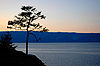
Southern Northwestern Far Eastern - Volcanoes of Kamchatka
- Central Sikhote-Alin
- Wrangel Island
Siberian - Golden Mountains of Altai
- Lake Baikal
- Putorana Plateau
- Uvs Nuur Basin3
Volga North Caucasian Authority control: SWD in the DNB: 4080244-9Categories:- Rift lakes
- Lakes of Russia
- World Heritage Sites in Russia
- Biosphere reserves of Russia
- Freshwater ecoregions
- Republic of Buryatia
- Irkutsk Oblast
- Extreme points of Earth
- Landforms of Siberia
- Lake Baikal
- Russian toponyms


Wikimedia Foundation. 2010.