- Gaborone
-
Gaborone — City — From top to bottom: skyline view of Gaborone, statue of Seretse Khama, the city centre of Gaborone, bird's-eye view of Gaborone
Nickname(s): Gabs, GC, Gabz, G-City Location of Gaborone in Botswana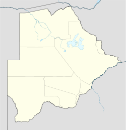
 Gaborone
Coordinates: 24°39′29″S 25°54′44″E / 24.65806°S 25.91222°ECoordinates: 24°39′29″S 25°54′44″E / 24.65806°S 25.91222°E Country  Botswana
District Gaborone Sub-district Gaborone Founded 1964[1] Named for Chief Kgosi Gaborone Government – Mayor Haskins Nkayigwa (BMD)[2] – Deputy Mayor Florence Shagwa (BCP)[2] Area[3] – Total 19.6 km2 (7.6 sq mi) Elevation[4] 983 m (3,225 ft) Population (2006)[5] – Total 191,776 – Density 1,101/km2 (2,851.6/sq mi) Time zone Central Africa Time (UTC+2) – Summer (DST) not observed (UTC+2) Geographical area code[6][7] 3XX ISO 3166 code BW-SE Twin Cities – Burbank  United States
– Zhejiang Province  China
ChinaWebsite Gaborone City Council Website Gaborone (Tswana IPA: [χabʊˈrʊnɪ];[missing tone] English /ˌɡæbəˈroʊniː/ or /ˌxɑːbəˈroʊneɪ/, named after Chief Kgosi Gabarone) is the capital and largest city of Botswana with a population of 191,776 based on a 2006 survey,[5] about 10% of the total population of Botswana.
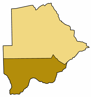
Gaborone is situated between Kgale and Oodi Hills, on the Notwane River in the southeastern corner of Botswana, and 15 kilometres (9.3 mi) from the South African border.[8] The city is served by the Sir Seretse Khama International Airport. It is an administrative district in its own right, but is the capital of the surrounding South-East District.[9] Locals often refer to the city as Gabs.[10]
Because the city had no tribal affiliation and was close to fresh water, the city was planned to be the capital in the mid-1960s when the Bechuanaland Protectorate became an independent nation. The center of the city is a long strip of commercial businesses, called the Mall, with a semicircle-shaped area of government offices to the west of the Mall. The city is one of the fastest-growing cities in the world, and this has created problems with housing and illegal settlements. The city has also dealt with conflicts spilling into the country from Zimbabwe and South Africa during the 1980s.
The city is the government capital as well as the economic capital; the city is headquarters to numerous companies and the Botswana Stock Exchange. Gaborone is also home to the Southern African Development Community (SADC) a supranational organization, hoping to increase economic unity.
Contents
History
Main article: History of Gaborone A postage stamp circa 1943, the postmark reading "Gaborone's Village"
 Rev. Derek Jones, the first mayor of Gaborone
Evidence shows that there have been inhabitants along the Notwane River for centuries. In more recent history, Chief Kgosi Gaborone left the Magaliesberg to settle in the area around 1880, and called the settlement Moshaweng. The word Gaborone literally means it does not fit badly or it is not unbecoming.[11] The city was then called Gaberones by the early European settlers.[12] Gaberones, derived from Gaborone's Village, was named after Chief Gaborone of the BaTlokwa,[8] whose home village, now called Tlokweng, was across the river from the Government Camp, the name of the colonial government headquarters. The nickname, GC, comes from the name Government Camp.[10] In 1890, Cecil John Rhodes picked Gaberones to house a colonial fort.[13] The fort was where Rhodes planned the Jameson Raid.[12] The city changed its name from Gaberones to Gaborone in 1969.[14]
In 1965, the capital of the Bechuanaland Protectorate moved from Mafeking to Gaberones. When Botswana gained its independence, Lobatse was the first choice as the nation's capital. However, Lobatse was deemed too limited, and instead, a new capital city would be created next to Gaberones.[10] The city was chosen because of its proximity to a fresh water source, its proximity to the railway to Pretoria, its central location among the central tribes, and its lack of association with those surrounding tribes.[8]
The city was planned under Garden city principles with numerous pedestrian walkways and open spaces.[3] Building of Gaborone started in mid-1964. During the city's construction, the chairman of Gaberones Township Authority, Geoffrey Cornish, likened the layout of the city to a “brandy glass” with the government offices in the base of the glass and businesses in the “mall”, a strip of land extending from the base.[15]
Most of the city was built within three years. Buildings in early Gaborone include Assembly buildings, government offices, a power station, a hospital, schools, a radio station, a telephone exchange, police stations, a post office, and more than 1,000 houses.[16] Because the city was built so quickly, there was a massive influx of labourers who had built illegal settlements on the new city's southern industrial development zone. These settlements were named Naledi. Naledi literally means the star, but could also mean under the open sky or a community that stands out from all others. In 1971, because of the growth of illegal settlements, the Gaborone Town Council and the Ministry of Local Government and Lands surveyed an area called Bontleng, which would contain low-income housing. However, Naledi still grew, and the demand for housing was greater than ever. In 1973, the Botswana Housing Corporation (BHC) built a "New Naledi" across the road from the "Old Naledi". Residents from Old Naledi would be moved to New Naledi. However, the demand for housing increased yet again; moreover, the residents who relocated to New Nadeli disliked the houses. The problem was solved in 1975 when Sir Seretse Khama, the president of Botswana, rezoned Naledi from an industrial zone to a low-income housing area.[17]
On 30 September 1966, Bechuanaland became the eleventh British dependency in Africa to become independent. The first mayor of Gaborone was Reverend Derek Jones.[18] The old Gaberones became a suburb of the new Gaborone, and is now known as "the Village".[10]
In the mid-1980s, South Africa attacked Botswana and conducted raids on Gaborone and other border towns. The raids resulted in fifteen civilian deaths.[19]
After the 1994 General Elections, riots started in Gaborone because of high unemployment and other issues.[19]
Today, Gaborone is growing very rapidly. In 1964, Gaborone only had 3,855 citizens;[20] seven years later, the city had almost eighteen thousand residents.[21] The city originally planned on 20,000 citizens, but by 1992, the city had 138,000 people. This has led to many squatter settlements on undeveloped land.[22] Former mayor Veronica Lesole has stated that Gaborone's development problems were caused by the original city planners.[23]
Geography
Gaborone is situated at 24°39′29″S 25°54′44″E / 24.65806°S 25.91222°E between Kgale and Oodi Hills, on the Notwane River in the southeastern corner of Botswana, and 15 kilometres (9.3 mi) from the South African border[8] Gaborone is surrounded by the following cities: Ramotswa to the southeast, Mogoditshane to the northwest, and Mochudi to the east, and Tlokweng across the river. Most of them are commuter towns for Gaborone. Suburbs in Gaborone include Broadhurst, Gaborone West, The Village, Naledi,[8] and New Canada. Phakalane, an affluent suburb, lies north of the city limits.[24]
In the center of the city lies the Mall, the financial and tourism center of Gaborone. The Mall houses numerous banks and shopping centres. At the eastern end of the Mall, one can find the Civic Centre along with the Pula Arch that commemorates Botswana's independence. The Botswana Stock Exchange, National Museum and Art Gallery, and the main campus of the University of Botswana also lie near the Mall. To the west of the Mall is the Government Enclave. This area contains the governmental buildings such as the National Assembly of Botswana and House of Chiefs of Botswana buildings. The National Archives building is also found here.

Mogoditshane, Molepolole Dumadumana, Kopong, Lentsweletau Tlokweng, Pilane, Mochudi Gabane, Thamaga 
Modipane, Sikwane  Gaborone

Kanye Ramotswa, Otse, Lobatse Climate
Gaborone Climate chart (explanation) J F M A M J J A S O N D 14332208232197430173028138.32497.523412350.92685.831155.83317583318713218Average max. and min. temperatures in °C Precipitation totals in mm Source: [25] Imperial conversion J F M A M J J A S O N D 5.690683.290662.986631.282550.375480.3733907341079460.288590.291632.391642.89064Average max. and min. temperatures in °F Precipitation totals in inches Gaborone has a hot semi-arid climate (Köppen climate classification BSh). Most of the year, Gaborone is very sunny. The summers are usually hot. The nights are cool. Usually, the summers with little rainfall are warmer than summers with regular rainfall. If there is a drought, the hottest temperatures of the year are usually in January or February. If there is normal rainfall, the hottest temperatures are usually in October, right before the rain starts. During the winter, days are still warm, and the nights are cold.[26]
There are on average seventy-four days per year with temperatures above 32 °C (90 °F). There is on average 196 days per year with temperatures above 26 °C (79 °F). There is on average fifty-one days per year with temperatures below 7 °C (45 °F). There is on average one day per year with temperatures below 0 °C (32 °F).[27] The average dew point peaks around January and February at 16 °C (61 °F) and hits the lowest levels in July at 2 °C (36 °F). The average dew point in a given year is 10 °C (50 °F).[27]
Precipitation in Gaborone is sparse and variable. Most of the rainfall in Gaborone falls during the summer months, between October and April.[26] There is on average forty days of thunderstorms per year, most of them happening during the summer months, and four days of fog, usually happening during the winter months.[27] Gaborone has been affected by three floods based on records going back to 1995, one in 2000, one in 2001 that caused an estimated 5,000,000 Botswana pula worth of damage, and one in 2006.[25]
The highest humidity occurs in June at 90% while the lowest humidity is in September at 28%.[26]
Solar radiation levels range from 14.6 MJ/m² in June to 26.2 MJ/m² in December.[26]
It is windier from August to November at 14 kilometres per hour (8.7 mph), and it is calmer from May to July at 8 kilometres per hour (5.0 mph). The average wind speed in a given year is 12 kilometres per hour (7.5 mph).[27]
Climate data for Gaborone Month Jan Feb Mar Apr May Jun Jul Aug Sep Oct Nov Dec Year Record high °C (°F) 39
(103)40
(104)39
(102)37
(98)33
(91)29
(84)28
(83)33
(91)39
(103)40
(104)40
(104)39
(103)40
(104)Average high °C (°F) 31
(87)30
(86)29
(84)26
(79)23
(74)21
(69)21
(69)24
(76)31
(87)29
(84)30
(86)30
(86)27.0
(80.6)Daily mean °C (°F) 27
(80)26
(78)24
(76)21
(70)18
(64)14
(57)14
(57)17
(63)21
(70)24
(75)25
(77)26
(78)21.3
(70)Average low °C (°F) 22
(72)21
(70)19
(67)16
(61)12
(53)7
(45)7
(45)11
(51)15
(59)18
(65)20
(68)21
(70)15.8
(60.5)Record low °C (°F) 14
(57)13
(55)11
(52)0
(32)−1
(30)−1
(30)−2
(28)0
(32)5
(41)7
(45)8
(46)11
(52)−2
(28)Precipitation mm (inches) 97
(3.8)84
(3.3)71
(2.8)41
(1.6)13
(0.5)5
(0.2)3
(0.1)5
(0.2)15
(0.6)43
(1.7)66
(2.6)89
(3.5)526
(20.7)Avg. precipitation days 7 5 4 3 1 0 0 1 1 4 6 8 40 Source: Weatherbase[27] Demographics
Historical populations Year Pop. ±% 1964 3,855 — 1971 17,700 +359.1% 1981 59,100 +233.9% 1991 133,500 +125.9% 2001 186,007 +39.3% 2006 191,776 +3.1% [5][20][21] The population, based on a 2006 survey, is 191,776. There are 92,859 males and 98,917 females in the city.[5] There are 58,476 households in Gaborone.[28] The city of Gaborone is home to over 10% of the population of Botswana.[5][19] Almost half of Botswana citizens live within 100 kilometres (62 mi) of Gaborone.[29]
The population growth rate of Gaborone is 3.4%, the highest in the country. This is most likely because the city has a more developed infrastructure, making it more livable.[30] Gaborone is one of the fastest-growing cities in the world.[8] Much of the growth is based on net in migration from the rest of Botswana.[31]
The sex ratio of Gaborone is 97.6, meaning that there are 976 men for every 1,000 women.[30] Most of the marriages in Botswana are registered in Gaborone; about 15% of all marriages in Botswana were registered in Gaborone in 2007.[32] On average, there are 3.3 persons per househould in Gaborone. This is a low number compared to the rest of Botswana.[5]
It is estimated that over one-third of the people living in Gaborone, 38.8%, have HIV—the highest prevalence in the world. The rate is even higher for people between the ages of 15 and 49 at 44%.[3]
Religion
 Map of the Roman Catholic Diocese of Gaborone
The Roman Catholic Diocese of Gaborone, which is under the Roman Catholic Archdiocese of Pretoria, is located in the city. The diocese contains the southern half of Botswana, and the bishop for the diocese is Bishop Valentine Tsamma Seane who was consecrated on 25 April 2009. The previous bishop was Boniface Tshosa Setlalekgosi. There is a catholic cathedral called Christ the King Cathedral.[33][34]
There is a Hindu temple in Gaborone, nicknamed Hindu Hall, as well as a gurudwara and several mosques.[35] Construction started in May 2001 on a Venkateswara temple in Gaborone West for a local community of Telugu people by the Botswana Hindu Charities Trust[36] and was complete in September 2007. The Indian High Commissioner, and the President Festus Mogae visited the temple upon its completion.[37]
Arts and culture
The National Museum and Art Gallery is located just northwest of the Mall along Independence Road.[38] The museum opened in 1968. It holds many things from traditional crafts to works of art by local artists. The museum houses original paintings by Thomas Baines and Lucas Sithole. Exhibits include Artists in Botswana, Children's Art Competition and Thapong International. Outside the museum, there are various forms of transportation such as wagons, sledges, and bakkies (pickup trucks). There is also an exhibit on the Bushmen, the earliest inhabitants of southern Africa.[39] The museum opened a 3.6-hectare (9-acre)[40] botanical garden called the National Botanical Garden on 2 November 2007.[41] The garden was built to protect Botswana's indigenous plant life, and 90% of its total plant species are native plants from Botswana.[40]
The Maitisong Festival was started in 1987 and is held every year for seven days on either the last week of March or the first week of April. The festival holds outdoor concerts, plays, and movies in various venues around the city.[12]
“My African Dream” is a performing-arts competition that is held every year at the Gaborone International Convention Center. The show features many kwaito dancers and musicians.[19]
The book series, The No. 1 Ladies' Detective Agency, is set in Gaborone. The series is written by Alexander McCall Smith. The books follow Precious Ramotswe, the first female private detective in Botswana, and the mysteries that she solves.
Economy
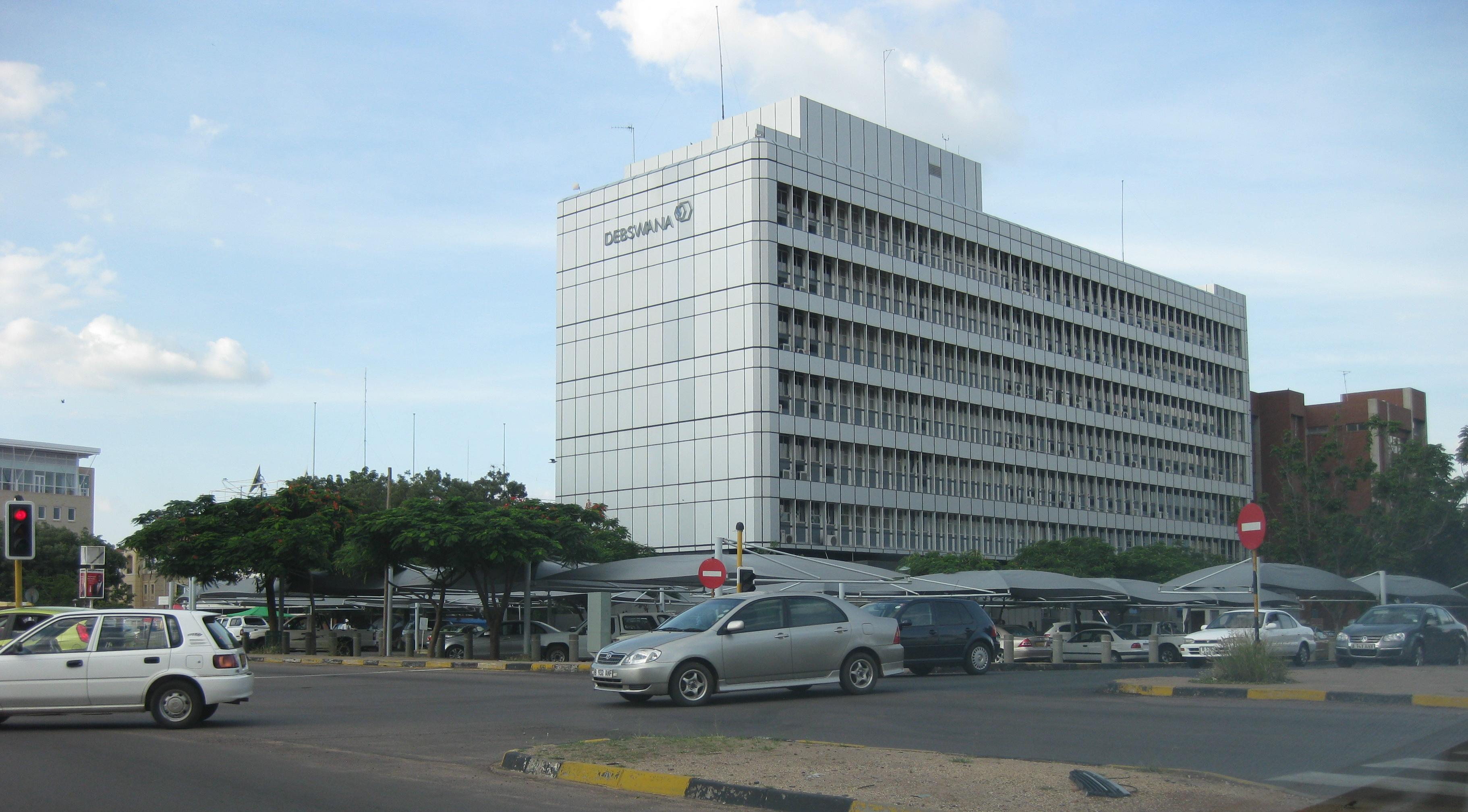
 Debswana offices in the downtown area
 Southern African Development Community headquarters
Gaborone is the center of the national economy. The headquarters of important financial institutions such as the Bank of Botswana, Bank Gaborone, BancABC, and the Botswana Stock Exchange are located downtown, as well as the headquarters for Air Botswana, Consumer Watchdog, Botswana Telecommunications Corporation, and Debswana, the joint diamond mining venture between De Beers and the Botswana government. The Southern African Development Community (SADC) has its headquarters in Gaborone; the organization was formed in 1980 to increase economic cooperation among its members and reduce dependence on South Africa.[8] Several international companies have invested in the city: Hyundai, IBM, Daewoo, Volvo, Owens-Corning, and Siemens.[31] Orapa House, owned by Debswana, is where the diamonds mined from Debswana are sorted and valued. Orapa House, located at the intersection of Khama Crescent and Nelson Mandela Drive,[38] has a unique style of architecture that allows the perfect amount of indirect sunlight to shine through the windows in order to accurately sort diamonds.[42] The Botswana Resource Conference is held annually at the Gaborone International Conference Centre.
According to Mercer's 2010 Worldwide Cost of Living Survey, Gaborone has the 203rd highest cost of living for expatriates in the world. Gaborone is the third least expensive city for expatriates in Africa, coming in above Addis Ababa, Ethiopia at 208th and Windhoek, Namibia at 205th. Karachi, Pakistan ranks last in the world at 214.[43]
Sports
 Botswana National Stadium in August 2010
Stadiums in Gaborone [44][45] Venue Sport Capacity Club(s) Botswana National Stadium Football, Athletics, Rugby, Tennis 50,000 Gaborone United, Notwane F.C.,
Police XI, Township Rollers F.C.Mochudi Stadium Football 10,000 Mochudi Centre Chiefs SSKB Stadium Football 5,000 Botswana Defence Force XI University of Botswana Stadium Football 5,000 Uniao Flamengo Santos F.C. There are several football stadiums located in and around Gaborone. They are SSKB Stadium, Mochudi Stadium, and Botswana National Stadium. There are also many football teams representing Gaborone. They include Botswana Defence Force XI, Gaborone United, Notwane FC, Police XI, and Uniao Flamengo Santos FC; all of them play in the Botswana Premier League. The Botswana national football team play in the National Stadium, but have never qualified for the FIFA World Cup nor the Africa Cup of Nations.
The Botswana Cricket Association, the governing body of cricket in Botswana, is headquartered in Gaborone.
The Gaborone City Marathon, the second marathon in Botswana, was held 18 April 2010. The route started at the Phakalane Golf Estate in Phakalane, north of the city, and went through Gaborone, passing the National Assembly Building.[46]
Parks and recreation
 Satellite image of the city; the large lake is Gaborone Dam
The Gaborone Dam is located south of Gaborone along the Gaborone-Lobatse road, and provides water for both Gaborone and Lobatse. The dam is the biggest in Botswana, able to hold 141,400,000 cubic metres (3.735×10¹⁰ US gal).[47] It is also starting to be marketed as a recreational area. The northern end of the reservoir is planned to become an entertainment venue called The Waterfront. There is a yacht club, called Gaborone Yacht Club, also on the northern side of the lake. The southern end houses the Kalahari Fishing Club and a new public facility called City Scapes. City Scapes contains parks, playgrounds, and boating facilities.[48] The dam is popular with birdwatchers, windsurfers, and anglers.[12] However, there is no swimming due to crocodiles and parasitic bilharzias.[42]
The Gaborone Game Reserve is a 600-hectare (1,500-acre) park east of the city on Limpopo Drive.[38] The reserve was built in 1988 and is now the third-busiest in Botswana. Examples of animals in the park are impala, kudu, ostriches, wildebeest, zebras, gemsbok, bushbuck, springbok, duiker, Common Eland, and warthogs.[12] The park is famous for its birdwatching.[39] Birds in the marshy section of the park include snake eagles, boubou, gallinule, kingfishers, and hornbills.[12]
Kgale Hill is located a few hundred metres from the city. The hill is nicknamed the Sleeping Giant and is 1,287 metres (4,222 ft). There are three different paths to reach the top, usually taking two hours.[12]
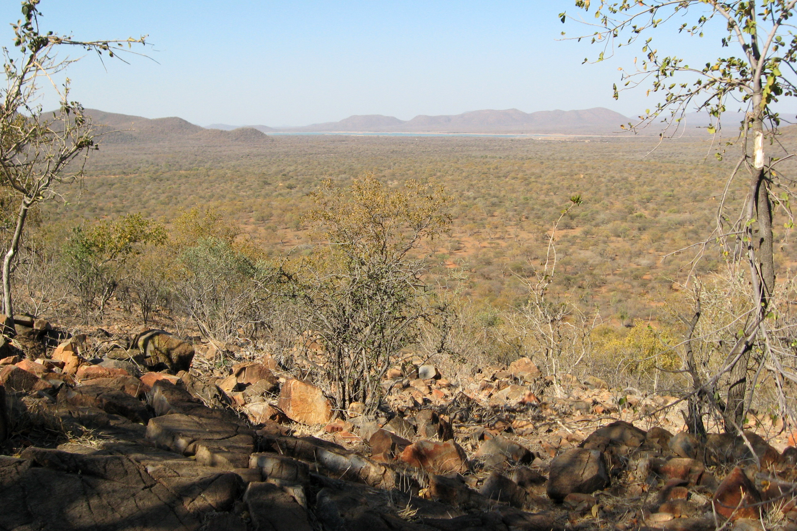
The Mokolodi Nature Reserve is a 30-square-kilometre (12 sq mi) reserve that was created in 1994.[49] It is located 12 kilometres (7.5 mi) south of Gaborone.[12] There are many different species of animals found in the park such as warthogs, steenbok, kudu, zebras, giraffes, Common Eland, ostriches, hippos and rhinos. The park helps with wildlife projects in Botswana that include: the reintroduction of the White Rhino and the relocation of “problem” cheetahs. Mokolodi also holds the Education Centre, which teaches children about the conservation projects.[49]
 Somarelang Tikologo Community Playground
Somarelang Tikologo (Environment Watch Botswana) is a member-based environmental NGO housed inside an ecological park at the heart of Gabarone. The aim of the organization is to promote sustainable environmental protection by educating, demonstrating and encouraging best practices in environmental planning, resource conservation and waste management in Botswana. The park was officially opened by the Botswana Minister of Environment, Wildlife and Tourism, Onkokame kitso Mokaila on 27 February 2009. The park contains a playground for children to play on throughout the day, a community organic garden, a recycling drop-off center, and a shop where visitors can purchase products made of recycled material.[50]
Government
Gaborone is controlled by the Gaborone City Council. The city council is run by the city clerk and the deputy city clerk. The city is governed by the mayor, deputy mayor, and several committees run by councillors: the financial and general purposes committee; the public health, social welfare and housing committee; the Self-Help Housing Agency (SHAA) management committee; the town planning committee; the trade licensing committee; and the education committee.[31] The councillors elect the mayor and place each other in the committees yearly.[20] The council has 2,515 employees.[31] The city council has been criticised by the Botswana Association of Local Authorities for its closed elections and minimal authority.[20] In 2010, the council had problems with waste management: Frenic, the waste management company hired by the city, sued the Gaborone City Council for unpaid compensation.[51] This has led to a buildup of uncollected garbage.[52]
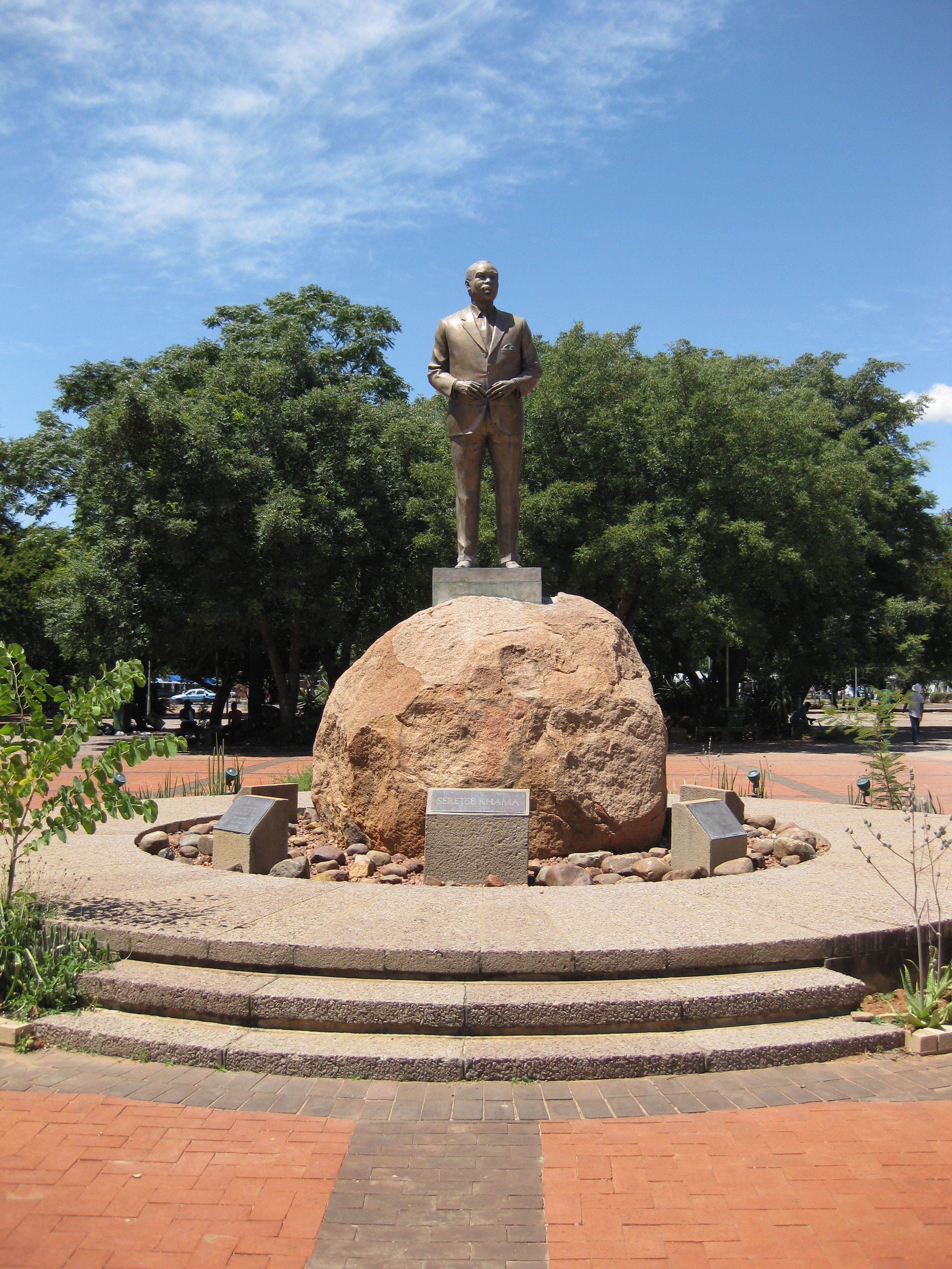
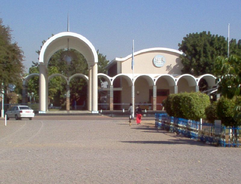
Gaborone is the political center of Botswana. Most government buildings are located west of the Main Mall in an area called the Government Enclave.[38] The National Assembly of Botswana, the House of Chiefs of Botswana, the National Archives,[3] and the Ministry of Health. Near the entrance of the parliament building, there is a statue of Sir Seretse Khama, Botswana's first president as well as a memorial dedicated to the three hundred Batswana who were killed from 1939 to 1945.[53] Another monument pays tribute to the Botswana Defence Force soldiers who died in the Rhodesian Bush War.[11]
Before 1982, Gaborone held one parliamentary constituency, one seat in the Parliament of Botswana. From 1982 to 1993, Botswana was divided into two constituencies, Gaborone North and Gaborone South. A third seat in Parliament was given to a member elected for the whole city of Gaborone. In January 1993, two new constituencies were created: Gaborone West and Gaborone Central. For local government elections, the four constituencies were divided into wards. Gaborone North had seven, Gaborone West had seven. Gaborone Central had six, and Gaborone South had five.[31] In 2002, the city had five constituencies: Gaborone North, Gaborone Central, Gaborone South, Gaborone West North, and Gabororone West South.[54]
An International Law Enforcement Academy (ILEA) was established on 24 July 2000 in Gaborone. The academy would provide training for middle managers for the countries in the Southern African Development Community (SADC).[55]
The city is also home to several embassies and consuls.
List of Foreign Missions and International Organizations in Gaborone[56][57] Mission Type Ambassador Website  Angola
Embassy Jose Agostinho Neto (Portuguese) Embassies of Angola  Austria
Honorary Consulate Doreen Khama Austrian Honorary Consul in Botswana  Belgium
Honorary Consulate  Brazil
Embassy Joao Inacio Oswald Padilha (Portuguese) Embaixada do Brasil em Gaborone  Canada
Honorary Consulate Anne Bookbinder Center for the Development of Enterprise Regional Office Sid Boubekeur CDE ChinaEmbassy Liu Huanxing Embassy of the People's Republic of China in the Republic of Botswana  Cuba
CubaEmbassy Ramon D.A. Medina Embassy of Cuba in Botswana  Denmark
Consulate Leif Bekker Danish Consulates in South Africa, Botswana, DRC, Lesotho, Madagascar, Namibia and Swaziland  European Union
Delegation of the European Commission Paul Malin Delegation of the European Commission in Botswana  Finland
Honorary Consulate Samuel Akuna Mpuchane Finland's Honorary Consulate, Gaborone (Botswana) Food and Agriculture Organization of the United Nations Country Office Han Gaoju FAO Representation in Botswana  France
Embassy Geneviève Iancu Embassy of France to Botswana  Germany
Embassy Annett Günther German Embassy Gaborone  Ghana
GhanaHonorary Consulate Afua Daaku  Guyana
Consulate Terrence H. Pariaug Guyana's Diplomatic & Consular Representatives  India
IndiaHigh Commission Madhava Chandra High Commission of India International Union for Conservation of Nature Country Office Masego Madzwamuse IUCN Botswana Office  Ireland
Honorary Consulate Barney O'Reilly Diplomatic and Consular Information for Botswana  Israel
Honorary Consulate Richard Lyons  Italy
ItalyHonorary Consulate Guido Renato Giachetti  Jamaica
Consulate Esau Waugh Consul General and Consulates  Japan
JapanEmbassy Ryoichi Matsuyama Embassy of Japan in Botswana  Kenya
KenyaHigh Commission Daniel Sidinga  Libya
LibyaPeople's Bureau vacant  Mozambique
High Commission Tiago R. Castigo  Namibia
High Commission Hadino Timothy Hishongwe  Netherlands
Consulate Jan Pitt Gaborone Consulate  Nigeria
High Commission Isaac O. Onuh  Norway
Honorary Consulate Per Erik Bergh  Russia
Embassy Anatoly Nikolaevich Korsun Embassy of the Russian Federation in the Republic of Botswana  South Africa
High Commission Ngconde M. Bryce Balfour  Southern African Development Community
Headquarters Tomas A. Salomao Southern African Development Community  Spain
SpainHonorary Consulate Guido Renato Giachetti  Sweden
Honorary Consulate Abdul Rahim Khan Sweden in Gaborone, Botswana  Thailand
Honorary Consulate United StatesEmbassy Michelle D. Gavin Embassy of the United States  United Kingdom
High Commission Frank J. Martin British High Commission Gaborone United Nations AIDS Country Coordinator Office Evaristo Marowa UNAIDS CC Office  United Nations Children Fund
Country Office Barbara G. Reynolds UNICEF  United Nations Development Programme
Country Office Khin-Sandi Lwin UNDP in Botswana United Nations High Commissioner for Refugees Country Office Roy Herrmann United Nations Population Fund Country Office Argentina Matavel UNFPA in Botswana  World Health Organization
Country Office Eugène Kojo Appiah Nyarko Botswana WHO Country Office  Zambia
High Commission Mwamutenta R. Musakabantu  Zimbabwe
Embassy Thomas Mandigora Education
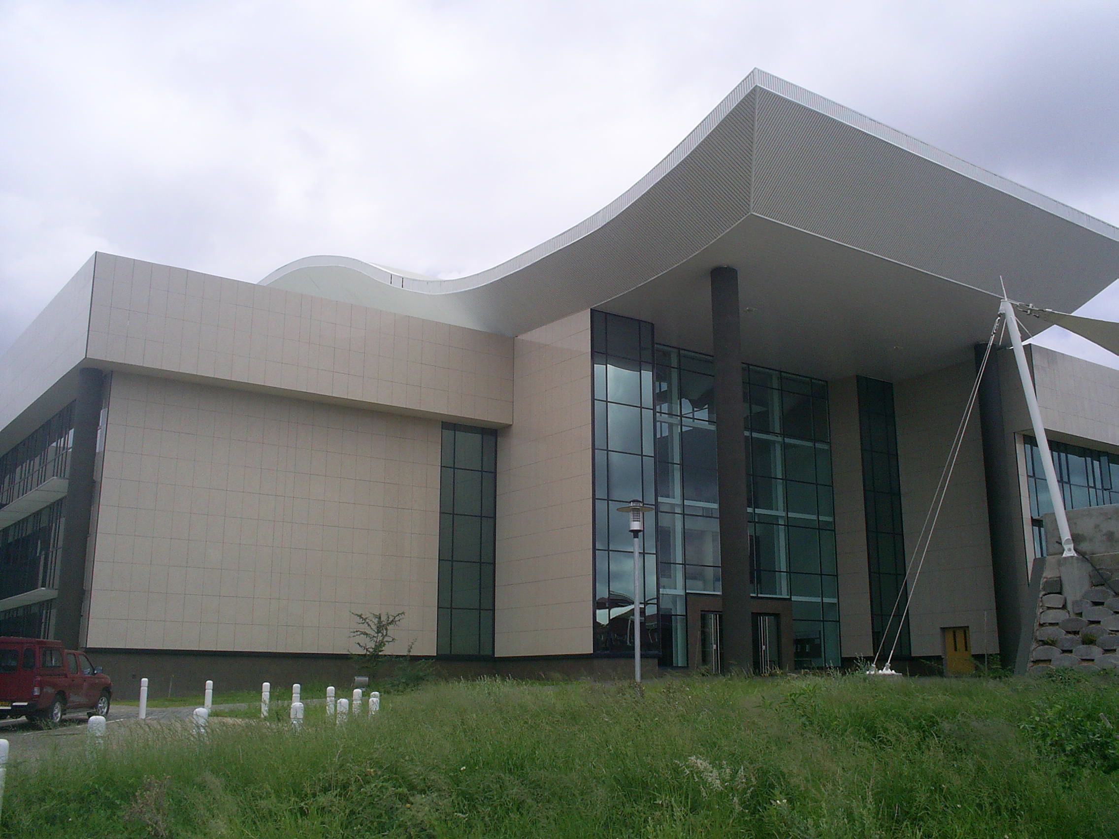
 Environmental Science Building at the University of Botswana
 University of Botswana Faculty of Business
There are more people who have earned a degree or postgraduate qualifications in Gaborone than anywhere else in Botswana. 70.9% of the population of Gaborone has earned at least a secondary-level education[5]
Gaborone has many primary and secondary schools, both public and private. These include Westwood International School, Maru-a-Pula School, Legae Academy and Thornhill Primary School.
Universities
The main campus of the University of Botswana, established in 1982,[8] is on the eastern side of the city.[38] Other universities include the Limkokwing University Of Creative Technology, which also has a campus in Gaborone. The Botswana Accountancy College, which caters for both accounting and IT students, Gaborone Technical College, Boitekanelo College, and Botswana College of Agriculture (located about 15 kilometres (9.3 mi) from the city centre) are also located at Gaborone. The Gaborone Universal College of Law, opened in 2006, has its main campus in Gaborone.[58] The university held its first graduation in 2010 for its first graduating class.[59]
Media
A number of newspapers published in Gaborone. They include Mmegi, The Botswana Gazette, and The Voice.
Radio station Yarona FM broadcasts from Gaborone; its frequency in Gaborone is 106.6 FM. Another small, local radio station in Gaborone is Gabz FM.[60]
Before 2000, residents of Gaborone received television programming from BOP TV in Mafikeng via a repeating transmitter on the summit of Kgale Hill.[60] Today, the Gaborone Broadcasting Company and Botswana TV provide television programming for Gaborone.
Infrastructure
Gaborone is one of the fastest growing cities in Africa. The growth of Gaborone, especially suburban growth, has caused much of the farmland surrounding the city to be absorbed into the city. Much of the food for Gaborone comes from north of the city with some smaller-scale farms on the southern end.[61]
The city centre was planned to be functionalist,[3] with buildings built in the Modern architecture. The city is surrounded by smaller buildings.[62] The city's central business district (CBD) is still under construction so when one says downtown, they actually mean the Main Mall and Government Enclave areas where tall buildings are usually found.[62][63] The Main Mall, a car-free shopping and commercial area, runs in an east-west direction with the Government Enclave and National Assembly on the west end and the Gaborone City Town Council complex on the east.[11]
 The Three Dikgosi Monument
Gaborone's CBD is home to the new Square Mall, The Tower, the new SADC headquarters, the Industrial Court,[64] a court specifically for settling trade disputes,[65] and the Three Dikgosi Monument, a landmark featuring the statues of Khama III, Sebele I, and Bathoen I,[66] three dikgosi, or chiefs, who traveled to Great Britain to establish the Bechuanaland Protectorate separate from Southern Rhodesia (present-day Zimbabwe) or the Cape Colony (present-day South Africa). The monument was inaugurated on 29 September 2005.[67] While the statues represent famous historical figures, there has been some controversy over the cost of the construction, P12,000,000 (approx. US$1.7M, €1.4M, or £1.1M as of June 2010), and over the construction company, North Korean Masundae Overseas Projects, putting the wrong inscription date.[68] Other buildings under construction in the CBD include the Holiday Inn Gaborone, retail space, and office space.[69]
Utilities
The city gets most of its water from the reservoir formed from the Gaborone Dam on the southeast side of the city, which has facilitated growth.[10] The city of Gaborone was originally constructed as a small town, so the Gaborone Dam needed to be built to provide water for all its citizens.[24]
From 2007 to 2008, 23,963,000 cubic metres (6.3304×10⁹ US gal) of water was sold in Gaborone. The government sector bought the most water, 11,359,000 cubic metres (3.0007×10⁹ US gal). 8,564,000 cubic metres (2.262×10⁹ US gal) of water was bought for domestic use, and 4,040,000 cubic metres (1.07×10⁹ US gal) of water was bought by the commercial and industrial sectors. In 2008, the city of Gaborone consumed 25,657,363 kilolitres (6.777958×10⁹ US gal) of water, and the water consumption per capita was 0.184 cubic metres (48.6 US gal) per person per year, the lowest rate since 1999.[47]
Gaborone has some of the highest water tariffs in the country because of high transportation costs and high water consumption. The high tariffs may also be due to the fact that some of Gaborone's water supply is imported from the Letsibogo Dam.[47]
The average pH of the water in the Gaborone Dam is 7.95 as of February 2006. The concentration of calcium in the reservoir was 14.87milligrams per litre from April 2001 to August 2006. During the same period, the concentration of calcium carbonate (CaCO3) was 57.73 milligrams per litre, slightly over Botswana's ideal concentration which means the water is hard. Also during the same period, the chloride concentration was 6.44 mg/l, the fluoride concentration was 0.54 mg/l, the potassium concentration was 6.72 mg/l, and the sodium concentration was 10.76 mg/l.[47]
Health Care
 The Princess Marina Hospital
The Botswana Red Cross Society, established in 1968, is headquartered in Gaborone. The Princess Marina Hospital is the main referral hospital in Gaborone and currently houses 500 beds.[70]
The Cancer Association of Botswana is a voluntary non-governmental organization established as a trust in 1998. The Association is a leading service provider in supplementing existing services through provision of cancer prevention and health promotion programmes, facilitating access to health services for cancer patients and offering support and counseling to those affected. Its headquarters is at Diktlhakore Way, Extension 12, Gaborone.
Transportation
The railway that served the founding purpose of the city remains important, bisecting the city in a north-south direction.[8] Botswana Railways runs a line that goes from Cape Town to Harare via Bulawayo. The railway station in Gaborone is located south of the Parliament House in the city's center.[38] The line stops at the following cities in and near Botswana: Ramatlabama on the South African border, Lobatse, Gaborone, Palapye, Serule, Francistown, Ramokgwebana, and Plumtree, Zimbabwe.[71] The line became a cargo-only line starting 1 April 2009.[72]
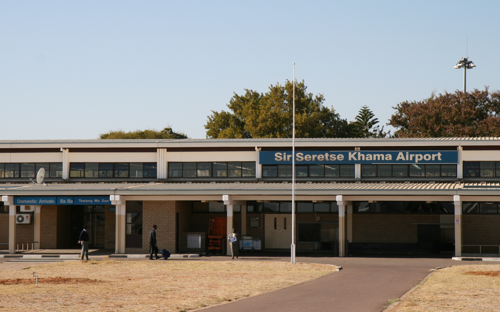
Sir Seretse Khama International Airport (ICAO code: FBSK[73] IATA code: GBE[73]) lies 25 kilometres (16 mi)[19] north of the city[38] and has flights to Johannesburg, Harare, Francistown, and Maun with connections to Kasane and Livingstone.[74] It is the headquarters of Air Botswana, the national airline of Botswana. Starting August 2010, Air Botswana has direct flights to Lusaka International Airport in Lusaka, Zambia and flights to Lusaka via Kasane. The airline plans to create a route from Gaborone to Luanda, Angola in the future.[75]
In 2008, Sir Seretse Khama International Airport handled 15,844 aircraft movements, second only to Maun Airport (ICAO code: FMBN[76] IATA code: MUB[76]) Air traffic in Gaborone has decreased since 2006. However, Gaborone has the most air passenger traffic, accounting for 51.6% of all passenger movement in Botswana. International passengers total 244,073 passengers while domestic air passenger movement comes up to 333,390 passenger.[77]
For more details on on the following topic, see 1999 Air Botswana incident.Gaborone gained media attention in October 1999 because of the death of Chris Phatswe. Phatswe was a pilot for Air Botswana who committed suicide by crashing his plane into the runway at Sir Seretse Khama International Airport. Before his death, Phatswe was grounded because he was unable to pass the physical. Also, it was later found that he had AIDS. Although he never stated it, these obstacles may have caused him to choose to kill himself. He crashed his plane into two other planes on the tarmac. This almost crushed Air Botswana as they had only one plane left after the incident.[78] Airdisaster.com has photos of the aftermath.
 Road map of Gaborone
Highways in and around Gaborone include the Trans-Kalahari Highway, A1 Highway, and the Cairo-Cape Town Highway. There are five major roads in Gaborone that go to Lobatse, Kanye, Molepolole, Francistown via Mochudi, and Tlokweng.[79]
Gaborone has several vehicle licensing stations. 15,538 new private motor vehicles, accounting for 46.5% of Botswana's total new vehicle registrations, were registered in Gaborone in 2008, of which 8,440 were passenger cars, 440 were minibuses, 204 were motorcycles, and 181 were tractors. The total has increased from 12,690 new vehicle registrations in 2007. Gaborone also has the highest number of vehicle registration renewals at 73,206 in 2008.[77]
Including the district of Gaborone West, Gaborone had 9,415 vehicle accidents with 74 human fatalities in 2008. Most of the traffic collisions in that year, 3,146 collisions, were side collisions. 263 accidents involved animals. The city has also seen 679 pedestrian casualties in 2008; 24 pedestrians were killed. The biggest majority of vehicle accident casualties involved pedestrians, and most traffic accidents occur between 16:00 and 18:00.[77]
 Kombi
KombiPublic transport in the city is generally reliable, when compared with major African cities. Kombis (small vans) and taxis ply the routes within the city while buses serve surrounding villages and other towns in Botswana.[8]
Notable natives and residents
See also Category: People from Gaborone.- Kgosi Gabarone, Motswana chief, after whom the city is named
- Mpule Kwelagobe, Miss Universe and Miss Universe Botswana 1999
- Sumaiyah Marope, Miss Botswana 2009
- Matsieng, a Setswana traditional music group, formed in Gaborone
- Thamsanga Mnyele, member of the African National Congress and artist
- Dirang Moloi, member of the Botswana national football team
- Vernon Nkadimeng, member of the African National Congress, killed in Gaborone by the apartheid police
- Dipsy Selolwane, football player
- Boniface Tshosa Setlalekgosi, Roman Catholic bishop of the Diocese of Gaborone, Botswana since 1981
- Alister Walker, squash player
- Deane Yates, founder of Maru-a-Pula School
- Precious Ramotswe, fictional lady detective
Sister cities
Gaborone has been twinned with one city and one province:
Gallery
 Street scene near the Main Mall
 Gaborone's city centre
 Another aerial view of the city
 Rhodesia Railways car at the national museum
 Aerial view of the city looking east—downtown is in the right-center of the image, with the reservoir just beyond
 Statue of Khama outside the Botswana Parliament building
 Overlooking Mokolodi Nature Reserve, just outside of Gaborone, Botswana
 Skyline of Gaborone
 University of Botswana Administration Building
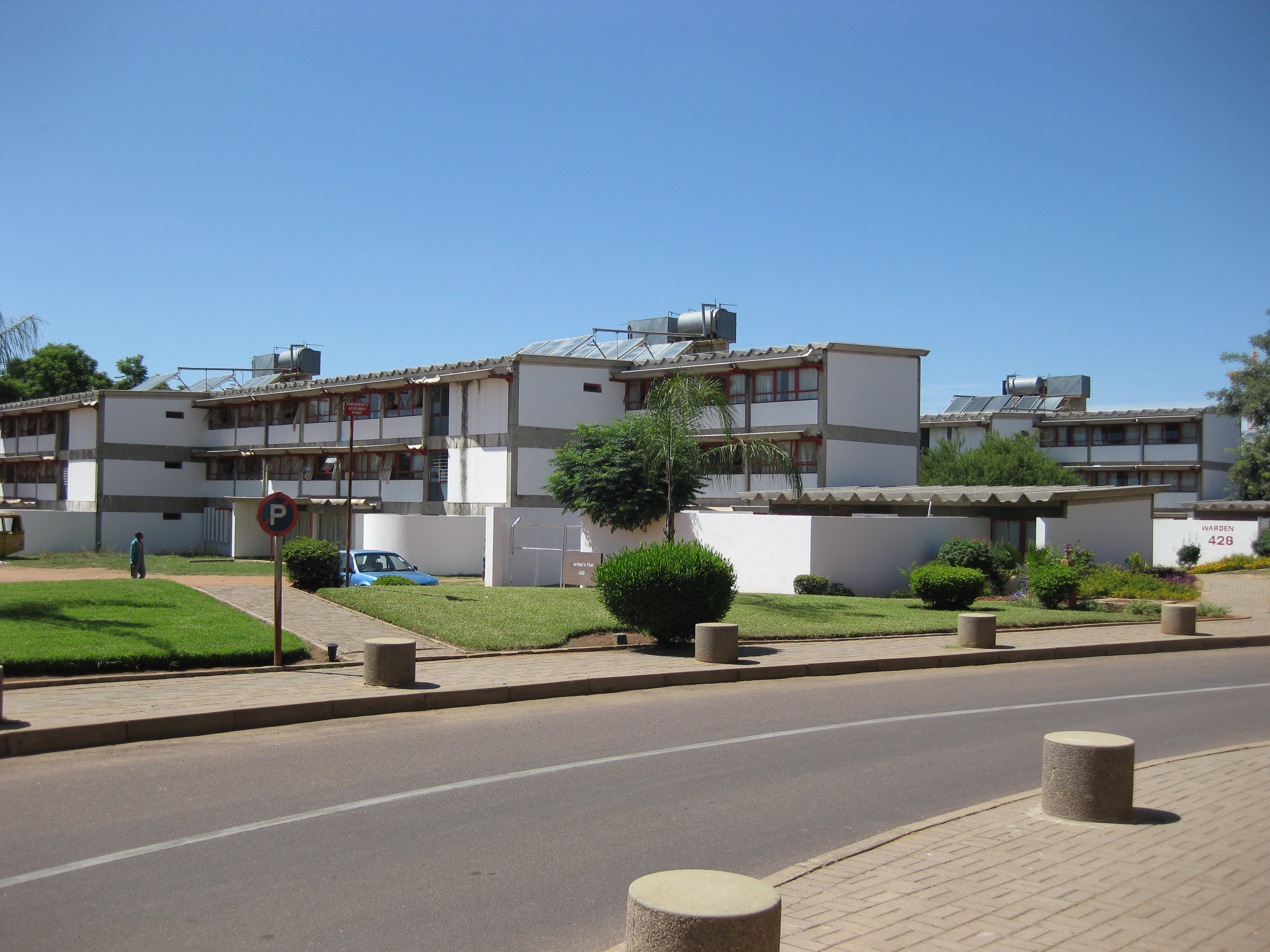
 Dormitories for the University of Botswana
 Courtyard and University of Botswana buildings
 University of Botswana intramural football game
 Parliament Buildings of Botswana


References
- ^ Parsons, Neil (1999-08-19). "Botswana History Page 7: Geography". Botswana History Pages. Gaborone, Botswana: University of Botswana History Department. http://www.thuto.org/ubh/bw/bhp7.htm. Retrieved 2009-08-04.
- ^ a b Keoreng, Ephraim (2011-10-05). "New Gaborone Mayor seeks power to hire and fire". Gaborone, Botswana: Mmegi Online. http://www.mmegi.bw/index.php?sid=1&aid=494&dir=2011/October/Wednesday5. Retrieved 2011-10-09.
- ^ a b c d e Keiner, Marco; Zegras, Christopher; Schmid, Willy A. (2004). Keiner, Marco; Zegras, Christopher; Schmid, Willy A. et al.. eds. From understanding to action: sustainable urban development in medium-sized cities in Africa and Latin America. Springer. pp. 19, 63, 68, 93. ISBN 9781402028793. http://books.google.com/?id=eHZYT0-SsSEC. Retrieved 2009-08-06.
- ^ "Gaborone, Botswana Page". Falling Rain Genomics, Inc.. http://www.fallingrain.com/world/BC/09/Gaborone.html.
- ^ a b c d e f g Central Statistics Office (2009-01). "BOTSWANA DEMOGRAPHIC SURVEY 2006" (PDF). Gaborone, Botswana. http://www.cso.gov.bw/images/stories/HouseHold/2006_bdsrprt.pdf. Retrieved 2010-07-03.
- ^ timeanddate.com
- ^ Botswana Telecommunications Authority (2009-09-11) (DOC). Botswana (country code +267). International Telecommunication Union. Archived from the original on 2009-12-27. http://www.webcitation.org/5mKyF8Dce. Retrieved 2009-12-27.
- ^ a b c d e f g h i j Seth, Willie (2008). "Major urban centres". Botswana and Its People. Godfrey Mwakikagile. pp. 44–46. ISBN 9780981425870. http://books.google.com/books?id=bR54xeODwCIC&lpg=PA43&pg=PA43#v=onepage&q=&f=false. Retrieved 2009-08-04.
- ^ Laws of Botswana, Ministry of Local Government
- ^ a b c d e Njeru, Purity (2009). "History of Gaborone". Nairobi, Kenya: The African Executive. http://www.africanexecutive.com/modules/magazine/articles.php?article=703. Retrieved 2009-08-04.
- ^ a b c "Travel Companion - Southern Botswana" (PDF). Travel Companion. Botswana Tourism Board. Archived from the original on 2011-05-31. http://www.webcitation.org/5z6NUtnVK. Retrieved 2011-05-31.
- ^ a b c d e f g h Hardy, Paula; Firestone, Matthew D. (2007). "Gaborone". Botswana & Namibia. Lonely Planet. pp. 75–88. ISBN 9781741047608. http://books.google.com/books?id=HSAs1_B-93YC&lpg=PP1&pg=PA74#v=onepage&q=&f=false. Retrieved 2009-08-04.
- ^ "African cities- Gaborone History". Gaborone.info. AfricanCities.net. http://gaborone.info/php/gabhist.php?name=Gaborone%20History. Retrieved 2009-08-04.
- ^ "Regions Given New Spelling". Spokane Daily Chronicle. Associated Press (Spokane, Washington, USA): p. 11. 1969-12-22. http://news.google.com/newspapers?id=7bszAAAAIBAJ&sjid=IfgDAAAAIBAJ&dq=gaborone&pg=7329%2C1913552. Retrieved 2010-07-11.
- ^ Paine, David J. (1966-04-15). "Capital City Being Built On Virgin Soil". Eugene Register-Guard. Associated Press (Eugene, Oregon, USA): section D, p. 3. http://news.google.com/newspapers?id=7uQQAAAAIBAJ&sjid=-OADAAAAIBAJ&dq=gaberones&pg=4458%2C3421646. Retrieved 2010-07-11.[dead link]
- ^ killion (2009-06-29). "The Unsustainable urban growth of Gaborone City, Botswana". Boidus: Blogs. http://www.boidus.co.uk/?p=1188. Retrieved 2009-08-04.
- ^ Van Nostrand, John Cornelius (1982). "Old Naledi: History of Settlement". Old Naledi, the village becomes a town: an outline of the Old Naledi Squatter Upgrading Project, Gaborone, Botswana. James Lorimer & Company. pp. 13–15. ISBN 9780888626509. http://books.google.com/books?id=qGjfAc4J1yUC&lpg=PP13&pg=PP13#v=onepage&q=&f=false. Retrieved 2009-09-19.
- ^ Grant, Sandy (2009-06-18). Our Heritage.. 26. Gaborone, Botswana: Mmegi Online. http://www.mmegi.bw/index.php?sid=6&aid=12&dir=2009/June/Thursday18. Retrieved 2009-08-06.
- ^ a b c d e LeVert, Suzanne (2007). Botswana. Marshall Cavendish. pp. 15, 27–28, 105. ISBN 9780761423300. http://books.google.com/?id=f9JybmRxB2oC. Retrieved 2009-08-06.
- ^ a b c d Maundeni, Zibani (June 2004) (PDF). Mapping Local Democracy in Gaborone City. Botswana Association of Local Authorities. ISBN 99912-564-2-3. Archived from the original on 2010-08-03. http://www.webcitation.org/5rhBG0k11. Retrieved 2010-08-03
- ^ a b Central Statistics Office. "Table 1.6: Distribution of Population in Urban Settlements: 1971- 2001 Censuses". Gaborone, Botswana. http://www.cso.gov.bw/index.php?option=com_content&task=view&id=147. Retrieved 2009-12-27.
- ^ Carr, Michael (1997). "The form and future shape of the modem city". New patterns: process and change in human geography (2nd ed.). Nelson Thornes. p. 224. ISBN 9780174386810. http://books.google.com/books?id=7lKIMAS_7hoC&lpg=PA211&pg=PA211#v=onepage&q=&f=false. Retrieved 2009-08-06.
- ^ "Garden City Concept is a thing of the past, says Richard Rogers". Boidus.co.bw. 2011-07-15. http://boidus.co.bw/blog/?p=2295. Retrieved 2011-10-09.
- ^ a b Phakalane Properties (2008). "Gaborone Information - Phakalane Properties, Botswana". Phakalane, Botswana. http://www.phakalane.com/phakalane/. Retrieved 2011-05-24.[dead link]
- ^ a b Central Statistics Office (2009-08). "NATURAL DISASTERS DIGEST 2008" (PDF). Gaborone, Botswana. http://www.cso.gov.bw/images/stories/Enviro/naturaldisasters_digest.pdf. Retrieved 2010-07-03.
- ^ a b c d Bauer, Carl (2005). "Climate". Energy Efficiency and Energy Conservation in the Building Sector in Botswana (Gaborone, Botswana: Bauer Consult): pp. 6–13. http://www.bauerconsultbotswana.com/3_Climate.pdf. Retrieved 2009-08-04.
- ^ a b c d e "Weatherbase: Historical Weather for Gaborone, Botswana". Weatherbase. http://www.weatherbase.com/weather/weather.php3?s=44286&refer=&units=metric. Retrieved 2009-08-04.
- ^ Central Statistics Office (2008-02-07). "Table 1.1: Population by sex and census districts (1991 And 2001)". Gaborone, Botswana. http://www.cso.gov.bw/index.php?option=com_content&task=view&id=142&Itemid=89. Retrieved 2009-08-05.
- ^ Jefferis, Keith; Pickering, Dawn; Bogolo (2010). "Botswana Country Overview 2010/11". Botswana Resource Conference 2010. Capital Resources. http://www.capital.bw/resources/presentation2010/Botswana%20Country%20Overview%202010-11.pdf. Retrieved May 24, 2011.
- ^ a b Central Statistics Office (February 2005). "2001 POPULATION CENSUS ATLAS: BOTSWANA" (PDF). Gaborone, Botswana. http://www.cso.gov.bw/images/stories/Census_Publication/pop%20atlas.pdf. Retrieved 2009-08-05.
- ^ a b c d e Lekorwe, Mogopodi (1998) (PDF). The politics of urban governance and management in Gaborone. Pula: Botswana Journal of African Studies. 12. University of Botswana. Archived from the original on 2010-08-03. http://www.webcitation.org/5rhGd1XXI. Retrieved 2010-08-03.
- ^ A. N. Majelantle (May 2010). "MARRIAGE STATISTICS 2007" (PDF). STATS BRIEF. Gaborone, Botswana: Central Statistics Office. p. 2. Archived from the original on 2010-07-04. http://www.webcitation.org/5qyc2XAMi. Retrieved 2010-07-06.
- ^ Cheney, David M. (2009-05-10). "Gaborone (Diocese) [Catholic-Hierarchy]". Dioceses. www.Cathoic-Hierarchy.org. http://www.catholic-hierarchy.org/diocese/dgabo.html. Retrieved 2009-08-06.
- ^ Diocese of Gaborone, Botswana. Giga-Catholic Information. 2009-07-19. http://www.gcatholic.com/dioceses/diocese/gabo0.htm. Retrieved 2009-08-06.
- ^ High Level Committee On Indian Diaspora (2001-12-19). "Chapter 8 – Other Countries of Africa". Report of the High Level Committee on the Indian Diaspora. 2. New Delhi. pp. 102–103. http://indiandiaspora.nic.in/diasporapdf/chapter8.pdf. Retrieved 2009-08-06.
- ^ African abode for the Lord of the Seven Hills. Hyderabad: The Hindu. 2006-02-27. http://www.hindu.com/2006/02/27/stories/2006022714500500.htm. Retrieved 2009-08-06.
- ^ Dinamalar.com _ Ulagatamilargal. Dina Malar. 2007-09-19. Archived from the original on 2008-02-11. http://web.archive.org/web/20080211213401/http://www.dinamalar.com/Ulagatamilargal_English/2007sep19/Africa.asp. Retrieved 2009-08-06.
- ^ a b c d e f g Botswana Tourism Board (2001). Gaborone City map (Map). Botswana Maps. http://www.botswanatourism.co.bw/maps/img/gabs_big.gif. Retrieved 2009-08-04.
- ^ a b "Gabarone Holidays – a Visit to the Vibrant Cosmopolitan Capital". 2006-05-24. http://www.syl.com/travel/gabaroneholidaysavisittothevibrantcosmopolitancapital.html. Retrieved 2009-08-05.
- ^ a b Botanic Gardens Conservation International. "National Botanical Garden". http://www.bgci.org/garden.php?id=2254&ftrCountry=BW&ftrKeyword=&ftrBGCImem=&ftrIAReg=. Retrieved 2009-09-19.
- ^ "National Museum to Launch Botanical Garden". 2007-10-25. http://palapye.wordpress.com/2007/10/25/national-museum-to-launch-botanical-garden/. Retrieved 2011-05-31.
- ^ a b "African cities- Gaborone Culture". Gaborone.info. AfricanCities.net. http://gaborone.info/php/gabculture.php?name=Gaborone%20Culture. Retrieved 2009-08-05.
- ^ "Worldwide Cost of Living survey 2010 - City rankings". Cost of Living Survey. London: Mercer. 2010-06-29. http://www.mercer.com/costoflivingpr. Retrieved 2010-07-06.
- ^ worldstadia.com. "Stadiums in Gaborone". http://www.worldstadia.com/ws/show-page.php?menuCommand=showcity&menuData=Gaborone&menuSubData=Botswana. Retrieved 2010-07-01.
- ^ World Stadiums. "Stadiums in Botswana". http://www.worldstadiums.com/africa/countries/botswana.shtml. Retrieved 2010-07-01.
- ^ "Gaborone City Marathon". http://www.gaboronecitymarathon.com/. Retrieved 2010-08-04.
- ^ a b c d Majelantle, A. (October 2009). "Botswana water statistics" (PDF). Botswana Water Statistics. Gaborone, Botswana: Central Statistics Office. Archived from the original on 2010-07-07. http://www.webcitation.org/5r28HPAkm. Retrieved 2010-07-07.
- ^ Gabscity.com. "City – Gabscity.com all about Gaborone". Gaborone, Botswana. http://www.gabscity.com/city/index.php. Retrieved 2009-08-04.
- ^ a b Mokolodi Nature Reserve. "Introduction". Mokolodi Nature Reserve. Archived from the original on 2008-03-12. http://web.archive.org/web/20080312010501/http://www.mokolodi.com/introduction.php. Retrieved 2009-08-05.
- ^ Somarelang Tikologo. "What is ST?". Somarelang Tikologo. http://www.somatiko.org.bw. Retrieved 2009-09-17.
- ^ Mooketsi, Lekopanye (2010-03-03). "Frenic Company sues Gaborone City Council". Mmegi. http://www.mmegi.bw/index.php?sid=1&aid=603&dir=2010/March/Wednesday3. Retrieved 2010-08-04.
- ^ Ngwanaamotho, Maranyane (2010-04-09). "Gaborone City Council fails to collect garbage". Mmegi. http://www.mmegi.bw/index.php?sid=1&aid=1532&dir=2010/April/Friday9. Retrieved 2010-08-04.
- ^ "Botswana Review 29th Edition". Botswana Review of Commerce and Industry (Gaborone, Botswana: B&T Directories (Pty) LTD) 29. 2010. http://www.scribd.com/doc/32694240/Botswana-Review-2010. Retrieved 2010-10-11.
- ^ "Constituencies". Parliament of Botswana. http://www.parliament.gov.bw/pgcontent.php?UID=615. Retrieved 2010-08-03.
- ^ "History". ILEA Gaborone-Botswana. 2009-06-29. http://www.ileagaborone.co.bw/History.htm. Retrieved 2011-05-24.
- ^ "Ministry of Foreign Affairs and International Cooperation – Missions Accredited to Botswana". 2009-04-17. http://www.mofaic.gov.bw/index.php?option=com_content&task=view&id=41&Itemid=58. Retrieved 2010-06-26.
- ^ "Ministry of Foreign Affairs and International Cooperation – International Organizations Based in Botswana". 2008-09-07. http://www.mofaic.gov.bw/index.php?option=com_content&task=view&id=104&Itemid=147. Retrieved 2010-06-26.
- ^ "About Us". Gaborone Universal College of Law. http://www.guc.co.bw/guc-aboutus.html. Retrieved 2010-10-09.
- ^ Mokgoabone, Kabo (2010-09-06). "Gaborone University College of Law holds 2010 graduation". Sunday Standard. http://www.sundaystandard.info/article.php?NewsID=8767&GroupID=1. Retrieved 2010-10-09.
- ^ a b Denbow, James Raymond; Thebe, Phenyo C. (2006). "Literature and Media". Culture and customs of Botswana. Greenwood Publishing Group. pp. 72–73. ISBN 9780313331787. http://books.google.com/books?id=8ycoVZ-DfrYC&pg=PA55&dq=gabz+FM&lr=&as_drrb_is=b&as_minm_is=0&as_miny_is=2006&as_maxm_is=0&as_maxy_is=2009&as_brr=3&source=gbs_toc_r&cad=8. Retrieved 2009-08-06.
- ^ Cavric, Branko I.; Mosha, Aloysius C. (July 2001). "Incorporating Urban Agriculture In Gaborone City Planning" (PDF). Urban Agriculture Magazine (RUAF Foundation) 4: 25–27. http://www.ruaf.org/sites/default/files/Incorporating%20Urban%20Agriculture%20In%20Gaborone%20City%20Planning.pdf. Retrieved 2009-08-04.
- ^ a b "Gaborone: a capital city w/ a strange design". 2008-02-25. http://members.virtualtourist.com/m/d513c/1d7ca9/. Retrieved 2009-08-04.
- ^ Gabscity.com. "Home – Gabscity.com all about Gaborone". Gaborone, Botswana. http://www.gabscity.com/index.php. Retrieved 2009-08-04.
- ^ Mosinyi, Wanetsha (2009-05-08). New CBD threatens office space market. Gaborone, Botswana: Mmegi Online. http://www.mmegi.bw/index.php?sid=4&aid=20&dir=2009/May/Friday8. Retrieved 2009-08-06.
- ^ Ministry of Labour and Home Affairs. The Industrial Court of Botswana. 26. Gaborone, Botswana: Republic of Botswana. Archived from the original on 2008-03-27. http://web.archive.org/web/20080327024303/http://www.gov.bw/index.php?option=com_content&task=view&id=30&Itemid=40. Retrieved 2009-08-06.
- ^ "Historians support dikgosi statues". Gaborone, Botswana: Gabscity.com. 2005-09-08. http://www.gabscity.com/place-to-visit/historians-support-dikgosi-statues.html. Retrieved 2010-06-30.
- ^ Staff Writer (2005-12-19). The Highlights Of An Eventful Year. 49. Gaborone, Botswana: Mmegi Online. http://www.mmegi.bw/2005/December/Monday19/917370795169.html. Retrieved 2010-06-30.
- ^ Keto Segwai (2006-07-28). Three dikgosi in waiting. 23. Gaborone, Botswana: Mmegi Online. http://www.mmegi.bw/2006/July/Friday28/122256372162.html. Retrieved 2010-06-30.
- ^ Benza, Brian (2008-08-11). Masa Towers To Cost P275 Million – Giachetti. 25. Gaborone, Botswana: Mmegi Online. http://www.mmegi.bw/index.php?sid=4&aid=20&dir=2008/August/Monday11. Retrieved 2009-08-06.
- ^ Princess Marina Hospital improvements - VelaVKE
- ^ Botswana Tourism Board. Botswana Railway Network (Map). 1 : 8,000,000. Botswana Maps. http://www.botswanatourism.co.bw/maps/img/railway_big.jpg. Retrieved 2009-08-04.
- ^ Malikongwa, Lewis (2009-02-27). Termination of Botswana Railways' Passenger Service. Botswana: Ministry of Works and Transport. http://www.botswanarailways.co.bw/press/27feb09.html. Retrieved 2009-08-04.
- ^ a b Airport information for Sir Seretse Khama International Airport at Great Circle Mapper.
- ^ Botswana Tourism Board. Domestic & international airline routes map (Map). Botswana Maps. http://www.botswanatourism.co.bw/maps/img/airline_big.gif. Retrieved 2009-08-04.
- ^ "Gabs-Lusaka flight takes off". Mmegi. 2010-08-03. http://www.mmegi.bw/index.php?sid=1&aid=3901&dir=2010/August/Tuesday3. Retrieved 2010-08-04.
- ^ a b Airport information for Maun Airport at Great Circle Mapper.
- ^ a b c A. N. Majelantle (December 2009). "Botswana transport statistics - 2008" (PDF). Botswana Transport Statistics. Gaborone, Botswana: Central Statistics Office. Archived from the original on 2010-07-06. http://www.webcitation.org/5r1sNfkq4. Retrieved 2010-07-06.
- ^ BBC News Online (1999-10-11). Suicide pilot destroys Air Botswana fleet. BBC News Online. http://news.bbc.co.uk/2/hi/africa/471568.stm. Retrieved 2009-08-06.
- ^ Botswana Tourism Board. Road network map (Map). 1 : 6,000,000. Botswana Maps. lower right inset. http://www.botswanatourism.co.bw/maps/img/road_big.jpg. Retrieved 2009-08-04.
- ^ "Burbank's Sister Cities". Burbank Sister City Organization. http://www.burbanksistercity.org/burbank_sister_cities.html. Retrieved 2010-07-22.
- ^ Mooketsi, Lekopanye (2009-04-01). "Chinese firms to build massive industrial park". Mmegi. http://mmegi.bw/index.php?sid=4&aid=10&dir=2009/April/Wednesday1. Retrieved 2010-08-03. "The last event was the signing ceremony for a twinning arrangement between Zhejiang Province and the Gaborone City Council."
External links
- Gaborone City Council Website
- Gaborone travel guide from Wikitravel
- Gaborone Satellite view at WikiMapia (not affiliated with Wikipedia/Wikimedia Foundation)
- Gaborone Encyclopædia Britannica entry
- Map of Gaborone
Articles Related to Gaborone  Botswana topics
History Bantu expansion · Cape Colony · United States of Stellaland · Bechuanaland Protectorate · History of GaboroneGeography Districts · Sub-districts · Cities (Capital) · Lakes (Reservoirs) · Mountains · Rivers · Climate · Wildlife · Extreme pointsPolitics President · Government · Political parties · Elections (Constituencies) · Constitution · Foreign relations · Military · Law enforcement · Human rights (LGBT rights)Economy Agriculture · Energy · Tourism · Botswanan pula · Communications · Companies · Mining · Transport · Trade unions · HealthDemographics Culture  Geographic locale
Cities Gaborone
Rural villages Capitals of Districts of Botswana Capital, District Italics indicates national capital.
50 largest cities of Botswana by population Italics indicate capitals of districts- Gaborone
- Francistown
- Molepolole
- Serowe
- Selebi-Phikwe
- Maun
- Kanye
- Mahalapye
- Mogoditshane
- Mochudi
- Shakawe
- Lentsweletau
- Molapowabojang
- Gumare
- Tshabong
- Lerala
- Mmathethe
- Gweta
- Mathangwane
- Mmankgodi
Retrieved from Botswana's 2001 Population and Housing CensusCapitals of Africa Abuja, Nigeria
Accra, Ghana
Addis Ababa, Ethiopia
Algiers, Algeria
Antananarivo, Madagascar
Asmara, Eritrea
Bamako, Mali
Bangui, Central African Republic
Banjul, Gambia
Bissau, Guinea-Bissau
Bloemfontein, South Africa 1
Brazzaville, Rep. of the Congo
Bujumbura, Burundi
Cairo, Egypt
Cape Town, South Africa 2
Conakry, GuineaPort Louis, Mauritius
Porto-Novo, Benin
Praia, Cape Verde
Pretoria, South Africa 3
Rabat, Morocco
Saint-Denis, Réunion
São Tomé, São Tomé and Príncipe
Tripoli, Libya
Tunis, Tunisia
Victoria, Seychelles
Windhoek, Namibia
Yaoundé, Cameroon
Yamoussoukro, Côte d'Ivoire1 Judicial. 2 Parliamentary. 3 Executive. 4 An unrecognised or partially-recognised state.Categories:- Gaborone
- Capitals in Africa
- Populated places in Botswana
- South-East District, Botswana
- Capitals of Botswanan districts
- Populated places established in 1964
- Planned cities


Wikimedia Foundation. 2010.