- Medzev
-
Medzev Town 
 Coat of arms
Country Slovakia Region Košice District Košice-okolie Elevation 313 m (1,027 ft) Coordinates 48°41′59″N 20°53′36″E / 48.69972°N 20.89333°E Area 31.88 km2 (12.31 sq mi) Population 3,776 (31 December 2005) Density 118 / km2 (306 / sq mi) First mentioned 1359 Mayor Valeria Flachbartová Timezone CET (UTC+1) - summer (DST) CEST (UTC+2) Postal code 044 25 Area code +421-55 Car plate KS 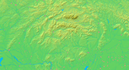

 Location in Slovakia
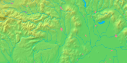
 Location in the Košice Region
Statistics: MOŠ/MIS Website: www.medzev.sk Medzev (Hungarian: Mecenzéf, German: Metzenseifen) is a town and large municipality in Košice-okolie District in the Košice Region of eastern Slovakia.
Contents
History
In historical records the town was first mentioned in 1359. It was founded and settled by ethnic Germans.
Geography
The town lies at an altitude of 313 metres and covers an area of 31.861 km². It has a population of about 3800 people. It is located at the foothills of the Slovak Karst (south) and Volovské vrchy (north) on the Bodva River, around 35 km west of Košice.
Demographics
According to the 2001 census, the town had 3,667 inhabitants. 75.43% of inhabitants were Slovaks, 13.55% Germans, 6.65% Roma, 1.55% Hungarians and 0.44% Czechs.[1] The religious make-up was 77.58% Roman Catholics, 12.95% people with no religious affiliation, 2.18% Greek Catholics and 0.79% Lutherans.[1]
International relations
See also: List of twin towns and sister cities in SlovakiaTwin towns — Sister cities
Medzev is twinned with:
References
- ^ a b "Municipal Statistics". Statistical Office of the Slovak republic. Archived from the original on 2008-02-08. http://web.archive.org/web/20080208225314/http://www.statistics.sk/mosmis/eng/run.html. Retrieved 2008-02-10.
External links
Categories:- Cities and towns in Slovakia
- Villages and municipalities in Košice-okolie District
- Košice-okolie District geography stubs


Wikimedia Foundation. 2010.