- Mittelplate
-
Mittelplate Location of Mittelplate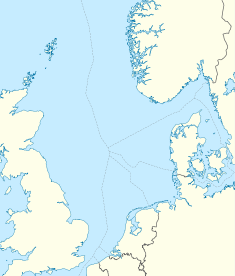

Country Germany Offshore/onshore Offshore Coordinates 54°01′33″N 8°43′52″E / 54.0259°N 8.731°ECoordinates: 54°01′33″N 8°43′52″E / 54.0259°N 8.731°E Operator(s) RWE Dea Partners RWE Dea (50%), Wintershall (50%) Field history Discovery 1981 Start of production 1987 Production Producing formations Middle Jurassic Mittelplate is Germany’s largest oil field which is located 7 km (4.3 mi) from the shore, in environmentally important Schleswig-Holstein Wadden Sea National Parks tidal flats.[1] The development of the field was done by a consortium of RWE Dea AG and Wintershall AG. By the 20th anniversary of the start of production, 20 million tonnes of crude has been produced from the field.[2] Mittelplate field holds nearly 65% of Germany's crude oil reserves[3]
Contents
History
The field was discovered in 1981 by well Mittelplate 1 which confirmed reservoir contained 75 million tonnes of crude oil. By the 1950s, geologists suspected oil off the German coast. Preliminary test borings in the 1960s did indeed turn up indications of oil, though not in economically profitable quantities. The oil crisis of 1973 and 1979 raised awareness of indigenous oil sources. In 1980 and 1981, test borings in the Mittelplate vicinity found oil in several sandstone layers. Due to location of the field in ecologically sensitive area, hydrographic, hydrodynamic and meteorological studies modelling storm, wave, ice-flow conditions were done and an artificial island holding a drilling and production facility was built in 1985.[4]
Technical features
 Mittelplate pipeline construction in the tidal flats
The island which is protected by 11 meter high sheet piling measures at 70 m (230 ft) by 95 m (312 ft). Western section of the field includes 18 production wells. The first oil came onstream in 1987 and was being delivered ashore on 45 metres (148 ft) long by 18 metres (59 ft) wide double hull barges. A new redevelopment plan included the construction of a land-based facility in Dieksand from where 2,000 m (6,600 ft)-3,000 m (9,800 ft) long extended-reach production wells[4] were to tap into the eastern part of the field. As per the development program, a pilot well and seven high-tech extended reach well measuring at 7,727 metres (25,351 ft), 8,284 metres (27,178 ft), 8,367 metres (27,451 ft), 8,995 metres (29,511 ft), 9,275 metres (30,430 ft), 8,450 metres (27,720 ft), 8,672 metres (28,451 ft) and a 4 4 kilometres (2.5 mi) section cutting through the Büsum salt diapir were to ensure a faster exploitation of the field. The redevelopment plan also included construction of 7.5 kilometres (4.7 mi) pipelines from the island to Friedrichskoog-Spitze and 2.8 kilometres (1.7 mi) pipeline to the Dieksand Land Station. This will enabled the Mittelplate consortium to transport up to 1 million tonnes or 7,550,000 barrels (1,200,000 m3) of oil a year.[5] Oil is pumped ashore and water extracted during processing is then routed back by the second pipeline for reinjection into the lower section of reservoir. Modified island facility now contains living accommodation for up to 96 people.[1][6]
Ownership
The Mittelplate Consortium is operated by RWE Dea, but both RWE Dea and Wintershall AG have 50% share in the venture. Out of total capital spending of €670 million by the consortium, €100 million was spent on construction of the pipeline transporting crude oil ashore and €50 million was spent on construction of a new T-150 drilling rig[7] Being an operator of the consortium, RWE Dea accounts for nearly 60% of total domestic oil production in Germany[8]
Production
 Mittelplate A as seen from the sea, in the background you can see the coast
Starting from October 1987, the field has been tapped in several sandstone layers at depths reaching 2,000 m (6,600 ft)-3,000 m (9,800 ft).[2] The size of the deposit was adjusted upward to over 100 million tons, of which 15 million tons were extracted by June 2005. The annual production of Mittelplate Island amounts to 900,000 tons of oil. Under prevailing conditions, about 40 million tons are still economically extractable.[1] Since 2000, nearly horizontal borings (some up to about 9200 meters long) have been extracting from the eastern part of the field directly from land on Dieksand / Friedrichskoog. The oil is piped from there to Brunsbüttel and onward to oil refineries in Hemmingstedt.
Safety and environmental protection
The companies developing the field spent a substantial part of €670 million already invested over 20 years into industrial safety and environmental protection programs due to unique location of the field in Wattenmeer tidelands.[2] Pipe-laying in the area and production in the field have been in accord with National Parks Law.[6] However, Greenpeace along with World Wildlife Fund (WWF) have been active critics of the field development in Wattenmeer. The national park is home to nearly 4,000 species, 250 of which do not exist anywhere in the world but Wattenmeer. Up to 12 million migratory birds use the park rich of mussels, worms, snails, shrimp as a resting place. Nearly 200,000 shelducks are believed to gather around the Elbe river estuary each summer.[9]
References
- ^ a b c Offshore Technology. Mittelplate Redevelopment, Germany
- ^ a b c RWE description of Mitteplate
- ^ Wintershall Press Release 2006. Mittelplate Consortium: New drilling rig develops more Mittelplate oil
- ^ a b Petroleum Geology Conference Series. The Mittelplate oil field
- ^ John Bradbury (2005-01-05). "Mittelplate's makeover". E&P. Hart Energy Publishing, LP. http://www.epmag.com/archives/offshoreReport/2198.htm. Retrieved 2009-12-21.
- ^ a b The Mittelplate project - a production platform in the North Sea tidal flats
- ^ "RWE celebrates 20 years' oil production from Mittelplate Island". Scandinavian Oil and Gas Magazine. 2007-10-07. http://www.scandoil.com/moxie-bm2/news/rwe-celebrates-20-years-oil-production-from-mittel.shtml. Retrieved 2009-12-23.
- ^ ChemCoast Park Brunsbüttel
- ^ Rafaela von Bredow (2008-08-02). "Drilling for Oil in a Coastal Paradise". Spiegel Online International. http://www.spiegel.de/international/germany/0,1518,532656,00.html. Retrieved 2009-12-23.
External links
 Media related to Mittelplate at Wikimedia Commons
- Mittelplate official website
- Bird's-eye view of the Mittelplate drilling island
- Further information from the broadcast Quarks & Co on 25 May 2004
Categories:- Oil fields of Germany
- Geography of Schleswig-Holstein
- North Sea energy
- RWE


Wikimedia Foundation. 2010.