- Monarto, South Australia
-
Monarto
South Australia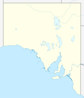
 Monarto
Population: 5254 Established: 1973 Coordinates: 35°04′S 139°07′E / 35.067°S 139.117°ECoordinates: 35°04′S 139°07′E / 35.067°S 139.117°E Time zone: • Summer (DST)
ACST (UTC+9:30) ACDT (UTC+10:30)
Location: 63 km (39 mi) from Adelaide LGA: Rural City of Murray Bridge State District: Kavel Federal Division: Barker Monarto is a region and formerly proposed city in South Australia. It is north of the South Eastern Freeway between the Callington and Murray Bridge exits 63 km from Adelaide.
The land was acquired by the Dunstan state government in the 1970s to create a new city in an effort to limit the continued sprawl of Adelaide. Trees were planted and plans made between 1973 and 1976 with the project receiving A$10.5 million in Commonwealth funding under the 'new cities programme' of the Whitlam Federal Government. However, the plan was eventually cancelled in 1980.[1] This would have been similar to the 1950s Playford government's successful establishment of Elizabeth to the north of Adelaide, although the urban sprawl has since extended to encompass Elizabeth. Monarto would be on the eastern side of the Mount Lofty Ranges, creating a natural barrier to keep the two cities separate.
Unfortunately for Monarto residents, the plan never came to fruition. A large portion of the land has now been taken up by the Monarto Zoo, established in 1983. There are several conservation parks in Monarto - mainly in Monarto South. These parks are often visited by Bush Walkers and Bird Watchers. An industrial estate has also been established at Monarto as part of the growth of the city of Murray Bridge.
Big W have a distribution center located at Monarto.[2] Other large companies with warehousing in Monarto include Scotts Transport, Holden and Inghams
Monarto is adjacent to the main Adelaide to Melbourne railway line, and was formerly a junction for a branch line running north on the plain between the Murray River and the Mount Lofty Ranges. Currently Ferries McDonald Road in Monarto South is in the process of receiving approval for a road upgrade, specifically a bitumization of the road. Due to a colony or colonies of Mallee Fowl the project has had to go through several iterations to ensure that the environmental impact is minimized. This will create a transport link from Langhorne Creek to the Barossa. The Murray Bridge Council are the project managers of this project.
Monarto is home to the Murray Bridge Motocross Club with a track that runs both bikes and quad bikes, and the Monarto Shooting Club.
Most of the residents of Monarto run small hobby like farms, raising cows, sheep and horses. Crops in the area include wheat, oats and barley.
References
- ^ "Urban Planning". Atlas of South Australia. http://www.atlas.sa.gov.au/go/resources/atlas-of-south-australia-1986/the-course-of-settlement/urban-planning. Retrieved 2006-08-29.
- ^ "Big W Distribution Centre - Monarto, SA". Archived from the original on 2008-02-01. http://web.archive.org/web/20080201184628/http://www.fielders.com.au/case_study.asp?csID=2. Retrieved 2008-03-07.
Categories:- Towns in South Australia
- History of South Australia
- Planned cities in Australia

Wikimedia Foundation. 2010.