- Mangochi
-
Mangochi Lake Malawi, on eastern edge of Mangochi Location in Malawi
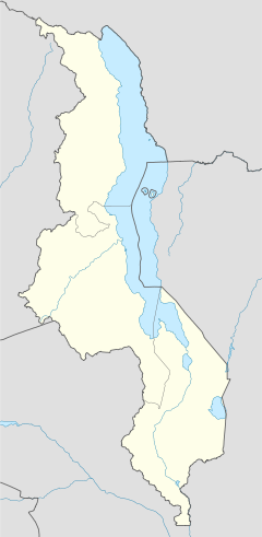
 Mangochi
Coordinates: 14°27′36″S 35°16′12″E / 14.46°S 35.27°E Country  Malawi
Region Southern Region District Mangochi District Population (2008)[1] - Total 51,429 - Languages Yao Time zone +2 Mangochi is a township in the Southern Region of Malawi. Located near the southern end of Lake Malawi, in colonial times it used to be called Fort Johnston. As of 2008 it has a population of 51,429.
Contents
History
Mangochi was founded by colonial administrator Sir Harry Johnston in the 1890s as a British colonial defense post on the littoral plain of the Shire River's western shore.[2] After this, Fort Johnston – as the town was then known – was an important slave market and administrative center.[3]
The British gunboat Gwendolen was built in Mangochi in 1897.[3] At 340 short tons (310 t), it was the largest ship to sail on Lake Malawi until being scrapped shortly after World War II.[3] The gunboat, operated by the Protectorate of Nyasaland, scored an early success in World War I when it defeated the German vessel Hermann von Wissmann in August 1914.[4]
Rioting in June 2003 injured three people.[5] From March to November 2007, roughly 480 children were "rescued" from child labor on tobacco farms in Mangochi.[6] In July 2008, elephants terrorised areas around Maldeco Fisheries in Mangochi and caused several deaths and damage to property, mainly crops.[7] The Ministry of Tourism, Wildlife and Culture proposed moving the elephants into several game reserves, although the proposal stalled when some residents said they wanted the elephants to remain.[7]
Geography
 A diagram depicting the amount of rainfall in Mangochi from August 2007 to July 2008
Mangochi is at an elevation of 1,541 feet (470 m), near the southern end of Lake Malawi, between the main lakeshore road and the Shire River[3] and 5 miles (8 km) south of its entrance into Lake Malombe.[2] The town is roughly 120 miles (190 km) northeast of Blantyre, Malawi's largest city.[5] It is situated 1.4 miles (2.3 km) away from Mponda, 2.2 miles (3.5 km) away from Chipalamawamba, 2 miles (3.2 km) away from Mbaluku Laini and 1.4 miles (2.3 km) away from Yangala.
Demographics
Population development
Year Population[1] 1987 14,758 1998 27,055 2008 51,429 Languages and ethnicities
Yao, specifically of the Mangochi dialect, is the main language spoken in this town.[8] A Swahili settlement was also established in Mangochi.[9] Mangochi is mainly inhabited by the Yao people.[2]
Economy
Mangochi was developed as an agricultural center and has marine-engineering shops. Cash crops grown in the area include tobacco, cotton, and groundnuts.[2] Rice and maize are intensively grown along the lakeshore, and commercial fishing is also important.[2]
Facilities
Amenities
Amenities include several shops, supermarkets, a post office and banks.[3]
Bridges
Within Mangochi there is the Shire Bridge, which Lonely Planet described as "scenic".[3]
Museums
The Lake Malawi Museum houses ethnic, environmental, and historical exhibits.[3] They include the Hotchkiss gun[3] with which the British gunboat Guendolin defeated the German gunboat Hermann von Wissmann with a single shot in their brief naval engagement in August 1914. The museum has also a scale model of the Guendolin.[3] An even older exhibit is a marine steam engine that was built in 1898 and powered the Universities' Mission to Central Africa's SS Chauncy Maples until 1953.[10]
Religion
Mangochi is home to a large mosque[3] as well as a modern Catholic Cathedral.[11]
Clocks
Mangochi is home to a clock tower erected in honour of Queen Victoria, dating back to the early 20th century.[11]
Transport
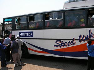
Mangochi is located just off the M3 road.[11] All buses travelling from Monkey Bay to Blantyre stop in Mangochi.[3] Minibuses travel to Liwonde, Zomba, and Blantyre.[3] Matolas travel to Liwonde National Park and to the border town of Chiponde.[3]
Tourism
Mangochi is described by Lonely Planet as having a "vaguely Swahili feel", with "palm trees, Arab-looking people and coconuts for sale in the street."[3] There are several guesthouses and lodges for tourists in Mangochi.[3] Pranay B. Gupte suggested staying at the Nkopola Lodge, where one can swim, fish, and sail.[12]
References
- ^ a b "World Gazetteer: Malawi: largest cities and towns and statistics of their population". World Gazetteer. http://www.world-gazetteer.com/wg.php?x=&men=gcis&lng=en&dat=32&srt=pnan&col=dq&geo=-150. Retrieved 2008-07-17.
- ^ a b c d e "Mangochi". Encyclopaedia Britannica. 2008. http://www.britannica.com/EBchecked/topic/362011/Mangochi. Retrieved 2008-07-18.
- ^ a b c d e f g h i j k l m n o Murphy, Alan; Armstrong, Kate; Firestone, Matthew D.; Fitzpatrick, Mary (2007). Lonely Planet Southern Africa: Join the Safari. Lonely Planet. p. 205. ISBN 1740597451.
- ^ The Story of the Rhodesias and Nyasaland A. J. Hanna Faber and Faber, 1960
- ^ a b "Soldiers Sent To Help Quell Riots in Malawi". The New York Times. 2003-06-29. http://query.nytimes.com/gst/fullpage.html?res=9C00E6DA173AF93AA15755C0A9659C8B63. Retrieved 2008-07-17.
- ^ "Attitudes to Child Labour Changing". UN Integrated Regional Information Networks (AllAfrica). 2006-11-19. http://allafrica.com/stories/200711191244.html. Retrieved 2008-07-17.
- ^ a b Msiska, Karen (2008-07-07). "Mangochi against removal of elephants". The Daily Times. http://allafrica.com/stories/200711191244.html. Retrieved 2008-07-18.
- ^ Baldauf, Richard B.; Kaplan, Robert (2004). Language Planning and Policy in Africa: Botswana, Malawi, Mozambique and South Africa. pp. 85–89. ISBN 1853597252.
- ^ Baldauf, p. 91
- ^ "The Ship". Chauncy Maples, Lake Malawi's Clinic. Chauncy Maples Trust. 2009–2011. http://www.chauncymaples.org/ship/default.php. Retrieved 28 July 2011.
- ^ a b c "Mangochi". Malawi Tourism. http://www.malawitourism.com/Pages/The%20Regions/South/mangochi.html. Retrieved 2008-07-18.
- ^ Gupte, Pranay B. (2008-09-28). "Malawi Now Inviting Visitors to Its Feast of Beauty; Malawi Is Now Inviting Visitors to Share In Its Feast of Natural Beauty If You Go". The New York Times.
External links
Categories:- Populated places in Malawi


Wikimedia Foundation. 2010.