- Mattagami River
-
Mattagami River Rivière Mattagami (French) River  Mattagami River at Smooth Rock Falls
Name origin: Ojibwe language Country Canada Ontario Ontario Region Northeastern Ontario Districts Cochrane, Timiskaming, Sudbury Part of James Bay drainage basin Source Mattagami Lake - location Gouin Township, Sudbury District - elevation 330 m (1,083 ft) - coordinates 48°00′46″N 81°33′28″W / 48.01278°N 81.55778°W Mouth Moose River - location Gardiner Township, Cochrane District - elevation 48 m (157 ft) - coordinates 50°43′42″N 81°29′14″W / 50.72833°N 81.48722°W Length 443 km (275 mi) Basin 37,000 km2 (14,286 sq mi) 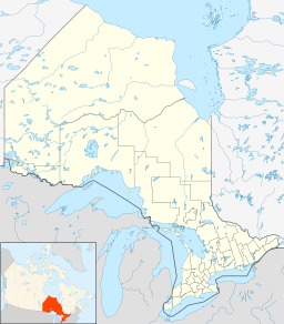
 Location of the mouth of the Mattagami River in Ontario
The Mattagami River is a river in the James Bay drainage basin in Cochrane District, Timiskaming District and Sudbury District in Northeastern Ontario, Canada.[1][2]
The Mattagami flows 443 kilometres (275 mi) from its source at Mattagami Lake in geographic Gouin Township[3] in the Unorganized North Part of Sudbury District, on the Canadian Shield southwest of Timmins,[4] to Portage Island in geographic Gardiner Township[5] in the Unorganized North Part of Cochrane District, in the Hudson Bay Lowlands.[6] Here the Mattagami's confluence with the Missinaibi River forms the Moose River, about 100 kilometres (60 mi) from that river's tidewater outlet at James Bay.[7] The Mattagami River flows through the city of Timmins as well as the town of Smooth Rock Falls[7] and its drainage basin encompasses 37,000 square kilometres (14,000 sq mi).[4]
The Mattagami's name comes from the Ojibwe and means either "the start of water" (maadaagami) or "turbulent water" (madaagami).
Contents
Course
For a map showing the river course, see this reference.[2]
Economy
Where the Groundhog and Kapuskasing Rivers flow into the Mattagami, Ontario Power Generation operates the Little Long Generating Station,[8] with a dam just over 5 km in length.
Tributaries
Tributaries include the:
- Kapuskasing River
- Nemegosenda River
- Chapleau River
- Nemegosenda River
- Groundhog River
- Ivanhoe River
- Nat River
- Kamiskotia River
- Grassy River
- Tatachikapika River
- Mattagami Lake
- Minisinakwa River
- Nabakwasi River
- Opikinimika River
- Noble River
- Nabakwasi River
- Minisinakwa River
References
- ^ "Mattagami River". Geographical Names Data Base. Natural Resources Canada. http://geonames.nrcan.gc.ca/search/unique_e.php?id=FCEAJ&output=xml. Retrieved 2011-09-20.
- ^ a b "Mattagami River". Atlas of Canada. Natural Resources Canada. 2010-02-04. http://atlas.nrcan.gc.ca/site/english/maps/topo/map?mapsize=750%20666&mapxy=953255.528141%20144836.425775&scale=2500000&feature_na=Rivi%E8re%20Mattagami&searchstring=Rivi%E8re%20Mattagami&layers=fapfeature%20fapfeature%20north_arrow%20other_features%20million_grid%20t50k_grid%20grid_50k_3%20roads%20hydrography%20boundary%20builtup%20vegetation%20populated_places%20railway%20power_network%20manmade_features%20designated_areas%20water_features%20water_saturated_soils%20relief%20contours%20toponymy%20contour%20nodata_ntdb_50k&map_layer%5bnortharrow%5d_class%5b0%5d_style%5b0%5d=ANGLE%20-12.102032008891399&urlappend=%26unique_key%3D4190d2aabbe311d892e2080020a0f4c9%26map.layer%5Btextzoom03%5D%3DFEATURE+POINTS+940912.984195+291933.343499+END+TEXT+%22Rivi%25E8re+Mattagami%22+END%26map.layer%5Btextzoom46%5D%3DFEATURE+POINTS+940912.984195+291933.343499+END+TEXT+%22Rivi%25E8re+Mattagami%22+END%26map.layer%5Blineresultzoom0%5D%3DDATA+fap_rivers%26map.layer%5Blineresultzoom1%5D%3DDATA+fap_rivers%26map.layer%5Blineresultzoom2%5D%3DDATA+fap_rivers%26map.layer%5Barrowzoom03%5D%3DFEATURE+POINTS+940912.984195+291933.343499+END+END. Retrieved 2011-09-20. Shows the course of the river highlighted on a map.
- ^ "Gouin" (PDF). Geology Ontario - Historic Claim Maps. Ontario Ministry of Northern Development, Mines and Forestry. http://www.geologyontario.mndmf.gov.on.ca/website/historic_claim_maps/G/Gouin.pdf. Retrieved 2011-09-20.
- ^ a b "Rivers Flowing into Hudson Bay, James Bay or Ungava Bay - Moose River". Rivers. Atlas of Canada. http://atlas.nrcan.gc.ca/site/english/learningresources/facts/rivers.html/#bay. Retrieved 2011-09-20. Length to head of Lake Minissinakwa.
- ^ "Gardiner" (PDF). Geology Ontario - Historic Claim Maps. Ontario Ministry of Northern Development, Mines and Forestry. http://www.geologyontario.mndmf.gov.on.ca/website/historic_claim_maps/G/Gardiner.pdf. Retrieved 2011-09-20.
- ^ "Ecozones". Far North Ontario. Ontario Ministry of Natural Resources. 2011-04-07. http://www.mnr.gov.on.ca/en/Business/FarNorth/2ColumnSubPage/266513.html. Retrieved 2011-09-20.]
- ^ a b Ministry of Transportation of Ontario (2010-01-01) (PDF). Map 15 (Map). 1 : 1,600,000. Official road map of Ontario. http://www.mto.gov.on.ca/english/traveller/map/images/pdf/northont/sheets/Map15.pdf. Retrieved 2011-09-20.
- ^ "Little Long Generating Station". Hydro - Northeast Plant Group. Ontario Power Generation. http://www.opg.com/power/hydro/northeast_plant_group/little_long.asp.
External links
Categories:- Rivers of Ontario
- Timmins
- Geography of Timiskaming District, Ontario
- Geography of Sudbury District, Ontario
- Geography of Cochrane District, Ontario
- Northern Ontario geography stubs
- Kapuskasing River


Wikimedia Foundation. 2010.