- Chenango County, New York
-
Chenango County, New York 
Location in the state of New York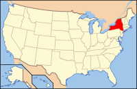
New York's location in the U.S.Founded March 15, 1798 Seat Norwich Area
- Total
- Land
- Water
899 sq mi (2,328 km²)
895 sq mi (2,318 km²)
4 sq mi (10 km²), 0.48%Population
- (2010)
- Density
50,477
56/sq mi (21.7/km²)Website www.co.chenango.ny.us - For other places named "Chenango," see Chenango (disambiguation).
Chenango County is a county located in the U.S. state of New York. As of the 2010 census, the population was 50,477. The county's name originates from an Oneida word meaning "large bull-thistle." Its county seat is Norwich.
Contents
History
When counties were established in what is now the American state of New York in 1683, the present Chenango County was part of Albany County. This was an enormous county, including the northern part of New York State as well as all of the present State of Vermont and, in theory, extending westward to the Pacific Ocean even though territories located to the west of present-day Pennsylvania were under effective French control as part of New France. This county was reduced in size on July 3, 1766, by the creation of Cumberland County, and further on March 16, 1770, by the creation of Gloucester County, both containing territory now in Vermont.
On March 12, 1772, what was left of Albany County was split into three parts, one remaining under the name Albany County. One of the other pieces, Tryon County, contained the western portion (and thus, since no western boundary was specified, theoretically still extended west to the Pacific). The eastern boundary of Tryon County was approximately five miles west of the present city of Schenectady, and the county included the western part of the Adirondack Mountains and the area west of the West Branch of the Delaware River. The area then designated as Tryon County now includes 37 counties of New York State. The county was named for William Tryon, colonial governor of New York.
In the years prior to 1776, most of the Loyalists in Tryon County fled to Canada. In 1784, following the peace treaty that ended the American Revolutionary War, the name of Tryon County was changed to Montgomery County in honor of the general, Richard Montgomery, who had captured several places in Canada and died attempting to capture the city of Quebec, replacing the name of the hated British governor.
 The "Twenty Townships" west of the Unadilla River, conveyed by the Oneida Indians in 1788. Known as "Clinton's Purchase"
In 1789, Montgomery County was reduced in size by the splitting off of Ontario County. The actual area split off from Montgomery County was much larger than the present county, also including the present Allegany, Cattaraugus, Chautauqua, Erie, Genesee, Livingston, Monroe, Niagara, Orleans, Steuben, Wyoming, Yates, and part of Schuyler and Wayne Counties.
Herkimer and Tioga Counties were two of three counties split off from Montgomery County (the other being Otsego County) in 1791.
Chenango County was formed on March 15, 1798 from 1,610 square miles (4,170 km2) of Tioga and Herkimer Counties.
On April 4, 1804, 70 square miles (180 km2) of Chenango County was partitioned to expand Oneida County, including the communities of Waterville, and Sangerfield.
On March 21, 1806, 650 square miles (1,680 km2) of Chenango County was partitioned to produce Madison County. This produced Chenango County as it exists today.
Government and politics
Chenango County is considered a red county. In 2004 Republican George Bush won by a 11% margin over Democrat John Kerry. In 2006 it, surprisingly, choose both Eliot Spitzer and Hillary Clinton carried it winning 57% and 54% of the vote. In 2008 John McCain carried Chenango County over Barack Obama by a surprisingly close margin of 49.59%-48.45% or a difference of 237 votes.[1] In 2010 Andrew Cuomo, Chuck Schumer and Kirsten Gillibrand each carried it.
Geography
Chenango County is in the approximate center of the state, west of Albany, north of Binghamton, and southeast of Syracuse. The county is considered to be in the Southern Tier region of New York State.
According to the U.S. Census Bureau, the county has a total area of 899 square miles (2,328.4 km2), of which 894 square miles (2,315.4 km2) is land and 4 square miles (10.4 km2) (0.48%) is water.
The Chenango River, a tributary of the Susquehanna River flows southward through the county.
Adjacent counties
- Madison County, New York - north
- Otsego County, New York - northeast
- Delaware County, New York - southeast
- Broome County, New York - south
- Cortland County, New York - west
Cities, towns, and villages
Norwich, the county seat, is the only city in Chenango County. Other settlements in the county are designated villages or hamlets.
In New York, a "town" is a political subdivision (synonymous with township). The towns in northern Chenango County originated from the Twenty Townships ceded by the Oneida tribe to the State of New York.
In addition to the city of Norwich, the county has the following named towns and villages:
- Afton (village)*
- Afton (town)
- Bainbridge (town)
- Bainbridge (village)
- Columbus (town)
- Coventry (town)
- Earlville (village)
- German (town)
- Greene (town)
- Greene (village)
- Guilford (town)
- Lincklaen (town)
- McDonough (town)
- New Berlin (town)
- New Berlin (village)
- North Norwich (town)
- Norwich (town)
- Otselic (town)
- Oxford (town)
- Oxford (village)
- Pharsalia (town)
- Pitcher (town)
- Plymouth (town)
- Preston (town)
- Rockdale (hamlet)
- Sherburne (town)
- Sherburne (village)
- Smithville (town)
- Smyrna (town)
- Smyrna (village)
- South Otselic (town)
Demographics
Historical populations Census Pop. %± 1800 15,666 — 1810 21,704 38.5% 1820 31,215 43.8% 1830 37,238 19.3% 1840 40,785 9.5% 1850 40,311 −1.2% 1860 40,934 1.5% 1870 40,564 −0.9% 1880 39,891 −1.7% 1890 37,776 −5.3% 1900 36,568 −3.2% 1910 35,575 −2.7% 1920 34,969 −1.7% 1930 34,665 −0.9% 1940 36,454 5.2% 1950 39,138 7.4% 1960 43,243 10.5% 1970 46,368 7.2% 1980 49,344 6.4% 1990 51,768 4.9% 2000 51,401 −0.7% 2010 50,477 −1.8% Source: NYSDED[1][2] As of the census[3] of 2000, there were 51,401 people, 19,926 households, and 13,549 families residing in the county. The population density was 58 people per square mile (22/km²). There were 23,890 housing units at an average density of 27 per square mile (10/km²). The racial makeup of the county was 97.65% White, 0.82% Black or African American, 0.27% Native American, 0.28% Asian, 0.02% Pacific Islander, 0.22% from other races, and 0.74% from two or more races. 1.07% of the population were Hispanic or Latino of any race. 20.2% were of English, 14.5% German, 13.8% Irish, 12.3% American and 8.9% Italian ancestry according to Census 2000 [2]. 96.7% spoke English and 1.3% Spanish as their first language.
There were 19,926 households out of which 32.50% had children under the age of 18 living with them, 53.10% were married couples living together, 9.80% had a female householder with no husband present, and 32.00% were non-families. 26.10% of all households were made up of individuals and 11.40% had someone living alone who was 65 years of age or older. The average household size was 2.52 and the average family size was 3.01.
In the county the population was spread out with 26.20% under the age of 18, 7.00% from 18 to 24, 27.50% from 25 to 44, 24.40% from 45 to 64, and 14.90% who were 65 years of age or older. The median age was 38 years. For every 100 females there were 97.00 males. For every 100 females age 18 and over, there were 94.70 males.
The median income for a household in the county was $33,679, and the median income for a family was $39,711. Males had a median income of $30,363 versus $22,429 for females. The per capita income for the county was $16,427. About 10.70% of families and 14.40% of the population were below the poverty line, including 19.50% of those under age 18 and 8.70% of those age 65 or over.
Education
Morrisville State College has a branch in Norwich.
See also
- List of counties in New York
- National Register of Historic Places listings in Chenango County, New York
References
Notes
Sources
- NEW YORK: Atlas of Historical County Boundaries; Compiled by Kathryn Ford Thorne; Edited by John H. Long.
External links
- Chenango County, NY government
- Chenango County "Online Visitors Travel Guide"
- Chenango County at the Open Directory Project
- Chenango County GenWeb
- Chenango County Democratic Committee
- The Evening Sun, Chenango County newspaper
- Chenango County Chamber of Commerce

Madison County Otsego County Cortland County 
 Chenango County, New York

Broome County Delaware County Municipalities and communities of Chenango County, New York City 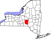
Towns Villages Afton | Bainbridge | Earlville‡ | Greene | New Berlin | Oxford | Sherburne | Smyrna
Hamlets Holmesville | Mount Upton | Rockdale
Footnotes ‡This populated place also has portions in an adjacent county or counties
Categories:- New York counties
- Chenango County, New York
- 1798 establishments in the United States
- Populated places established in 1798


Wikimedia Foundation. 2010.