- Colatina
-
Coordinates: 19°32′20″S 40°37′51″W / 19.53889°S 40.63083°W
Contents
Geography
Colatina is the second largest city in the north of Espírito Santo, Brazil, 127 km north of the capital Vitória and on the trainline from Vitória to Minas Gerais. It lies on the banks of the Doce river, through which as much as 700 cubic meters of water per second may flow. Its population was 110,513 (2005) and its area is 1,423 km².[1]
History
The first attempts to colonize the area where Colatina now lies were in 1857. 46 people established themselves in the area, which was easy at first, as land had already been assigned to each family. This proved unsustainable, though, when the Indians attacked the colony and massacred quite a number of people. In 3 years, all of the colonists had left the area, and it would be another 30 years before major influx would start up again. Until then, small advances were made along small river tributaries, which went on until 1925. Only after 1928, after the completion of the bridge over the Doce river, did more stable and sustained growth come to the region.
The city is the seat of the Roman Catholic Diocese of Colatina.
References
External links
 Municipalities of Espírito Santo
Capital: Vitória Mesoregion Central Afonso CláudioGuarapariSanta TeresaVitória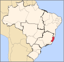
Mesoregion Litoral Norte LinharesMontanhaSão MateusMesoregion Noroeste Barra de São FranciscoColatinaNova VenéciaMesoregion Sul AlegreAlegre · Divino de São Lourenço · Dores do Rio Preto · Guaçuí · Ibatiba · Ibitirama · Irupi · Iúna · Muniz FreireCachoeiro de ItapemirimItapemirimCategories:- Municipalities of Brazil
- Populated places in Espírito Santo
- Espírito Santo geography stubs

Wikimedia Foundation. 2010.