- Crawinkel
-
Crawinkel 

 CrawinkelLocation of Crawinkel within Gotha district
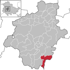

Coordinates 50°47′0″N 10°47′0″E / 50.783333°N 10.783333°ECoordinates: 50°47′0″N 10°47′0″E / 50.783333°N 10.783333°E Administration Country Germany State Thuringia District Gotha Mayor Stefan Schambach Basic statistics Area 25.27 km2 (9.76 sq mi) Elevation 469 m (1539 ft) Population 1,563 (31 December 2010)[1] - Density 62 /km2 (160 /sq mi) Other information Time zone CET/CEST (UTC+1/+2) Licence plate GTH Postal code 99330 Area code 03624 Website www.crawinkel.de Crawinkel is a municipality in the eastern part of Germany in the district of Gotha, Thuringia. Crawinkel was first mentioned in 1088.
After the Armistice with France in 1940, during World War II, German forces took numerous memorials from the forest of Compiègne, where the Armistice with Germany that ended World War I was also signed, as prizes to Crawinkel. These included the actual railway carriage where both armistices were concluded. In 1945, the car was dynamited and its pieces buried. Since the German reunification in 1989, numerous artifacts have been recovered and returned to France.
References
- ^ "Bevölkerung nach Gemeinden, erfüllenden Gemeinden und Verwaltungsgemeinschaften" (in German). Thüringer Landesamt für Statistik. 31 December 2010. http://www.statistik.thueringen.de/datenbank/TabAnzeige.asp?tabelle=gg000102%7C%7C.
Towns and municipalities in Gotha (district) Aspach • Ballstädt • Bienstädt • Brüheim • Bufleben • Crawinkel • Dachwig • Döllstädt • Drei Gleichen • Ebenheim • Emleben • Emsetal • Eschenbergen • Friedrichroda • Friedrichswerth • Friemar • Fröttstädt • Georgenthal • Gierstädt • Goldbach • Gotha • Gräfenhain • Großfahner • Günthersleben-Wechmar • Haina • Herrenhof • Hochheim • Hohenkirchen • Hörselgau • Laucha • Leinatal • Luisenthal • Mechterstädt • Metebach • Molschleben • Nesse-Apfelstädt • Nottleben • Ohrdruf • Petriroda • Pferdingsleben • Remstädt • Schwabhausen • Sonneborn • Tabarz • Tambach-Dietharz • Teutleben • Tonna • Tröchtelborn • Trügleben • Tüttleben • Waltershausen • Wangenheim • Warza • Weingarten • Westhausen • Wölfis • Zimmernsupra Categories:
- Municipalities in Thuringia
- Gotha district geography stubs


Wikimedia Foundation. 2010.