- Moleson Creek
-
Moleson Creek Location in Guyana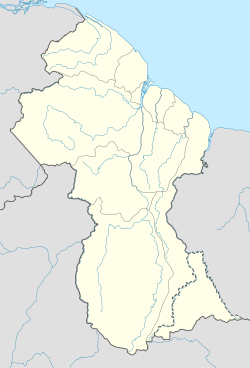
 Moleson Creek
Coordinates: 5°30′N 57°15′W / 5.5°N 57.25°WCoordinates: 5°30′N 57°15′W / 5.5°N 57.25°W Country  Guyana
Region East Berbice-Corentyne Moleson Creek is a community on the Corentyne River in the East Berbice-Corentyne region of Guyana, located at 5°30′0″N 57°15′0″W / 5.5°N 57.25°W. It is north of Orealla Mission, 10km south of Corriverton, and approximately 90 km from New Amsterdam.
Since 1998, the CANAWAIMA ferry connects South Drain with South Drain in Suriname.[1] This is the only legal connection between the two countries, but before the repavement of the road between South Drain and Nieuw Nickerie many travelers preferred to take a back-track route.[2]
References
- ^ Ministerie van Transport, Communicatie en Toerisme - De Canawaima Ferry Service Incorporated
- ^ Kaieteur News - Canawaima Ferry Service seeks to boost travel
Settlements in GuyanaFor the definition of city, town, etc see Settlements in Guyana. Cities Towns Albion · Anna Regina · Bartica · Corriverton · Fort Wellington · Ituni · Lethem · Linden · Mabaruma · Mahaica · Mahaicony · New Amsterdam · Paradise · Rosignol · Skeldon · Vreed en HoopVillages Adventure · Aishalton · Annai · Arimu Mine · Belfield · Beterverwagting · Better Hope · Biloku · Blairmont · Burma · Buxton · Campbelltown · Cane Grove · Charity · Clonbrook · Crabwood Creek · El Paso · Enmore · Enterprise · Esau and Jacob · Everton · Fort Washington · Good Hope · Governor Light · Hackney · Helena · Holmia · Hope · Hosororo · Hyde Park · Imbaimadai · Isherton · Issano · Isseneru · Jonestown · Kabakaburi · Kalkuni · Kamarang · Kamikusa · Kamwatta Hill · Kangaruma · Kartabo · Kartuni · Keweigek · Koriabo · Kumaka, Barima-Waini · Kumaka, East Berbice-Corentyne · Kuru Kuru · Kurupakari · Kurupung · Kwakwani · Kwebanna · Leonora · Long Creek · Lusignan · Mahdia · Maicobi · Makouria · Mara · Matthew's Ridge · Meten-Meer-Zorg · Moleson Creek · Mora Point · Morawhanna · Moruca · New Found Out · Nonpareil · Orealla · Orinduik · Paramakatoi · Parika · Peters Mine · Pickersgill · Port Kaituma · Port Mourant · Potaro Landing · Princeville · Providence · Rockstone · Rose Hall · Santa Rosa · Saveretik · Saxacalli · Schoon Ord · Seweyo · Silver Hill · Spring Garden · St. Monica Karawab · Suddie · Surama · Takama · Three Friends · Timehri · Towakaima · Tumatumari Landing · Tumatumari · Tumereng · Uitvlugt · Unity Village · Victoria · Wakapau · Wandaik · Wel te Vreeden · Weldaad · Wichabai · Wowetta · Zeeburg · ZeelandiaCommunities Estates Catherinas Lust · Dadanawa RanchMissions Neighbourhoods GeorgetownCategories:- Populated places in Guyana
- East Berbice-Corentyne
- Guyana geography stubs

Wikimedia Foundation. 2010.