- Cooch Behar
-
This article is about the municipality in West Bengal, India. For its namesake district, see Cooch Behar district.For other uses, see Cooch Behar (disambiguation).
Cooch Behar — city — 
Coordinates 26°19′27″N 89°27′04″E / 26.32419°N 89.45103°ECoordinates: 26°19′27″N 89°27′04″E / 26.32419°N 89.45103°E Country India State West Bengal District(s) Cooch Behar Chairman Biren Kundu Parliamentary constituency Cooch Behar (SC) Assembly constituency Cooch Behar Uttar (SC), Cooch Behar Dakshin, Natabari Population
• Density
106,760 (2011[update])
• 12,878 /km2 (33,354 /sq mi)
Time zone IST (UTC+05:30) Area 8.29 km2 (3 sq mi) Website coochbehar.nic.in Cooch Behar (pronounced /ˌkuːtʃ bɨˈhɑr/; Bengali: কোচবিহার, Kochbihar ? [kotʃbihaɾ]) is the district headquarters and the largest city of Cooch Behar District in the Indian state of West Bengal. It is situated in the foothills of the Eastern Himalayas and located at 26°22′N 89°29′E / 26.367°N 89.483°E. Cooch Behar is the only planned town in North Bengal region with remnants of royal heritage.[1] One of the main tourist destinations in West Bengal, the town is well-known for the Cooch Behar Palace and Madan Mohan Bari temple and has been declared a heritage town.[2] It is also well known for being the maternal home of Maharani Gayatri Devi.
During the British Raj, the town of Cooch Behar was the seat of the princely state of Koch Bihar, ruled by the Koch dynasty. After 20 August 1949, Cooch Behar District was transformed from a princely state to its present status, with the town of Cooch Behar as its headquarters.[3]
Contents
Etymology
Main article: Etymology of Cooch BeharThe name Cooch-Behar is derived from the name of the Koch or Rajbongshi tribes indigenous to this region for many centuries.[4] The word Behar is derived from Sanskrit: विहार vihara.
History
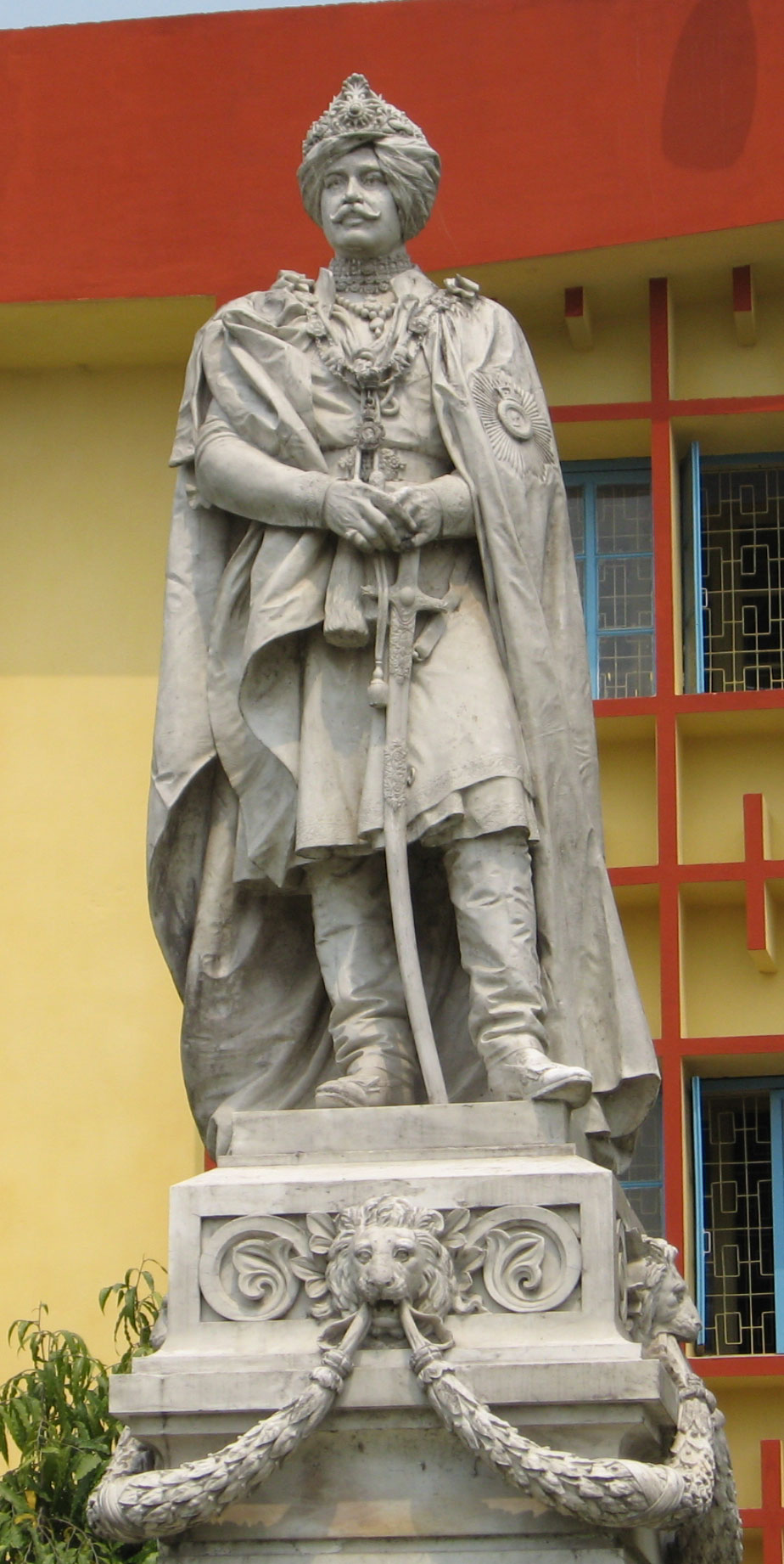
See also: Koch dynasty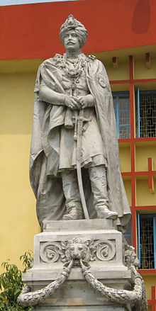 Maharaja Nripendra Narayan
The princely state known during British rule as Cooch Behar had been part of the Kamarupa Kingdom from the 4th century to the 12th century. In the 12th century, the area became a part of the Kamata Kingdom, first ruled by the Khen dynasty from their capital at Kamatapur. The Khens were an indigenous tribe, and they ruled till about 1498 CE, when they fell to Alauddin Hussain Shah, the independent Pathan Sultan of Gour. The new invaders fought with the local Bhuyan chieftains and the Ahom king Suhungmung and lost control of the region. During this time, the Koch tribe became very powerful and proclaimed itself Kamateshwar (Lord of Kamata) and established the Koch dynasty.
The first important Koch ruler was Biswa Singha, who came to power in 1510 or 1530 CE.[5] Under his son, Nara Narayan, the Kamata Kingdom reached its zenith.[6] Nara Narayan's younger brother, Shukladhwaj (Chilarai), was a noted military general who undertook expeditions to expand the kingdom, and he became governor of its eastern portion. After Chilarai's death, his son Raghudev became governor of this eastern portion. Since Nara Narayan did not have a son, Raghudev was seen as the heir apparent. However, a late child of Nara Narayan removed Raghudev's claim to the throne. To placate him, Nara Narayan had to anoint Raghudev as a vassal chief of the portion of the kingdom east of the Sankosh river. This area came to be known as Koch Hajo. After the death of Nara Narayan in 1584, Raghudev declared independence, and the kingdom ruled by the son of Nara Narayan, Lakshmi Narayan, came to be known as Cooch Behar. The division of the Kamata Kingdom into Koch Behar and Koch Hajo was permanent. Koch Behar aligned itself with the Mughal Empire and finally joined the India as a part of the West Bengal, whereas remnants of the Koch Hajo rulers aligned themselves with the Ahom kingdom and the region became a part of Assam.
The early capital of Koch Kingdom (Cooch Behar) was not static and became stable only when shifted to Cooch Behar town. Maharaja Rup Narayan, on the advice of an unknown saint, transferred the capital from Attharokotha to Guriahati (now called Cooch Behar town) on the banks of the Torsa river between 1693 and 1714. After this, the capital was always in or near its present location.
In 1661 CE, Maharaja Pran Narayan planned to expand his kingdom. However, Mir Jumla, the subedar of Bengal under the Mughal emperor Aurangazeb, attacked Cooch Behar and conquered the territory, meeting almost no resistance.[7] The town of Cooch Behar was subsequently named Alamgirnagar.[8] However, Maharaja Pran Narayan regained his kingdom within a few days.
During 1772–1773, the king of Bhutan attacked and captured Cooch Behar. To expel the Bhutanese, the kingdom of Cooch Behar signed a treaty with the British East India Company on 5 April 1773, and the king of Cooch Behar became a feudal ruler under the British.[9]
The famous Victor Jubilee Palace, a landmark in the city, was designed on the lines of Buckingham Palace of London, in 1887, during the reign of Maharaja Nripendra Narayan.[8] In 1878, the maharaja married the daughter of Brahmo preacher Keshab Chandra Sen, and this union led to a renaissance in Cooch Behar state.[10] Maharaja Nripendra Narayan is known as the architect of modern Cooch Behar town.[11]
Under an agreement between the kings of Cooch Behar and the Indian Government at the end of British rule, Maharaja Jagaddipendra Narayan transferred full authority, jurisdiction and power of the state to the Dominion Government of India, effective 12 September 1949.[3] Cooch Behar District became part of the state of West Bengal on 19 January 1950, with Cooch Behar town as its headquarters.[3]
Geography
 Torsa River near Cooch Behar
Cooch Behar is situated in the foothills of Eastern Himalayas, located at 26°22′N 89°29′E / 26.367°N 89.483°E in the north of West Bengal. It is the largest town and district headquarters of Cooch Behar District with an area of 8.29 km².[12]
The Torsa river flows by the western side of town. Heavy rains in the area often cause strong river currents and flooding. The turbulent water carries huge amounts of sand, silt, and pebbles, which have an adverse effect on crop production as well as on the hydrology of the region.[13] Alluvial deposits form the soil, which is acidic.[13] Soil depth varies from 15 cm to 50 cm, superimposed on a bed of sand. The foundation materials are igneous and metamorphic rocks at a depth 1000 m to 1500 m. The soil has low levels of nitrogen with moderate levels of potassium and phosphorus. Deficiencies of boron, zinc, calcium, magnesium, and sulphur are high.[13]
The town of Cooch Behar and its surrounding regions face deforestation due to increasing demand for fuel and timber, as well as air pollution from increasing vehicular traffic. The local flora include palms, bamboos, creepers, ferns, orchids, aquatic plants, fungi, timber, grass, vegetables, and fruit trees. Migratory birds, along with many local species, are found in the city, especially around the Sagardighi and other water bodies.[14]
Climate
Five distinct seasons (summer, monsoons, autumn, winter and spring) can be observed in Cooch Behar, of which summer, monsoons and winter are more prominent. Cooch Behar has a moderate climate characterised by heavy rainfall during the monsoons and slight rainfall from October to mid-November.[13] The district does not have high temperatures at any time of the year. The summer season is from April, the hottest month, to May. During the summer season, the mean daily maximum temperature is 36.5°C, and the mean daily minimum is 20.2 °C.[15] The winter season lasts from the end of November to February; January is the coldest, when temperature ranges between 10.4 °C and 24.1 °C.[15] The lowest and highest temperatures recorded have been 3.9 °C and 39.9 °C respectively.[citation needed] The atmosphere is highly humid throughout the year except from February to May, when relative humidity is around 50 to 70 percent. The rainy season lasts from June to September. Average annual rainfall in the district is 3,201 mm.[15] However, the climate has undergone a drastic change in the past few years, with the mercury rising and the rainfall decreasing each year.[16]
Economy
 Most of the government offices are situated in the Sagardighi area
The central and state governments are the largest employers in Cooch Behar town.[citation needed]. Cooch Behar is home to a number of district-level and divisional-level offices and has a large government-employee workforce. Business is mainly centred on retail goods; the main centres lie on B.S. Road, Rupnarayan Road, Keshab Road and at Bhawaniganj Bazar.
An industrial park has been built at Chakchaka, just four kilometres from town, on the route to Tufanganj. A number of small companies such as Poddar Food Products Pvt., Ltd, and Deepa Casing Pvt., Ltd have set up industries there.[17]
Farming is a major source of livelihood for the nearby rural populace, and it supplies the town with fruits and vegetables. Poorer sections of this semi-rural society are involved in transport, basic agriculture, small shops and manual labour in construction. As the town is near the international border, the Border Security Force (B.S.F.) maintains a large presence in the vicinity of Cooch Behar. This gives rise to a large population of semi-permanent residents, who bring revenue to the local economy. The state government is trying to promote Cooch Behar as a tourist destination, though income from tourism is low.[18]
Civic administration
 The office of the District Magistrate
Cooch Behar Municipality is responsible for the civic administration of the town. The municipality consists of a board of councillors, elected from each of the 20 wards[19] of Cooch Behar town as well as a few members nominated by the state government. The board of councillors elects a chairman from among its elected members; the chairman is the executive head of the municipality. The present chairman is Biren Kundu. Currently, the Indian National Congress Party holds power in the municipality. The state government looks after education, health and tourism in the town.
The town is within the Cooch Behar (Lok Sabha constituency) and elects one member to the Lok Sabha (the Lower House of the Indian Parliament). The town area is covered by one assembly constituency, Cooch Behar Dakshin that elects one member to the Vidhan Sabha, which is the West Bengal state legislative assembly.[20] Cooch Behar town comes under the jurisdiction of the district police (which is a part of the state police); the Superintendent of Police oversees the town's security and matters pertaining to law and order. Cooch Behar is also home to the District Court.
Utility services
Cooch Behar is a well-planned town,[21] and the municipality is responsible for providing basic services, such as potable water and town sanitation. The water is supplied by the municipality using its groundwater resources, and almost all the houses in the municipal area are connected through the system. Solid waste is collected every day by the municipality van from individual houses. The surface drains, mostly uncemented, drain into the Torsa River. Electricity is supplied by the West Bengal State Electricity Board, and the West Bengal Fire Service provides emergency services like fire tenders. Most of the roads are metalled (macadam), and street lighting is available throughout the town. The Public Works Department is responsible for road maintenance in the town and on the roads connecting Cooch Behar with other towns in the region. Health services in Cooch Behar include a government-owned District Hospital, a Regional Cancer Centre, and private nursing homes.
Transport
 Coochbehar Airport
Rickshaws are the most widely available public transport within Cooch Behar town. Most of Cooch Behar's residents stay within a few kilometres of the town centre and have their own vehicles, mostly motorcycles and bicycles.
The New Cooch Behar railway station is around five kilometres from town and is well connected to almost all major Indian cities including Kolkata, Delhi, Mumbai, Bangalore, Chennai, Guwahati. The rail route is one of the important connecting North-East India with remaining parts of the country. All express and Superfast trains going towards North East have a stoppage here. Another station named Cooch Behar situated inside the town exists but only two pairs of local trains run on this route.
Cooch Behar is headquarters of the North Bengal State Transport Corporation, which runs regular bus service to places in West Bengal, Assam and Bihar. Private buses are also available. Most buses depart from the Central Bus Terminus near Cooch Behar Rajbari. Hired vehicles are also available from the taxi stand near Transport Chowpathi.
Cooch Behar has an airport with flight services run by a regional airline named North East Shuttels to Kolkata and Guwahati.[22] Another nearest airport is in Bagdogra near Siliguri, about 160 kilometres from Cooch Behar. Indian Airlines, Jet Airways and Kingfisher Airlines are the major carriers that connect the area to Delhi, Kolkata, Guwahati, Mumbai, Chennai, Bangkok, Paro, Chandigarh.
Demographics
In the 2011 census, Cooch Behar Urban Agglomeration had a population of 106,760, out of which 53,803 were males and 52,957 were females. The 0-6 years population was 7,910. Effective literacy rate for the 7+ population was 91.75 per cent.[23]
See also: List of cities in West BengalAs per the 2001 census,[24] the Cooch Behar municipal area has a population of 76,812. The sex ratio is 972 females per 1,000 males. The decadal growth rate for population is 7.86 %. Males constitute 50.6% of the population, and females constitute 49.4%. Cooch Behar has an average literacy rate of 82%, which is higher than the national average of 64.84%. The male literacy rate is 86%, while female literacy rate is 77%. In Cooch Behar, 9% of the population is under 6 years of age.[25]
The major religions followed in Cooch Behar are Hinduism, followed by Islam; Christianity and Sikhism. The religious composition is closely linked with that of Bengal and Assam with 76.44% hindus and 23.34% muslims.[15]
Communities that inhabit Cooch Behar include the Bengalis, Gorkha, Marwaris, Biharis and Rajbangsi. Commonly spoken languages include Bengali and Hindi. English and Assameese are understood by most of the people.[15]
Culture
 The Ras Chakra during Ras Mela in Madan Mohan Bari
Popular festivals in Cooch Behar include, Durga Puja in October, along with Ras Purnima, when a big fair is organised in the town near the famous Madan Mohan Temple.[26] Cooch Behar Ras mela is the oldest in the North Bengal region.[27] Other major festivals celebrated in the region include Pohela Baishakh (Bengali New Year), Rathayatra, Dolyatra or Basanta-Utsab, Diwali, Poush parbon (festival of Poush), Christmas, Eid ul-Fitr and Eid ul-Adha. During Rathayatra, a small fair is organised at Gunjabari area of the town.
Cooch Behar has a mixture of cultures, similar to those of West Bengal and Bangladesh. Rice and fish are traditional favorites, leading to a common saying that "fish and rice make a Bengali" (machhe bhate bangali). Meat consumption has increased with higher production in recent years. Bhuna Khicuhri (a dish made of rice and dal) and labra (a fully mixed-vegetable preparation) are quite popular and are served during any religious occasion. As in any part of West Bengal, people of Cooch Behar are known to prepare distinctive confections from milk products; popular ones are Rôshogolla, Chômchôm Kalakand Sandesh Misti Doi and Kalojam. Bengal's vast repertoire of fish-based dishes includes various hilsa, ilish preparations (a favorite among Bengalis). Fast foods, such as Paratha (fried bread), egg roll (flatbread roll with vegetable stuffings and egg), and phuchka (deep fried crêpe with tamarind and lentil sauce), are also widely popular. The momo is another popular snack made from vegetable or meat filling, which is steamed and served with a soup. Another popular snack is Ghatigaram, a variety of Jhalmuri (a mixture made out of flattened rice and other spices).
Bengali women commonly wear a sari (shaŗi) and the salwar kameez, which are distinctly designed as per local customs. However, Western-style attire is also quite popular, especially amongst youngsters. Men wear traditional costumes such as the kurta with dhoti or pyjama, often on religious occasions.
A characteristic feature of Cooch Behar is the Para or neighbourhoods with a strong sense of community attachment. Typically, every para has its own community club with a clubroom and often a playground. People here habitually indulge in adda or leisurely chat, and these adda sessions are often a form of freestyle intellectual conversation. Residents of Cooch Behar are fond of music and generally listen to Rabindra Sangeet, Bangla Bands, Hindi Pop music and the local Bhawaiya Sangeet. The local Bengali dialect, is different from the one spoken in Kolkata. The local dialect is more closer to that of East Bengal and a mix of Assamese and Rajbangsi language.
The sole museum in Cooch Behar is located inside the Cooch Behar Palace. It has a variety of photographs and articles used by the maharajas of Cooch Behar and also information about the tribals of North Bengal. The town boasts a well-archived North Bengal State Library. Rabindra Bhawan, an auditorium, is often chosen as the venue for cultural events such as dramas, concerts, poetry-recitals, and dance programs. Temples exist throughout region; the Madan Mohan Temple, Bara Debi Bari and Rajmata Temple are centres of religious and cultural importance.
Education
 A.B.N. Seal College Building
Cooch Behar's schools are either run by the state government or by private and religious organisations. The schools usually use English and Bengali as their medium of instruction, although the use of national language Hindi is also stressed. The schools are affiliated with the ICSE or the CBSE or the West Bengal Board of Secondary Education. Some of the reputed schools in the town include Jenkins School, Sunity Academy, Kendriya Vidyalaya, St. Mary’s H.S. School, B.D. Jain Modern School, Cooch Behar Rambhola High School, Nipendra Narayan H.S. School, Maharani Indira Devi High School and Uchha Balika Vidhyalaya. There are five[28] colleges and a polytechnic in the Cooch Behar town including A.B.N. Seal College, Cooch Behar College, University B.T. & Evening College, Thakur Panchanan Mahila Mahavidyalaya all of which are affiliated with the University of North Bengal, Siliguri and Cooch Behar Polytechnic (Estd. August 1964) a Government Diploma level Institute with 3 yrs.(10+) Civil, Electrical, Mechanical & Automobile Engineering and 2 yrs.(12+) Pharmacy course under West Bengal State Council of Technical Education, Kolkatta.
There is also an Agricultural University, Uttar Banga Krishi Vishwavidyalaya, situated just outside the main town at Pundibari.
Media
Newspapers in Cooch Behar include English language dailies, The Statesman and The Telegraph, which are printed in Siliguri, and The Hindustan Times and the Times of India, which are printed in Kolkata and received after a day's delay. In addition, Hindi and Bengali publications, including Anandabazar Patrika, Bartaman, Ganashakti, Uttar Banga Sambad and Dainik Jagran, are available.
The public radio station All India Radio is the only radio channel that can be received in Cooch Behar. However, recently WorldSpace Satellite Radio has started transmission in Cooch Behar.[clarification needed] Cooch Behar receives almost all the television channels available in the rest of the country. Apart from the state-owned terrestrial network Doordarshan, cable television serves most of the homes in the town, while satellite television is common in the outlying areas and in wealthier households. Besides mainstream Indian television channels, the town also receives Nepali television channels and Bangladeshi television channels.
Cooch Behar has three cinema halls, featuring Hindi, Bengali, and English films. Internet cafés are available in the main market area, connected through broadband, provided by BSNL. The area is serviced by local cell phone companies such as BSNL, Reliance Infocomm, Vodafone, Aircel, Tata Indicom and Airtel.
Sports
 Cooch Behar Stadium
Like most other towns in India, Cooch Behar has not been left out in the game of cricket. Cricket is the most popular game followed by football, swimming, badminton, volley ball, kabadi. Cooch Behar has two outdoor stadiums, M.J.N. Stadium and Cooch Behar Stadium, for games such as cricket and football. Cooch Behar also has a new indoor stadium, Netaji Subhas Indoor Stadium. Inter-district and inter-school meets are often held in these stadiums. Swimming is practised under the guidance of trained coaches in the local Sagardighi. The popularity of games changes according to the season - for example, cricket and badminton are played during winter, swimming and water polo in summer and football during the monsoon. Cooch Behar town is one of few district towns in India with three stadiums.
Notes
- ^ Coochbehar
- ^ The Tribune, Chandigarh, India - Nation
- ^ a b c "Brief Royal History of Cooch Behar 5". http://coochbehar.gov.in/HTMfiles/brief_history.html. Retrieved 2006-10-22.
- ^ Pal, Dr. Nripendra Nath (2000). Itikathai Cooch Behar (A brief history of Cooch Behar). Kolkata: Anima Prakashani. pp. 11–12.
- ^ Royal history of Cooch Behar
- ^ "Royal History of Cooch Behar". http://coochbehar.gov.in/HTMfiles/royal_history.html. Retrieved 2006-10-22.
- ^ Pal, Dr. Nripendra Nath (2000). Itikathai Cooch Behar (A brief history of Cooch Behar). Kolkata: Anima Prakashani. p. 68.
- ^ a b "Royal Banglapedia Kamta-Koch Behar". http://banglapedia.search.com.bd/HT/K_0064.htm. Retrieved 2006-10-01.
- ^ Pal, Dr. Nripendra Nath (2000). Itikathai Cooch Behar (A brief history of Cooch Behar). Kolkata: Anima Prakashani. p. 73.
- ^ Pal, Dr. Nripendra Nath (2000). Itikathai Cooch Behar (A brief history of Cooch Behar). Kolkata: Anima Prakashani. p. 75.
- ^ "Royal History of Cooch Behar 5". http://coochbehar.gov.in/Htmfiles/history_book5.html. Retrieved 2006-10-22.
- ^ "West Bengal Census". http://web.cmc.net.in/wbcensus/DataTables/02/Table4_3.htm. Retrieved 2006-10-01.
- ^ a b c d Annual Plan on Agriculture 2003-04. Cooch Behar: Cooch Behar District Agriculture Office. p. 02.
- ^ "West Bengal Tourism: Cooch Behar". http://www.wbtourism.com/heritage/coochbehar.htm. Retrieved 2006-11-07.
- ^ a b c d e District Profile, Cooch Behar Government website Accessed on October 1, 2006
- ^ Sharma Lakhotia, Anuradha (2006-11-07). "Darjeeling warming up faster than earth". The Telegraph. http://www.telegraphindia.com/1061107/asp/siliguri/story_6968627.asp. Retrieved 2006-11-07.
- ^ Industries in Cooch Behar, Cooch Behar Government Website Accessed on October 1, 2006
- ^ Tourism Development in Cooch Behar, Cooch Behar Government Website Accessed on October 1, 2006
- ^ District Administration Accessed on October 1, 2006
- ^ "Press Note, Delimitation Commission" (PDF). Assembly Constituencies in West Bengal. Delimitation Commission. pp. 4, 23. http://www.wbgov.com/e-gov/English/DELIMITATION.pdf. Retrieved 2009-04-18.
- ^ "North Bengal: Cooch Behar". http://www.north-bengal.com/places/coochbehar/. Retrieved 2006-11-07.
- ^ "More airports for Indian cities, says India's Civil Aviation Minister". Trav Talk. 2006-03-27. http://www.ddppl.in/march%202006/27th%20march/index.htm. Retrieved 2006-09-29.[dead link]
- ^ "Urban Agglomerations/Cities having population 1 lakh and above". Provisional Population Totals, Census of India 2011. http://www.censusindia.gov.in/2011-prov-results/paper2/data_files/India2/Table_3_PR_UA_Citiees_1Lakh_and_Above.pdf. Retrieved 2011-10-21.
- ^ "Census of India 2001: Data from the 2001 Census, including cities, villages and towns (Provisional)". Census Commission of India. Archived from the original on 2004-06-16. http://web.archive.org/web/20040616075334/http://www.censusindia.net/results/town.php?stad=A&state5=999. Retrieved 2008-11-01.
- ^ West Bengal Census Accessed on October 1, 2006
- ^ Fairs and Festivals in Cooch Behar Accessed on October 1, 2006
- ^ Cooch Behar Ras mela: The Statesman
- ^ Education in Cooch Behar, Cooch Behar Government Website Accessed on October 1, 2006
References
- Cooch Behar District’s Official Website
- Banglapedia Kamta-Koch Behar
- Translation from Itikathai Cooch Behar (A brief history of Cooch Behar) by Dr. Nripendra Nath Pal
Cities and towns in Cooch Behar district Cooch Behar Sadar subdivision Dinhata subdivision Mathabhanga subdivision Mekhliganj subdivision Tufanganj subdivision Baxirhat · TufanganjRelated topics Cooch Behar topics · People from Cooch Behar district · Indo-Bangladesh enclaves · Villages in Cooch Behar districtCities and towns
in other districtsBankura · Bardhaman · Birbhum · Dakshin Dinajpur · Darjeeling · Hooghly · Howrah · Jalpaiguri · Malda · Murshidabad · Nadia · North 24 Parganas · Paschim Medinipur · Purba Medinipur · Purulia · South 24 Parganas · Uttar DinajpurMunicipalities & CD blocks of West Bengal Municipal
CorporationsMunicipalities Alipurduar · Arambagh · Ashoknagar Kalyangarh · Baduria · Baidyabati · Bally · Balurghat · Bangaon · Bankura · Bansberia · Baranagar · Barasat · Bardhaman · Barrackpore · Baruipur · Basirhat · Beldanga · Berhampore · Bhadreswar · Bhatpara · Bidhannagar · Birnagar · Bishnupur · Bolpur · Budge Budge · Chakdaha · Champdani · Chandrakona · Contai · Cooch Behar · Dainhat · Dalkhola · Darjeeling · Dhulian · Dhupguri · Diamond Harbour · Dinhata · Dubrajpur · Dum Dum · Egra · English Bazar · Gangarampur · Garulia · Gayespur · Ghatal · Gobardanga · Guskara · Habra · Haldia · Haldibari · Halisahar · Hugli-Chuchura · Islampur · Jalpaiguri · Jamuria · Jangipur · Jhalda · Jhargram · Jiaganj Azimganj · Jaynagar Mazilpur · Kaliaganj · Kalimpong · Kalna · Kalyani · Kamarhati · Kanchrapara · Kandi · Katwa · Kharagpur · Kharar · Khardaha · Kshirpai · Konnagar · Krishnanagar · Kulti · Kurseong · Madhyamgram · Maheshtala · Mal · Mathabhanga · Mekhliganj · Memari · Midnapore · Murshidabad · Nabadwip · Naihati · Nalhati · New Barrackpur · North Barrackpur · North Dumdum · Old Maldah · Panihati · Panskura · Pujali · Purulia · Raghunathpur · Raiganj · Rajarhat · Rajpur Sonarpur · Ramjibanpur · Rampurhat · Ranaghat · Raniganj · Rishra · Sainthia · Shantipur · Serampore · Sonamukhi · South Dumdum · Suri · Taki · Tamluk · Tarakeswar · Titagarh · Tufanganj · Uluberia · Uttarpara Kotrung
Community
development
blocks*A Alipuduar I · Alipurduar II · Amdanga · Amta I · Amta II · Andal · Arambagh · Arsha · Ausgram I · Ausgram II B Baduria · Bagdah · Baghmundi · Bagnan I · Bagnan II · Balagarh · Balarampur · Balurghat · Bally Jagachha · Bamangola · Bandwan · Bangaon · Bankura I · Bankura II · Barjora · Bansihari · Barabani · Barabazar · Barrackpore I · Barrackpore II · Barasat I · Barasat II · Baruipur · Basanti · Basirhat I · Basirhat II · Beldanga I · Beldanga II · Berhampore · Bhagawangola I · Bhagawangola II · Bhagabanpur I · Bhagabanpur II · Bhangore I · Bhangore II · Bharatpur I · Bharatpur II · Bhatar · Binpur I · Binpur II · Bishnupur, Bankura · Bishnupur I, South 24 Parganas · Bishnupur II, South 24 Parganas · Bolpur Sriniketan · Budge Budge I · Budge Budge II · Burdwan I · Burdwan II · Burwan C Canning I · Canning II · Chakdaha · Chanchal I · Chanchal II · Chandipur · Chanditala I · Chanditala II · Chapra · Chandrakona I · Chandrakona II · Chhatna · Chinsurah-Mogra · Chopra · Contai I · Contai II · Contai III · Cooch Behar I · Cooch Behar II D Darjeeling Pulbazar · Dantan I · Dantan II · Daspur I · Daspur II · Debra · Deganga · Diamond Harbour I · Diamond Harbour II · Deshapran · Dhaniakhali · Dhupguri · Dinhata I · Dinhata II · Domjur · Domkal · Dubrajpur E Egra I · Egra II · English Bazar F Falakata · Falta · Farakka · Faridpur-Durgapur G Gaighata · Galsi I · Galsi II · Gangajalghati · Gangarampur · Garhbeta I · Garhbeta II · Garhbeta III · Gazole · Ghatal · Goalpokhar I · Goalpokhar II · Goghat I · Goghat II · Gopiballavpur I · Gopiballavpur II · Gorubathan · Gosaba H Habibpur · Habra I · Habra II · Haldia · Haldibari · Hanskhali · Hariharpara · Haringhata · Haripal · Harirampur · Harishchandrapur I · Harishchandrapur II · Haroa · Hasnabad · Hemtabad · Hili · Hingalganj · Hirbandh · Hura I Ilambazar · Indas · Indpur · Islampur · Itahar J Jagatballavpur · Jalangi · Jalpaiguri · Jamalpur · Jamboni · Jamuria · Jangipara · Jaynagar I · Jaynagar II · Jhalda I · Jhalda II · Jhargram · Jorebunglow Sukhiapokhri · Joypur, Bankura · Joypur, Purulia · K Kakdwip · Kalchini · Kaliachak I · Kaliachak II · Kaliachak III · Kaliaganj · Kaliganj · Kalimpong I · Kalimpong II · Kalna I · Kalna II · Kandi · Kanksa · Karandighi · Karimpur I · Karimpur II · Kashipur · Katwa I · Katwa II · Keshiari · Keshpur · Ketugram I · Ketugram II · Khanakul I · Khanakul II · Khandaghosh · Kharagpur I · Kharagpur II · Khargram · Kharibari · Khatra · Khejuri I · Khejuri II · Khoyrasole · Kotulpur · Krishnaganj · Krishnanagar I · Krishnanagar II · Kulpi · Kultali · Kumarganj · Kumargram · Kurseong · Kushmandi L Labpur · Lalgola M Madarihat-Birpara · Magrahat I · Magrahat II · Mahisadal · Mal · Manbazar I · Manbazar II · Mandirbazar · Manikchak · Manteswar · Mathabhanga I · Mathabhanga II · Mathurapur I · Mathurapur II · Matiali · Matigara · Maynaguri · Mayureswar I · Mayureswar II · Mejia · Mekhliganj · Memari I · Memari II · Midnapore Sadar · Minakhan · Mirik · Mohammad Bazar · Mohanpur · Mongalkote · Moyna · Murarai I · Murarai II · Murshidabad-Jiaganj N Nabadwip · Nabagram · Nagrakata · Nakashipara · Nalhati I · Nalhati II · Namkhana · Nandakumar · Nandigram I · Nandigram II · Nanoor · Naoda · Narayangarh · Naxalbari · Nayagram · Neturia O Old Malda · Onda · P Panchla · Pandabeswar · Pandua · Panskura I · Panskura II · Para · Patashpur I · Patashpur II · Patharpratima · Patrasayer · Phansidewa · Pingla · Polba-Dadpur · Puncha · Purbasthali I · Purbasthali II · Pursurah · Purulia I · Purulia II R Raghunathganj I · Raghunathganj II · Raghunathpur I · Raghunathpur II · Raiganj · Raina I · Raina II · Raipur · Rajarhat · Rajganj · Rajnagar · Ramnagar I · Ramnagar II · Rampurhat I · Rampurhat II · Ranaghat I · Ranaghat II · Rangli Rangliot · Ranibandh · Raniganj · Raninagar I · Raninagar II · Ratua I · Ratua II S Sabang · Sagar · Sagardighi · Sahid Matangini · Sainthia · Salanpur · Salboni · Saltora · Samserganj · Sandeshkhali I · Sandeshkhali II · Sankrail, Howrah · Sankrail, Paschim Medinipur · Santipur · Santuri · Sarenga · Shyampur I · Shyampur II · Simlapal · Singur · Sitai · Sitalkuchi · Sonamukhi · Sonarpur · Sreerampur-Uttarpara · Suri I · Suri II · Sutahata · Suti I · Suti II · Swarupnagar T Taldangra · Tamluk · Tapan · Tarakeswar · Tehatta I · Tehatta II · Thakurpukur Mahestala · Tufanganj I · Tufanganj II U Udaynarayanpur · Uluberia I · Uluberia II
- Similar to Tehsils in many states of India
Categories:- Cities and towns in Cooch Behar district


Wikimedia Foundation. 2010.