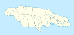
- Duckenfield, Jamaica
-
Duckenfield — Village — Coordinates: 17°55′01″N 76°15′25″W / 17.9170027°N 76.2568331°WCoordinates: 17°55′01″N 76°15′25″W / 17.9170027°N 76.2568331°W[1] Country Jamaica Parish St Thomas Time zone EST (UTC-5) Duckenfield, Jamaica is a village in St Thomas, in south-east Jamaica. It is named after the sugar plantation on which it is located. It is a very poor community,[2] but it has grown substantially in recent years. There are plans to build an international airport in the vicinity in order to open the eastern end of the island to tourism.[3]
The economy of Duckenfield is dominated by the nearby sugar estate and factory which are the only major employers in the vicinity. Any change in the fortunes of the sugar industry has an immediate and dramatic effect.[4]
Contents
Amenities
There are two primary schools, Duckenfield Primary[5] and Dalvey Primary. a hospital and a post office.
See also
External links
- Aerial view.
- Photos: [1] [2] [3] [4]
References
- ^ "Wikimapia". http://wikimapia.org/#lat=17.9170027&lon=-76.2568331&z=15&l=0&m=b&v=8. Retrieved 2009-09-07.
- ^ "Early Fall Newsletter 2008". Isaiahsixeight.org. 2008-09-24. http://isaiahsixeightorg.blogspot.com/. Retrieved 2009-09-11.
- ^ Brown, Ingrid (2008-01-29). "Big tourism plan for eastern Jamaica". The Jamaica Observer. http://www.jamaicaobserver.com/news/html/20080128T230000-0500_131932_OBS_BIG_TOURISM_PLAN_FOR_EASTERN_JAMAICA.asp. Retrieved 2009-09-11.[dead link]
- ^ Brown, Ingrid (2009-02-06). Jamaica Observer. http://www.stthomasjamaica.com/news223a09.html. Retrieved 2009-09-11.
- ^ "DUCKENFIELD PRIMARY SCHOOL SAYS 'THANK YOU DIGICEL FOUNDATION'". Digicel Foundation. 2009-01-23. http://www.digiceljamaicafoundation.org/en/news/duckenfield-primary-school-says-thank-you-digicel-foundation. Retrieved 2009-09-11.
 Settlements in JamaicaFor the definition of city, town, etc see Settlements in Jamaica.
Cities Towns Above Rocks · Albert Town · Alexandria · Alligator Pond · Anchovy · Annotto Bay · Balaclava · Bamboo · Bath · Bethel Town · Black River · Bluefields · Bog Walk · Brown's Town · Buff Bay · Bull Savanna · Cambridge · Cascade · Cave Valley · Chapelton · Christiana · Claremont · Clarendon Park · Clark's Town · Coleyville · Constant Spring · Croft's Hill · Dalvey · Darliston · Discovery Bay (Dry Harbour) · Duncans · Easington · Ewarton · Falmouth · Frankfield · Franklin Town · Frome · Gayle · Golden Grove · Gordon Town · Grange Hill · Green Island · Guy's Hill · Hagley Gap · Hayes · Hartland · Highgate · Hope Bay · Hopewell, Hanover · Islington · Kellits · Lacovia · Linstead · Lionel Town · Little London · Lluidas Vale · Lucea · Lucky Hill · Maggotty · Malvern · Manchioneal · Mandeville · Maroon Town · Mavis Bank · May Pen · Moneague · Moore Town · Morant Bay · Nain · Negril · Newcastle · Ocho Rios · Old Harbour Bay · Old Harbour · Oracabessa · Osbourne Store · Petersfield · Point Hill · Port Antonio · Port Esquivel · Port Maria · Port Royal · Porus · Race Course · Richmond · Rio Bueno · Riversdale · Rocky Point · Runaway Bay · Saint Ann's Bay · Sandy Bay · Santa Cruz · Savanna-la-Mar · Seaford Town · Seaforth · Sherwood Content · Siloah · Southfield · Stonehenge · Trinity Ville · Ulster Spring · Vineyard Town · Wakefield · Whitehouse · Williamsfield · Woodpark · YallahsVillages Accompong · Aeolus Valley · Airy Castle · Barking Lodge · Bog · Big Woods · Boscobel · Bull Bay · Carmel · Cattawood Springs · Cotterwood · Duckenfield · Duncans · Haddersfield · Hodges · Hopewell Hall · Hopewell, Clarendon · Hopewell, Manchester · Hopewell, Saint Andrew · Hopewell, Saint Ann · Hopewell, Saint Elizabeth · Hopewell, Westmoreland · Hopeton · Long Wood · Mavis Banks · Nanny Town · New Holland · New Roads · Nine Mile · Old Pera · Paynes Town · Port Morant · Roxborough, Manchester · San San · White Hall · Wood HallNeighbourhoods Kingston
and
St AndrewAllman Town · Barbican · Beverly Hills · Bournemouth Gardens · Camperdown · Cassava Piece · Cherry Gardens · Cockburn Gardens · Constant Spring · Cooreville Gardens · Cross Roads · Delacree Park · Denham Town · Duhaney Park · Eastwood Park · Fletcher's Land · Four Mile · Grants Pen · Greenwich Town · Half Way Tree · Hannah Town · Harbour View · Havendale · Hope Pastures · Hughenden · Jack's Hill · Jones Town · Kencot · Kingston Gardens · Kintyre · Liguanea · Manley Meadows · Mannings Hill · Maxfield · Meadowbrook · Meadowbrook Estate · Molynes Gardens · Mona · Mona Heights · Mountain View Gardens · Nannyville Gardens · New Haven · New Kingston · Newport West · Norbrook · Norman Gardens · Olympic Gardens · Papine · Patrick Gardens · Pembroke Hall · Perkins Estate · Queensborough · Queensbury · Rae Town · Red Hills · Richmond Park · Rockfort/Rennock lodge · Rollington Town · Seaview Gardens · Shooters Hill · Six Miles · St Mary · Stony Hill · Three Mile · Tivoli Gardens · Trench Town · Vineyard Town · Washington Gardens · Whitfield Town · Woodford Park · Ziadie GardensCategories:- Saint Thomas Parish, Jamaica
- Populated places in Jamaica
Wikimedia Foundation. 2010.

